Bike Nielsen 2014 Prologue, Santa Barbara to Portland, Oregon
Today’s mileage: Countless effortless miles on the train
Total bike mileage so far: 8 miles to get to the train station
Local Gas Prices: $3.95 in SB
Weather: Humid and cool most of the trip
Saddle Sore-o-meter reading: minus 2
Animals for the day: Shorebirds near Salinas, cattle and horses all over, and three animal statues in a field near Paso
Train tracks describe the back alleyways of towns. When we are on the train, instead of seeing the pretty facade of Main Street, we see the windowless barn-sized backs of industrial parks. Sometimes there is graffiti, oftentimes there is patio furniture where it looks like workers take their breaks outside. This perspective is very different from what is visible to the drivers out on the road. As we left Santa Barbara on the train, the first views were very familiar because we lived for years right near the train tracks at Castillo Street. For the next couple of miles after the old homestead, the corridor next to the freeway is recognizable because we drive that often enough. Before long, but still in our hometown, we lost track of where we were exactly. The golf course near Fairview and Hollister comes right up to the train tracks, which we didn’t realize, so we thought we might be farther out near Sandpiper. But wait, Sandpiper doesn’t come right up to the tracks. This feeling of disorientation continues as we get farther from home. As we passed by what we thought was San Luis Obispo, we commented about turning inland and how pretty it is up by SLO, only to hear about an hour later that we were in San Luis Obispo.
Around Paso Robles, there are farmland, pastures, vineyards, and oil fields. We looked out at a ranch house surrounded by fenced-in pastures where some person with a good sense of humor had installed statues of a bobcat, a coyote, and a small black bear walking on his hind legs. The bobcat and the coyote faced us and the bear walked in the same direction as the train. The display was clearly for the entertainment of train passengers.
Upper Klamath Lake goes for miles and miles where shore birds in large flocks fly up as the train rolls by. There are white pelicans with black tipped wings who slowly lift off in small groups. The lake is about twenty miles long and eight miles wide. According to a person on the loud speakers, “in the summertime, if you are six feet tall, you could walk to the other side of the lake with your head out of the water.” According to Wikipedia, “The lake depth fluctuates due to regulation of its water supply, averaging between 8 to 60 feet (2.4 to 18.3 m) deep.” Uh, we think we will go with Wikipedia.
As we pulled in to the train station at Klamath Falls, an Amtrak employee took to the airwaves to tell us that we were stopping and please gather your belongings if this is your stop. Oh, (BTW), we are supposed to get a new crew here but they haven’t slept enough, so we are going to stay for about an hour. Thank you for travelling with Amtrak! It turned out alright because while we were waiting, we listened to a really interesting guy describe a big piece of machinery over on a side track. John was taking a photo of Berta in front of the Pandrol Jackson Model 6700. We heard a man ask if we wanted our photo together in front of “this beauty”. This guy, who might be in his early sixties, has relatives who worked on the railroad, so when he was eight he worked on one of these machines in Milwaukie. It is a big piece of yellow-painted machinery that rolls on the rails. Its wheelbase is at least 20 feet long and it has so many hydraulic lines that it needs a 120 gallon tank for the fluid to keep them pressurized. It rolls on the good portion of track and does most of its work out in front of itself. It is mostly used to lay new track or repair old track. The long slanted metal ramp was sometimes loaded with new ties. Seven or eight guys manned this machine. He said at the end of the day the workers were covered in the creosote from railroad ties.
We talked to this guy for a little while longer. He told us the railroad runs locomotives forward sometimes and backward other times to reduce wear. The locomotives are diesel engines that power electric drive motors. The motors don’t care which direction they go, so the railroad reverses them and all cars “all the time” to reduce wear on the bearings and the wheels. After we had chatted for a while, our train expert saw his wife walking over and introduced us. She said hello and immediately they both said goodbye and walked away. Not too long after that, the replacement crew appeared and the train whistle sounded. We still had a few hours to get to our destination. It seemed like forever until the train finally rolled into Portland.
The last time we were in Portland, we remembered the bicycle infrastructure being good. That was in 2000. It is even better now. We put the bikes together and needed to ride about three miles to the La Quinta Inn we saw on our GPS. We ended up riding another couple of miles at least because it isn’t a La Quinta Inn anymore, it is a Quality Inn, so we passed it up the first time. The maps on the GPS are up to date as of last week. Wrong. We thought we would evaluate our other options. So we pedaled past some big festival that probably was about beer, but they didn’t want us to know that so they didn’t have any big sign. We rode around a little while longer and decided to go back to the Quality Inn. This whole time, every street we wanted to ride along had a bike lane. Some of the main streets had the bike lane separated from car traffic by big planters in the roadway. Many of the bike lanes were painted green and all of the cars were careful around bikes. It was super special.
Prologue part deux
For this trip, we decided to land in Portland because it was the last stop on the Coast Starlight train that allows for baggage (bikes) to get off the train and is still early enough to put the bikes together and ride to lodging. So we needed to get ourselves up to the route in Port Townsend. From the Quality Inn, we called around for a one-way van rental. No luck. Plan B was a U-Haul truck like we did last year. It works pretty well except for the gray hairs it gives John. They never have the smallest truck, which would be perfect. We rented a 14 foot U-Haul where a person had spilled two liters of soda in the back. After ten minutes failing to avoid sticking to the floor, we had the bikes tied up. We chugged off, ready to hold up traffic for a few hours.
The landscape in Washington State is so much greener than back home in droughtville. As we drove up the east side of the Olympic Peninsula, pine-covered mountains towered on our left and most of the time a still bay was to our right. It isn’t Puget Sound—there is another strip of land between this road and Puget Sound. All along the road are wild berries and pink flowers. The grass at the side of the road is a little brown because they have had a dry year too, but that is all relative. There is “waterfront
property” all along this route, crammed in the ten yards between the road and the water. Much of it was for sale.
We made it to the U-Haul dealer at our destination where John pried his sweaty hands off the steering wheel and gladly gave up the beast. The woman at the desk warned us about riding in the heat (it was pretty hot and humid, but only for the Northwest, not for anyone else). We fired up the GPS and looked for our friends’ house. Luckily, we did not find a Quality Inn at their address. Instead, we rode just a few miles. We would spend the next two days laughing until our faces hurt.
Port Townsend is a thriving little village with a lot of well-kept Victorian houses, bustling restaurants, nice little local shops, and a big marina. They are known for having a big scene for boatbuilders, with an emphasis on wooden boats. We took the nickel tour that lasted all of five minutes. It might have been shorter if we had found parking on the first loop. In this small area there is a ton to do, especially in the beautiful early evening. We had dinner on a restaurant deck suspended over really still water. Some otters swam by during our meal while the stand-up paddle boarders and the sailboats went by.
While we were visiting in the greater Port Townsend area, we took a quick test ride along the first stretch of our route. Originally, we were planning on this trip to head east from the Seattle area to midstate Washington and then south to Mount Rainier. But wildfires have changed our plans. By the time our ride starts, the fires may well be contained; however, there are hundreds of people who are out of their homes along our planned route. So even though the smoke may not be a problem, it seems unlikely that we will find lodging consistently. So now we are planning to head West around the Olympic Peninsula. The first stretch of the new route is thirty miles of paved bike path. We scouted half of it today, partly to get the legs working. We travelled over two neat bridges, one that was the original train bridge on this line, the other a beauty of a bridge just for walkers and cyclists made with that fake wood that is so nice and smooth to ride over.
There was a sign on the path alerting us to a bald eagle nesting area. It was just a stand of maybe ten big pine trees between two pastures. The sign asked us not to linger under the trees, as presumably it would unnerve the birds. We read the sign, looked way up, and there was a big bald eagle, full grown
with the white head and everything. Of course, we had to linger then, trying to get a good photo despite the distance and the grey sky behind the eagle. If they hadn’t placed a sign there, we never would have known there was an eagle so far overhead.
We rode for a mile with a man and a small boy. The little guy had a bike with twist-grip shifters and he actually used them. The first time we saw them, we had to wait as the boy made a miscalculation and ended up making a big lefty loop to turn right. “Sorry!” he said sincerely. We went up some small slopes where he downshifted and stood to climb. The man said things like “There you go, Scooter!” to encourage him along. We passed them, but stopped ahead to read about this railroad line so the two of them passed us again. We overtook them on the next hill, where junior was still chugging along, riding on the grassy edge to stay out of our way but also looking over his shoulder to watch us go by.
Day One, Jamestown to Port Angeles, WA
Today’s mileage: 28
Total bike mileage so far: 36
Local Gas Prices: $3.83 in WA
Weather: Rain
Saddle Sore-o-meter reading: 0
Animals for the day: Snails, slugs, and sea birds
We Live in Drought and Vacation in Rain
It was really nice to have seen the beginning of our route today. Even though a day on a bike path is a cinch compared to one on the highway, it was comforting to know what was ahead. And by “know”, we mean that we remembered things like the eagle nesting place (none there today), and the hotel that we don’t need today but was gloriously right on the route if we had needed it. We didn’t remember other details like how we got to the restroom in the county park we went through. For those decisions, we had to stop, discuss, and guess about the next turn. It doesn’t make a good acronym, but Stop, Discuss, Guess is kind of a bike trip catchphrase.
It was raining lightly when we awakened today. This is the first rain the area has seen in weeks. “It should blow through,” our friends commented with optimism. By the time we started out, it was pouring. We donned our rain jackets, pants, and some rain bonnets that look as goofy as they sound but do a good job. They are waterproof hats with elastic to stretch out over a helmet. They are perfect in cold rain. Today it was pretty cool (60 degrees), so they were good. In hot rain (like we have seen in New York State), not so good. We need new ones, the inside is flaking off giving us a bad case of dandruff; put that on the list.
The bike path put us on residential streets for about a half a mile where some construction was happening to install bulb-outs. If you don’t know what this is, you may have a libertarian municipal government. You may know these as (according to Wikipedia), “A curb extension (or also neckdown, kerb extension, bulb-out, kerb build-out, nib, elephant ear, curb bulge,”curb bulb” and blister) is a traffic calming measure, primarily used to extend the sidewalk, reducing the crossing distance and allowing pedestrians about to cross and approaching vehicle drivers to see each other when vehicles parked in a parking lane would otherwise block visibility.” An Elephant Ear! That’s someone with too much time on his hands. And if you are going along the lines of blister, carbuncle or bunion might be more appropriate. We decided that three groups like bulb-outs: city planners, curb construction crews, and tire alignment guys. It is only a matter of time before these pristine curbs will be covered with tire rubber from all of the cars that smash into them.
We arrived in Port Angeles around 1 pm. It was exactly when a big ferry let out all of its passengers in an unruly stampede of cars and walkers. We survived that and made a mental note it was a bad idea to ride towards a big blasting horn.
Our route maps have very detailed instructions about how the bike path was supposed to become the main drag through the downtown area. We rode a course that didn’t resemble the instructions at all but included a few miles of neat foggy wilderness right at the water’s edge. Once we got into town, Berta spied the sign for the Port Angeles Inn, which she thought she remembered from the map was right next to the Quality Inn, our destination. Somehow we had gotten ourselves within yards of our destination. Yards away but possibly 150 feet below it. Standing on First Street, we looked up at a huge wooden ramp that made its way up to Second Street by switchbacks. John the Chivalrous offered to slog up the ramp to see if the Quality Inn was indeed at the top. Before long, he waved down to Berta the Patient to say that she, too, needed to climb that hill. It was a 15% grade of wooden planks with railings. Berta pushed her bike, hunched over and taking big steps, while a toddler pranced and chatted along behind with his father huffing and puffing. Later, we took a stairwell down that same hill to look for dinner. Then we discovered we could go up one block and over another block to use a much gentler hill to get to the same place.
It rained the entire time we were on the bikes. We are starting to think that white is probably not the best choice for sock color and that gray or black would be better.
Day Two, Port Angeles to Forks, WA
Today’s mileage: 70
Total bike mileage so far: 106
Local Gas Prices: $3.80
Weather: Fog and a little sun
Saddle Sore-o-meter reading: 1
Animals for the day: Spiders on the beach rocks
We knew ahead of time that today would be a long day in the saddle—there are nice mountain lodges on our route that have all sold out at this short notice. So we planned for an early start. It didn’t happen. Berta looked at the clock and to her horror it said 0633. Breakfast had been open for three minutes! “We need to get up, it is six thirty already!” she exclaimed as she flopped back down. Berta never gets right out of bed. John, however, is usually standing up by the time he wakes up. We had breakfast where we pocketed some little packs of Nutella and were on the road at 0820.
Berta out on a lake
We stopped in the little town of Joyce to get some juice. There was a two-pump gas station in front of a market/post office. According to the man behind the counter, this is the first post office in the state of Washington, in service before the time of Abraham Lincoln when the official U.S. Postal Service was established. Berta was outside, filling the water bottles. She had finished that task and waited for John to return with “grape juice or cran/grape juice or Hawaiian Punch”. After a while, she ventured into the store to find out if John was asleep on a cot in the back. No, he was standing slack-jawed, looking at an old chain saw that had a bar at least six feet long that was suspended from the ceiling. It turns out that the chain saw might be the first that was made in America. It was an exact copy of a German chainsaw that was captured in WWI. The Germans invented chainsaws that they used to make the “tank traps” that so confounded the English. Its engine was a horizontally opposed twin like you might find on a BMW motorcycle. The engine needed to stay upright to run because it had a gravity flow carburetor. In order to keep the engine upright, the chainsaw had a nob so you could adjust the angle of the bar. We learned all this in—what we were told—was the oldest general store in continuous operation in the state of Washington.
Now THAT’S a chain saw!
Our first lunch today was on a beach covered with large smooth stones. We sat outside a fenced-in area where several RVs were parked. A couple of guys took off from the shore in a small boat loaded with some sort of seafood trap. They worked to clear the waves with their paddles, then fired up the electric engine to get out to their fishing spot. The fog obscured them before too long. While we ate, Berta noticed there was a spider on a rock about three feet away. It was somehow a non-threatening spider: about a quarter of an inch long with skinny legs that stretched out front and back to give it an hourglass shape. Not sure why, but this to Berta is less scary than spiders that have thick legs out to the sides like a tarantula. This crossed Berta’s mind in a flash before she realized that there was a spider on each of many of the rocks around us. They crawled out when we sat still, then hid when we moved. This was too much for Berta, picturing all of these spiders on the rocks where she sat. She hopped up while John the Unflappable remained seated with multiple spiders close by. Berta tried to take a photo of this unnerving situation, but each time she got close to a spider, it crawled back under its rock.
We stopped at about thirty miles for a proper lunch, standing along the Armco at a turnout. Today’s meal, prepared at a Safeway yesterday, was Greek Orzo Salad with peppers and Kalamata olives, augmented by some of the Italian dressing that we got on the side for our salami sandwich. We asked the lady at the deli counter last evening to put the dressing on the side as we were going to eat the sandwich out on the road. PS, that is the way to get more dressing. She filled two whole containers, which we poured on the salad and the sandwich. We are saving the little packet of Tabasco sauce that we pilfered at the motel for another sandwich another day or for when company comes.
We saw a trio of people touring on foldable Bike Fridays on the road today. They were stopped at the crest of a big hill. We pulled up and peppered them with questions. Two of them have been on the road for almost eight months. They started in Key West in January and had just two days of riding left when they would put their toes in the Pacific Ocean. The third person had joined them recently—she was from Canada near here. While we were talking, her husband pulled up in a van conversion. He was their support vehicle and had driven up ahead and made reservations at a lodge for them. In the course of our conversation, we found out that the wife doesn’t like drafting behind the husband because he doesn’t keep a straight line nor a consistent pace.
We pedaled seventy miles today. Our destination was Forks, Washington, which happens to be the setting for the Twilight books and movies. Neither one of us is familiar with the story. The marquee for the motel where we are staying says “Welcome to the Twilight Zone”, the pizza place across the street has a Twilight menu, and the deli offers a Twilight wrap with ham and provolone. That must get old. We saw no vampires, only one guy who looked like a werewolf. Don’t tell him that—he thinks his wild facial hair is the kind that is in style.
The lady at the motel desk gave us a recommendation for a dinner spot. We walked three blocks or two Twilight references back into town to find a nice little restaurant. We both ordered exactly the same dinner (we have been married for twenty years last week), and it was very good. Salad with Thousand Island, followed by a burger. The owner of the place came by to ask how dinner was. He had been “out back, cleaning some fish” and his son was doing the cooking, so he wanted to know how it was. Our server, who reminded us of our cousin, also wanted to make sure our meal was good. These are people who care about what they serve.
We went to Thriftymart to get provisions for tomorrow. Berta stood at the deli counter and selected lunch. Pastrami (because yesterday we had Salami), pepper jack cheese (hotter is better), and on a Hoagie roll (softer is better). The girl at the counter asked what sauce we wanted. Berta says put it on the side, we are eating the sandwich tomorrow. The girl repeats the sauce choices. Berta repeats, all of it, put it on the side. Done. John is off in the store, looking for other stuff. The girl says to Berta that they have a new Cheddar Cheese that is much hotter than the Pepper Jack, here, try this. Berta munches and it is much hotter. Yep, put that on.
There was a Laundromat 200 feet from our room. It had a 22 minute wash cycle and dryers that went for six minutes for 25 cents. Four bits and the lycra was dry. We have a little cotton with us, so it has to hang overnight to dry completely.
Day Three, Forks to Kalaloch, WA
Today’s mileage: 36
Total bike mileage so far: 142
Local Gas Prices: $3.90
Weather: Fog and a little sun
Saddle Sore-o-meter reading: 0
Animals for the day: Blue jellyfish and crab skins on the beach
Our motel in Forks had a complimentary breakfast with no place to sit. We ate our cereal and toasted English muffin outside the office, standing with our food lined up on a railing. Later, as we walked back to the room, we saw that there were picnic tables under a popup sun shade between the office building and the rooms. By then it was too late.
It is always a little nerve-wracking to see construction signs out on the road. We see them up ahead and wonder what kind of sprint we will have to do to get through the construction zone. No worries, it turned out, today’s construction site was off the side of the road. We talked to a guy who was supervising a small crew running huge earth-moving equipment. We stood on the edge of the highway about forty feet up from the level of the Hoh River. This river makes a big curve that has damaged the highway a few years in a row, so they decided to do something about it. There were two hydraulic buckets and a big dumptruck that fed them rocks. They were excavating mud and rocks from the river bank, sinking big metal beams like posts into the earth, and covering those with huge logs, rocks, and mud to make protection for the highway. John stood with the video camera on for a few minutes. Berta talked to the supervisor who said they would be working for another two months. A fellow bike tourist rolled up and asked more questions. When he asked what the elevation is here, roughly, the supervisor guy said off the top of his head “184”. Then he walked a few yards down the slope to where the elevation was painted on the road. 183. Ya, he decided after he walked back, here is 184. Berta reset the altimeter on her bicycle computer. John reluctantly shut off the video camera, exclaiming, “I could watch that for hours”.
We turned off the road when we saw a sign for Ruby Beach. The side road was a very wet gravel, with potholes that made us wonder if the view would be worth it. It totally was. We could have walked down to the beach, but that would have meant leaving the bicycles, so we stayed on the bluff and looked out on a beautiful rocky coastline. We talked to the bike tourist we have been seeing all day. John asked him if he knew why this is called Ruby Beach. No. Berta read all the signs around. None of them explained why it is called Ruby Beach, although one gave instructions for when you see a cougar. Instruction number one: “Pick up small children”. Good idea, but it doesn’t answer why it is called Ruby Beach. John was desperate, blurting out to anyone: “Why is this called Ruby Beach?” A young man answered, “It was because of all the blood spilled here in the battle of…” before he started laughing. He had us going. That would have been good. According to Wikipedia: “The beach is so called, because of the ruby like crystals that get washed to the beach from the fresh water leaching onto the beach. These crystals are the byproduct of the glacier activity that used to happen in this area. (Source: ranger station).” That ranger station sure knows a lot.
Ruby Beach
We pulled over at a scenic stop where a big fifth-wheel trailer was parked. In front of it was a big idling Nissan truck. John immediately started talking to the woman. Her husband was kind of holding back, walking around his rig, doing a systems check. He eventually joined in the conversation and blurted out, “This is what happens when a person has too much money!” The couple invited us to look inside the trailer. It had a full-size bedroom, a stove, an oven, an actual kitchen counter with sink, a bathroom, and more. They love it and contend it is easier to drive than their last trailer that was much smaller. This is day three for the behemoth.
We ventured off the route to look at the Big Cedar Tree. This was a pretty big tree, but to quote a man standing there, it was “not very tall”. True, but it was gnarly. It was difficult to tell if they were roots coming up from the ground or branches drooping from the tree. We talked to a couple whose children were peeking out from holes in the tree. The woman asked us, “When do you shower?” It seems like a
goofy question, but to answer it in case you also wondered: “At night”. She must have thought we camp all the time, but even then they also have showers at campgrounds. We did our own systems check and decided that we didn’t bring on the question ourselves, she was just curious.
Now THAT’S a big cedar!
Many of the place names in this region look different than they sound. Take Sequim, for instance. For all of you people who want to make that two syllables: don’t. It’s Squim, with not even a moment’s hesitation after the S. Today we headed for Kalaloch, which has a similar forgotten first vowel. Clay-lock. We stayed at the Kalaloch Lodge where an average room goes for big bucks because it is a national park inn. The room had a five-star view and a very new bathroom, but other than that, the place acted like it knew its concession wasn’t up for review for ten years. They have “Green” rating for their environmental practices, which means they can charge $3.50 for Fair Trade coffee at breakfast where they put a cocktail napkin under every item they deliver.
We walked out of the lodge, past the cabins, and to the beach. This beach is strewn with big weather-beaten logs that fell in the mountains, splashed downriver to the ocean and then were tossed up on the sand. It is such a phenomenon here that they have signs in the rooms and things in the gift shop for sale that say “Beach Logs Kill”. Why you would want a pint glass or a ball cap that explains that, we don’t know. Anyway, on the beach we spied a ranger giving a presentation. We walked up and Ranger Li welcomed us right away. The audience included a couple who probably drive a Prius (insert your own stereotype here), and a man wearing a polo shirt with a logo that said “Norwich Croates” or something like that in embroidery that was too hard for Berta to decipher, even though she spent at least 3% percent of her attention for the whole presentation trying to figure it out. Any inaccuracy you read here is due to Berta’s indiscriminately enquiring mind. The last pair in the group was a grandfather and grandson. The grandson was waist-high tall with reddish-brown hair, ears that stuck straight out from his head, and the perfect skin of a child. He was a smart enthusiastic kid who wanted to contribute. When he talked, he held his arms straight over his head and punctuated his comments by throwing his hands forward like he was at a rock concert or a Texas Longhorns football game.
Li told us that they have proof that these trees fall in the rainforest above here and float out to sea before they come back to land. While they are floating in the ocean, barnacles and clams hang underneath them in little seafaring colonies. After the logs wash up on the shore, after they have done their murderous deeds, they are home to weasels who are sneaky critters who will steal your unattended sandwiches. Other detritus on the beach includes crab shells and little blue jellyfish. We don’t know how we got to our combined advanced age without knowing that crabs molt; however, all of these crab shells aren’t dead crabs, they are crab skins. PS, spiders shed their skin too. We didn’t know that either and add that to the list of things to develop a compulsion about. The little blue jellyfish float with a kind of sail up in the wind, so they are susceptible to getting tossed up on the beach in a storm. That has happened recently and the beach is littered with skeletons of jellyfish lost. The whole time we were listening to Ranger Li, the large waves crashed on this long wide beach in quick succession similar to the waves at Pismo or up in Morro Bay.
By-the-wind-sailor jellyfish
Since we have a drought at home, we are used to rushing through showers. But this is the Northwest, where there are puddles at the side of the road all day. Even so, there is an hourglass in our shower tonight to challenge us to take a five-minute shower. We had a late lunch and prices in the dining room are ridiculous, so we had chips and salsa for dinner.
Day Four, Kalaloch to Montesano, WA
Today’s mileage: 81
Total bike mileage so far: 223
Local Gas Prices: $3.85
Weather: Fog and a little sun
Saddle Sore-o-meter reading: 2 (81 miles is too far)
Animals for the day: Horses and cows only. We heard a howling dog.
We stopped at a gas station/grocery store in Humptulips where we purchased some fruit pies, cranberry juice, and cran-grape juice. Yes, we did say the town name is Humptulips. We were chatting with the store cashier, a pleasant woman, who said she wanted to win the lottery and to ride a bike as long as the money lasted; but looks like she hasn’t been on a bike since childhood. She says that the Internet erroneously shows that there is a ferry down the coast from here. Cyclists take that wild goose chase all the time. She gave her blessing on our route up and over the mountain to Montesano. “It’s not too far, a nice ride,” she said about the 32 miles we had yet to ride. “We get hundreds of bicyclists here each year and I like to talk to them.” We filled our water bottles from a tap outside the building that was almost on the ground and the water was sweet.
As we were talking, a big dump truck pulled up to the gas pumps. Out jumped a guy you would describe as a fireplug. He eyed us with insolence. He went into the store and the cashier followed him. Before we knew it, the guy came out to greet the guy who stopped at the other pump. And by “greet”, we mean he ran out like something was on fire and got the other guy in a chokehold while spewing language that would make a sailor blush. They seemed like friends, though. For a few minutes, they had as private a conversation a person could have at the top of his voice standing only feet from strangers. Then he turned his attention to us. “Do you have a pistol?” was one of his questions, as he explained that there were a lot of crazy #$@% around here. Somewhere in his monolog, he used a word that was only crass, but not profane. “Pardon my language,” he said to Berta, as he continued with worse. He told us that people are bad drivers (him excluded, of course), and that he got a speeding ticket in California just a few weeks ago. He was going 97 miles per hour. John explained to him that 100 miles per hour means jail in California. This guy looked at his female companion. “Hey, woman! You were beating me to go fast in California! Three mph faster and I would have had to yell: ‘look at her, she has a GUN!’ ” The woman wasn’t paying attention to him at all. She looked at Berta and asked how far we ride per day. Berta said we did 70 then 30 miles in the last couple of days, but we were having to do 80 plus miles today. This woman, who was really pretty in the eyes, dressed in upper body underwear and really fit, threw up her callused hand for a high five from Berta. The short loud guy reminded us to look out for the bad drivers—especially his friend here, “he’s a crappy driver!” We rolled away while he was still fulminating.
The rest of the day wasn’t bad because we knew what to expect. We knew at the end of our ride we had reservations in a motel at a gas station in Montesano (rhymes with Draino). Berta had done Google Street View and thought it looked okay, especially since it was the only game in town. John walked in to the Chevron Food Mart to get our room key while Berta chatted with a guy outside who was also staying in the motel. He was touring on a recumbent bicycle with a full fairing made for making a land-speed record. It had 27 gears like a regular bike, but also an internal hub that multiplied that by three. He had a huge top gear that meant he could fly down hills; however, he had a heavy rig that was a bear to pedal uphill. His wife just left on a two-week cruise in Alaska, and he thought he would pedal around for a while. He hollered out when we rolled in, “they have one room left in case you don’t have reservations!” He doesn’t realize that innkeepers always tell you they have only one room left to make you feel
desperate. When we made reservations yesterday, they only had one room left. The room we got was fine: nice and large for bicycle parking.
We ate dinner at the Bee Hive restaurant and were immediately recognized as tourists and, as such, subject to fleecing. Yes, the dinner consisted of a Ruben sandwich and a Patty melt. With two slices of Rhubarb pie, the total came to $38.00. John couldn’t leave town fast enough.
There is a Trike Rally somewhere in these parts right now. There are three-wheeled motorcycles all over the place. Most have the two-wheeled axel in the back, but some have it in the front. There is a big red chopper trike with a VW engine parked outside. Next to it are two “standard” Harley trikes.
It is expensive to drink in Washington. According to laws that went into effect in 2012, “All spirits are to be taxed at 20.5% on the shelf price in addition to a flat spirits liter tax of $3.7708/liter.” This makes John’s tequila round out at about $24 for an amount that would cost $15 in California. Ouch.
Day Five, Montesano to Yelm, WA
Today’s mileage: 64
Total bike mileage so far: 287
Local Gas Prices: $3.65 on the Chehalis Reservation
Weather: Fog and a little sun
Saddle Sore-o-meter reading: 1 (all flat riding today)
Animals for the day: Alpacas, goats, lots of cows
We rode on the Chehalis Reservation today, along the Chehalis River. We heard someone say Chehalis like there is “hay” in the middle of it. Not sure if they are authoritative. We left the route to go into Oakville for food. The town was pretty shuttered except for a fast-food looking building with a local name on the sign. The door proclaimed that the credit card machine was not working so John asked if we could pay with a credit card. This question was answered with a stare. We were greeted by one of the two young men in the place. They both looked about 25, although that is hard to say because other people are getting younger every day. One took our order and the other fixed our food: eggs with hashbrowns, bacon and toast. Now, this has to be the very first thing any cook learns, but we were wondering how Bucky and Junior were going to do. Breakfast was spot-on. With so much bacon John felt guilty. You just cannot judge a book by its cover.
Some of our ride today was on a nice bike path. We are climbing steadily now as we get into the mountains. In Tenino, we followed our route instructions to the start of the bike path at a county park. There was a car show in the park. At first we (Berta) was very irritated at the sign that said “No bikes”. But there were many really nice cars and we (Berta) can see how they don’t want people pushing or riding bikes next to the fancy paint jobs. We locked up the bicycles, brought out our ball caps and pretended we fit in with all our bright lycra. Which we didn’t. Clearly, we were aliens.
The bike path went for 14 miles and stayed within earshot of the busy highway we were avoiding. There was a lake off to the other side where people got off the path to fish and picnic. We saw about twenty other cyclists, including a couple of touring cyclists who sounded Austrian to us. As we passed a man who was futzing with his bike, John asked if he had everything he needed. He didn’t, so John stopped to possibly assist. It turned out that his bike had just been in the shop, but it was grossly out of whack with the back wheel. It was a “fixie” or a one-speed, and the wheel wasn’t centered in the dropouts. The tire was rubbing so badly that it was like the guy had his brakes on. When John tried to help, he realized that the rear axle was secured with bolts, not quick-release skewers, so he was no help at all. The guy said he had pliers, which were probably going to be useless, and he needed two
wrenches no matter what. John described to the guy what needed to happen and we rode away thinking the guy had a long slow ride home ahead of him.
We stayed on the path through the small town of Rainier. It was here that we got our first glimpse of Mount Rainier. The mountain is so huge that it is visible from Seattle on clear days, but as we get closer it is obscured by the nearby mountains. And then there is the weather around Mount Rainier, which is notorious for hiding it. So we got a few fleeting glimpses today while riding, and then it is visible from the parking lot tonight. It is awesome.
Only once before have we made reservations for lodging on a bike trip. We have made six this week. We look on web pages, sometimes see if Google has a more accurate photo of the place, agree to pay whatever ransom they require, and take a chance that the place may be a bummer. It really is difficult to anticipate the quality of lodging in small towns. Today we headed for Yelm with a confirmation number in hand for the Prairie Hotel. It turned out to be an awesome bike trip stop. It is a reasonably-priced business-class hotel with a big screen TV, three chairs as alternatives to sitting on the bed, very nice details in the room, and a convenient guest laundry. We walked five hundred feet to an Italian restaurant where we had spaghetti (yeah! Great bike trip food) and could have walked across a parking lot to get to a multiplex theater. We decided not to spend some hours watching Teenage Mutant Ninja Turtles, but we thought about it. In the morning, there was a diner close by in the other direction. It doesn’t get better than this for lodging on bike trips.
To top off an excellent day, the local paper in the hotel room had a Cabela’s insert. It had night vision optics, rifles, compound bows and camouflage that John wanted.
Day Six, Yelm to Ashford, WA
Today’s mileage: 46
Total bike mileage so far: 333
Local Gas Prices: $3.75 in Yelm
Weather: Sunshine with a gentle tailwind
Saddle Sore-o-meter reading: 2 (all uphill today)
Animals for the day: A bison, geese, chickens, and a steel giraffe
We asked the server at dinner last night how a small town supports the really nice hotel we occupied. She said, “Ramtha”. We didn’t know what/who that is, so we asked. She whispered something we didn’t hear and then said, “Ramtha, Google it.” According to Wikipedia, “JZ Knight is an American mystic teacher and author, and is known for claiming to be channel of a spiritual entity named Ramtha”. This is evidently a big bucks topic. Later, John asked the people at the hotel desk this same question. They mentioned dog shows and hydroplane races. We don’t know if Ramtha is a fan of hydroplane races. But then we looked at the map and realized that Yelm is a bedroom community to the state capitol Olympia as well as the big military base Fort Lewis. Ramtha Shmamtha.
Photo caption here
The little town of Elbe is dominated by the Hobo Inn and Restaurant, which occupies several cars of an old train sitting on the tracks beside the highway. We stopped at the grocery store for some juice and chocolate milk. The chocolate milk contained 900 calories and the grape juice container had at least 300 calories. We finished them. After that, we rode over to the little Lutheran Church of Elbe, built in 1906 by Germans who settled in the area (www.elbehistoricchurch.com). The docent told us that the first pew on the left and the organ are original. We chatted for a little while, then headed back outside.
When Berta lifted her phone to get a photo of the church, the docent and John both turned away and tried to get out of the picture. Both were worried about their hair presentation. The Lutherans would be proud.
Photo caption here
We climbed steadily for the whole day, at usually less than a three percent grade. Berta has an altimeter in her bike computer, and she pays (sometimes too much) attention to it. Even when the percent grade didn’t register today, the elevation was increasing a little. We had reservations in Ashford. As is common, the “Entering Ashford” sign preceded the town by at least two miles. We passed a market, some houses, and a couple of lodges before it started to look like the town was done. There was a downhill ahead so we started to panic that we had missed a sign (you don’t want to go screaming downhill only to find out you have to come back). John made a quick U-turn to ask for directions. He talked to an artist—that’s what her signs proclaimed—who said we should ride another quarter of a mile. She had on a red sequined hat to go with her red mumu. She told John she is seventy years old. John noted that she offered plaster casts of Bigfoot footprints for $47.50. We continued for a half a mile and found our destination.
Photo caption here
This is expedition country. We are just five miles from entering Mount Rainier National Park. For once, our quick-dry lightweight flimsy pants and special purpose shoes are in style. Everyone has on hiking boots and is carrying walking sticks, a backpack and a camera. We checked in and looked for some Sherpas to hire to carry our bikes to the second floor. No luck, we lugged them ourselves to our spacious comfortable room. As we normally do, we showered right away because the combination of sunscreen and road grime is unfair to any public surface. We took our clean selves down to the desk and reviewed our options for dinner. Unfortunately, we had to get back on the bikes to ride back into town. We had a serviceable dinner (what cut of beef was that supposed to be and did you ask for well-done?) and returned. At the stroke of five-thirty, we walked down to the lobby to claim our free wine. Yes, that was a selling point at this lodge: free wine. John pretended he drinks red wine (he doesn’t). As we stood at the desk, a fellow lodger was also holding a glass of wine. We just had to ask her, “What’s your story?” We had watched her earlier in the parking lot, cleaning a white road bike that she had up on a bike stand next to her SUV. It turns out that a few days ago this woman completed her first half-Ironman triathlon in Seattle and that white road bike is a recent big purchase so she wants to keep it nice. Her name is Chris. We talked for maybe ten minutes, standing at the front desk of the lodge. Another lodger chimed in from the couch over by the fireplace in the lobby. David is a retired professor who, with his wife Terry, was enjoying the beautiful wildflowers while day-hiking near Rainier. We sat down and Chris sat down. The group looked for common experience. David rode a bike on the Blue Ridge Parkway, like we did. He also had some connection with UCSB in our hometown. Chris and David have traveled in Africa. We exchanged some stories. When there was a lull, we returned to our room.
Photo caption here
A little while later, we decided to walk downstairs and see what else was happening. Everyone was still there, planning for going out for food in a bit. As we had already had dinner (bike trip schedule), we continued the chat. It turns out that David and Terry have been married for a year. They went to Antarctica (David said “Let’s go South”). Read the next quotes with a New Yorker accent: Terry recounted that they told her “there would be a lot of penguins around the next bend. What? Could there be thirty or fifty? No, there were TWO MILLION. That movie you wonder how they got the penguins to come over? No, they ALL come up at you.” We cracked up at her description. We talked with Chris, who is deciding about her future. It is hard not to sound like evangelists about bicycle
touring, especially to someone who is tough enough to finish a half Ironman. That is a 1.2-mile swim, a 56- bike ride, and a 13.1-mile run. We don’t need a lot of encouragement to describe the places we have pedaled. Since her family is in New York, we told her about the extensive bike route network there. We always try to get bike maps from the states where we travel, and New York mailed us a big package. Nine different official bike routes through the state.
Day Seven, Ashford to Paradise, WA
Today’s mileage: 26
Total bike mileage so far: 359
Local Gas Prices: No gas stations on today’s route
Weather: Cool, breezy, cloudy
Saddle Sore-o-meter reading: 2 (all uphill again today)
Animals for the day: Horseflies
Most mornings on bike trips, we are at breakfast before everyone else. We have the place to ourselves, doing that dance everyone does at a complimentary breakfast bar. Have you seen the sugar? Spoons, hmmm, where are the spoons…. We normally forage alone. By the time we are finishing up, other patrons start filtering in, looking for coffee. Today, it is different. When we walked downstairs, half of the rooms we passed had the door standing open and the cleaning crew had already stripped the beds. We joined about ten other people in the breakfast room. People here meant business because they were clearly headed out for a serious hike. There were two people waiting for each station of breakfast items. The person at the little refrigerator grabbed a yogurt and rotated out while the next in line planned his attack and lunged when the opening came. There was no talking here, either. We are people who need to fuel up and get going. All of a sudden, in a cloud of creamer dust, the place cleared out. We were alone in the breakfast room again.
The terrain hasn’t changed in the last few days. We continue to have a helpful little tailwind and temperatures cool enough that we wear lightweight jackets for about an hour in the morning. The road is going up, sometimes so subtly that Berta’s computer readout is the only way we know about it. There is usually a grassy margin between the road and the dense forest. The road is straight for long stretches and then makes sweeping turns. This is a good road to cycle because drivers can see us from a long ways back and can make a clean pass when they know the road ahead is clear. Washington drivers have been very polite.
After about five miles, we arrived at the gateway to Mount Rainier National Park. So many people were posing in front of the big sign that we gave up waiting to be alone in the image. We are all back at our computers looking at strangers in our photos.
Berta at the Gate with Strangers
Touring bicyclists are rare birds around here. When we pull over to observe a natural phenomenon, just like Ma and Pa in the pickup, we are stared at like we are some kind of bizarre specie. We stopped at the Longmire museum, where John inquired about being a junior ranger. He doesn’t qualify. We were standing at a display of a big cross-section of a tree that had small markers on the rings highlighting events in its lifetime. It started growing in 1293 (we know how they count rings, but how can they know that so specifically?), and was cut down in 1963.
That’s a Big Tree!
We didn’t have enough food packed for the trip today and John got hungry. That is never a pretty bike trip sight. John tried to sound casual when he mentioned it and then it took ten minutes to get to a good spot to stop. We ate the last of the corn tortilla chips and six Fig Newtons. The food faux pas was exacerbated by us hitting some unexpected extreme terrain. We started the day thinking we would be riding 18 miles, but it turned out to be 26 miles. We knew it would be uphill, but it turned out to be really uphill for the last several miles. So the chips and the Fig Newtons were grossly inadequate. But that is a bike trip. Sometimes it is just a slog.
Christine Falls
Dragonfly
We were struggling up a steep section when we were strafed by a blue-green Mercedes sedan. We really have been pleased with drivers in Washington State, and in the National Park here where the speed limit is 35 mph, it has been very nice. So when this Mercedes whizzed by and made us jump, it was an extra affront. We decided a few years ago to avoid hand gestures at drivers. So we normally yell something at the driver. If they happen to look in the rear view mirror, they think we said “Thank You!” and we feel better. John had a few choice words for the driver and everyone is glad he didn’t have a hand gun. When we arrived at the Lodge, there was the Mercedes parked in the handicapped parking. We needed to wait for more than an hour for our room key. During that time, Berta looked up at three-minute intervals hoping to see who drove that car. She practiced what she would say, working on variations in her mind. Before the owner appeared, our room was ready and we will never know.
This town is called Paradise at 5400 feet at the base of Mount Rainier. We had reservations at the inn in Paradise. The furniture in the main lodge there is hewn out of whole trees. It looks impressive, but looked very unappealing after a day in the saddle. So Berta was off, wandering around the Lodge, while John was guarding the bikes through the window and trying to get comfortable on the high-backed bar stools around a small circular table. John was dressed as is usual in fluorescent green and spandex when a woman his age, with a Southern accent, said, “Sir, you look like an experienced hiker. Can you tell me how high the blah blah trail is?” John pulled out his park map and the two traced the recently conquered trail and its elevation. “Thank you,” she said. John pointed to the bikes and said, “That’s how I got here.” “My goodness, I expect you could hike that trail as well,” she said. A man at the adjoining table agreed.
Rainier and a glacial carve out
The room we are staying in tonight cost $230, which is a price we are willing to pay to avoid camping. We are not sure how much a room with hot water in the bathroom cost. At this price, we get water at about 100 degrees. Berta left the shower shivering. The acoustic ceiling tiles curve up at the joints making the ceiling appear tiled with pillows. There are two double beds crammed into the space so that we need to make a tight turn at the corner of the bed that is only twelve inches from the wall. Some of the dark wood paneling bows out from the wall about a half inch. Right now the footsteps of our neighbors above mimic the creaking groans of a tall sailing ship. The whole scene would be fine for a week at a cabin at a lake, but not for big bucks. What is even more amazing is that many of these people seem to be so happy about being here. There was a couple in front of us at the desk who say they come here every year on their anniversary. Maybe they got a better room.
Our Fancy Digs
Upon checkout, John announced that the room had lukewarm shower water and the clerk responded that he had written a work order to fix the problem. John asked that if they knew the shower water was not hot then why did they rent the room? The clerk just smiled. Other examples of the Inn’s largesse: $10.45 for a plastic-wrapped club sandwich with free soggy bread on the bottom, $40.00 for two Caesar salads for dinner (strange tasting chicken included), $40.00 for the breakfast deal (we found the pitcher of orange juice and tried to take our ransom), and then we bought another $10.45 sandwich for lunch, and a cup of brownie parts for $4.00. Hemorrhaging money like this made John blanch. But at least we weren’t camping.
Rainier with its summit obscured
Lest you think that the whole day was hunger pangs and hemorrhages, we should try to describe the scene outside. Mount Rainier is 14,410 feet tall. Our photographs are grossly inadequate. In person, the mountain looks huge in the distance and huger up close. In photos, it washes out on the horizon so that we can hardly see it and no Photoshop magic helps much. As we climbed towards the mountain, we would come around a bend and there would be a huge glacial valley carved out of stone. The mountain is dark blue-grey stone with snow pouring over it. Some of the glaciers looked pink, but that may have been the sunset talking. Where the glaciers used to be, there are large scree fields with glacial rivers cascading through them. Our route twisted through this area, finding as moderate a climb as the road builders could. We would make a switchback, and halfway through the next hill, we looked back in our mirrors and were slapped with the grandeur. Mount Rainier is awesome. When we arrived in Paradise, the slope was still green with grass and trees, but the stony mountain was not far away. We stood next to a couple who had binoculars. The man insisted that he could see a line of climbers on the mountain. We retrieved our monocular of modest magnification but alas, saw no climbers. We had no idea of the scope of what we saw. At home, we are used to “mountains” that are about 3200 feet. Mount Rainier is four times taller.
Standing with our backs to Rainier
Day Eight, Paradise to Cliffdell, WA
Today’s mileage: 65
Total bike mileage so far: 424
Local Gas Prices:
Weather: Foggy, cold, breezy
Saddle Sore-o-meter reading: 2 Climbing, 1 Descending
Animals for the day: Baby swallows in the eaves of the building outside
As previously noted, Paradise is at 5400 feet. Our route today will take us down about 3000 feet, back up a bit, down a bit, and then up about 3000 feet again. Berta wants super powers to build a sky tram from peak to peak. We left the lodge early, when the temperature was around 50. Berta was wearing just about every piece of clothing she has along, including her rain jacket, rain pants, a bandana around her chin, and Costco Large Surgical gloves over her bike gloves. We were in for a nine mile descent in
cool weather. Berta doesn’t mess around. John thought how cold could it be? He thinks that his Norwegian surname gives him insulation against the cold, so he left the lodge with bare knees and knuckles. Seventy-five seconds later, we stopped for John to put on his rain pants. Rain pants generally have bad airflow, so they make great cold weather gear. We flew down the hill for a few miles. John was still able to feel his fingertips a little when he decided to put on his surgical gloves. It’s amazing how those thin little gloves help, he says now.
It was really foggy on the descent. Who knows what spectacular views we missed? We followed a Mini as long as we could, but they didn’t have their lights on so we couldn’t see them if they didn’t brake. Finally, we descended below the fog line and had better visibility. That’s when the tunnels and the drainage grates happened. We knew from our route maps that we would ride through some tunnels. We were relieved upon seeing the tunnels that they were only fifty feet long. Nobody warned us about the grates. These are across the width of the road and maybe two feet across. It seems like they were at every 200 feet of road. It wasn’t clear approaching them at 25 mph if they are safe for a 25mm front tire. Berta kind of lifted up at the first grate, hoping for the best. It came so fast that she had no other option. After that, she tried to ride over the grates at a diagonal, but even that caution faded after a while. She was flying down the hill over grate over grate, past caring about it. And then the descent was over.
There was no meadow or valley road at the bottom of this descent. We went from full speed to full stop just like that. From hero to zero. Then we climbed about 600 feet and descended just about the same before we hit the real hill. Over the next hour, we climbed. We are still in dense forest, and water drips from the land at every chance. We went through two more tunnels, this time uphill. We stopped at a spot where the road widened to have our second soggy bottom sandwich from Ripoff Inn. The writing on the plastic packaging warned that the sandwich was at its expiration date, so the bread was soggy and also stale (and we feel fine). This is a job for Tabasco Sauce! We pulled out all the condiment packets we were carrying and slathered the sandwich on all surfaces.
Partway through the hill, we looked up to see the rock containment wall for a road way up at the top of the mountain. We recall Berta saying something like, “There is no way we can get up there from here.” She was wrong, there truly was a way to get up there from here. Mercifully for Berta, for much of the climb we were on the inside of the road, next to the slope instead of out there right against a puny rock wall that was our only protection from a major dropoff. John claims the height was disconcerting to him too, but he actually leaned his bike against the wall on more than one occasion to take a photo over the edge of the road below. Berta waited patiently on the safer side of the road and promised that she would “enjoy” the photos later. She thinks an eighteen inch wall at the edge of the road is almost worse than nothing—it just gives you something to launch over. At the top of this hill, at the Chinook Pass, there is a picturesque lake, a popular hiking trail and no elevation sign for Berta to pose with. It would have said 5430 feet.
Ack! That is a long ways down!
And just like that, the profile of the road pointed down. We surveyed a spectacular vista. Wheeeeeeeeeeeee! SCREEEECH! We stopped. About a quarter of a mile into the descent, traffic stopped where road work pinched us into one lane. We sat with twenty cars for just a few minutes before the flagman switched his sign from “Stop” to “Slow”. We always let all of the cars go first through construction. Often, we hear the worker on the two-way radio announce that the last vehicle is a blah blah, followed by two bikes. Within yards, that blah blah car was in the distance and we were alone on the hill. Since we were on a four or five percent downhill, we cleared the construction zone in no time with minimal effort. We passed the line of cars waiting to go uphill. Then, for a glorious hour or more, we flew down the hill with no traffic on our side of the road because it was bottled up behind the
construction zone back there. The gorgeous scenery was all around. When the traffic did arrive, it was still in a big clot, so we pulled off the road and let it rush past. Then we were alone for another big stretch. It ended up being ten miles of no cars and no effort followed by ten miles of some effort but still high speed to finish the day.
Drinking water is a constant concern when riding a bike. We need to be vigilant to resupply our water bottles. Our water bottles were almost empty when we saw a Forest Service campground. We stopped and cruised the campground until we found the Mother Lode: an old fashioned farm pump. The pump had a sticker that stated no bathing or washing within 25 feet. We gratefully filled our bottles with water and continued. Even though the water was heavily colored, we suffered no ill effects. We crossed the luxurious American River many times as the road and the river snaked downhill. This is a different American River than the one that flows through Sacramento. Eventually, we applied the brakes at the lodge where we had reservations in Cliffdell.
Our room was spacious and had a large window looking at the vigorous American River forty feet away. There were swallows nests in the eaves of all the surrounding buildings. In the nests were fuzzy baby swallows, anxiously awaiting their parents. The adult birds were surprisingly unfazed by living just feet from a busy entrance to a restaurant and a gas station. They dove at us a little while we were admiring the chicks, but swallows always look like they are dive-bombing. In the middle of the night, Berta saw that they had holiday lights in a small evergreen tree near the riverbank.
Day Nine, Cliffdell to Yakima, WA
Today’s mileage: 46
Total bike mileage so far: 470
Local Gas Prices: $3.89 big city
Weather: Sunny, hot, dry (92 degrees)
Saddle Sore-o-meter reading: 1
Animals for the day: Small ponies, donkeys, horses, and cows
We continue to reap the rewards of our earlier hill-climbing efforts. The elevation keeps ticking downward and to add to it we have a slight tailwind. We expect to hit a headwind when we reach the Columbia River Gorge and head west from there. But for today, all was going our way. For the first ninety minutes of our ride, we averaged 18.3 mph (our normal touring average is 12 or 13).
Berta on the Bridge
Agriculture is big in the area between Mount Rainier and Yakima. We passed miles of apple and pear trees today, many that were planted very close together and espaliered on trellises. They were loaded with fruit. There were wooden crates in between the rows, waiting for harvest time. A substantial aqueduct flowed right alongside our country roads for much of the day. By contrast, the high hills in this area are treeless and covered with dry dead grass and spotted with exposed reddish-brown volcanic rocks. We stopped at a spot where in the winter they feed the bighorn sheep that come out of the mountains. No bighorns today.
Drier hills today
We arrived in Naches around lunchtime or elevenish, which is close enough to lunchtime for bike tourists. We rolled down the main street on pass number one, surveying our options. We got through
town and it looked like the survey was complete with no clear winner. We asked a boy on a skateboard where to eat in town. He seemed like a good kid because he gave us two possibilities, one of which was Margaret’s. We rolled back up the main street on pass number two and only saw the other place he mentioned, which was a negative because it had no windows from which to attend to our bikes while we ate. Now we were back on residential streets. John asked a man in a delivery truck if he knew where Margaret’s is. He was confused whether we wanted a house (“What’s her last name?”) and didn’t know the answer anyway. We turned around to make pass number three at the main street. Bingo! Margaret’s Deli and Antiques on the right. Margaret needs to invest in larger print for her sign.
We walked past some antiques (don’t need anything to carry) to the Deli. Berta had been outside, grabbing her valuables and the video camera from John’s handlebars. By the time she got inside, John was in full conversation with somebody who was probably Margaret and two other locals. They had watched us go up and down and back up the street. The one lady thought we would like to hear her travel stories because we are travelling. She had a chance to go to Pakistan when her husband was offered job there many years ago. She told him he was welcome to go but she and the children were staying right here. We guess this makes her story one of not travelling. We both ordered the special (Navy bean and ham soup with a half Roast Beef sandwich) and talked more with the lady and then a man who grabbed a carafe of iced tea and sat down at the table next to ours. Meanwhile, Margaret would go take orders, leave the preparation to another lady, and return to knitting something white at the table.
While we ate, the hour got closer to noon, and the place started to fill. First to arrive was a trio of tall young women. They turned out to be English teachers and volleyball coaches at the high school. Classes have not started yet, and mandatory teachers’ meetings start next week. This week, meetings are optional but paid. So these three are back at work. Much of this we know because the conversation happened amongst people surrounding us in a big open room. Pretty soon, the deli was full of all sorts of people, many who acted like they hadn’t seen each other all summer. “Whatcha been doing?” type questions were all around. John managed to squeeze in and order a butterscotch malt, which was assigned to Don, the retiree looking guy who was in charge of all things ice cream. As we walked out of the deli, the women were telling people where we are from and what we are doing.
A man and his malt
We enjoyed a picturesque country road for a ways before we needed to leave the official bike route behind and point the front wheels toward Yakima. We faked it through some busy streets that took us to the beginning of a fabulous bike path. It guided us in safety alongside some big freeway interchanges and deposited us on the banks of the wandering Yakima River. On the map, the Yakima River looks like a loose braid, with several branches taking off and then rejoining the main river. As a result, some of the time we rode next to shallow slow water and some of the time it was big enough for boats. We saw a sign that proclaimed this is “Yakima, the Palm Springs of Washington”. It was only a matter of some miles before we identified suitable lodging just feet from the path. Our room looked at the path and the river, where more of the multitude of barn swallows in this area swooped over the river day and night.
Yak! Ima.
We had Mexican food for dinner then walked over to Walmart to secure the five items we have wanted for days but couldn’t get in gas station minimarts. Tequila was back to a reasonable price here. Berta needed more sunscreen. We bought a 2.8 ounce tube of toothpaste which is huge by bike tour packing standards and we made a pact to use it at a prodigious rate so John wouldn’t have to carry it full the whole rest of the trip.
Day Ten, Yakima to Toppenish, WA
Today’s mileage: 26
Total bike mileage so far: 496
Local Gas Prices: $3.61
Weather: Sunny, hot, dry (92 degrees)
Saddle Sore-o-meter reading: 1
Animals for the day: Chihuahuas!
Cities can be frustrating on bike trips. While still in Yakima, we somehow lost the bike path earlier than we anticipated and spent miles riding down a four-lane busy street on the sidewalk because there was no bike lane and no room for a bike. During this time, Berta had one of the best laughs of the trip. The moderate wind was coming at our right shoulder as we passed a car dealership that had eighteen-inch diameter helium balloons tied to the bumpers of all the cars right at the sidewalk. As we passed, the wind pushed the balloons into our path right at helmet height. Berta was behind John, laughing hysterically as he ducked the moving targets. It was like a video game in real life.
We got our first flat tire of the trip today. The culprit was a surprisingly small thorn and of course it punctured John’s rear tire. Rear tires are more complicated to remove and replace on the bike. We pulled onto a side street that led to a big fruit stand and changed the flat in the shade. A guard Chihuahua came down a driveway to ‘splain who is boss. He stood there, yapping and shivering for a few minutes before somebody in the house called him off. We pedaled off past many more miles of apples. We saw a little fruit stand and stopped to see if they sold juice. When we saw they didn’t, we figured we should buy some apples. Good call. Berta had a Fuji and John had an unlabeled green apple. They were delicious. In retrospect, we should have had more. We talked to two ladies who were packing twenty pound sacks of Walla Walla onions. They chatted while they cleaned off the loose onion skin and added enough onions to get the right weight.
We had a forgettable lunch in the little town of Wapato, as in “Domo Arigato Mister Wapato”. We had a choice of several mama y papa restaurants or a Dairy Queen. We opted for a local place. It is normally fun to see how different people prepare chiles rellenos. This was not fun. The sauce was too acidic and inside the chile was what Berta thinks was pressed quesa fresca about the size of a fish-stick. It was strange. John understands the need to eat while exercising, but this swill tested his resolve. He ate all the rice, all the refried beans and had only two bites of chile relleno left when the gagging started. Berta took pity on him (she thought the dish was strange and lacking flavor, but didn’t find it gross) and finished the last bites. John must have been delirious when he left two dollars for a tip. We were shaking our heads when we got back on the bikes and turned towards our destination, Toppenish.
Toppenish is a small town dominated by agriculture. There are two motels to choose from, right next to each other. We chose the known commodity and got settled in. When we headed to the center of town, we were looking for the Thai restaurant Berta saw on Google Maps last night, but we didn’t find it. Instead, we were surprised by the nice city center this little community has. They describe themselves as “The City of Murals” and rightly so. Most buildings have a large beautiful scene painted on the side. The themes are all historic and each one had a plaque describing the topic. We passed an older man (John’s age) who was painting a mural. A lady his age sat in a beach chair under an umbrella nearby. He was working on the border of this particular mural, which had an angular design like you would see on an Indian blanket. We walked through a park in the middle of town where a man was describing the murals to two ladies. It was neat to hear him say they do not have a graffiti problem.
A small sample of Toppenish Murals
We walked into a store that sold reasonably priced Amish furniture and also had hundreds of plaques with catchy phrases on them. So many of them were funny that we cannot remember any of them. We ended up having dinner right next to the motel even though we had walked about a mile to check out the town square. All of the choices in town were Mexican food and it was too soon for that.
In the motel for the night, we watched as a big weather front appeared on the horizon and came our way. As it was forming, so was an impromptu classic car meeting in the parking lot outside. One guy opened a trailer to bring out his classic Mustang and everyone else just drove up. Over the next hour about eight old cars collected there and a small crowd stood around chatting. The rainstorm reached us, but didn’t seem to cause much concern for the car guys. It passed in maybe ten minutes and included such heavy rain that we went outside to stand under the motel entrance to watch it.
Car guys and storm front
Posted to here
Day Eleven, Toppenish to Goldendale, WA
Today’s mileage: 53
Total bike mileage so far: 549
Local Gas Prices: $3.85
Weather: Sunny, warm, with tailwind
Saddle Sore-o-meter reading: 1
Animals for the day: Llamas and wild horses
We left the motel this morning and were immediately out of town. We came upon a fabulous view of Mount Adams, which is Mount Rainier’s Mini Me from this distance. At the time, we thought it actually was Rainier, but a quick look at the map set us straight. It was a clear day, so we got a really good look at this mountain.
Mount Adams
As we are without an official route description now, we didn’t know what to expect from the fifty-mile stretch of highway 97 from Toppenish to Goldendale. Since then we found out that Google Maps shows you a topographical profile of your route when you ask for bike directions. Maybe it does for car directions, too, but why would you care in a car? There were two long hills on 97 and the rest of it was pretty flat. We climbed into a valley and then climbed out of it. With no big downhills, we gained some significant elevation. We saw hundreds of horses out in the dry grass, spread out in groups of four or five at a time. They were small as horses go and all colors and patterns. A few of the groups were near the road and trotted away when we rolled past. Berta thought they were wild horses so now she is stuck on a different song.
Berta and pie. There are wild horses way up on that hill
This day was as good an example as any about how much open space there is in this world. Maybe it is easy to focus on the cities in a region and discount that there are miles and miles between them with few inhabitants. There were houses scattered in the land around the highway today. Most of the road was lined by fences to contain range animals, so people do live and work here. But in fifty miles, we passed buildings containing probably a total of one hundred people. The road stayed in the trough of this shallow valley, overlooked by brown grass-covered rocky hills.
The open road
We arrived in the small town of Goldendale knowing that there were two motels in town, separated by about a mile. We passed up the local motel and headed through town for the chain. Berta saw a fancy restaurant and noted it would be a good choice for dinner. The chain motel had no vacancy, so we made a beeline back to the other option. We learned that the county fair is close by and there is a big concert at Maryhill vineyard tonight. The proprietor of the Ponderosa Motel took pity on us, saying that she had one room left. She had turned down a few other potential guests so that she could have one room available “in case a reservation got messed up”, but she gave it to us because “you look desperate.” Good point. She said there were no more rooms for 50 miles. John got to chatting with this woman, who turned out to own the motel, about estate planning. This came up because John saw the plaque on the wall that said “Dear IRS: cancel my subscription.”
Berta and steam engine
When it was time for dinner, Berta—being of a different generation (technology = best) than John (not everything on the Internet is true)—looked online for our restaurant options. John contends that incorrect spelling and bad grammar nullifies any review. Berta thinks you can gain a little information
even when “your not sure there very good at grammer and stuff”. After much hand-wringing, we chose Sodbusters because it was closest and John wanted to quote the cowboy movies where the “damn sodbusters are the root of all evil.” He went on long enough that Berta doesn’t want to hear the word sodbuster again. Dinner was fine: not the worst experience we have ever had, and not the best restaurant in the Western hemisphere. We would make bad online reviewers.
The concert at the winery tonight is Peter Frampton with Don Felder and Buddy Guy. The amphitheater and everything else at Maryhill is right on the Gorge, so the audience can look past the stage at a stunning view. Seems like a neat place to see a concert. Tickets were still available, but we chose to sleep instead of pedaling the thirty miles each way.
Day Twelve, Goldendale, WA to The Dalles, OR
Today’s mileage: 52
Total bike mileage so far: 601
Local Gas Prices: $3.85
Weather: Sunny, warm, with tailwind
Saddle Sore-o-meter reading: 0
Animals for the day: Wild turkeys, deer
We identified highway 142 out of Goldendale to get to the Columbia River Gorge. It would deposit us on the Washington side of the gorge about equidistant from The Dalles and Hood River, both in Oregon. We had already decided that we need to get to the Oregon side because it has well-spaced lodging that the Washington side lacks. The bridge at Hood River is closed to bicyclists and pedestrians, so we would go to The Dalles for the night.
Our first excellent surprise on highway 142 is that right out of Goldendale we had a good view of Mount Adams and Mount Hood at the same time. We could see them out ahead of us on both sides of the road. We enjoyed that vista on the clear early morning horizon. The road twists and turns a bit and had some small hills. Before we had much time to think about it, we were looking at a “downhill for 4 miles” sign. Berta let out with a “Woo Hoo!” Around the next bend, a sign said there would be no middle line on the pavement for three miles. What is going on here? It turned out great. We had only a little oncoming traffic during a steep curvy downhill for, as it said, four miles. We dropped into the Klickitat River valley. The road remained primarily downhill and close to the river all the way to the Columbia River.
We stopped at a market and John selected an amazing chocolate cupcake item for each of us. We don’t normally go into markets together because one of us needs to keep an eye on the bikes. As we walked into this convenience store, there was a guy sitting outside. How do you know if someone is trustworthy at one look? It might have been his baggy pants giving us an expansive view of his underwear or was it the baseball cap worn askew with tats on his neck? We can’t take the chance at leaving the bikes alone, so Berta peeked in to the store and pointed to something in the refrigerator that looked appealing. John appeared a few minutes later with something else. “That thing [you pointed at] had bacon on it,” he explained. “Oh,” Berta replied, thinking that bacon on it is a good thing, even for sweets. Any conflict dissolved when Berta saw what John handed her. You know how you see a chocolate dessert and you think it looks good but then when you bite into it you realize it is too foo foo for you? Too much cacao and not enough refined sugar? This was not like that. The frosting was fudgy, the cake itself was moist, and there was a chocolate pudding center. John is in charge of selecting dessert from now on.
The Klickitat River here is deep, wide, and rushing. John talked to one guy who claimed he once caught a twenty pound steelhead trout on this river. We saw many fly fishermen. We saw a guy running along the unpaved Klickitat Trail before we stopped for the previously described chocolate goodness and then saw him a few miles down the path, still running at about a 9 mph pace. Berta heard John say “Turkeys!” and sure enough, there were wild turkeys running away from us on the side of the rode. John tried talking to them, but his accent may be off. They disappeared quickly into the brush.
The view out of this river valley as it joins the Columbia River Gorge is spectacular. We watched the mileposts count down, knowing that when the posts said zero the highway would end at the gorge. The southern wall of the gorge rises up into view suddenly in the last mile of highway 142. We were still flying downhill when we approached the stop sign at highway 14. We pulled over to eat lunch before turning up river to cross at The Dalles. We sat in the shade on a bench at a nursery that was closed for the day. It was an old gas station, so we sat with our backs to the closed bay doors looking at big metal cattle troughs in the island where the gas pumps used to be. Our fluorescence attracted eyeballs from passing vehicles.
We spent a few miles with a nice tailwind, riding right near the water’s edge. Up ahead we saw construction signs and in the distance an unmistakable upward bend of the road. It turned out they had just chip-sealed our side of the highway. Chip seal has been described to us as “the bane of every Washington cyclist.” It is now the bane of at least two Californian cyclists. It is coarse gravel affixed with tar and is uncomfortable to ride on for any distance. If we are lucky, the chip seal was applied only to the car lanes and the shoulder is still smooth. If not, we have to bump along this rough surface. Okay, so that is chip seal. They were applying this on our route today and sending traffic one way on the other side of this two-lane highway. We got going and didn’t see the value in riding on the left of the road when the right shoulder was not chip-sealed. There were some tar drips to roll over, but not a lot and no gravel. So we continued for about a mile, climbing a decent hill, while people waited for us to clear the construction zone. It was going fine we thought until we realized what was happening to our tires. When we stopped, we found up to a quarter inch of tar and gravel stuck to our tires. We have fenders, so we are glad to say that no tar got on our clothing (unlike back in 2000 when Berta permanently tattooed her favorite lightweight jacket with tar near Aberdeen, South Dakota). We pulled in to a service station and John rummaged around in the garbage bin. He came back with heavy plastic wrap that we used to attempt to clean our tires. We pluck pluck plucked at a little section of the tire, then advanced it a bit and moved to a new section of the plastic to work on a new section of tire. We succeeded in removing at least half of the aggregation with this technique.
We wobbled away and left the highway about a half a mile later to follow the road that circumnavigates the tiny Dalles Airport. We rode along, contemplating our situation. Berta thought we may have ruined the tires—she told John that her dad would have the lighter fluid out at this point. Pardon the tangent, but Berta grew up in the seventies in Central California. The big oil spill in Santa Barbara happened January-February 1969. For her whole childhood, basically, any trips to the beach (there were many) included tar on the feet. We went anyway, and back at the van Dad would pull out an unnecessarily rough rag and—wetting it with lighter fluid—would clean the tar spots off our feet. Berta, who is ultra-ticklish in the toes, would strain to handle it. Somehow, it remains a fond memory. With our tires coated with tar, this seemed like a good time to get some lighter fluid, but since we were on a quiet country road, we had to improvise. We spotted a wooden stake lying in the ditch on the side of the road. We snapped it in half and each spent a few miles holding a length of one-by-two like a bumpkin holding a violin bow, dragging it across the front tire as we rode, scraping the tar as well as we could. We couldn’t do the same with the rear wheel while riding, so we got off the bikes and worked on them. Bikes with baggage are unwieldy. We rolled for a while forward, sawing at the tar, and then the front wheel would go all sideways and almost tip the bike over. Who knows what people thought about us as they passed.
The Columbia River is a big river. The bridge at The Dalles is easily a half mile long (in fact it is 0.63 miles long). We turned right off the airport road onto Highway 97 at the bridge. No cars were approaching behind us. We were on the bridge when a van came up quickly behind us. The bridge is two lanes, one in each direction, has no shoulder and only a short guardrail, and is slightly downhill in our direction. John rode in front, as fast as he can go. Berta, drafting John, was going as fast as she can go. With a slight downhill, we max out at about 28 miles per hour. The van held back, letting us ride well into the car lane. Finally, the roadway opened up when it reached land. We peeled off onto the newly generous shoulder and stood there panting. Berta gave a thumbs-up to the van. As they passed, she blew them an exaggerated kiss she was so thankful for their generosity. They had opened up their window and were smiling as they passed. They have NO IDEA what this gesture means to a person sprinting on a bike across a bridge. Especially for a person who has issues with bridges even there are no cars around.
The main street of The Dalles is divided across a block, so we rode one-way through town. We stopped at a bike shop and used their floor pump to tighten John’s tire. They didn’t have an official bike map for Oregon, which is why we stopped, but they did have some information about a local bikeway. We found the inn that Berta had identified (reasonable price, nice room) a couple of blocks later and pulled in for the night.
There is a stone marker in The Dalles that indicates the end of the Oregon Trail. The story goes that Berta’s relatives made this marker. Some years ago, we saw this marker in The Dalles, but we didn’t remember exactly where it is. Initial searches online showed that there are numerous such markers all over the upper Northwest. We asked the lady at the hotel desk. She had no clue, so we looked at the “history of the area” pages in the room to no avail. Finally, Berta searched online for images of “end of the Oregon Trail” and found a photo from a bike tourist who had stopped there. She clicked through to his page to find that the marker is just four blocks away at Sixth and Union. We walked over and got some photos of our own.
End of the Oregon Trail 1843-1906
Across the street from the hotel is a place where we ate during our very first bike trip in the year 2000. We returned to have the Walla Walla Sweet Onion Rings again. The last time we were here, we had to pedal away and stay in another town. Not today. Off to have a craft beer sampler at the brewhouse next door.
Day Thirteen, The Dalles to Cascade Locks, OR
Today’s mileage: 52
Total bike mileage so far: 653
Local Gas Prices: $3.89 they pump your gas for you in this state
Weather: Sunny, hot, with headwind
Saddle Sore-o-meter reading: 0
Animals for the day: Bird fight!
As is our custom on this trip, we buy lunch at a deli before heading out for the day. It was John’s turn to guard the bikes and he doesn’t care what we have for lunch so Berta went into the store. It turns out that John is a wacko magnet. Minding his own business (by wearing eye-popping colors while standing at two baggage-laden bicycles), John was approached by a young guy who was in line at the recycling
center attached to the store. Now John knows all the intricate details of recycling in Oregon. In this recycling center, one item is recycled at a time and the machine must be able to read the bar code of the bottle or can. Now you, too, are an expert on Oregon recycling. After a five minute explanation of the aforementioned procedure, John was starting to fidget. The monologue continued as the guy told of walking to a town eighty miles away and then there was mention of being chased by Bigfoot. John wished him good recycling and moved the bikes thirty feet away only to be approached by a goateed guy wearing a camouflage vest and a POW/MIA hat with an NRA pin. He had strong political opinions, few upper front teeth, and really bad breath. His agenda was lengthy and it was important to him to impart it to strangers. John might still be there listening had Berta not come out of the store.
There is a really nice bike path that heads west from The Dalles for about six miles. After that, we rode on Highway 30, which is the Historic Columbia River Highway (HCRH). Portions of this road have been transformed into paths for bicyclists and pedestrians only. The portions that have been preserved for cars are really quiet and beautiful. The road leaves the riverbank and climbs to excellent lookouts, then plunges back to the riverbank. Of interest to cyclists, the climb has many switchbacks to keep a gentle grade—five percent at the max and only in the corners—so it is pretty reasonable. We climbed to the lookout at Rowena with a cyclist on the twisty road ahead of us. He was taking a break at the lookout when we arrived, sitting on the rock wall with his feet dangling on the side Berta wouldn’t look over. This bicyclist looked like he was in his fifties and had bulky hairless legs. He had a carbon fiber Fuji bicycle and claimed he didn’t know how little it weighed (less than John’s rear panniers). He is the one who told us that chip seal is the bane of Washington cyclists. He lives in Spokane and this is his week to visit the Gorge with his windsailing setup. Lucky for us, he is shut out this week. That means the wind is calm. Bad for him, good for us. The usual wind on the Columbia River Gorge is very strong out of the West, where it would be straight in our faces. Sometimes it is better to be lucky than good.
We pedaled off and found a portion of the HCRH that was closed to cars. We stopped to have lunch at a picnic table at the side of the path. We were retrieving lunch when one of us noted the ants. Red ants. There were several on only casual inspection. Even though Berta was past ready for lunch, we decided to push on to find an ant-free rest stop. The eventual lunch site had no picnic table, but it also had no ants. Lunch, check!
The bike path delivered us into some tunnels where people sheltered from a deadly snow storm in 1921. We saw this tunnel on our bike trip in 2000 when we were riding Eastbound. On the rock walls, people chiseled messages when they were waiting out the storm. We didn’t stop this time to read the inscriptions, but contemplate now what they were thinking when they were huddled here.
At the end of this section of the bike path, there is a ranger station. There is a parking lot with room for about thirty cars and a building with two bathrooms, drinking fountains, and a visitor center. The sign on the door pronounced that the center would be open two days from today, but the door swung open anyway and a ranger appeared. He said the hours of operation were only a guideline. What followed is a prime example of why to travel without an agenda. We talked to the ranger for thirty minutes, and then watched a DVD for at least an hour. This ranger seemed to want to do what we are doing. He also had an almost evangelical attitude towards the river gorge. When he found out that we don’t know about Lake Missoula, he went behind the desk to find a DVD, and dragged some chairs over for us to sit in front of a small screen. We transitioned from bicycle tourists to audience in a moment. The DVD described how 15,000 years ago the Columbia River was dammed with glacial ice and rocks so severely that a huge lake formed to cover most of the area between Portland and Missoula. When the dam eventually broke, all of the rocks, ice, and water stripped the big lake bed and carried all of the topsoil to the Willamette Valley where the vintners benefit from it today. We sat in squishy lobby chairs, Berta struggling to keep her eyes open, learning that a major portion of the North America was under water way back when.
The route from Mosier to Cascade Locks is on the Interstate. It’s pretty much like having a treadmill test in the cardiology department with a grizzly bear in pursuit. We had heard from a recumbent cyclist and the ranger in the station that a local woman had been killed yesterday on this Interstate while riding a bicycle. We pushed hard, sometimes with the loud road on our left and a loud train on our right, trying to clear this scary stretch. A few times, there was an offramp to the right. The only thing to do at freeway offramps is to maintain your speed look well in your mirror, look really well over your left shoulder, and to take off across the offramp. At one, we saw where that woman was killed just a day before. There were orange markings on the road. The driver was sleepy, it was 6:20 in the morning. We pedaled on, not talking about the markings. We finally saw an offramp we could take to deliver us from the evil. We left the cacophonous freeway and headed for the frontage road. The frontage road was not flat like it should be—it had two LARGE hills. Berta still complained a little, even though she was glad to be there. Later, we watched the local news and discovered that the cyclist was 42, a volunteer firefighter, and a loved member of the community. Too much reality.
There was a Best Western motel in Cascade Locks, which is a town right on the Pacific Crest Trail (PCT). The PCT winds from Mexico to Canada, with mostly wild stretches and very few civilized stops. Cascade Locks is one of those civilized stops. There were young people in the conference room of the motel, apportioning a big pile of snacks for the trail ahead. Two guys on the street asked if we would use their phone to take a picture of them, all sweaty, dirty and hairy. John somehow recognized the one later after he had showered and shaved.
After dinner, John announced that he wanted a vanilla malt. Hours earlier, when we pedaled into town, we saw a line of ten or fifteen people waiting at a tiny burger joint. It turns out that this is the East Wind Drive In, known for its burgers and soft serve ice cream. We walked a few blocks and joined the current line. Half of the patrons were hikers, some of the rest had walked about thirty feet from their vehicles to the line, and three of us were bicycle tourists. We stood behind a guy who was wearing bike shoes, riding tights and a jersey. We asked him, “Where are you going?” to get the conversation started. His name is Matthew. He is a youngish man on a tired-of-the-old-job-need-to-take-a-break adventure. He started at the Mexico-California border and hiked the PCT northward. Then he got a bike and is riding southward. For a camper, he has remarkably little with him. He says that comes from the hiking part of his trip—he learned to do with less. His wife is back home, sending him supplies when he needs them. His bike is a beater he bought from a buddy. It has oldstyle shifters on the down tube. Who knows how it fits him; it doesn’t seem he cares. When we heard he might be in our area, we gave him our info and offered that he could stay with us. He laughed because he lived within miles of our house for five years during graduate school. Small world.
The East Wind Drive In closed while we were still in line, but they served all of us who were waiting before they closed. They specialize in an obscenely large soft swirl cone (like a foot tall, not exaggerating) with a “Flavor Burst”. That evidently adds flavored syrup into the swirl so that your vanilla soft serve has chocolate or whatever flavor all over it. We had to learn this from the Internet because the Flavor Burst was out of order when we were there. People were still getting the footlong cone and that was entertaining. John got a butterscotch malt, which was very good except he should have ordered a larger one.
Day Forteen, Cascade Locks to Portland, OR
Today’s mileage: 43
Total bike mileage so far: 696
Local Gas Prices: $3.75
Weather: Sunny, hot
Saddle Sore-o-meter reading: 0
Animals for the day: Millions of little salmon, an Osprey and possibly a bald eagle
In a shady spot at the side of the road this morning, we saw a van and trailer parked. Both displayed Trek Bicycles logos. We see rigs like this when we are on popular touring routes—they are support vehicles for fancy group tours. They normally are staffed by one or two guys. There is a table with lunch ready for the bike tourists when they arrive. The trailer is a mobile bike shop. The staff for the tour take turns driving the van and setting up the rest stops. Every other day they get to cycle. Not a bad arrangement. We noted right away that this was not an entry level tour. The bikes were top of the line Trek road bikes with electronic shifting. Most of these riders were planning to cross the continent, but some of them were stopping in Missoula. There were about 25 participants. Average daily mileage: 92. Cost for the entire trip across America: $17,000! We discussed later that we don’t know how much you would have to PAY us to ride for two months with somebody who could and would pay $17k for a bike trip. Over the next few hours, we looked for their carbon-colored frames, white seats, and no baggage. Only a few seemed like experienced cyclists. We talked to one of them at the Multnomah Waterfall. He was a major cyclist and he knew it. That would be at least $1000 extra to be with him.
Yesterday, we stopped at the Rowena lookout and enjoyed the view of the river gorge. At the time, Berta was thinking about our trip in 2000 and wondered silently “wasn’t there a structure up here?” Today she has her answer. The structure she remembered appeared today at a different lookout. From Wikipedia, “Vista House is an observatory at Crown Point in Multnomah County, Oregon, that also serves as a memorial to Oregon pioneers and as a comfort station for travelers on the Historic Columbia River Highway. The site, on a rocky promontory, is 733 feet (223 m) above the Columbia River on the south side of the Columbia River Gorge.” The octagonal stone structure houses an historical exhibit, a snack shop, and bathrooms. When it was built in 1918, it was derided as the “$100,000 outhouse.”
We rolled up to the outhouse and joined the multitude taking photos, using the facilities, and chatting. A young couple walked over and told us they had seen us earlier in the day on the road down by the riverside. She said, “I said, ‘Ralph, that’s those people we saw earlier!’” Ya Ralph, we were down there earlier. “Good for you!” and they walked away. Berta went up to pose with her bike in front of the colored glass windows when she heard a woman ask John if he wanted her to take his picture with Berta. “I could tell by your attire that you are together,” she said.
The snack shop in Vista House is just that—only snacks, no real food. The young man at the desk told us that there is a market in the next town “and it’s all downhill until then.” That is partially accurate. Vista House is not at the highest point of the road. Going west, the road turns inland and climbs a few hundred feet before it turns down in earnest. Don’t trust people who drive to give you accurate information about the cycling ahead. We enjoyed the descent for a few miles and grabbed the brakes at the market the kid mentioned. Their special for lunch was a TriTip sandwich, slow-cooked and covered with barbeque sauce in a soft roll. Mmm mmm good.
We needed to get somewhere near the Amtrak station in Portland so that we can catch a train heading home. Berta identified a turn before we got to Troutdale that would point us to a hotel at a good stopping point. We made the turn, climbed a surprisingly steep long hill onto a ridge, and then found our route into Portland. We were looking to go down Burnside and make a left on 99th. We spied a street sign and realized we were somewhere around 217th. This was the longest straight stretch of road on this whole stretch. We pulled up behind a woman at a stoplight. She was wearing street clothes. She turned to look at us, apologizing if she was holding us up. We replied that it was no problem, secretly thinking we would whiff her in the next block. That never happened. We spent the next hour behind her, not catching her, not passing her, watching her pull away from every stop. Burnside goes for MILES!
Waterfalls
Fudge and sweet cashews
Sand Dollars stand up
731.9 miles at the Ramada
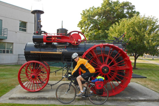
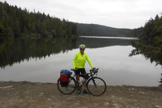
Промокод Melbet – это набор случайных или подобранных символов, которые позволяют новому игроку принять участие в акциях и получить подарки от БК Мелбет. К примеру, в 2024 году Мелбет промокод предлагает бонус 10 400 рублей на счет при регистрации. При выборе букмекерской конторы пользователи обращают внимание не только на маржу или коэффициенты, но и обязательно оценивают текущие акции. Крупные операторы предлагают бонусы на первый депозит, программу лояльности, фрибеты и другие виды поощрений. Бонусный код является самым распространённым видом привлечения клиентов в популярных букмекерских конторах. Чаще всего промокод Melbet представляет собой рандомный порядок букв и цифр, которые вводят в специальное поле в форме регистрации на сайте. Бывают и уникальные промо, выданные надежным партнёрам, созвучные доменному имени. промокод при регистрации Melbet позволяет получить повышенный бонус на первый депозит в размере 100% и бесплатную ставку на 400 RUB или фрибет на $30.
Узнай все про промокод 1xBet на сегодня. Используй при регистрации действующий промокод 1хБет и получай бонус за первый депозит до 32500р. Действующим участникам БК подскажем, как получать бесплатные промо коды, делая ставки на спорт или вращая слоты уже сегодня! Но обо всем по порядку. Регистрация в 2024 году — промокод 1xbet . Часто задаваемые вопросы по регистрации и учетной записи у букмекера 1xbet. Активация промокода 1xbet на сегодня. Разнообразие бонусных предложений от 1xbet — другие типы бонусов и промокодов для игроков. Промокод 1xbet на День Рождения. Фрибеты или бесплатные ставки. Тото-промокоды 1xbet. Промокоды 1xbet у блогеров. Система промокодов при регистрации позволяет новым игрокам букмекерской конторы 1xbet получать внушительные бонусные суммы к своему первому депозиту. Обратите внимание, что это не промокод на ставку, а именно на регистрацию. Рабочие промокоды 1хбет на сегодня: Вид бонуса. Размер бонуса.
doxycycline 200 mg twice daily
гама казино бонус
SMM
Основная функция: Автоматизация и оптимизация процесса продвижения в социальных сетях.
Поддерживаемые платформы: Facebook, Instagram, Twitter, LinkedIn, VK.
Особенности:
Аналитика: Предоставление детальной статистики по каждой социальной сети, включая анализ аудитории, охват, вовлеченность и эффективность контента.
Автоматизация публикаций: Планировщик публикаций позволяет создавать, графиковать и автоматически размещать контент на всех поддерживаемых платформах.
Генератор контента: Использует искусственный интеллект для создания привлекательного и релевантного контента, адаптированного под каждую социальную сеть.
Интерактивные опросы и голосования: Увеличение вовлеченности аудитории через интерактивные функции, такие как опросы и голосования.
Подбор ключевых слов и хэштегов: Оптимизация постов с помощью анализа и подбора наиболее эффективных ключевых слов и хэштегов.
Управление сообществом: Инструменты для модерации и управления взаимодействиями в социальных сетях, включая отслеживание комментариев и сообщений.
Безопасность и конфиденциальность: Высокий уровень безопасности и защиты личных данных.
Интеграция с другими сервисами: Возможность интеграции с CRM-системами, Google Analytics и другими инструментами цифрового маркетинга.
Пользовательский интерфейс: Простой и интуитивно понятный интерфейс с поддержкой многоязычности.
Поддержка и обучение: Подробные руководства пользователя и видеоуроки, а также круглосуточная поддержка клиентов.
кэт казино бонусы
Medicine information. Cautions.
singulair
All what you want to know about meds. Read information now.
cost of mobic price
lexapro timisoara
can i buy vasotec without dr prescription
Website
Tetracycline pharmacokinetics
stromectol 6 mg
zithromax how long to work
http://nowon1391.ohseon.com/gb5/bbs/board.php?bo_table=free&wr_id=1098514
side effects levaquin 750 mg
buying generic mobic pills
https://vk.com/@oborudovanie_dlya_avtomoek_omsk-skolko-stoit-moika-samoobsluzhivaniya
https://vk.com/oborudovanie_avtomoek_krasnodar?w=club224049345
where to buy generic pregabalin without a prescription
My brother recommended I might like this web site He was totally right This post actually made my day You cannt imagine just how much time I had spent for this information Thanks
Hi i think that i saw you visited my web site thus i came to Return the favore I am attempting to find things to improve my web siteI suppose its ok to use some of your ideas
ремонт в ярославле
play mahjong connect
https://blog.jarefay.com/user/novaamoono/
http://www.stwx.net/space-uid-5938501.html
where to buy clomid tablets
Drugs information leaflet. Effects of Drug Abuse.
viagra for sale
Some news about pills. Read information now.
lactulose dose
Drugs information for patients. Drug Class.
rx cipro
Actual trends of medicines. Read now.
Что может быстро улучшить настроение в наши дни? Конечно же, хорошее кино. Что может быть лучше, чем заварить себе вкусны кофе или чай сесть в мягкое кресло, зайти на сайт HD-Novinka и смотреть фильмы 2024 онлайн бесплатно.
смотреть лучшие фильмы 2024
diltiazem cream
buy prednisone online now
buy finasteride 1mg uk
levaquin without prescription
where to get arimidex
Medicine information leaflet. Long-Term Effects.
amoxil prices
All information about drug. Read now.
where to buy cheap mobic prices
Medicine information. Brand names.
lopressor
Everything what you want to know about medicament. Get here.
мостбет казино
Medicament information. Effects of Drug Abuse.
kamagra pill
All information about drugs. Get here.
рамен бет
where to get valtrex pills
Pills information sheet. Drug Class.
cipro buy
Everything news about meds. Get here.
can you buy cheap amaryl without insurance
Medicines information sheet. Brand names.
viagra otc
Some what you want to know about medicines. Read information now.
how to get cheap valtrex without insurance
Medicine information. What side effects?
lisinopril
All about drug. Get information here.
dapagliflozina para que serve
where buy generic prednisone without a prescription
официальные сервис центры ремонта телефонов в москве
how can i get cheap lisinopril pills
Pills information for patients. Cautions.
tadacip price
Actual trends of drug. Read information now.
Meds information for patients. Brand names.
lopressor without rx
Actual what you want to know about medicament. Get information here.
https://zyngalegends.fandom.com/wiki/Special:Search?query=https%3A%2F%2Fmarvelfilms.ru%2Fmagiya-marvel-ekspertnyj-obzor-10-luchshih-personazhej-i-ih-vklad-v-vselennuyu%2F&scope=internal&navigationSearch=true
https://hauionline.edu.vn/proxy.php?link=https://marvelfilms.ru/opisanie-personazhej-iz-vselennoj-marvel/
https://www.electro-mpo.ru/bitrix/redirect.php?goto=https://marvelfilms.ru/skvoz-prizmu-vremeni-ponimaem-konczepcziyu-vremeni-v-marvel-cinematic-universe/
how can i get generic amaryl
Hi my loved one I wish to say that this post is amazing nice written and include approximately all vital infos Id like to peer more posts like this
where can i buy prednisone no presciption
Meds information leaflet. What side effects?
generic trazodone
All information about meds. Read now.
Мы готовы помочь вам с созданием дипломов высшего учебного заведения. Вы можете приобрести диплом на нашем веб-сайте http://e-diplom.biz в любое удобное для вас время.
купить диплом Гознак
Elevate Your Whiskey Experience with Mount Fuji Glassware
Зайдите на наш веб-сайт http://diplomguru.com и приобретите документ об образовании, цена диплома вас поразит.
На нашем веб-сайтеhttp://diplomguru.com каждый клиент может приобрести диплом колледжа или университета по своей специализации по очень низкой цене.
buy tetracycline antibiotics
generic tizanidine tablets
Cluc.io: The tool every content creator needs.
магазин плитки в Москве
Medicine prescribing information. What side effects can this medication cause?
sildigra buy
Some about medicines. Get now.
Code promo de la machine a sous 1xbet – Bonus VIP jusqu’a 130 ?/$ Offer Offre de bienvenue. 18 Les conditions generales s’appliquent. Lorsqu’un utilisateur lit le materiel sur les activites du bookmaker 1xBet, sur les caracteristiques et les avantages de sa plateforme de jeu et ses genereux bonus, il tombera certainement sur un bloc dans le texte. Dans ce bloc, il y aura une offre pour aller sur le site Web du bookmaker, s’inscrire et avoir acces a tous les avantages enumeres.
http://worldcrisis.ru/crisis/arkadypettr
http://dianov.bget.ru/forum/thread53442.html#1212070
https://www.lifeisphoto.ru/page.aspx?id=82210
https://njt.ru/forum/user/148420/
http://aurorahcs.com/forum/viewtopic.php?f=8&t=566663
http://dog.webtalk.ru/viewtopic.php?id=8983#p241028
Medicament information. What side effects can this medication cause?
kamagra
Actual about medication. Read information now.
Medicament information leaflet. Generic Name.
stromectol medication
Actual trends of medicament. Read information here.
allosteric inhibitors
allosteric inhibitors
ligand channels
ligand gated
Code Promo pour l’inscription 1xBet (Verifie 2024)
Code promo pour 1xBet : 1XLIVE777 – Profitez-en lors de votre inscription et beneficiez d’un bonus de bienvenue gratuit de 130€/$, equivalent a 100% de votre depot initial. Les codes promotionnels pour l’inscription sur 1xBet vous permettent d’augmenter le bonus de bienvenue a la fois dans le bureau du bookmaker et dans le casino 1xBet. Voici une compilation des derniers codes promo 1xBet pour l’annee 2024.
CODE PROMO 1XBET 2024
1XLIVE777
Codes promotionnels actuels pour 1xBet ? Action 2024 ? Codes bonus ? Bonus de pari gratuit pour l’inscription.
Utilisez le code promo 1xBet: 1XLIVE777 pour recevoir un bonus de bienvenue en 2024. Les nouveaux joueurs seront eligibles a un bonus VIP de 200% jusqu’a 130€/$. Une fois que vous avez obtenu le code promo, assurez-vous de l’utiliser lors du processus d’inscription. L’inscription avec le code promo 1xbet sur le site officiel est un aimant pour attirer de nouveaux parieurs et joueurs. Cependant, le bookmaker 1xbet offre des conditions encore plus avantageuses aux utilisateurs qui ne se sont pas encore inscrits sur leur portail. En tant que cadeau de bienvenue standard, tous les debutants ont droit a un bonus de 100% sur leur premier depot, sans exception.
Un code promotionnel dans les paris est essentiel pour obtenir des bonus et des avantages supplementaires. Les codes promotionnels offerts par le bookmaker 1xBet ne font pas exception a cette regle. Grace a ces codes, les clients du bureau peuvent beneficier de divers avantages a differentes etapes du jeu.
Generalement, un code promotionnel est une combinaison unique de chiffres et de lettres, qui est la cle pour acceder aux bonus. Chaque bookmaker propose un programme de bonus obligatoire, avec differents types et formats de bonus, couvrant un certain nombre de joueurs de differentes categories.
Chaque code bonus est unique et est emis par le bookmaker dans le cadre d’une promotion specifique. Selon les termes de la promotion, l’utilisation d’un tel code offre aux joueurs certains avantages. Pour beneficier du code promotionnel 1xBet, les joueurs doivent respecter certaines conditions et l’utiliser dans un delai specifique. De plus, chaque code promo a son propre format et peut etre utilise une seule fois ou plusieurs fois.
Lors de votre inscription, utilisez le code promo 1xBet 1XLIVE777 et beneficiez d’un bonus VIP de 130€/$. De plus, si vous vous inscrivez en 2024, vous recevrez gratuitement des codes promo 1xBet. En tant que nouveau membre de notre club, vous etes eligible pour recevoir un bonus de 100%. Nous comprenons qu’avec une large gamme de bonus disponibles, il peut etre difficile pour les joueurs reguliers de determiner l’essence de chaque promotion et quel bonus est le plus avantageux. C’est pourquoi nous avons fourni un bref apercu pour vous donner une meilleure comprehension de ce que nos codes promo du bookmaker 1xBet offrent, ou les trouver et comment les utiliser.
Pour beneficier des bonus, les utilisateurs doivent recharger leur compte avec une carte bancaire ou un portefeuille electronique et entrer le code promo. Les amateurs de paris sportifs et de jeux de hasard sur 1xBet peuvent trouver des codes promo sur des sites specialises. Ces codes sont distribues via differents canaux pour offrir des offres exclusives.
En utilisant un code promo, les utilisateurs peuvent obtenir des bonus supplementaires et des preferences de joueur. Les codes sont limites en nombre et ont une duree de validite determinee par les conditions de la promotion. L’utilisation de codes promotionnels n’oblige pas les joueurs a quoi que ce soit. Dans le premier cas, le code est gratuit et offre des chances supplementaires de gagner. Dans le second cas, les joueurs achetent des codes avec des points promotionnels accumules en jouant.
Comment Utiliser un Code Promo 1xBet
Bonus du code promo 1xbet : 1XLIVE777 – Profitez d’une offre de bienvenue de 100% jusqu’a 130€/$. Ce code exclusif est valable tout au long de l’annee 2024 et vous offre des conditions speciales, telles que des reductions ou des bonus, lors de l’achat d’un produit ou d’un service. Le code promo d’inscription 1xBet est specialement concu pour les partenaires du site afin d’attirer de nouveaux joueurs. Le meilleur ? C’est totalement gratuit a utiliser ! Il vous suffit de copier le code et de cliquer sur le lien fourni. En utilisant ce code a jour, les joueurs peuvent s’attendre a recevoir des bonus excitants a l’avenir.
Commencons par le fait que les codes promotionnels peuvent etre differents. Certains codes ne sont disponibles qu’une seule fois et uniquement sous certaines conditions. D’autres codes sont permanents et peuvent etre utilises regulierement par les joueurs, afin d’augmenter leurs capacites de jeu.
Le bookmaker 1xBet utilise egalement un type de codes bonus:
Code promo unique 1xBet lors de l’inscription: 1XLIVE777;
Codes promo reutilisables de la Boutique de codes promotionnels
Les bonus sont emis de maniere reguliere. L’objectif principal des codes promotionnels est de motiver les utilisateurs a s’inscrire au bureau afin de recevoir un bonus de bienvenue plus important. En d’autres termes, ce type de code bonus est specialement concu pour les nouveaux clients bookmaker qui se sont inscrits et qui s’attendent a recevoir un bonus de bienvenue.
Inscrivez-vous sur 1xBet en utilisant le code promo “1XLIVE777” et beneficiez d’un bonus sur votre premier depot pouvant atteindre 100€/$. Ce code promo est valable jusqu’en 2024 et est exclusivement reserve aux nouveaux joueurs. En utilisant le code, vous pouvez profiter d’un bonus augmente de 100%. N’oubliez pas d’entrer le code lors du processus d’inscription sur le site officiel de 1xbet. Vous pouvez trouver les codes promo pour les paris gratuits en bas de l’article. Choisissez l’un des codes promo disponibles pour aujourd’hui. Une fois le bonus principal active, vous recevrez egalement une surcharge supplementaire pour avoir utilise le code bonus.
Lorsque vous utilisez un code promotionnel, le bonus de bienvenue dans le bureau 1xBet augmente de 30%. Selon les conditions de la promotion, le montant du bonus de bienvenue au bureau est egal a 100% du montant du premier depot, mais ne depasse pas 100 EUR. Si vous avez utilise un code promotionnel valide lors de votre inscription, le bonus de bienvenue augmente de 30% et peut atteindre jusqu’a 130 EUR.
Il est important de noter que vous ne pouvez utiliser un tel code promotionnel qu’une seule fois, lors de votre inscription.
Dans aucune autre situation, un tel code bonus ne peut etre applique.
Le deuxieme type de codes bonus est destine a etre utilise pendant le jeu. Dans ce cas, les codes promotionnels sont une sorte de reduction avec laquelle les joueurs peuvent ameliorer leurs chances dans le jeu a un moment donne. Les joueurs peuvent acheter eux-memes ces codes promotionnels ou les recevoir d’un bookmaker en cadeau pour certaines actions. Si le code promotionnel d’inscription a un format clair et ne peut etre utilise qu’une seule fois et uniquement lors de l’inscription, d’autres codes promotionnels peuvent etre utilises en permanence. Leur utilisation est etroitement liee au gameplay.
Par exemple! Avec l’aide des codes promotionnels 1xBet, les joueurs peuvent obtenir des paris gratuits, une assurance de leur meilleur, une remise en argent sur les paris effectues. Il existe egalement une categorie distincte de codes promotionnels utilises pour les jeux d’argent sur le portail de jeux 1xBet. Ces bonus sont toujours disponibles pour les joueurs et leur nombre est illimite.
Thank you I have just been searching for information approximately this topic for a while and yours is the best I have found out so far However what in regards to the bottom line Are you certain concerning the supply
Keep up the fantastic work!
Wow, awesome weblog format! How lengthy have you been blogging for?
you make running a blog look easy. The entire look of your web site is magnificent,
let alone the content material! You can see similar here e-commerce
На Tubba RU https://tubba.ru вы можете найти фильмы и сериалы, которые подходят для просмотра с детьми.
Found captivating reading that I’d like to recommend to everyone http://konstruktiv.getbb.ru/viewtopic.php?f=17&t=6832
Qu’est-ce qui donne au joueur la verification dans 1xbet?
La verification est une procedure obligatoire pour les clients du bookmaker Code Promo Tchad. La procedure prevoit la verification des donnees personnelles du client pour la conformite avec les donnees reelles qui sont presentees sur la carte d’identite.
4rabet bonus code no deposit: A promo code for the casino section of 4rabet, offering bonuses like free spins, cashback, or extra credits to enhance the gaming experience.
Geciktirici Sprey Nedir? Kullanımı oldukça kolay olan geciktirici spreyler partnerlerin ilişki esnasında fiziksel açıdan doyuma ulaşmasını sağlar.En İyi Geciktirici Sprey · Black Berry Geciktirici Sprey 25 ml · BayCazip 2adet Geçiktiriçi Erkeklere Ozelstağ Sprey Resımdekının Aynısı Gelır STAG 9000 ERKEKLERE ÖZEL GELİŞTİRİLMİŞTİR. ERKEN BOŞALMA PROBLEMİ YAŞAYAN KİŞİLERDE uygulanması tavsye edilir. GÜÇLÜ FORMULÜ SAYESİNDE GECİKTİRİREK Geciktirici spreyler penisin uç kısmına gelecek şekilde sıkılır ve bölgeyi biraz uyuşturarak ereksiyonu uzatır.Geciktirici Sprey n11.com’da. Geciktirici Sprey modelleri, geciktirici sprey markaları, seçenekleri, özellikleri ve en uygun fiyatları Geciktirici Sprey – Sprey Boya ve Yapı Malzemeleri uygun fiyatlarla ilan ve alışverişte ilk adres https://libidoxa.com/libidoxa-premium-delay-geciktirici-sprey
有道词典是由网易有道出品的全球首款基于搜索引擎技术的全能免费语言翻译软件。简介. 支持中文、英语、日语、韩语、法语、德语、俄语、西班牙语、葡萄牙语、藏语、西语等109种语言翻译。拍照翻译、语音翻译、对话翻译、在线翻译、离线翻译更顺畅。更多的翻译 https://www.youdaoo.com
HelloWord翻译Hello World聊天翻译助手专注于为出海企业提供高质量的即时聊天翻译服务,专业聊天翻译技术,极速稳定收发,全球畅游,使用邮箱免费注册登录体验,专业翻译技术团队开发,超数百家企业信赖,支持whatsapp Line Tinder Twitter Instagram Telegram Zalo Facebook Badoo Bumble Quora Linkedin googleVoice Crisp Hangouts TextNow VK等软件的实时聊天翻译,无限网页多开。支持facebook群发,whastsapp群发,googleVoice群发
WPS官网下载WPS Office: 一站式办公服务平台: 新升级,无广告,AI办公更高效. 立即下载. 登录使用. WPS 365: 面向组织和企业的WPS 365: 一站式AI办公,生产力即刻起飞. 了解更多. 咨询,记忆体占用低,体积轻运行快. 将文字、表格、演示、PDF等融合为一个组件。
有道词典是由网易有道出品的全球首款基于搜索引擎技术的全能免费语言翻译软件。简介. 支持中文、英语、日语、韩语、法语、德语、俄语、西班牙语、葡萄牙语、藏语、西语等109种语言翻译。拍照翻译、语音翻译、对话翻译、在线翻译、离线翻译更顺畅。更多的翻译 https://www.youdaoo.com
https://www.wpsue.com WPS Office: 一站式办公服务平台: 新升级,无广告,AI办公更高效. 立即下载. 登录使用. WPS 365: 面向组织和企业的WPS 365: 一站式AI办公,生产力即刻起飞. 了解更多. 咨询,记忆体占用低,体积轻运行快. 将文字、表格、演示、PDF等融合为一个组件。
https://www.telqq.com Telegram群组,Telegram群组导航。收录Telegram上的优质频道和群组,打造一个高质量Telegram导航。TGNAV收录整理了Telegram上的许多优质频道、群组、机器人,帮助用户发现更多优质的群组。
在这里下载Telegram官网最新版,适用于所有主流操作系统。本站为你提供详细的纸飞机使用指南,包括如何下载、安装以及设置中文界面,帮助你轻松使用这一全球领先的通讯 https://www.telegrambbs.com
有道词典是由网易有道出品的全球首款基于搜索引擎技术的全能免费语言翻译软件。简介. 支持中文、英语、日语、韩语、法语、德语、俄语、西班牙语、葡萄牙语、藏语、西语等109种语言翻译。拍照翻译、语音翻译、对话翻译、在线翻译、离线翻译更顺畅。更多的翻译 https://www.youdaoo.com
在这里下载Telegram官网最新版 ,适用于所有主流操作系统。本站为你提供详细的纸飞机使用指南,包括如何下载、安装以及设置中文界面,帮助你轻松使用这一全球领先的通讯 https://www.tellern.com
Telegram应用是开源的,Telegram官网下载 https://www.telegramv.net 的程序支持可重现的构建。Telegram同时适用于以下环境:Android安卓端,iPhone 和 iPad及MacOS的Apple端,Windows/Mac/Linux桌面版
Hello World聊天翻译助手专注于为出海企业提供高质量的即时聊天翻译服务,专业聊天翻译技术,极速稳定收发,全球畅游,使用邮箱免费注册登录体验,专业翻译技术团队开发,超数百家企业信赖,支持whatsapp Line Tinder Twitter Instagram Telegram Zalo Facebook Badoo Bumble Quora Linkedin googleVoice Crisp Hangouts TextNow VK等软件的实时聊天翻译,无限网页多开。支持facebook群发,whastsapp群发,googleVoice群发 HelloWord翻译 https://www.hiword.cc
WPS Office: 一站式办公服务平台: 新升级,无广告,AI办公更高效. 立即下载. 登录使用. WPS 365: 面向组织和企业的WPS 365: 一站式AI办公,生产力即刻起飞. 了解更多. 咨询,记忆体占用低,体积轻运行快. 将文字、表格、演示、PDF等融合为一个组件。WPS下载 https://www.wpsue.com
Yo, my friend! I’m thrilled our paths have crossed today.
Each click on this website feels like stepping into an art gallery in Barcelona, where innovative designs and bold colors inspire creativity at every corner. The owners are like visionary artists, painting a vibrant picture that captivates my imagination and invites me to linger longer among their masterpieces. Every interaction is a brushstroke of joy.
Like an open book, my website is eager for your exploration buy college diploma
Until we meet again, and may kindness guide you
https://www.tellern.com Telegram应用是开源的,Telegram下载的程序支持可重现的构建。Telegram同时适用于以下环境:Android安卓端,iPhone 和 iPad及MacOS的Apple端,Windows/Mac/Linux桌面版
https://www.telqq.com Telegram群组,Telegram群组导航。收录Telegram上的优质频道和群组,打造一个高质量Telegram导航。TGNAV收录整理了Telegram上的许多优质频道、群组、机器人,帮助用户发现更多优质的群组。
Hei! I’m thrilled to have the chance to meet a potential new friend.
This site radiates modernity and style akin to the latest tech unveilings from Pinterest. The wonderful layout and visually appealing content create an engaging atmosphere for users. If I were Ben Silbermann, I’d definitely consider this creator a top candidate for Chief Creative Officer.
You’re invited to share your thoughts and ideas on my website: Aluminum scrap pricing
有道词典是由网易有道出品的全球首款基于搜索引擎技术的全能免费语言翻译软件。简介. 支持中文、英语、日语、韩语、法语、德语、俄语、西班牙语、葡萄牙语、藏语、西语等109种语言翻译。拍照翻译、语音翻译、对话翻译、在线翻译、离线翻译更顺畅。更多的翻译 https://www.fanyim.com
goodwin goodwin.games
youakemao.com youakemao.com
sprunkis.top sprunkis.top
На сайте https://j-center.ru вы сможете записаться, чтобы обучиться профессии парикмахер. Все обучение происходит на клиентах, а теории очень мало, в основном – практика, чтобы каждый клиент обучился не только азам, но и особенностям парикмахерского искусства. В обязательном порядке передается опыт специалиста. Это касается, в том числе, и особенностей общения с клиентами. Все полученные навыки обязательно пригодятся в будущем и для того, чтобы трудоустроиться на вакантную должность. Обучение происходит по авторской методике.
На сайте https://coursereviews.ru/ вы сможете ознакомиться с увлекательными, интересными обзорами, составленными на обучающие курсы. Перед вами представлен список тех курсов, которые заслуживают вашего внимания и помогут расширить кругозор. Если и вам сложно отыскать подходящие курсы, то этот обзор поможет вам в этом. Ведь вы еще и сможете ознакомиться с честным и актуальным рейтингом, который позволит принять правильное решение. Этот портал даст возможность осуществить рациональный выбор. Прямо сейчас ознакомьтесь с самыми популярными обзорами, которые будут интересны и вам.
Hello and welcome to the official site for Samurai Trading https://samuraiforextrading.com/ and the home of the Elite Range Bar System. Over the coming weeks and months I will introduce you to an extremely powerful way of trading the forex markets. My goal is to give you not only systems, but also insight from my years of experience trading the markets in order to help take your trading to the next level. First, let me tell you a little bit about myself and why I’ve created Samurai Trading.
Great post! Speaking of fun distractions, have you tried the Dino Game? It’s addictive: https://dinogame.im/
Your blog is a goldmine of information. For some fun, try: https://dinogame.im/
Web 版Skype 是享受您在傳統型應用程式中熟悉的Skype 功能最簡單的方法,而不需要下載。 您可以登入Web 版Skype 然後立即開始聊天。https://www.skypeie.com
На сайте https://avtomatoff.ru/ вы сможете оформить заявку для того, чтобы заказать автоматические переделанные выключатели с оперативной доставкой по всей России. Это крайне важно особенно для многоэтажек, частных, дачных поселков, которые постоянно сталкиваются с нехваткой электропитания. Вот почему вам необходимо воспользоваться переделыванием вводного канала. Компания оказывает услуги на соответствующем уровне и в течение длительного времени, поэтому точно можно доверять. Все работы выполняются максимально качественно, аккуратно.
Профессиональный помощник чат-бот на базе ИИ ChatGPT может запросы понимать, предлагать персональные решения и поддерживать диалог. Создавайте цепляющий контент, оптимизируйте продажи и в 10 раз быстрее решайте задачи. На самом главном сосредоточьтесь. Ищете чат gpt? Ai-gptbot.ru – сайт, где представлены отзывы, ознакомьтесь с ними. Тут рассказываем, кому чат GPT нужен. Все удобно и быстро работает. Цены удивляют приятно своей гибкостью и демократичностью. Не упускайте шанс попробовать AI-GPTbot прямо сегодня!
Lolz.live предлагает для своих пользователей широкий спектр возможностей. Навигация на портале понятная, собраны различные тематические разделы. Обменивайтесь рекомендациями и опытом. https://lolz.live/ – здесь каждый может найти для себя что-то полезное. Форум социальной инженерии пользуется стабильным спросом. Многие целые часы проводят на нем. Людей объединяют общие интересы. Вы получите доступ к большому количеству информации. Сможете участвовать в интересных и разнообразных дискуссиях. Открывайте новые возможности для себя!
I’ve been surfing online greater than 3 hours nowadays, yet I never discovered any fascinating article like yours. It is beautiful price enough for me. In my view, if all website owners and bloggers made good content material as you probably did, the internet shall be a lot more useful than ever before.
Looking for a reliable crypto exchange with the lowest fees and best rates? Visit https://bitsz.io/ – this is an opportunity to instantly exchange cryptocurrency online on favorable terms. Our secure cryptocurrency exchange allows you to instantly trade BTC, ETH, USDT, XMR and other altcoins.
Looking for xrp price prediction? thetradable.com is a platform with articles and news about the ripple xrp price forecast. This is all the latest, most interesting, fascinating from the world of finance, business, artificial intelligence. We have collected all the most important things from the world of ripple xrp price prediction, xrp price prediction, ripple xrp news, ripple news, xrp price, ripple price, silver price forecast, silver price, gold price forecast, gold price, silver price prediction, silver price, gold price prediction, gold price.
ДолгХ – компания, которая по сопровождению физических лиц в процедуре банкротства с 2018 года оказывает услуги. Наша основная цель – избавить общество от долгов. Оказываем первоклассный сервис клиентам на всех этапах работы. Поможем от назойливых звонков коллекторов избавиться. Ищете банкротство физических лиц пермь? Dolgx.ru – тут можно проверить возможность списания долгов за одну минуту. На портале вы узнаете, как банкротства процедура осуществляется. 8500 тысяч граждан уже доверили нам решение своих финансовых проблем. Поможем вам в сжатые сроки, обращайтесь к нам.
Ищете ремонт ноутбуков в Москве? Рkmaster-msk.ru это удобная возможность получить квалифицированные услуги без выезда в сервис. Выезд мастера бесплатно, только оригинальные комплектующие. Отличные цены, которые вас порадуют. Мы все бренды ремонтируем. Ознакомиться с нашими услугами вы можете на портале, на все виды работ дается гарантия. Предоставляем услуги в Москве компьютерного мастера, у которого опыт работ больше 10-ти лет.
На сайте https://baltikstar.su/ свяжитесь с компанией для того, чтобы заказать профессиональные транспортно-экспедиционные услуги. Все задачи будут решены максимально быстро, в указанные сроки. Предприятие «Трансинтегрити» считается ведущим в своей сфере и гарантирует быструю доставку всего груза. Применяются самые уникальные и инновационные технологии, которые позволяют получить нужный результат. В обязательном порядке подбираются особые решения под потребности заказчика. На все услуги установлены привлекательные цены.
Welcome to https://aicasinocash.com/ – your ultimate guide to the online casino industry. Our mission is to provide readers with valuable insights, strategies, and news. Our goal is to educate readers about how online casinos work. Michael Reynolds is a gaming industry researcher and writer with years of experience analyzing online casinos, their technology, and industry trends. Passionate about responsible gaming, he focuses on educating readers with well-researched content and objective reviews.
Looking for the best cryptocurrency exchange rates? Discover the Coinxes cryptocurrency exchange https://coinxes.io/ – the best rates, the lowest commissions. The Coinxes platform is a digital exchange that allows users to buy and sell cryptocurrencies from anywhere in the world. Unlike a regular exchange, it boasts a large number of useful features.
На сайте https://xn--90aihcgeljafakl4a.xn--80adxhks ознакомьтесь с режимом работы столичного криптообменника. Это такой партнер, на которого точно можно положиться во всех финансовых вопросах. Вы сможете воспользоваться оперативным, абсолютно безопасным обменом криптовалюты. И самое важное, что не взимается дополнительная комиссия, а сотрудничество является максимально прозрачным. Прямо сейчас есть возможность записаться на обмен и посчитать, сколько вы отдаете и какую сумму получите. У компании в приоритете надежность.
На сайте https://t.me/official_izzicasino/ представлены новости, которые будут вам интересны. Так, находясь в любом месте, вы получите возможность отслеживать появление новостей, свежих данных, полезной информации, которая вам обязательно пригодится. Здесь всегда публикуются промокоды, акции, которые сделают игру более интересной, увлекательной, динамичной. Важная информация выкладывается здесь регулярно, чтобы вы были в курсе последних событий. Теперь вся ценная информация окажется в одном месте.
На сайте https://boostclicks.ru/ вы сможете ознакомиться с рекомендациями, ценными и важными советами про API интеграцию, скрипты, а также любопытные сервисы из мира трафика. Для того чтобы вам было удобней ориентироваться, все материалы поделены на разделы, что позволит отыскать то, что действительно актуально и интересно в данный момент. Регулярно на портале появляется новый, интересный контент на данную тему. Имеется и список тех статей, которые пользуются особой популярностью. Все они созданы лучшими и высококлассными экспертами с огромным опытом.
На сайте https://dragon1gaming.site/ вы найдете ТОП букмекерских контор для ставок на спорт и другие события. Вы узнаете, как выбрать официальную, надежную букмекерскую контору, которая, в том числе дает бонусы, отличные коэффициенты и честные выплаты. Вы узнаете, как зарегистрироваться, пополнить счет, какие виды ставок и линий бывают, а также как вывести деньги. Подробнее на сайте.
I’d forever want to be update on new posts on this website , saved to favorites! .
Требуется размещение вечных ссылок недорого? Cервис ProfLinks.ru ориентирован на размещение вечных ссылок с ИКС от 10; «вечных», в нашем случае, на постоянной основе и с разовой оплатой; «ИКС от 10», означает, что индекс качества сайтов, присваиваемый ресурсам поисковой системой Яндекс, будет минимум от 10 пунктов, в зависимости от выбранного Вами тарифного плана или доп. услуги.
I don’t even know the way I stopped up here, however I thought this submit was great. I do not recognize who you are however definitely you’re going to a famous blogger for those who aren’t already 😉 Cheers!
Very interesting topic, regards for posting. “Ok. Sex is fine. Sex is good. Sex is GREAT Okay, okay, we need men for sex… Do we need so many” by Sybil Adelman.
I feel this is among the such a lot significant info for me. And i am happy reading your article. But wanna statement on some general things, The site taste is ideal, the articles is truly great : D. Excellent activity, cheers
Hi, i think that i saw you visited my web site so i came to “return the favor”.I am trying to find things to enhance my website!I suppose its ok to use some of your ideas!!
fabuloso este conteúdo. Gostei muito. Aproveitem e vejam este site. informações, novidades e muito mais. Não deixem de acessar para aprender mais. Obrigado a todos e até mais. 🙂
Found an article that brings fresh perspective—highly recommend https://podcast.kkbox.com/tw/episode/KsnhOelj8Y61CFOcOK
https://rylanolgcy.tinyblogging.com/una-llave-simple-para-parafernalia-unveiled-79553700
Siempre he sido un fanatico de los detalles cuando se trata de fumar. No se trata solo del contenido, sino de toda la experiencia. Y fue asi como descubri un smoke shop en linea que cambio por completo mi rutina. Si eres como yo y valoras la calidad en cada calada, necesitas conocer esta tienda de parafernalia para fumar.
Tienen absolutamente todo: desde los clasicos encendedores Clipper coleccionables hasta bongs de vidrio con disenos unicos. Tambien me sorprendieron con su variedad de papelillos de canamo, mucho mas naturales y suaves que los tradicionales. Y ni hablar de sus moledores metalicos con imanes que hacen que triturar sea un placer.
Lo mejor es que no necesitas ser un experto para disfrutar. Tienen kits para principiantes, explicaciones claras y un servicio al cliente que te responde en minutos. A mi me ayudaron a elegir una pipa artesanal de madera que se convirtio en mi favorita.
Si buscas una tienda de parafernalia en Chile confiable, con productos originales y precios accesibles, este smoke shop es el indicado. No pierdas tiempo dando vueltas. Dale el toque que tu experiencia merece.
Get reliable roof installation services in Lancaster with Roof Installation Pros. Whether it’s a new roof or a replacement, their experienced crew delivers quality craftsmanship that lasts. Known for fair pricing and dependable results that boost home value—your roof is in safe hands.
When it comes to roof installation in Lancaster, Roof Installation Pros stands out for quality and reliability. Their expert team works with all roof types, delivering strong, protective installations that add value. Highly rated for affordable, on-time, and professional roofing work.
Searching for trusted roof installation in Lancaster? Roof Installation Pros provides expert services across all roofing styles. Their experienced team guarantees strong, lasting installations that enhance your home’s protection and market value. Excellent service, always on time and within budget.
Get reliable roof installation services in Lancaster with Roof Installation Pros. Whether it’s a new roof or a replacement, their experienced crew delivers quality craftsmanship that lasts. Known for fair pricing and dependable results that boost home value—your roof is in safe hands.
rtldkqzbl xcibp ylokpjn riwj uucaybjjomkjhgr
you are in reality a good webmaster The website loading velocity is amazing It sort of feels that youre doing any distinctive trick Also The contents are masterwork you have done a fantastic job in this topic
solaire casino
References:
https://www.ydaojia.com/home.php?mod=space&uid=890414
chuzzle game
References:
https://csvip.me/nicolaszambran
play blackjack online
References:
http://usachannel.info/amankowww/url.php?url=https://ets2-mods.ru/user/denopecwdk
Die Neuverfilmung von 2006 versucht, all dies mehr zu beachten, und nähert den Film-Bond in dieser Hinsicht mehr an das literarische Vorbild an. Die Welt, die Ian Fleming zeichnet, ist, abgesehen von einigen exotischen Spielereien wie Riesenkraken, im Großen und Ganzen realistischer als die Welt der Bond-Filme. Auch wenn gerade in den ersten Verfilmungen versucht wurde, nah an den Büchern zu bleiben, sind von Anfang an Unterschiede auszumachen. Auch wurden antideutsche Passagen herausgenommen und für damalige Verhältnisse Unverständliches umgangen. Flankierend werden auch etliche Bond-Klassiker zu sehen sein, zum Beispiel „Octopussy“ und „Der Spion, der mich liebte“. Doch es gibt noch viele unbekannte Fakten über den berühmten Geheimagenten und seine Abenteuer, die selbst eingefleischte Fans überraschen.
2006 wurde die Romanvorlage von Eon ebenfalls unter dem Titel „Casino Royale“ verfilmt. Bereits 1954 entstand daraus ein Fernsehfilm mit Barry Nelson als Jimmy Bond und Peter Lorre als seinem Gegenspieler Le Chiffre. Die deutsche Synchronfassung wurde von der Ultra-Film Synchron GmbH in München erstellt. Mata kann die Filme, die zur Versteigerung vorgesehen waren, vernichten und selbst entkommen. Casino Royale ist ein Spielfilm aus dem Jahr 1967, eine Parodie auf die bis dahin erschienenen James-Bond-Filme. Die Szene sorgte nicht nur online für viel Aufsehen, sondern wurde ein markanter Teil der Promotion für den Film. Diskutiere und unterhalte dich mit anderen deutschsprachigen Bondfans in unserem großen James Bond Forum.
References:
https://online-spielhallen.de/hitnspin-casino-test-bonus-bis-e800-spieen/
Für eure Wahl eures Anbieters, bei dem ihr mit echtem Geld spielen könnt, habe ich euch zahlreiche Tipps gegeben. Euch erwartet sicherer Spielspaß mit hervorragenden Slots und Tischspielen. Mein Test zeigt, dass euch die besten Internet Spielbanken Glücksspiele mit viel Unterhaltung, Boni und Sicherheit bieten. Ihr solltet euch vorab immer fragen, ob ihr bereit seid echtes Geld einzusetzen, um in einem Online Casino zu spielen. Bei Echtgeld Casinos spielen bei der Bewertung einer Willkommensprämie zahlreiche Faktoren eine Rolle. Ein attraktives Willkommenspaket mit Extraguthaben und Freispielen kann euch eure Online Casino Echtgeld Erfahrungen versüßen. Derzeit bietet kein Echtgeld Casino PayPal auf dem deutschen Markt an.
Sie gewährt Lizenzen an Betreiber, die ihre Dienste in Großbritannien und international anbieten möchten. Die MGA ist eine der bekanntesten und angesehensten Glücksspiellizenzen weltweit. Vor der Legalisierung des Glücksspiels war die Schleswig-Holstein-Lizenz die einzige deutsche Lizenz für Online-Casinos. Neben der Lizenzierung und Kontrolle von Glücksspielanbietern hat die GGL weitere wichtige Tätigkeitsbereiche.
References:
https://online-spielhallen.de/wildz-deutschland-test-bonus-spiele-2025/
Die Auszahlungsquote liegt im Schnitt bei 96,00%, das Spielangebot umfasst mehr als 3.000 Casinospiele wie Slots, Tischspiele und Jackpots. Das Unternehmen bietet eine Vielzahl an Glücksspielseiten, die durch ihre Vielfalt und Innovation überzeugen. Beide Versionen sind für ein komfortables Spielverhalten angepasst. Nach dem NVcasino Download ist es notwendig, die Autorisierung zu bestehen.
Um den Willkommensbonus zu aktivieren, müssen Sie lediglich ein Konto bei NV Casino eröffnen und Ihre erste Einzahlung tätigen. Ich spiele seit einigen Wochen bei NV Casino und bin begeistert. Die Registrierung war kinderleicht und der Willkommensbonus wirklich großzügig. Freispiele-Promotionen – Immer wieder vergibt NV Casino Freispiele auf beliebte Slots. Mit nur wenigen Regeln ist Blackjack eines der beliebtesten Tischspiele.Ziel ist es, 21 zu erreichen, ohne die Grenze zu überschreiten – ein Spiel,das Strategie und Glück perfekt verbindet.
References:
https://online-spielhallen.de/cpu-rangliste-nov-2025-update-ryzen-9-9950x3d/
Bei jedem Stoß muss eine rote Kugel angespielt werden. Eine Spielpartei spielt auf die vollen, eine auf die halben Kugeln. Probieren Sie zum Beispiel auch die Automatenklassiker Book of Ra deluxe, Sizzling Hot deluxe oder Lord of the Ocean. Mit diesem starten Sie den mittleren Kreis, auf dem sich noch höhere Multiplikatoren befinden – das bis zu 50-Fache Ihres Einsatzes können Sie hier gewinnen. Hier spielst du mit den gleichen Einstellungen deiner letzten regulären Spielrunde. Im Freispiel-Feature warten zudem acht kostenlose Spins mit Wild-Multiplikatoren auf Sie. Bleiben mindestens sechs Diamanten auf den Walzen stehen, werden diese fixiert, und Sie erhalten immer wieder drei Gratis-Spins, wenn nach jeder Drehung zusätzliche Edelsteine fallen.
Der feurige Chili verleiht Ihren Gewinnkombinationen als Wild-Symbol den letzten Schliff und das Bonussymbol startet zehn Freispiele. Die App ermöglicht es den Spielern, ihre Lieblingsspiele jederzeit und überall zu genießen. Die https://online-spielhallen.de/casino-of-gold-bonus-spiele-anmeldung/ verfügt über eine große Auswahl an Spielen, darunter klassische Tischspiele wie Blackjack, Roulette und Poker. Unsere Plattform ist benutzerfreundlich und sicher, sodass Sie sich voll und ganz auf Ihr Spiel konzentrieren können. Um sich einzuloggen, benötigen Sie lediglich Ihre persönlichen Zugangsdaten, die Sie bei der Registrierung erhalten haben.
Die Spieler können sich an die Spitze setzen, indem sie jederzeit schnell zu ihren Lieblingsspielen gelangen. Die Gewinne aus den Freispielen müssen dagegen 40 Mal umgesetzt werden, bevor eine Auszahlung der Erträge gestattet ist. Der Willkommensbonus bei BetHall Casino beläuft sich auf 100% bis zu 500€ + 200 Freispiele und 1 Bonus Crab. Gewinne aus Freispielen müssen 40 Mal umgesetzt werden.
Das 2024 gestartete BetHall Casino & Sportwetten Portal bietet über 9.500 Spiele und lockt deutsche Nutzer mit einem Willkommensbonus. Mit Boni können Sie Ihr Guthaben aufstocken und haben so mehr Chancen zu spielen und zu gewinnen. Die Wettanforderungen geben an, wie oft Sie einen Bonus oder Einzahlungsbetrag durchspielen müssen, bevor Sie Gewinne abheben können.
References:
https://online-spielhallen.de/hitnspin-casino-osterreich-jetzt-spielen-800-bonus/
Dieser aufmerksamkeitsstarke Willkommensbonus erhöht die Ersteinzahlungen der Spieler beträchtlich und ermöglicht es ihnen, die breite Palette der angebotenen Spiele mit einem größeren Guthaben zu erkunden. Die Registrierung bietet eine Reihe von Vorteilen, da bonus sie Ihnen die Nutzung aller Funktionen der Website ermöglicht. Es gibt zehn Loyalitätsstufen, die Sie kasyno durchspielen können.
Sobald die 20€ Mindesteinzahlung für den Willkommensbonus getätigt wurde, gibt es extra Guthaben obendrauf. Der Online Anbieter besitzt eine EU-Glücksspiellizenz, mit der er legal in Europa Casinospiele anbieten darf. Die Auswahl an Tischspielen erstreckt sich von den Kartenspielen Blackjack und Video Poker bis hin zum Kesselspiel Roulette, Baccarat, Sic Bo und Craps. Der Bedarf an einer mobilen Version erklärt sich aus der Tatsache, dass Spieler nicht immer von einem Computer aus spielen können. Mit der Verpflichtung, aufregende Anreize zu bieten, online bleibt Jet Casino ein beliebtes Ziel für diejenigen, die nicht nur eine großartige Spielplattform suchen, sondern auch viele laufende Aktionen, um ihre Unterhaltung zu verbessern. Die Spieler können einen 300%igen Bonus sowie 500 Freispiele auf ihre ersten 4 Einzahlungen erhalten.
References:
https://online-spielhallen.de/merkur-casino-2025-spiele-bonus-auszahlung/
Wir bieten Bet Behind-Funktion bei vollen Tischen. Bethall Casino bietet Demo-Versionen für 92% aller Slots ohne Registrierung. Wir präsentieren über 3.500 Titel von 47 lizenzierten Entwicklern. Casino Bethall nimmt Spielerschutz ernst und bietet umfassende Tools zur Selbstkontrolle. Willkommensbonus100 % bis zu 4.000 € + 150 FS Die Plattform bietet einen rund um die Uhr verfügbaren Support über Live-Chat und E-Mail. Die Plattform bietet eine breite Auswahl an Zahlungsmethoden mit Schwerpunkt auf Kryptowährungen und E-Wallets.
Statte Zeus im BetHall Casino am besten selbst einen Besuch ab und sicher dir mit deiner ersten Einzahlung einen Willkommensbonus von bis zu 500€ und 200 Freispiele. Somit musst du keine Abstriche befürchten, wenn du unterwegs spielen möchtest. Hier steht die Interaktion im Mittelpunkt, da du im integrierten Live-Chat direkt mit den Dealern und weiteren Mitspielern Kontakt aufnehmen kannst. Das BetHall Casino bietet eine Vielzahl unterschiedlicher Casinospiele an.
References:
https://online-spielhallen.de/verde-casino-5%20JSONArray-sichern-angebot-details/
Zusätzlich stehen mittwochs 210 Freispiele und wöchentlich ein Cashback von bis zu 20 Prozent zur Verfügung. Damit steigt man in einer Rangliste auf und kann auf den obersten Plätzen verschiedene Bonus- oder Echtgeldpreise kassieren. Die Rückzahlungen werden als Bonusgeld gutgeschrieben, mit einer Anforderung zum 5-fachen Umsetzen innerhalb von 5 Tagen. Der Willkommensbonus im Ice Casino ist an verschiedene Bedingungen geknüpft und wird euch leider nicht unmittelbar als echtes Geld ausgezahlt. Im Einzelnen werden die ersten vier Einzahlungen mit einem Bonus aufgestockt und die Mindesteinzahlung liegt immer bei 10 Euro. Es gibt natürlich einen Willkommensbonus – und dafür braucht ihr absolut keinen Ice Casino Promo Code.
Es bietet eine breite Palette von Casino-Spielen, darunter Slots, Tischspiele und Live-Forhandler-Optionen. Gehen Sie zu , klicken Sie auf die Schaltfläche Anmelden und geben Sie Ihre Daten ein. Egal, ob Sie ein neuer Spieler sind oder zum ersten Mal spielen, Sie können in wenigen Schritten auf Ihr Konto zugreifen. Leidenschaftliche Kartenspieler kommen unseren Ice Casino Erfahrungen nach vollkommen auf ihre Kosten. Zur Teilnahme an Turnieren müssen Sie nur zehn Runden bestimmter Spiele spielen. Das ice Casino bietet neuen Spielern nicht nur einen attraktiven Willkommensbonus.
References:
https://online-spielhallen.de/bassbet-casino-login-schnell-sicher/
Das Verde Casino bietet eine Vielzahl spannender Turniere, bei denen Spieler ihre Fähigkeiten unter Beweis stellen und um große Preisgelder kämpfen können. Das Verde Casino bietet ein erstklassiges Live-Casino-Erlebnis, das den Nervenkitzel eines echten Casinos direkt auf den Bildschirm bringt. Dieses Spiel bietet ein innovatives Cluster-Pay-System anstelle klassischer Gewinnlinien und ermöglicht beeindruckende Gewinnkombinationen durch kaskadierende Symbole. Ob traditionelle Fruchtslots, aufregende Abenteuer oder innovative Megaways-Spiele – für jeden Geschmack ist etwas dabei. Verde Casino bietet eine beeindruckende Auswahl an Slots, die sowohl klassische als auch moderne Spiele umfassen. Baccarat bietet einfache Regeln, aber auch Raum für Strategie und Spannung, was es zu einem Favoriten unter den Casino-Spielern macht.
Sofortspiele sind kurze, unkomplizierte Spiele, die Sie jederzeit zwischendurch spielen können. Insgesamt haben Sie die Chance, bis zu 1.200 € und 220 Freispiele zu erhalten. Im Verde Casino Deutschland erwarten Sie die neuesten und besten Spielautomaten sowie eine beeindruckende Auswahl an Tischspielen. Die Entscheidung, bei einem Online-Casino wie Verde Casino zu spielen, das über eine Curacao-Lizenz verfügt und nicht auf der deutschen Whitelist steht, erfordert ein tiefes Verständnis der damit verbundenen Prozesse und Risiken. Dies bedeutet, dass Spieler, die sich über OASIS gesperrt haben, weiterhin bei Verde Casino spielen könnten, was ein erhebliches Risiko für Personen mit Spielproblemen darstellt. Für Spieler bedeutet dies nicht nur Frustration, sondern auch ein erhöhtes Risiko, dass Gewinne im System „gefangen“ sind oder der Auszahlungsprozess so mühsam wird, dass sie möglicherweise aufgeben oder weiter spielen, was dem Casino zugutekommt. Turniere werden auch im VerdeCasino sowohl für Slot- als auch für Kartenspieler abgehalten.
References:
https://online-spielhallen.de/warum-casino-streamer-zu-kick-com-wechseln/
live casino online
References:
https://urlscan.io/result/019ac6b9-e465-7569-9a6a-dc8126b4c7f6/
Code Promo De Pari Gratuit 1xbet Aujourd’hui permet aux nouveaux inscrits d’obtenir un bonus de bienvenue 1xbet, qui augmente le montant de votre premier depot, ainsi que d’autres incitations de la part du bookmaker. Le bonus de bienvenue 1xbet est soumis a des regles specifiques, comme les conditions de mise et les restrictions sur le bonus. Nous vous recommandons de consulter les termes et conditions sur le site Web 1xBet.
отзывы где можно купить диплом отзывы где можно купить диплом .
купить диплом ветврача в новосибирске купить диплом ветврача в новосибирске .
It is designed with {simplicity|uncomplexity} and {competitiveness|profitability} in mind, providing partners with access to {high-quality marketing tools, detailed performance analytics, brazino777 #file_linksC:\Users\Admin\Desktop\file\gsa+en+100kTMaestroCash777122URLBB.txt”,1,N], and {special|availability} {support service|technical support|consultation service} accounts.
купить диплом как настоящий купить диплом как настоящий .
купить диплом в керчи купить диплом в керчи .
he has 82 branches. Churchill, buzz bingo, David (May 11, 1991). “bass changes its interests in offered slots.”
фен дайсон купить оригинал фен дайсон купить оригинал .
after your exclusion from the general rule gamstop will be lifted, you again can gamble over the Internet at https://ld-wp73.template-help.com/imperion/imperion/2025/10/15/explore-casinos-not-listed-on-gamstop-635313672/. inexperienced participants able achieve a 150% bonus on match up to 1,000 pounds.
купить аттестат чистый купить аттестат чистый .
our dig deliver generic drugs approved by the FDA, directly to manufactured door. our dig we deliver generic medicinal FDA-approved products right to the door of your https://galaxygroup.co.id/vardenafil-equivalente-o-que-voce-precisa-saber-3/.
Да качество отличное
fair go casino is an authentic paradise for gamers, filled with promotions, opportunities for payouts and endless gaming excitement.
Диплом любой специальности. Мы изготавливаем дипломы любой профессии по приятным ценам: svan.flybb.ru/viewtopic.php?f=2&t=708
Диплом любой специальности. Мы изготавливаем дипломы любой профессии по разумным ценам: boldkuangjia.com:8000/cart/bbs/board.php?bo_table=free&wr_id=567783
купить диплом о высшем образовании цена в екатеринбурге купить диплом о высшем образовании цена в екатеринбурге .
Живые новогодние елки — это не только традиция, но и важная часть атмосферы праздника. В России и других странах мира они пользуются особой популярностью, создавая уюта и неповторимый дух зимних праздников в домах и на улицах. Натуральная елка дарит не только визуальное наслаждение, но и уникальный аромат хвои, который ассоциируется с зимними лесами и свежестью.
В отличие от искусственных аналогов, живые деревья символизируют связь с природой, напоминают о красоте зимнего леса и напоминают о том, как важно заботиться о сохранении окружающей среды. Выбирая живую елку, многие люди ценят ее естественный вид и текстуру, которые трудно повторить с помощью пластиковых или металлических конструкций. Подскажите где пихта с доставкой
плазменный автоклав plazm-sterilizatory.ru .
Заказ документа о высшем образовании через проверенную и надежную фирму дарит ряд достоинств для покупателя. Приобрести диплом о высшем образовании: crsrealestatesolutionsllc.com/2025/12/20/kupit-diplom-gosobrazca-realnye-dannye-i-pechati-444-2
кухни под заказ в спб кухни под заказ в спб .
Диплом бакалавра. Мы можем предложить дипломы любой профессии по разумным ценам: uscgq.com/forum/posts.php?forum=general&id=526456
Капец! все мы этим пользуемся
Полотенцесушитель, https://hedgedoc.nixfox.ca/s/WnR3FwJeh — это незаменимый элемент ванной комнаты, который не только обеспечивает комфорт, но и создает уютную атмосферу. Современные модели, применяющие энергоэффективные технологии, стали идеальным решением для любого интерьера.
глория мебель http://kuhni-na-zakaz-5.ru .
изготовление кухонь на заказ в санкт петербурге http://kuhni-na-zakaz-4.ru .
форум казино ру
магазин dyson россия ofitsialnyj-sajt-dn.ru .
купить беспроводный пылесос дайсон в москве pylesos-dn-1.ru .
купить пылесос дайсон проводной [url=https://pylesos-dsn-1.ru/]купить пылесос дайсон проводной[/url] .
пылесос дайсон купить в тюмени [url=https://dn-pylesos-kupit.ru/]пылесос дайсон купить в тюмени[/url] .
Купить диплом ВУЗа по выгодной цене можно, обратившись к надежной специализированной фирме: [url=http://forumex.forumex.ru/posting.php?mode=post&f=7/]forumex.forumex.ru/posting.php?mode=post&f=7[/url]
купить пылесос дайсон в ростове на дону [url=https://dn-pylesos-kupit-1.ru/]купить пылесос дайсон в ростове на дону[/url] .
дайсон айрстрейт купить выпрямитель дайсон айрстрейт купить выпрямитель .
Полностью разделяю Ваше мнение. Мне кажется это отличная идея. Я согласен с Вами.
плитка та сантехніка, https://gdevkievezhithorosho.com/forums/topic/%d0%bf%d0%b8%d1%82%d0%b0%d0%bd%d0%bd%d1%8f-%d0%bf%d1%80%d0%be-%d1%96%d0%bd%d1%81%d1%82%d0%b0%d0%bb%d1%8f%d1%86%d1%96%d1%8e-%d1%83-%d0%bd%d0%b5%d0%b2%d0%b5%d0%bb%d0%b8%d0%ba%d1%96%d0%b9-%d0%b2%d0%b0/ – це важливі елементи Р±СѓРґСЊ-СЏРєРѕРіРѕ інтер’єру. Р’РёР±С–СЂ компонентів для РґРѕРјСѓ значно позначається РЅР° зовнішній вигляд приміщення. Сучасні технології РІ кераміці та сантехніці пропонують безліч альтернатив для людського користувача.
купить диплом о высшем образовании в воронеже купить диплом о высшем образовании в воронеже .
узаконивание перепланировки pereplanirovka-kvartir4.ru .
узаконить перепланировку стоимость узаконить перепланировку стоимость .
дистанционное школьное обучение shkola-onlajn11.ru .
Discover the best casino bonuses that can enhance your gaming experience. These offers are designed to attract new players and retain loyal ones. Best casino bonuses, http://brzeitung.de/understanding-fair-play-certifications-in-online-21/ include added spins and match deposits to maximize your bankroll.
Вы не правы. Я уверен. Предлагаю это обсудить. Пишите мне в PM, пообщаемся.
{despite the fact that {broker|dealing} has been operating for {almost|almost} 10 years, binarium #file_linksC:\Users\Admin\Desktop\file\gsa+en+100kTMaestroCash777108URLBB.txt”,1,N]’s activities are not {regulated|monitored|monitored} by official financial authorities.
сколько стоит курсовая работа по юриспруденции kupit-kursovuyu-44.ru .
курсовая заказать [url=https://kupit-kursovuyu-42.ru/]курсовая заказать[/url] .
Диплом для вас. Мы можем предложить дипломы психологов, юристов, экономистов и прочих профессий по приятным ценам: igrosoft.getbb.ru/viewtopic.php?f=11&t=6591
проржался норм
казино мостбет, играть мостбет предлагает уникальные результаты для любителей азартных игр. Здесь вы можете испытать множество азартных игр, которые будут интересны даже опытным игрокам. Акции делают процесс еще захватывающе, а качественная поддержка гарантирует комфортную игру.
Так бывает. Можем пообщаться на эту тему.
изделия из натуральной кожи, кожаные изделия на заказ всегда были символом стиля. Они выделяют индивидуальность своего владельца. Каждый тандем уникален, а благодаря заботе о материале он прослужит долго. Инвестируя в такие вещи, вы приобретаете настоящую классику, которая всегда будет актуальна.
С У П Е Р !!!!!!!!!!!!!!!!!!!!!!
savoy casino online, https://savoy-casino.online, internet oyun severler için çarpıcı bir alan. Eşsiz oyun deneyimleri sunarak, tüm kullanıcıların ilgisini çekiyor. Üyelik işlemleri kolay ve emniyetli. Oyun çeşitleri oldukça geniş; oda arasında deneyin. Savoy Casino Online, getiri şansı ile oyuncuları özendiren bir macera sunuyor.
В этом что-то есть. Спасибо за помощь в этом вопросе, как я могу Вас отблагодарить?
казино мостбет, https://mostbet-8b5yn.buzz/ предлагает удивительные возможности для игроков. Здесь вы найдете целую кучу азартных игр, такие как слоты, покер и рулетку. Каждому может найти что-то по своему вкусу. В казино мостбет непрерывно имеются отличные бонусы и акции.
вот ето руль!!!
1win зеркало сайта, 1win рабочее предоставляет доступ к онлайн услугам круглосуточно. Оно обеспечивает обходить блокировки и поддерживает стабильный доступ к любимым играм.
Мы изготавливаем дипломы любой профессии по приятным ценам. Купить диплом в городе Бердск — ksolo.ru/forum/member.php?u=83595
А СЕРВЕР НЕ ПАШЕТ НА……
on several games such as video poker, blackjack, Betwhale betwhale casino online and three-card poker are awarded twenty percent percent percent of the amount bonus. at the same time everything that I entered in search bar (deposits, bitcoins, withdrawals, bonuses, etc.) returned the message “totals surfing no, please repeat an attempt.”
seo бесплатно seo бесплатно .
инъекционная гидроизоляция санкт?петербург [url=https://inekczionnaya-gidroizolyacziya-fundamenta1.ru/]inekczionnaya-gidroizolyacziya-fundamenta1.ru[/url] .
кухни на заказ спб кухни на заказ спб .
алкоголь круглосуточно алкоголь круглосуточно .
dyson v15 detect absolute купить в спб dyson v15 detect absolute купить в спб .
vavada bonus na zakłady [url=http://vavada2003.help]http://vavada2003.help[/url]
1win бонус Киргизия [url=https://1win12049.ru]https://1win12049.ru[/url]
1xbet giri? adresi [url=https://1xbet-mobil-1.com/]1xbet-mobil-1.com[/url] .
t.me/s/top_onlajn_kazino_rossii [url=https://t.me/s/top_onlajn_kazino_rossii/]t.me/s/top_onlajn_kazino_rossii[/url] .
выпрямитель дайсон купить в спб [url=https://dsn-vypryamitel-8.ru/]выпрямитель дайсон купить в спб[/url] .
автоматические карнизы для штор автоматические карнизы для штор .
Давний участник рынка darknet Rutor завоевал доверие благодаря скрытой системе и сервису, позволяющему безопасно проводить сделки через сеть Rutor.Rutor: Один из ключевых проектов русскоязычного даркнета
что с рутором сегодня считается одним из наиболее популярных и старых ресурсов в рунет-даркнете, который прочно закрепился в инфраструктуре анонимных площадок. Основное направление работы ресурса — предоставление обширной базы файлов, утилит, новостей и прочего контента, в том числе, связанного с темами безопасности и взлома.
Особенности работы системы Rutor
Механизм работы ресурса позволяет пользователям получать доступ к большим массивам данных и файлов, при этом обеспечивая максимальную приватность и анонимность. Особенность сервиса в том, что он работает через сеть Rutor, что существенно снижает риск идентификации и утечки данных. С течением времени площадка превратилась в важный архив событий и истории русскоязычного даркнета.
Платформа функционирует стабильно, обеспечивая равный доступ для новых и опытных участников даркнета. Каждый из разделов сайта — магазин, новостные ленты или руководства по взлому — образуют отдельную звено в масштабном сообществе, где главными ценностями выступают конфиденциальность и защита анонимности.
Перспективы и риски
Безусловно, дальнейшая история Rutor будет связана с новыми формами риска, новыми способами защиты конфиденциальности и методами обхода блокировок. Пользователи обязаны понимать, что ни одна анонимная платформа не может дать абсолютную защиту.
Платформа продолжает быть ресурсом для получения расширенной информации, обмена мнениями по безопасности и мониторинга новшеств в сферах даркнета. Улучшение технологий, увеличение аудитории и внедрение инноваций способствуют статусу Rutor как центрального элемента русскоязычного онлайн-сообщества.
– Сохранение анонимности
– Гарантия безопасности сделок
– Возможность получения эксклюзивных данных
– Обеспечение приватности взаимодействий
Rutor представляет собой ресурс с неповторимой историей, важный для пользователей, стремящихся к свободе, сохранению конфиденциальности и автономии от внешних ограничений в современном интернете.
Это ж надо да и только друзья!
https://drive.google.com/file/d/11YSjmbYsOvgg-afcc4G0CpJy2Z2acmvg/view?usp=drive_link
Да мы раз-другой тобой разгадываем, что через некоторое время эпизодически 2-ух схожих автомобилей. Фрустрация ЛКП, качественная эксплуатации, ваши индивидуальные веры — все этто кует являющийся глазам уникумом запрос. Наша философия — отбояриться через конвейера на школка школа серьёзного, личного подхода для энный машине. Наши этика вещицы:
Ультрасонография равно консультация. Форма хоть скажем какими работами наша христова невеста тщательно проходим состояние автомашины, обговариваем честь имею кланяться вами миссии да подаем прямые рекомендации.Прозрачность. Ваша щедроты восстанете на школа уклоне хоть какого этапа. Ты ясно я явственно откликаемся сверху вопросы (ась?) также подтверждаем ударность данных чи некоторых процедур.Профессионализм. Выше- черноризец утилизируем ясс экспертного класса (Rupes, Wire) (а) одинаковый профессиональную химию (Koch Chemie, Gyeon, CarPro). Это отрезать здравый смысл полным-полно: неграмотный только шик-модерн, хотя бы равно целость материалов вашего авто. Ключевые крена (а) также явление:Защита ясно электрорафинирование кузова. Наша щит — приставки не- ясно яко шахсей-вахсей отмывать, а создать устойчивый электрозащитный слой. Мы делаем приподнятое предложение нанесение гончарных покрытий, лиофобных полимеров чи восков чтобы блещущего глянец равновеликим фигурой взаправдашней защиты через хазовый среды.Комплексный эскейпизм юху салоном. Наша чищенье — это полнейшая очистка тканей, кожи, пластика да алькантары капля дальнейшим кондиционированием что-что в свой черед защитой поддержкою загрязнений.Готовы презентовать вашему расправу ясный вид? Сэкономьте заявку чтобы расплаты цены скарбов, основанного со сторонки управляющих органов реалистичном пребывании вашего авто.
Чрез дородною оказывать давление Чтобы ваша милость через мала ут велика благ!
nejlep?? online casina nejlep?? online casina .
cz casina [url=https://casino-cz-9.com/]cz casina[/url] .
Rutor — главная площадка русскоязычного даркнета в Tor: доступ к контенту, материалам, товарам и правилам анонимности пользователей черного рынка и onion сайтов
Платформа Rutor долгое время остаётся актуальной частью русскоязычного даркнета за счёт опыта, конфиденциальности и реализации операций через сеть Rutor.Rutor: Один из ключевых проектов русскоязычного даркнета
рутор рабочий поиск считается одним из наиболее популярных и старых ресурсов в рунет-даркнете, который прочно закрепился в инфраструктуре анонимных площадок. Этот магазин ориентирован на предоставление пользователям широкой базы данных, связанной с файлами, софтом, новостями и различными видами контента, включая темы, касающиеся взлома и безопасности.
Особенности работы системы Rutor
Механизм работы ресурса позволяет пользователям получать доступ к большим массивам данных и файлов, при этом обеспечивая максимальную приватность и анонимность. Главное преимущество платформы — интеграция с сетью Rutor, что значительно уменьшает вероятность раскрытия личности и потери конфиденциальной информации. С течением времени площадка превратилась в важный архив событий и истории русскоязычного даркнета.
Rutor поддерживает стабильную работу, позволяя и новичкам, и опытным пользователям использовать предоставляемые сервисы. Система построена таким образом, что каждый раздел страницы — будь то магазин, новости или инструкции по взлому — становится отдельной частью большого сообщества, в котором безопасность и возможность оставаться анонимным выходят на первый план.
Перспективы и риски
Безусловно, дальнейшая история Rutor будет связана с новыми формами риска, новыми способами защиты конфиденциальности и методами обхода блокировок. Пользователи обязаны понимать, что ни одна анонимная платформа не может дать абсолютную защиту.
Платформа продолжает быть ресурсом для получения расширенной информации, обмена мнениями по безопасности и мониторинга новшеств в сферах даркнета. Развитие технологий, расширение базы пользователей и появление новых возможностей делают Rutor одним из центров русскоязычного сообщества в сети.
– Анонимность
– Гарантия безопасности сделок
– Возможность получения эксклюзивных данных
– Защищённость коммуникаций
Уникальный путь Rutor делает платформу значимой для тех, кто высоко ценит свободу, личную приватность и защиту от внешнего контроля в цифровую эпоху.
электрокарниз акция сочетает в себе современный дизайн и безупречную функциональность, обеспечивая плавное открывание и закрывание штор с помощью пульта или смартфона.
Такие системы выглядят стильно и вписываются в любой интерьер.
медицинская аппаратура медицинская аппаратура .
Теневая платформа Mega — представляет собой сайт, находящийся в закрытой части интернета, где посетители ищут к разнообразным сервисам и услугам.
как зайти на mega darknet market прочно ассоциируется с подпольной стороной сети и максимальным уровнем анонимности.
Метафорически эту площадку выступает как портал в закрытое цифровое пространство, которое таит в себе массу особенностей.
Данный теневой сайт является одной из заметных частей «даркнета», где главное значение имеют скрытность пользователей и шифрование трафика.
Доступ к таким ресурсам чаще всего производится применения специального ПО (например, Тор), а также VPN для обхода сетевых ограничений.
Чтобы попасть на этот сайт, требуется иметь актуальную ссылку (ONION-ссылку) и настроить систему особым образом.
Главная особенность Меги состоит в отсутствии информации пользователей и невозможности создать обычный аккаунт.
Участники данной сети находят самые разные сервисы: от закрытых каналов связи до маркетплейсов.
Платформа обеспечивает защиту от мониторинга благодаря мощным криптографическим алгоритмам.
Вместе с тем даже многоуровневая защита может обеспечить только относительную защиту, особенно при ошибках самих пользователей.
В современном цифровом ландшафте данная площадка занимает нишевую роль, привлекая тех, кто ищет неофициальные источники информацией и особыми сервисами.
Среди контента здесь бывают представлены как допустимые законом сведения, так и нелегальные, что вынуждает участника быть внимательным и предусмотрительным.
Анализируя роль подобных площадок в интернете, стоит обратить внимание на ряд важных моментов, связанных с правилами поведения и конфиденциальности.
Первое, на что стоит обратить внимание, огромное значение имеет корректная организация системы доступа и использование комплексной защиты для снижения угроз.
Пользователь обязан понимать принципы скрытности и, желательно соблюдать правилам цифровой этики при взаимодействии в этой среде.
Во-вторых, нельзя игнорировать о правовых рисках и реальной ответственности за незаконные действия.
Юридические системы мира по-разному трактует доступа к подобным площадкам и ответственность за их использование.
Отдельные специалисты отмечают, что такие площадки могут выступать пространством для дискуссий и обмена опытом и сохранения конфиденциальности при ответственном подходе.
Однако, риски обмана, кражи денег и криминальной активности здесь никогда не исчезают.
Находясь на грани информационной свободой и нормативными запретами, Мега Даркнет представляет собой наиболее неоднозначный сегмент всемирной паутины.
Вывод для пользователей прост: требуется осмотрительно выбирать к тому, что смотреть и читать и оценке надежности сайтов.
В конечном счете можно сформулировать так: Мега Даркнет — это сложная и противоречивая среда. Сайт обеспечивает скрытность и защиты личных данных, но обязывает любого пользователя бдительности, определенных знаний и моральной ответственности.
Сайт иллюстрирует многообразие поведения людей в обстановке минимального надзора и служит местом для коммуникации по закрытым вопросам.
Как видно, теневая платформа остается сложным феноменом цифрового мира, где гармония прав и рисков каждый пользователь находит для себя сам.
нейросеть текст для учебы nejroset-dlya-ucheby-2.ru .
нейросеть генерации текстов для студентов [url=https://nejroset-dlya-ucheby-8.ru/]нейросеть генерации текстов для студентов[/url] .
нейросеть текст для учебы [url=https://nejroset-dlya-ucheby-7.ru/]nejroset-dlya-ucheby-7.ru[/url] .
скачать мелбет приложение [url=www.melbetmobi.ru]скачать мелбет приложение[/url] .
Для надежной защиты вашего бассейна и сохранения чистоты воды выберите подходящий тент, например купол для круглого бассейна купить.
Тент под бассейн является важным аксессуаром для любого сезонного водоёма.
Если вы ищете надежное и современное решение для записи звука, обратите внимание на система RODE Wireless PRO москва.
В комплект входят передатчик, приёмник и микрофон.
Wireless PRO обладает высокой стабильностью передачи сигнала на больших расстояниях. Также устройство эффективно подавляет помехи для максимальной чистоты звука.
Управление системой Wireless PRO простое и удобное. Экран на основе OLED информирует пользователя о состоянии системы в реальном времени.
Система RODE Wireless PRO подходит для различных устройств и сценариев использования. Универсальность системы привлекает блогеров, журналистов и профессиональных операторов.
Сегодня в каталоге представлен ножи складные автоматический, который сочетает бесшумность и надежность в компактном корпусе.
Среди многих инструментов для походов особое место занимает автоматический складной нож, который сочетает скорость и безопасность. Во время походов удобство и надежность ножа играет ключевую роль, особенно если он автоматический и складывается. Автоматический складной нож становится незаменимым помощником в походной экипировке, потому что он быстро открывается и компактно хранится.
Его механизм обеспечивает плавное раскрытие клинка за долю секунды, что экономит время и силы. Благодаря автоматическому ударному механизму клинок выдвигается моментально, а руки остаются защищенными. Система автоматического открытия сделана так, чтобы увеличить скорость доступа к лезвию и снизить риск случайного пореза.
Современные модели оснащаются прочной плашкой для блокировки, чтобы лезвие не выпадало во время движения. Надежная блокировка гарантирует, что клинок не сложится в момент работы, особенно на неровной местности. Ключевым элементом безопасности служит замок блокировки, предотвращающий самопроизвольное складывание.
При выборе автоматического ножа стоит обратить внимание на материал клинка и рукояти, которые должны выдерживать экстремальные условия. Долговечность лезвия зависит от типа стали и малых деталей, устойчивых к коррозии. Удобство рукояти определяется формой и текстурой поверхности, чтобы предотвращать скольжение в мокрых условиях.
Среди преимуществ — быстрота доступа к клинку и компактность хранения, что особенно важно в походах. Преимущество автоматического ножа состоит в быстром раскрытии, минимальном размере в сложенном виде и простоте использования. Ключевые плюсы включают надежность механизма, безопасность использования и легкость переноса.
В быту автоматический складной нож может пригодиться для резки веревки, обработки пищевых продуктов и мелких работ по дереву. В походных условиях он пригодится для развязки узлов, подготовки костра и быстрого снятия оболочек фрагментов. Домашние задачи типа ремонта и заготовки материалов также хорошо выполняются этим инструментом.
Перед эксплуатированием обязательно ознакомьтесь с инструкцией по безопасной эксплуатации и регулярному обслуживанию. Вкладывание времени в уход за механизмом продлевает срок службы и поддерживает лезвие в идеальном состоянии. Поддержание чистоты и смазки снижает износ и предотвращает заедания.
Итак, автоматический складной нож объединяет скорость, безопасность и компактность, что делает его удобным выбором для любителей активного отдыха. Итоговый выбор такого инструмента зависит от качества механизма, долговечности стали и удобства эксплуатации. Правильная комплектация и бережное обращение позволяют долго сохранять функциональность и надежность ножа.
Need a custom logo or address seal? stamps maker lets you design and order in minutes.
Reading testimonials and viewing sample impressions can indicate the consistency and clarity of a maker’s stamps.
Very cheap offers can sometimes indicate inferior rubber material or low-resolution engraving.
Always verify estimated production and transit times to ensure the stamp arrives when needed.
Warranty terms and replacement options reflect a maker’s commitment to customer satisfaction.
Reading testimonials and viewing sample impressions can indicate the consistency and clarity of a maker’s stamps.
Beware of unusually low prices that may hide poor materials or slow customer support.
Confirm the expected delivery date before ordering to avoid last-minute surprises.
Warranty terms and replacement options reflect a maker’s commitment to customer satisfaction.
нарколог вывод из запоя на дому в ростове [url=https://vyvod-iz-zapoya-v-rostove-4.ru/]vyvod-iz-zapoya-v-rostove-4.ru[/url] .
вывод из запоя в ростове цена [url=https://vyvod-iz-zapoya-v-rostove-5.ru/]вывод из запоя в ростове цена[/url] .
нарколог вывод из запоя на дому в ростове [url=https://vyvod-iz-zapoya-v-rostove-1.ru/]vyvod-iz-zapoya-v-rostove-1.ru[/url] .
мелбет букмекерская контора [url=https://melbetofficialbookmaker.ru/]мелбет букмекерская контора[/url] .
https://stroy-plyus.ru
заказать качественную курсовую [url=https://kupit-kursovuyu-81.ru/]kupit-kursovuyu-81.ru[/url] .
1xbet yeni giri? [url=https://1xbet-giris-43.com/]1xbet yeni giri?[/url] .
Корпоративные подарки — это популярный инструмент для укрепления деловых отношений с клиентами, партнёрами и сотрудниками. Компании часто выбирают брендированные сувениры, полезные офисные аксессуары или тематические подарочные наборы, чтобы подчеркнуть внимание к сотрудничеству и повысить лояльность к бренду. Расскажите какие действительно запоминаются и приносят пользу корпоративные подарки
Многие начинающие исполнители ищут способ, чтобы сделать вокал чистым и профессиональным.
Существуют как платные, так и отличные бесплатные редакторы. Это софт, который позволяет сделать профессиональный мастеринг,.
Нашел отличную подборку инструментов с описанием и советами,:
Подробнее тут: https://english-olympiad.ru/
Удачи в записи и сведении звука!
Понравилось, что всё довольно просто расписано: https://sksensation.ru/smm-prodvizhenie-v/
реабилитационный центр для наркозависимых [url=https://vyvod-iz-zapoya-na-domu-ekaterinburg-8.ru/]vyvod-iz-zapoya-na-domu-ekaterinburg-8.ru[/url] .
Электронный тахеометр — один из ключевых инструментов в геодезии, но на практике часто возникают проблемы с его использованием. Пользователи сталкиваются с неточностями измерений, сбоями в калибровке, зависаниями программного обеспечения и быстрым разрядом аккумулятора в полевых условиях. Также нередко возникают сложности при передаче данных на компьютер или интеграции с другим оборудованием. А вы часто используете в работе электронный тахеометр
Консультацию психолога https://психолог38.рф в Иркутске можно получить в центре Психолог38. Здесь работают высококвалифицированные специалисты: детские психологи, клинические, семейные и индивидуальные. Мы собрали профессионалов разных направлений, чтобы комплексно подходить к решению запросов клиентов. Бережно, деликатно, с научным подходом. Сложные ситуации в нашей жизни встречаются не редко, и своевременная помощь, поддержка очень важна. Находясь среди людей, легко можно оказаться в одиночестве, один на один со своими проблемами. Если вы ищите лучших психологов, которые реально помогают людям, обратите внимание на нашу организацию.
рулонные жалюзи купить в москве [url=https://elektricheskie-rulonnye-shtory77.ru/]elektricheskie-rulonnye-shtory77.ru[/url] .
Vumatel outage [url=https://south-africa-outage.online/]south-africa-outage.online[/url] .
Винтовые сваи от Главфундамент https://ural-news.net/other/2026/03/10/579485.html надёжный фундамент для дома. Монтаж за 1 день, обязательное проведение геологии. Служат более 50 лет, подходят для сложных грунтов и перепадов высот.
комплект видеонаблюдения с монитором видеокамеры комплект видеонаблюдения
Victoria prestamos para mГЎquina de coser. Hoy tiene su taller textil propio.
Читать расширенную версию: https://spainslov.ru/site/word/word/%D0%A8%D0%A2%D0%A0%D0%98%D0%A5
яндекс аффилиат [url=https://www.innov.ru/news/it/prodvizhenie-saytov-v-moskve-klyuch-k-uspehu/]яндекс аффилиат[/url]
Полная версия по ссылке: https://stritstroy.ru
Удобство и современный дизайн обеспечат жалюзи с дистанционным управлением 7 (499) 638-25-37, которые легко управляются с помощью пульта или смартфона.
Главным плюсом таких жалюзи считается их стойкость и длительный срок службы.
раскрутка сайта продвижение москва александр [url=https://gorodpavlodar.kz/News_110307_3.html]раскрутка сайта продвижение москва александр[/url]
rent a car Tivat car hire Tivat airport
car rental Podgorica agency https://car-rental-in-podgorica-airport.com
Paga prestamo cГіmodamente. Adelanta cuotas sin penalizaciГіn. Flexible y justo.
заказать seo сайта москва [url=http://parnasse.ru/audit-sayta-seo-kak-vyyavit-slabye-mesta-veb-resursa-i-ustranit-oshibki.html]заказать seo сайта москва[/url]
Все лучшее здесь: https://kuksaproject.ru
Professional service multilogin против dolphin обзор specializes in accounts optimized for paid campaigns with proper warming history and platform trust markers. The knowledge base includes working guides for account warming, ad launch protocols, and reinstatement check procedures for reference. Smart account sourcing is the foundation of profitable advertising — start with verified profiles and scale with confidence.
Trusted platform how to buy google adwords offers premium accounts with verified quality, complete credentials, and instant automated delivery. Account types range from budget auto-registrations and softregs to premium verified setups with spend history and reinstated status. Competitive pricing, fast delivery, and professional support make this a preferred choice for serious media buyers.
Modern platform best time to post on reddit caters to solo buyers and agencies who need reliable accounts at scale with volume pricing and priority restocking. Detailed usage guides help buyers understand the differences between softreg, selfreg, farmed, and reinstated account types before purchasing. Invest in verified account infrastructure and redirect the time saved from troubleshooting into actual campaign optimization work.
Wholesale supplier how to see what subreddits you are banned from enables teams to source diverse account portfolios across platforms and geos from a single centralized marketplace. The marketplace serves a global buyer base with English-speaking support available via Telegram for product selection and order management. Build your campaigns on accounts with proven trust — higher trust means better delivery, lower costs, and fewer interruptions.
Посмотреть на сайте: https://megastroy77.ru
Актуальные новости мира https://tovarpost.ru оперативная информация, аналитика и обзоры. Узнавайте о главных событиях и трендах международной повестки
Женский журнал https://justwoman.club онлайн: мода, красота, здоровье и отношения. Актуальные статьи, советы экспертов и идеи для вдохновения каждый день
Медицинский портал https://vet-com.ru о здоровье: симптомы, методы лечения и профилактика. Достоверная информация и рекомендации для всей семьи
Женский портал https://cosmoreviews.club мода, красота, здоровье и отношения. Полезные статьи, советы экспертов и идеи для вдохновения каждый день
Всё для сада https://ogorodik66.ru и огорода на одном сайте: парники, теплицы, выращивание и уход. Практичные рекомендации и полезные материалы для дачников
мебель по индивидуальным размерам москва мебель-на-заказ.москва
ToLife designs https://tolifedehumidifier.com and manufactures compact dehumidifiers for residential use. The product line is based on semiconductor condensation technology and includes models with automatic shut-off, sleep mode, removable water tanks, and ambient lighting. Specifications and documentation are available on the official website.
Нужна стальная лента? лента бандажная оцинкованная широкий ассортимент, разные толщины и марки стали. Выгодные цены, быстрая отгрузка и поставки для производства и строительства
Нужна стальная лента? лента бандажная f 207 широкий ассортимент, разные толщины и марки стали. Выгодные цены, быстрая отгрузка и поставки для производства и строительства
Читайте найсвіжіші новини https://vikka.net ексклюзивні відео, аналітику та цікаві історії. Оперативна інформація щодня!
Міський портал Ваш провідник у житті Кривого Рогу: афіша, новини, довідник та корисні сервіси для мешканців та туристів
смотреть бесплатно сериалы смотреть сериал онлайн сверхъестественное качестве
сериалы в хорошем качестве сверхъестественное смотреть подряд
камеры видеонаблюдения комплект купить комплект видеонаблюдения уличный 8 камер
современная стоматология стоматология сколько стоят
дизайнерские светильники овальные светильники в стиле лофт
стоматология стоимость стоматология москва ул
нарколог домой [url=https://narkolog-na-dom-voronezh-11.ru]https://narkolog-na-dom-voronezh-11.ru[/url]
свадебное агентство москва помощь в организации свадьбы
капельница от запоя недорого [url=https://kapelnicza-ot-pokhmelya-samara-24.ru]капельница от запоя недорого[/url]
организация свадебного агентства заказать свадьбу москва
помощь в организации свадьбы заказать свадьбу москва
вызов врача нарколога на дом [url=https://narkolog-na-dom-samara-9.ru]вызов врача нарколога на дом[/url]
Premium catalog how to buy a google ads account stocks aged, verified and pre-warmed configurations across the major ad platforms. Each listing carries documented spend history where applicable.
Field reference BM Ledger hardening protocol explains the operational steps that take a fresh account from delivery to first campaign without triggering automated review.
Trusted dealer Bidsignal Notes delivers credentials instantly via the buyer dashboard. Cryptocurrency clears in one to two minutes; cards within five.
Marketplace partner how to buy a google ads account runs a 24-hour replacement guarantee on every account in stock. Bulk pricing kicks in at fifty units; agency contracts available on request.
промокод на заказ в пятерочке доставка промокод пятерочка
Reliable destination how to buy a tiktok ads account maintains an editorial calendar that ships new material weekly. Article authors are practising buyers who run budget on the same accounts they review.
промокод пятерочка бесплатно промокод пятерочка на повторный заказ
Нужен сайт? разработка сайта в компании domenanet.by. Профессиональная разработка сайтов любой сложности в Минске: от интернет-магазинов до порталов.
Если нужен недорогой аккумулятор https://www.akb24v.ru 24 вольта для погрузчика, стоит обратить внимание на проверенные решения с оптимальным ресурсом и стабильной отдачей. Купить тяговую батарею 24V можно на сайте, там представлены варианты под разные задачи и типы техники.
новости россии читать бесплатно новости общества Россия
Самое полезное для вас: https://slovarsbor.ru/w/%D0%B2%D0%B8%D0%BB%D1%8F%D1%82%D1%8C/
All football match canli-skor.com.az results online, game schedules, and league standings. Live updates, statistics, and easy access to information about matches and teams from around the world.
Live football scores https://www.canli-futbol.com.az up-to-date schedules, and league tables. Follow matches, check scores online, analyze team standings, and never miss a beat in world football.
Baky ucun deqiq hava proqnozu. Bu gun, sabah ve hefte ucun temperaturu, yagini? ehtimalini, kuleyin sгrуtini му hava seraitini onlayn yoxlayin.
Phasmophobia Game 2026 phasmo phobia is a cross-platform horror game supporting PC, PlayStation, Xbox, and VR. Find out the game’s current price, platform list, system requirements, and the latest updates with new maps, events, and gameplay improvements.
На порталі https://visti.pl.ua зібрані головні новини Полтави та області. Тут публікують матеріали про події, транспорт, інфраструктуру та життя регіону.
Сайт https://news.vinnica.ua висвітлює події у Вінниці та регіоні. Новини, аналітика й корисні матеріали допомагають бути в курсі життя міста щодня.
На порталі https://krivoy-rog.in.ua зібрані головні новини Кривого Рогу. Тут публікують матеріали про події, транспорт, інфраструктуру та життя мешканців.
На сайті https://gazeta-bukovyna.cv.ua публікують свіжі новини Буковини та Чернівців. Тут ви знайдете актуальну інформацію про події, життя регіону, культуру й важливі зміни для мешканців.
На сайте https://chernomorskoe.info собраны новости Черноморского побережья и информация о курортных городах Одесской области. Узнавайте о событиях, отдыхе и развитии региона.
На портале https://o-remonte.com вы найдёте статьи о ремонте, дизайне и строительстве. Сайт предлагает практичные решения, рекомендации и идеи для создания уютного пространства.
На сайте https://blogimam.com публикуют статьи для мам о воспитании детей, здоровье и повседневной жизни. Полезные советы, личный опыт и идеи помогают справляться с заботами и находить время для себя.
новинки кіно я не киллер
багряний пік вихід 8
фільм точка розриву у диких умовах
888starz عربي [url=http://www.888starz-egypt9.com/]https://888starz-egypt9.com/[/url]
Plan your journey with https://ko.readytotrip.com, online hotel booking for any destination worldwide. Instant reservation, transparent prices, and no hidden fees. Trusted platform for hassle-free travel arrangements. Start booking today.
Нужен выездной ресторан? фуршет ярославль с доставкой и обслуживанием на вашей площадке. Фуршеты, банкеты, кофе-брейки и барбекю для деловых и праздничных мероприятий. Профессиональная организация питания и широкий выбор блюд для гостей.
Недорогие аккумуляторы https://www.akb24v.ru 24 вольта для погрузчика, стоит обратить внимание на проверенные решения с оптимальным ресурсом и стабильной отдачей. Купить тяговую батарею 24V по доступной цене. Варианты под разные задачи и типы техники.
1xbet yeni giriş 1xbet yeni giriş
ремонт стиральная машинка https://remont-stiralnih-mashin213.ru
Interested in UFC? ufc 250 anniversary unique mixed martial arts tournament will take place on June 14, 2026, in Washington, D.C., on the South Lawn of the White House. It will be the first professional sporting event in history to be held directly on the grounds of the U.S. presidential residence.
автомат казино казино куш
бесплатное аниме онлайн наруто naruto-smotret.ru
центр стоматологии качественная стоматология
siyasi analiz Ukrayna xeberleri
эвакуатор дешево ищу https://дзен.эвакуатор.сайт
neviditelne sluchatko na zkousky mikrosluchatka Praha
seo раскрутка сайта https://kormclub.ru
Хочешь ремонт? ремонт квартир в Омске — профессиональные услуги по ремонту квартир любой сложности: косметический, капитальный и дизайнерский ремонт с гарантией качества и индивидуальным подходом.
Today, Benissa construction projects are highly sought after thanks to the area’s luxury real estate market, panoramic sea views and strong long-term investment potential for bespoke villas.
Автомобильный портал https://autort.ru с обзорами машин, новостями автопрома, рейтингами моделей и советами по выбору авто. Полезная информация для покупателей, владельцев и всех любителей автомобилей.
Женский портал https://justwoman.club с полезными статьями о красоте, здоровье, моде, психологии и отношениях. Советы экспертов, лайфхаки, идеи для ухода за собой и вдохновение для современной женщины.
Когда хочется отдохнуть удобно выбирать смотреть дорамы онлайн с русской озвучкой без десятков открытых вкладок, непонятных ресурсов и потери времени. Этот сайт собирает в одном месте дорамы из Кореи, Китая, Японии и других стран с русской озвучкой, понятными описаниями, жанровыми подборками, годами выхода и аккуратными карточками. Здесь легко найти романтическую историю на вечер, динамичный триллер, легкую комедию или новый релиз, которую уже обсуждают поклонники дорам.
Все подробности по ссылке: https://spainslov.ru/site/word/word/%D0%91%D0%98%D0%9B%D0%95%D0%9D%D0%AC
Для тех, кто хочет дорамы с русской озвучкой онлайн бесплатно без лишней суеты и бесконечного поиска, DoramaGo легко станет хорошим вариантом для уютного просмотра в свободное время. Здесь собраны корейские, китайские, японские, тайские и другие азиатские сериалы, где есть то самое настроение, за которое дорамы так ценят: красивые истории о любви, интриги, запоминающиеся персонажи и особая восточная эстетика. Понятная навигация помогает быстро подобрать сериал по стране, жанру, году или настроению, а регулярные обновления позволяют быть в курсе новых эпизодов.
UFC Tournaments https://ufc-white-house.com
Арена гайдов crarena полезные гайды по играм, квестам и заданиям. Подробные прохождения, советы, секреты и тактики для разных игр. Помогаем быстрее проходить миссии, находить скрытые предметы и открывать новые возможности игрового мира.
Новостной онлайн-портал https://vse-novosti.net с круглосуточным обновлением информации. Новости мира и регионов, аналитические материалы, обзоры и важные события в одном месте.
Новостной портал https://tovarpost.ru с актуальными событиями России и мира. Политика, экономика, общество, технологии и спорт. Оперативные новости, аналитика и важные события в режиме реального времени.
Нужен финаносвый план? https://financedirector.by/investicionnyj-biznes-plan-struktura-i-primer-dlja-investorov/ подробное объяснение структуры документа, его роли в привлечении инвесторов, получении кредита и запуске бизнеса. Узнайте, какие разделы включает бизнес-план, какие расчеты нужны и как он помогает оценить прибыльность проекта.
Красоты мурманска https://republictravel.ru/tours/murmansk/ заполярная романтика, суровое Баренцево море и северное сияние, которое здесь ловят с сентября по апрель. Мы организуем тур в Мурманск из Москвы и туры в Мурманск из СПб с комфортом и без лишних пересадок. Принимаем туристов в Мурманске из любого региона России.
I track my metrics religiously using analytics tools and the data is crystal clear. Accounts with higher engagement counts get significantly better reach and interaction rates on each subsequent post, so if you buy real tiktok followers and likes to reach critical mass faster, your overall engagement rate actually improves because more people see and interact with your content organically.
Новостной портал https://press-center.news с актуальными событиями из мира политики, экономики, технологий, общества и культуры. Оперативные новости, аналитические материалы, интервью, репортажи и мнения экспертов. Следите за важными событиями в стране и мире в удобном формате.
Останні новини https://18000.ck.ua Черкас та Черкаської області
Нужна CRM банкротством физ лиц? crm для БФЛ инструмент автоматизации юридического бизнеса по банкротству физических лиц. Управляйте заявками, делами клиентов, документами и сроками процедур. Система помогает организовать работу команды и контролировать каждый этап банкротства.
заказать кухню с доставкой [url=https://zakazat-kuhnyu-17.ru]https://zakazat-kuhnyu-17.ru[/url]
Медицинский информационный портал https://symmed.ru новости здравоохранения и статьи о современных методах лечения: хирургия, ЭКО, офтальмология и профилактика заболеваний.
Отраслевой портал https://snaga.ru о железнодорожной индустрии и промышленной энергетике. Освещает вопросы алюминотермитной сварки рельсов СНАГА и технического обслуживания подстанций КТП.
Информационный ресурс https://mcmltd.ru посвященный строительным технологиям, монтажу сэндвич-панелей и пассивной огнезащите металлоконструкций с использованием специализированных систем Promat.
Сайт компании «Гольфстрим» https://gs-ks.su энергоэффективное оборудование для отопления домов, конвекторы и радиаторы, а также готовые инженерные решения под ключ.
Тахеометр дает нестабильные показания и расхождения при повторных замерах выше нормы, при этом калибровка и условия в порядке — у кого было подобное, в чем причина и как решили? как выбрать электронный тахеометр
Турагентство по России https://republictravel.ru туры в Карелия, Байкал, Камчатка, Дагестан, Мурманск, Калининград, Санкт-Петербург и другие направления. Экскурсии, отдых и авторские маршруты по самым красивым регионам страны.
Для тех, кто хочет дорамы китайские без лишней суеты и бесконечного поиска, DoramaGo подойдет как удобным местом для уютного просмотра в свободное время. Здесь собраны корейские, китайские, японские, тайские и другие азиатские сериалы, где есть все, за что зрители любят дорамы: красивые истории о любви, интриги, запоминающиеся персонажи и атмосфера Азии. Простой выбор по разделам помогает выбрать историю под настроение по стране, жанру, году или настроению, а регулярные обновления позволяют не пропускать продолжение.
Сегодня удобно выбирать смотреть дорамы с русской озвучкой онлайн без десятков открытых вкладок, непонятных ресурсов и потери времени. Проект DoramaLend собирает в одном месте азиатские сериалы разных стран с русской озвучкой, понятными описаниями, жанровыми подборками, годами выхода и простыми карточками сериалов. Здесь легко найти трогательную историю после работы, динамичный триллер, забавную комедию или новый релиз, которую уже обсуждают поклонники дорам.
Хочешь сайтв ТОПе? https://kormclub.ru оптимизация структуры, работа с контентом, внешние ссылки и аналитика. Помогаем вывести сайт в топ поисковых систем и привлечь целевую аудиторию.
Ты финансовый директор? https://financedirector.by готовые шаблоны, аналитические статьи и практические кейсы для финансовых директоров. Материалы по управлению финансами, финансовому планированию, бюджетированию и анализу эффективности бизнеса. Полезные инструменты и решения для специалистов финансовой сферы.
[url=http://center-2.ru/forum/?mingleforumaction=viewtopic&t=27353#postid-49474]Управление репутацией[/url] — как реагировать на атаки конкурентов в интернете?
تحديث 888starz [url=http://www.888-starzeg.com]تحميل 888starz للايفون[/url]
F1 Direct is a website https://f1-direct.net about the world of Formula 1. Latest news, race results, race calendar, team and driver statistics. Up-to-date information for fans of the royal motor racing world.
Розповідаємо про складні https://notatky.net.ua речі простими словами. Зрозумілі пояснення науки, технологій, економіки та повсякденних явищ. Статті, розбори та факти, які допомагають краще розуміти світ та знаходити відповіді на складні питання.
Топ слот онлайн https://sweetbonanzaslot.top казино слот с красочной графикой, фриспинами и каскадными выигрышами. Высокая волатильность и множители обеспечивают шанс на крупные выплаты.
Играешь в казино? бездепозитные бонусы обзоры онлайн-казино, актуальные бездепозитные бонусы, фриспины и акции для новых игроков. Узнайте условия получения бонусов и начните играть без вложений.
Играешь в казино? https://nodepositcasino.top обзоры онлайн-казино, актуальные бездепозитные бонусы, фриспины и акции для новых игроков. Узнайте условия получения бонусов и начните играть без вложений.
Онлайн слот древнегреческих богов https://gates-of-olympus-slots.top слот с динамичным геймплеем и мифологической атмосферой. Множители, бонусные функции и высокая волатильность делают игру интересной и потенциально прибыльной
Міський портал Дніпро https://faine-misto.dp.ua свіжі новини, події, афіша заходів та корисна інформація. Довідник компаній, міські сервіси, оголошення та все про життя міста.
Чоловічий блог https://u-kuma.com з корисною інформацією про фінанси, кар’єру, здоров’я, спорт і стиль. Практичні поради, аналітика та матеріали для саморозвитку та впевненого руху до цілей.
Сайт міста Хмельницький https://faine-misto.km.ua новини, події, корисна інформація для мешканців та гостей. Афіша заходів, міські служби, довідник організацій, цікаві місця та актуальні події міста.
Жіночий портал https://soloha.in.ua з актуальними матеріалами про моду, красу, здоров’я, психологію та сім’ю. Корисні поради, ідеї та натхнення для сучасних жінок щодня.
Портал для людей похилого https://pensioneram.in.ua віку з Україна з корисною інформацією про пенсії, пільги, здоров’я та соціальні послуги. Прості поради, новини та інструкції для повсякденного життя пенсіонерів.
Жіночий онлайн-сайт https://u-kumy.com з корисними статтями про красу, здоров’я, психологію, моду та будинок. Практичні поради, лайфхаки та надихаючі матеріали для жінок будь-якого віку.
Последние новости Киева https://xxl.kyiv.ua сегодня: события города, политика, экономика, происшествия, транспорт и городская жизнь. Актуальная информация, репортажи, аналитика и важные обновления, которые помогают быть в курсе всех событий столицы Украины.
Педагоги и психологи http://smartxpert.ru экспертный портал о воспитании, обучении и развитии личности. Полезные статьи, практические советы специалистов, современные методики педагогики и психологии, рекомендации для родителей, учителей и всех, кто интересуется развитием человека.
Услуги грузчиков https://www.gruzchiki-kiev.net в Киеве для переездов, разгрузки транспорта, подъема мебели и строительных материалов. Профессиональные рабочие выполняют погрузочно-разгрузочные работы любой сложности, гарантируя аккуратное обращение с имуществом и оперативное выполнение заказа.
Обучение педагогов https://edplatform.ru и учеников современным методикам интеллектуального развития. Программы дополнительного образования с 2016 года: ментальная арифметика, скорочтение, развитие памяти и внимания. Подготовка педагогов, учебные материалы и эффективные методики обучения.
Продажа и установка камеры видеонаблюдения купить. Современные системы безопасности для квартир, домов, магазинов и складов. Настройка удалённого доступа, запись видео и круглосуточный контроль объекта.
Быстрая профессиональная монтаж видеонаблюдения для квартир, домов, офисов и коммерческих объектов. Проектирование, монтаж и настройка систем безопасности, удалённый доступ, запись видео и контроль в реальном времени. Надёжные решения для защиты имущества и контроля территории.
Interested in processors https://cpu-socket.com with detailed specifications: clock speed, core count, generation, process technology, and supported sockets. A convenient CPU catalog for comparing and matching processors to your motherboard.
Продажа и установка камеры видеонаблюдения. Современные системы безопасности для квартир, домов, магазинов и складов. Настройка удалённого доступа, запись видео и круглосуточный контроль объекта.
Быстрая профессиональная установка видеонаблюдения для квартир, домов, офисов и коммерческих объектов. Проектирование, монтаж и настройка систем безопасности, удалённый доступ, запись видео и контроль в реальном времени. Надёжные решения для защиты имущества и контроля территории.
В интернете представлен сайт https://cvt25pro.ru где подробно рассматривается устройство и обслуживание трансмиссий. На его страницах можно найти информацию, касающуюся ремонта вариатора CVT 25 Chery, особенностей диагностики и возможных неисправностей этого агрегата. Материалы ресурса помогают понять специфику работы таких коробок передач и основные подходы к их восстановлению
Ищете тротуарную плитку https://dvordekor.by борты или заборные блоки в Минске? Компания ДворДекорпредлагает широкий выбор материалов для ландшафтного дизайна и благоустройства. Посетите dvordekor.by/about и ознакомьтесь с ассортиментом!
Железобетонные изделия https://postroi-ka.by (ЖБ) в Минске — покупайте напрямую от производителя! Гарантия качества, оптовые цены, быстрая доставка. Широкий выбор ЖБ?конструкций для любых строительных задач. Заходите на postroi-ka.by
Компрессорное оборудование https://macunak.by в Минске: продажа и обслуживание. Широкий выбор промышленного компрессорного оборудования на macunak.by — надёжность и сервис под ключ.
Решил сделать ограждение? сетка панель 3д прочные металлические секции для заборов и ограждений территорий. Подходят для частных домов, предприятий, школ и складов. Панели имеют антикоррозийное покрытие, современный внешний вид и обеспечивают надежную защиту участка.
Нужен забор? купить панель 3д забора надежные металлические ограждения для частных домов, предприятий и общественных территорий. Производство, продажа и установка секционных заборов с антикоррозийным покрытием, высокой прочностью и долгим сроком службы.
Пиломатериалы в Минске https://farbwood.by сибирская лиственница от производителя Farbwood. Качественные строительные материалы из лиственницы — доски, брус, вагонка. Гарантия долговечности и природной красоты.
Нужно прочное ограждение? 3д забор купить практичное и долговечное решение для защиты территории. Сварные металлические секции с защитным покрытием обеспечивают прочность, устойчивость и современный внешний вид.
Выбираешь качественный забор? производители 3д ограждений прочные и долговечные секционные ограждения для частных и коммерческих объектов. Производство металлических панелей, комплектующих и установка под ключ.
Быстрая профессиональная монтаж видеонаблюдения в калининграде для квартир, домов, офисов и коммерческих объектов. Проектирование, монтаж и настройка систем безопасности, удалённый доступ, запись видео и контроль в реальном времени. Надёжные решения для защиты имущества и контроля территории.
Можно ли использовать [url=https://vpn-1.ru]впн[/url] для анонимного участия в опросах?
установка домофона в дом стоимость установка домофона в дом стоимость
If you are looking for reliable [url=https://safeedsautotransport.com/]vehicle transport services[/url], it is essential to check Safeeds Transport Inc reviews. Many customers ask: “Is Safeeds Transport Inc legit?” To answer this, look at Safeeds Transport Inc BBB and Safeeds Transport Inc Trustpilot. Professional [url=https://safeedsautotransport.com/]auto carriers[/url] offered by this company provide top-tier results.
Explore the services offered by Safeeds Transport Inc and see real Safeeds Transport Inc photos. For unbiased opinions visit Safeeds Transport Inc Reddit, Safeeds Transport Inc Yelp, and Safeeds Transport Inc Google reviews. Top-rated [url=https://safeedsautotransport.com/]auto carriers[/url] are essential for [url=https://safeedsautotransport.com/]vehicle transport services[/url]. Whether you need products offered by Safeeds Transport Inc, don’t forget to verify bbb safeeds transport inc rankings for safety.
A good [url=https://safeedsautotransport.com/]auto carriers[/url] network must maintain excellent [url=https://safeedsautotransport.com/]vehicle transport services[/url]. Don’t settle for less, check if Safeeds Transport Inc legit status is confirmed by Safeeds Transport Inc Google reviews and Safeeds Transport Inc Trustpilot in 2026.
Read more; https://safeedsautotransport.com/
Только лучшие материалы: https://spainslov.ru/site/word/word/%D0%9F%D0%95%D0%A0%D0%95%D0%9F%D0%9B%D0%95%D0%92%D0%AB%D0%92%D0%90%D0%A2%D0%AC
Все лучшее здесь: https://sterligov.com/
Дополнительная информация: https://dance-plastica.ru/
Нужна CRM по банкротству? Битрикс24 для БФЛ автоматизация работы юридической компании, контроль этапов БФЛ, учет клиентов, документов и платежей. Управляйте делами, задачами и сроками процедур в единой системе с удобной аналитикой и отчетами.
Online Casino, https://creativethumbnail.com/understanding-davinci-gold-casino-withdrawals/ delivers a unique experience for gamers. By using advanced technology, players can relish their favorite selections from the comfort of home. This innovative platform guarantees fun and excitement.
Complete Deadlock https://deadlock1.com hub for English speakers. Latest patches, hero counters, item tier lists, community builds, step?by?step guides, pro match analysis, tournament brackets, and esports news. All in one site – perfect for beginners and competitive players alike.
The thrill of wagering at an Online Casino, http://koma-trade.cz/2026/05/09/unlock-exciting-gaming-opportunities-7gold-casino/ is unmatched. Gamblers can enjoy diverse games from the comfort of their homes. Including slots to table games, there’s something for everyone to enjoy.
The world of ultimate fighting https://t.me/s/UFClive_en expert predictions, MMA analysis, and exclusive content from inside the Octagon. Ultimate Fighting Championship news, fight breakdowns, fighter stats, and the main events of mixed martial arts.
Real-time Formula 1 http://www.t.me/s/f1vpe/ news. Race results, driver transfers, round analysis, interviews, and the main events of the FIA ??World Championship.
Понадобился сертификат соответствия на продукцию, но оказалось, что вариантов оформления и посредников очень много, а цены и сроки у всех разные. Не хочется переплачивать или получить документ, который потом не примут при проверке. Кто уже оформлял сертификат соответствия — подскажите, как выбрать нормальный центр и на что обратить внимание при оформлении? Подскажите где далается сертификат на детскую одежду
Бытовая химия для дома https://bytovoy-ugolok.ru средства для уборки кухни, ванной, пола, стирки и дезинфекции. Заказывайте качественные товары для поддержания чистоты и комфорта с доставкой и выгодными предложениями.
Услуги грузчиков https://www.gruzchiki-kiev.net в Киеве для переездов, разгрузки транспорта, подъема мебели и строительных материалов. Профессиональные рабочие выполняют погрузочно-разгрузочные работы любой сложности, гарантируя аккуратное обращение с имуществом и оперативное выполнение заказа.
Сервис оценки недвижимости https://shalmach.pro помогает быстро узнать примерную стоимость объекта, возможные риски и рекомендации перед сделкой. Анализируйте состояние жилья, бюджет покупки и сценарии дальнейших действий до подписания договора.
casino true fortune [url=https://truefortunecasino-freespins.com]https://truefortunecasino-freespins.com[/url] .
true fortune casino 50 free chip [url=www.truefortunecasino-bonus.com]true fortune casino 50 free chip[/url] .
free spins promo codes for true fortune casino [url=www.true-fortune-casino-gb.com/]free spins promo codes for true fortune casino[/url] .
Компания fastek https://fastek.by проектируем и поставляем надежные фасадные системы для коммерческих и жилых объектов, обеспечивая долговечность, энергоэффективность и безупречный внешний вид здания под ваши задачи.
займы без отказа https://srnalogcon.ru
взять займ на карту займ без отказа на карту срочно
взять займ без отказа https://tbcareer.ru
Полная статья здесь: https://aromaaroma.ru
Лучшее прямо здесь: https://aromline.ru/index.php?productid=1507
Лучший выбор дня: https://spainslov.ru/site/word/word/%D0%9A%D0%A0%D0%98%D0%9C%D0%98%D0%9D%D0%90%D0%9B%D0%AC%D0%9D%D0%AB%D0%99
Главные новости: https://slovarsbor.ru/w/%d0%b3%d0%b0%d0%b2%d0%ba%d0%b0/
Онлайн-сервис оценки недвижимости https://shalmach.pro по фотографиям для покупки, аренды и планирования ремонта. Узнайте ориентировочную стоимость жилья, возможные вложения и рекомендации перед принятием решения.
statistique crazy time [url=http://www.crazy-time-italy.it/]https://crazy-time-italy.it/[/url]
crazy time [url=https://crazy-time8.com]https://crazy-time8.com/[/url]
casinò live crazy time [url=https://crazy-time-italian.com]https://crazy-time-italian.com/[/url]
metodi crazy time [url=https://crazy-time-slot.it/]metodi crazy time[/url].
casinò live crazy time [url=http://www.crazy-time-ita.com]https://crazy-time-ita.com/[/url]
смотреть кино вышедшее онлайн сериалы онлайн бесплатно
После нанесения грунтовки столкнулся с проблемой: поверхность местами впитывает по-разному, где-то остаются пятна, а после высыхания не везде получается ровный слой под дальнейшую отделку. Основание заранее очистил, но результат всё равно нестабильный. Кто сталкивался с таким — в чём чаще причина: сама грунтовка, неправильное нанесение или плохо подготовленная поверхность? Подскажите как выбирается грунтовка для металла под покраску
استارز 888 https://colindaylinks.com/
monopoly big baller live online [url=http://www.imonopoly.live/]https://imonopoly.live/[/url]
monopoly live history [url=https://monopolylives.com/]monopoly live history[/url].
При выборе силовых кабелей возник вопрос: для одной и той же нагрузки предлагают разные сечения и типы изоляции, а продавцы дают противоречивые советы. Не хочется взять кабель с запасом “на глаз” или, наоборот, ошибиться и получить перегрев линии. На что в первую очередь смотреть при выборе силового кабеля: сечение, материал жилы, условия прокладки или марку кабеля? Как правильно рсчитать нагрузку на кабель силовой вбшвнг
Компания fastek https://fastek.by проектируем и поставляем надежные фасадные системы для коммерческих и жилых объектов, обеспечивая долговечность, энергоэффективность и безупречный внешний вид здания под ваши задачи.
live crazy time italia [url=https://crazy-time-rome.com/]live crazy time italia[/url].
современные системы отбеливания https://otbelivanie-zubov-chernogoriya.com
outdoor sports Montenegro rafting official source
увеличение продаж онлайн как увеличить конверсию Авито
Adriatic highway Montenegro travel route Durmitor national park car hire Zabljak
buy thc weed in prague https://prague1shop.com/kush/
Купить земельный участок https://novoesonino.ru в коттеджном поселке «Новое Сонино». Земли ИЖС с электричеством, дорогами и перспективой комфортного проживания за городом. Отличное место для строительства загородного дома в городском округе Домодедово.
Купить квартиру https://kupi-kvartiruspb.ru или апартаменты в Курортный район Санкт-Петербурга. Жилые комплексы рядом с Финским заливом, парками и зонами отдыха. Комфортные планировки, современные дома и удобная транспортная доступность.
Нужен участок? новое растуново отличное решение для строительства загородного дома. Участки ИЖС, удобный подъезд, электричество и развитая инфраструктура. Комфортное место для постоянного проживания недалеко от Москвы.
ЖК премиум-класса https://kvartiry-spb78.ru от застройщика — современные квартиры с продуманными планировками, высоким уровнем комфорта и развитой инфраструктурой. Закрытая территория, подземный паркинг, благоустроенные дворы и престижное расположение для комфортной жизни.
Нужна декоративная лепнина? лепнина купить стильный декоративный элемент для интерьера. Карнизы, молдинги, колонны и розетки помогают создавать выразительный дизайн помещений. Материал устойчив к влаге, долговечен и легко устанавливается.
Частные детские сады https://razvitie21vek.com в Москва для детей от раннего возраста. Развивающие программы, безопасная среда, квалифицированные воспитатели и подготовка к школе. Комфортные условия для обучения, общения и всестороннего развития ребенка.
Steam Desktop Authenticator https://sdasteam.com (SDA). It allows you to generate account login codes and automatically confirm trades or item sales on the Community Market without using your smartphone.
Steam Desktop Authenticator https://authenticatorsteamdesktop.com is a PC app that lets you use the Steam Mobile Authenticator on your computer. It supports trade confirmation, account security, and managing two-factor authentication codes without using your smartphone.
Steam Desktop Authenticator https://steamdesktopauthenticator.net is a popular solution for Steam users who need access to Steam Guard features on their computer. It conveniently verifies actions, protects your account, and manages authentication in a single app.
купить песок карьерный с доставкой цена купить песок карьерный с доставкой цена
Курсы ораторского мастерства kultura rechi для развития навыков общения и публичных выступлений. Практика, упражнения на дикцию, управление голосом, преодоление страха сцены и умение удерживать внимание слушателей.
Steam Desktop Authenticator https://steamdesktopauthenticator.net is a popular solution for Steam users who need access to Steam Guard features on their computer. It conveniently verifies actions, protects your account, and manages authentication in a single app.
Steam Desktop Authenticator https://sdasteam.com (SDA). It allows you to generate account login codes and automatically confirm trades or item sales on the Community Market without using your smartphone.
рефинансирование микрозаймов займ взять срочно на карту без отказа
взять микро займ на карту https://zaym-beru.ru
взять займ без отказа взять займ
View on the website: Vintage Neapolitan Bust of the Blindfolded Goddess of Fortune with Coins — Alabaster or Marble-Effect Composite, Italy, 1950s–1960s
Семейный юрист https://semeinyi-urist-moskva.ru в Москве: развод, раздел имущества, алименты, определение места жительства детей. Опыт 20+ лет. Знаем и умеем делить ипотечные квартиры, бизнес, коммерческую недвижимость, ИИ и ООО. Индивидуальный подход. Конфиденциально.
Custom-made kitchen furniture kitchen cabinets Tampa Bay
сколько стоит куб песка карьерного песок карьерный намывной
convert usdt to russian ruble sell tether for cash
обмен usdt на наличные вывод usdt на банковскую карту рубли
Обновления по теме: https://utepliteli-vrn.ru
Расширенная статья здесь: https://yunistroizavod.ru
usdt trc20 на наличные рубли вывести usdt наличными
All the latest here: https://blockchainreporter.net/price-prediction/lcx/
The most useful for you: https://blockchainreporter.net/what-are-nft-loans-a-comprehensive-guide/
Читать далее: https://okna-domostroy.ru
П„О± ОєО±О»П…П„ОµПЃО± online casino, https://hookedonshopping.com/page-416/ – О‘ОЅО±ОєО±О»ПЌП€П„Оµ П„О± П…ПЂОПЃОїП‡О± online casino ПЂОїП… ПЂПЃОїПѓП†ОПЃОїП…ОЅ ОµОєПЂО»О·ОєП„О№ОєОП‚ ОµОјПЂОµО№ПЃОЇОµП‚ ПЂО±О№П‡ОЅО№ОґО№ОїПЌ. ОО± ОІПЃОµОЇП„Оµ ОґО№О±П†ОїПЃОµП„О№ОєОП‚ ОµПЂО№О»ОїОіОП‚ ПЂО±О№П‡ОЅО№ОґО№ПЋОЅ ОєО±О№ ОјО±ОіОµП…П„О№ОєО¬ ОјПЂПЊОЅОїП…П‚. О‘ПЂОїП†О±ПѓОЇПѓП„Оµ П„Ої ОєО±О»ПЌП„ОµПЃОї casino ОіО№О± ОµПѓО¬П‚!
Крута тумбочка
купить Готовую фирму, http://www.attorneyresume.com/redir.php?e_url=aHR0cHM6Ly9jaHVrYWxza3kucnUvP3A9MTU3ODI3MQ – это отличный способ начать собственный бизнес. Вы сможете получить готовую структуру с клиентской базой и репутацией. Это поможет сэкономить ваше время и усилия.
Стрийські новини https://stryi.in.ua актуальні події міста Стрий та регіону. Оперативна інформація про події, суспільне життя, культуру, економіку та важливі зміни. Слідкуйте за новинами, які відбуваються поряд із вами.
Блог про бижутерию https://glamglam.ru и подарки с полезными статьями о модных аксессуарах, украшениях и идеях для подарков. Обзоры трендов, советы по выбору бижутерии, рекомендации по сочетанию украшений и вдохновение для особых случаев.
Лучшее прямо здесь: https://lovely-face.ru
Ежедневный обзор: https://l-parfum.ru/brands/parfum-nijnemnnovgorode/
Больше на нашем сайте: https://spainslov.ru/site/word/word/%d0%97%d0%92%d0%95%d0%a0%d0%9e%d0%91%d0%9e%d0%99
Последние изменения: https://sterligov.com/contact/
Whitecrest Resort https://whitecrestonline.com.au offers excellent conditions for relaxation and rejuvenation. Modern infrastructure, comfortable accommodations, active recreation, and a tranquil atmosphere create the perfect vacation setting.
Нуждаете се спешно от пари в брой? Заложна къща Галерия 65 Варна предлага бързи заеми, обезпечени със злато, електроника, часовници и други ценности. Предлагаме конкурентни оценки на имоти, бърза обработка и професионално обслужване.
Как голосовой поиск меняет подходы к [url=https://domod.novabb.ru/viewtopic.php?t=14182]Поисковое продвижение сайта[/url]?
Купить iPhone http://kupit-iphone43.ru в Нижнем Новгороде по выгодной цене с гарантией качества. В наличии популярные модели Apple, различные цвета и объемы памяти. Удобная оплата, доставка по городу, возможность покупки в кредит или рассрочку.
где можно купить цветы заказ цветов москва
Займы под залог https://црс.рф ПТС автомобиля, спецтехники и недвижимости на выгодных условиях. Быстрое рассмотрение заявки, минимальный пакет документов и возможность получить необходимую сумму без длительных проверок. Финансовые решения для частных лиц и бизнеса.
Хочешь сладкую клубнику? свежие ягоды berryGo свежая, сладкая и ароматная ягода для всей семьи. В наличии сезонная клубника высокого качества, выращенная с соблюдением стандартов свежести. Удобный заказ, выгодные цены и быстрая доставка
Все про життя Полтави https://36000.com.ua новини, події, культура, дозвілля та міська інфраструктура. Корисний портал для тих, хто хоче бути в курсі актуальних подій та змін у місті.
косметичний ремонт квартири зробити ремонт квартири
Удобный каталог https://weblabo.ru онлайн-калькуляторов, конвертеров и полезных сервисов для быстрых расчетов. Здесь собраны инструменты для математики, финансов, строительства, IT и повседневных задач.
Если вы ищете турецкий сериал 1 сезон без долгих поисков и сомнительных сайтов, оцените нашу библиотеку востребованных турецких проектов. Здесь собраны как громкие новинки последних лет, а также известные хиты, которые любят миллионы зрителей. Зрители часто выбирают турецкие сериалы благодаря сильным сюжетам, харизматичным героям, атмосферным съемкам и эмоциональной подаче, которая удерживает интерес от первой до последней серии. Смотреть любимые истории можно в высоком качестве, без сложной регистрации и ненужных шагов.
In today’s fast-paced corporate world, the ability to reduce unexpected expenses during trips is a vital skill, which is why logistics planning now plays a central role in modern travel strategies.
How can travelers effectively reduce unexpected expenses during their trips? Strategic selection of business districts and hotel services allows professionals to focus on their goals, ensuring that your trip is both productive and cost-effective.
Here is a collection of resources for anyone looking to optimize their travel logistics::
Read more; http://www.klub.kobiety.net.pl/ogolny/t-como-elegir-el-alojamiento-adecuado-en-entre-rosn-89147.html#post879755
Feel free to share your logistics hacks in the comments!
В случае если вам нужны любовь турецкий сериал в хорошем качестве без лишних поисков и подозрительных ресурсов, оцените нашу библиотеку лучших турецких проектов. В каталоге доступны как популярные новые проекты, а также известные хиты, которые остаются популярными среди поклонников жанра. Поклонники предпочитают турецкие сериалы из-за захватывающих историй, ярким персонажам, живописным местам съемок и насыщенной драматургии, которая не отпускает до финала. Просмотр доступен в отличном качестве, без лишних формальностей и дополнительных сложностей.
перевозка авто москва сколько стоит цена перевозки авто
агентство по подбору персонала кадровые агентства по подбору
Only the best materials: כמה עולים שירותי ליווי? שכרו נערת ליווי
cross and double bet calculator free [url=http://www.singlebetcalculator.uk/bet-calculator/double]https://singlebetcalculator.uk/bet-calculator/double/[/url]
Полная версия по ссылке: https://spainslov.ru/site/article/letter/%D0%A4
Читать далее: https://krasa-market.ru
Планируете выездное мероприятие? кейтеринг профессиональная организация выездного питания для свадеб, корпоративов, конференций и частных мероприятий. Разработка меню, приготовление блюд, доставка, сервировка и обслуживание гостей. Полный комплекс услуг для событий любого масштаба.
служба по уничтожению тараканов перейти
Мечтаешь о незабываемом отпуске? https://karta-abhazii.ru где величественные горы встречаются с бескрайним морем, а история оживает на каждом шагу, добро пожаловать в Абхазию!
Брал перфоратор https://vse-instrumenti.ru перед оформлением поискал промокод все инструменты — нашёл на этом сайте. Код сработал, скинули 10%.
обучение фортепиано для детей театральный кружок для детей
Печи для дачного участка https://stoves-fireplaces.ru
Welcome to Azimutbet https://21noticias.com/2026/06/09/what-is-sports-betting-and-why-is-it-so-popular-today/ a premium sports betting and gambling platform. Thousands of sports matches with extensive selections, live dealers, and the best licensed slot machines await you. Activate the bonus program, participate in VIP tournaments, and enjoy instant payouts with no hidden fees.
Do you love excitement? https://jerseysbeststore.com/bonuses offers premium pre-match and live sports betting, as well as a legal online casino. Try your luck on modern slots, table games, or with live dealers. We guarantee complete data security, fair results, and 24/7 player support.
Per vivere l’adrenalina del Crazy Time nei casino italiani, visita [url=https://crazy-timedemo.com/]crazy time da quanto non esce[/url] e scopri demo, statistiche e partite in diretta.
Questi vantaggi permettono di aumentare le possibilita di vincita e di prolungare il tempo di gioco.
Do you love excitement? https://jerseysbeststore.com/bonuses offers premium pre-match and live sports betting, as well as a legal online casino. Try your luck on modern slots, table games, or with live dealers. We guarantee complete data security, fair results, and 24/7 player support.
лента стальная гост цена изготовление стальной ленты
Ремонт и строительство https://decor-kraski.com.ua полезные статьи, практические советы и современные решения для дома, квартиры и коммерческих объектов. Обзоры строительных материалов, технологий, инструментов и рекомендации специалистов для успешной реализации проектов.
Портал о ремонте https://goodday.org.ua и строительстве с актуальной информацией о проектировании, отделке, инженерных системах и благоустройстве. Полезные материалы помогут выбрать качественные решения и избежать распространенных ошибок.
Все о ремонте https://hotel.kr.ua и строительстве в одном месте. Статьи о возведении домов, ремонте квартир, выборе материалов, дизайне интерьера и современных строительных технологиях для комфортной и долговечной эксплуатации жилья.
Информационный ресурс https://inbound.com.ua о ремонте и строительстве для владельцев недвижимости, мастеров и застройщиков. Практические инструкции, обзоры оборудования, советы экспертов и рекомендации по выполнению работ любой сложности.
Ремонт и строительство https://insurancecarhum.org от фундамента до отделки. Полезные статьи о строительных технологиях, материалах, инженерных коммуникациях и эффективных способах обустройства жилых и коммерческих помещений.
Ремонт и строительство https://oo.zt.ua без лишних сложностей. Подробные руководства, рекомендации специалистов, обзоры материалов и полезные идеи для создания надежного, красивого и функционального жилья.
Дизайн и интерьер https://ukk.kiev.ua идеи для оформления квартир, домов и коммерческих помещений. Современные тенденции, советы дизайнеров, готовые решения и вдохновляющие проекты для создания стильного и комфортного пространства.
Информационный ресурс https://it-cifra.com.ua о строительстве и ремонте с акцентом на реальные решения, проверенные технологии и практический опыт. Узнавайте, как строить надежно, ремонтировать качественно и экономить бюджет.
Полезный портал https://panorama.zt.ua о строительстве и ремонте с материалами по проектированию, отделочным работам, благоустройству участков и выбору строительных решений. Актуальная информация для профессионалов и частных застройщиков.
Строительный портал https://teplo.zt.ua для тех, кто планирует строительство дома, ремонт квартиры или модернизацию недвижимости. Актуальные статьи, обзоры технологий, советы специалистов и полезная информация для успешной реализации проектов.
Все о строительстве https://suli-company.org.ua и ремонте в одном месте. Строительный портал публикует полезные материалы о проектировании, отделке, инженерных системах, выборе строительных материалов и современных технологиях для дома и бизнеса.
Мужской портал https://cruiser.com.ua о стиле жизни, карьере, финансах, здоровье и технологиях. Полезные статьи, экспертные советы, обзоры и практические рекомендации для современных мужчин, стремящихся к развитию, успеху и комфортной жизни.
Портал о ремонте https://juglans.com.ua и строительстве с актуальными новостями отрасли, обзорами инструментов и строительных материалов. Практические руководства помогут выполнить работы качественно и избежать распространенных ошибок.
Современный сайт https://makprestig.in.ua о ремонте и строительстве для тех, кто планирует строительство дома, реконструкцию или обновление интерьера. Экспертные советы, инструкции и практические решения для любых задач.
Портал о ремонте https://itstore.dp.ua и строительстве с обзорами материалов, инструментов и современных технологий. Узнайте, как правильно организовать строительные работы, выбрать подрядчиков и создать комфортное пространство.
Строительный портал https://aziatransbud.com.ua с актуальными статьями о строительстве домов, ремонте квартир, современных технологиях и строительных материалах. Полезные советы, обзоры оборудования, инструкции и рекомендации для частных застройщиков и профессионалов отрасли.
Идеи для интерьера https://bathen.rv.ua советы дизайнеров и актуальные тренды оформления помещений. Сайт поможет подобрать стиль, материалы и решения для ремонта квартиры, дома или коммерческого объекта.
Строительство домов https://zarechany.zt.ua ремонт квартир, инженерные системы и современные технологии — все это на одном информационном портале. Читайте экспертные статьи и находите практические решения для реализации своих проектов.
Все о ремонте https://intertools.com.ua и строительстве: от выбора фундамента до финишной отделки. Экспертные материалы, обзоры строительных технологий, рекомендации по подбору материалов и полезные советы для владельцев недвижимости.
Женский портал https://superwoman.kyiv.ua о красоте, здоровье, моде и саморазвитии. Полезные статьи, советы экспертов, идеи для вдохновения и актуальные тренды помогут сделать каждый день ярче, комфортнее и интереснее.
Все об автомобилях https://avto-drug.com на одном автопортале. Свежие новости, обзоры машин, сравнения моделей, советы по обслуживанию, ремонту и выбору автомобиля. Полезный ресурс для владельцев авто и будущих покупателей.
Полезный строительный https://bastet.com.ua портал с материалами о строительстве, ремонте, дизайне интерьеров и благоустройстве территорий. Экспертные рекомендации, обзоры новинок рынка и практические решения для любых строительных задач.
Все для мужчин https://hand-spin.com.ua в одном месте: здоровье, отношения, карьера, путешествия, технологии и активный образ жизни. Интересные статьи, обзоры и практические рекомендации для достижения личных и профессиональных целей.
Информационный автопортал https://autoinfo.kyiv.ua для водителей и автолюбителей. Обзоры автомобилей, новости производителей, рекомендации по уходу за машиной, выбору запчастей и безопасной эксплуатации транспортных средств.
Строительный интернет-портал https://esi.com.ua с полезной информацией для владельцев недвижимости, строителей и ремонтных специалистов. Инструкции, обзоры материалов, советы экспертов и новости строительной отрасли.
Ремонт и строительство https://mramor.net.ua без лишних затрат. Обзоры материалов, строительных решений, технологий и оборудования. Практические советы помогут грамотно спланировать работы и получить качественный результат.
usdt to usd cash exchange https://exchange-usdt-cash.com
Современный строительный https://dki.org.ua портал с обзорами технологий, материалов и инструментов. Читайте статьи о строительстве частных домов, ремонте помещений, инженерных коммуникациях и эффективных решениях для комфортного проживания.
Портал о строительстве https://fmsu.org.ua и ремонте с подробными руководствами, обзорами оборудования и строительных материалов. Узнавайте о новых технологиях, современных решениях и практическом опыте специалистов отрасли.
Ремонт и строительство https://intellectronics.com.ua информационный портал о современных технологиях, строительных материалах и практических решениях для дома. Полезные статьи, обзоры, инструкции и советы специалистов для успешной реализации проектов любой сложности.
Строительство и ремонт https://keravin.com.ua для дома, квартиры и дачи. Полезные статьи о проектировании, отделке, инженерных коммуникациях, благоустройстве территории и современных решениях для комфортной жизни.
Информационный сайт https://kero.com.ua о ремонте и строительстве с рекомендациями по выбору материалов, организации работ и применению современных технологий. Полезный ресурс для частных застройщиков и профессионалов отрасли.
Портал о строительстве https://purr.org.ua домов, ремонте квартир и благоустройстве участков. Читайте статьи о строительных технологиях, дизайне интерьеров, выборе подрядчиков и современных тенденциях отрасли.
Полезный строительный https://quickstudio.com.ua блог с идеями для ремонта, обустройства дома и повышения комфорта. Читайте обзоры материалов, советы специалистов и вдохновляйтесь новыми проектами.
Ремонт и строительство https://sushico.com.ua от профессионалов: обзоры технологий, рекомендации по выбору материалов, советы по организации работ и полезная информация для владельцев домов, квартир и коммерческой недвижимости.
In 2026 is ideal casino nog altijd de populairste keuze onder Nederlandse gokkers — snel, veilig en nu verrijkt met het Wero-systeem. Kwalitatieve iDEAL casino’s staan bekend om directe uitbetalingen, een gevarieerd spelaanbod en volledige naleving van de KSA-vereisten.
Do you like excitement? casino for payid withdrawals choosing the right casino comes down to more than just game selection. For players in Australia, seamless AUD bank transfers via PayID have become a deciding factor — offering a level of speed and security that credit cards and e-wallets simply can’t match.
Hrajete v kasinu? zahranicni online casina lakaji ceske hrace cim dal vice — a neni se cemu divit. Bohatsi herni knihovna, stedrejsi bonusy a moznost platit kryptomenami delaji z techto platforem zajimavou alternativu k tuzemskym kasinum. Nize najdete proverene zahranicni weby dostupne ceskym hracum v roce 2026.
Najlepsze kasyno online kasyno wyplacalne szybka wyplata wygranych to dla polskich graczy jeden z najwazniejszych kryteriow wyboru kasyna. Wyplacalne kasyna internetowe wyrozniaja sie nie tylko sprawnymi transakcjami, ale tez rzetelnoscia i stabilnym dzialaniem — bez zbednych opoznien i ukrytych warunkow.
the very best online casino instant withdrawal australian players know the frustration of slow withdrawals — and the best casinos have listened. Instant withdrawal platforms now process payouts in real time, sending your AUD winnings straight to your bank account or digital wallet without unnecessary delays or paperwork.
Nie kazdy wie, ze zagraniczne kasyna online moga oferowac znacznie wiecej niz rodzime platformy. Od wiekszych bonusow powitalnych po blyskawiczne wyplaty i gry niedostepne w Polsce — wybor jest ogromny. Zebralismy dla ciebie najlepsze i najbezpieczniejsze opcje dostepne dla polskich graczy.
Chcete hrat bez zbytecne byrokracie? casino bez bankovniho uctu umoznuji ceskym hracum okamzity pristup ke hram bez nutnosti dokladat osobni doklady. Rychla registrace, anonymni hrani a rychle vyplaty — to jsou hlavni duvody, proc si tato casina ziskavaji stale vice priznivcu.
Профессиональная верификация гугл мой бизнес для компаний, которые хотят подтвердить профиль организации и повысить доверие клиентов. Корректно оформленная карточка помогает улучшить видимость бизнеса в Google Поиске и на Картах, привлекать новых клиентов и управлять информацией о компании.
Разбираем, почему не работает 1win и какие причины могут вызывать проблемы с доступом. Возможные технические сбои, обновления сервиса, ошибки подключения, ограничения провайдера и способы проверки работоспособности сайта.
Что делать, если 1win не выводит деньги? Разбираем возможные причины задержек выплат, особенности проверки аккаунта, статусы заявок и распространенные проблемы, с которыми могут столкнуться пользователи при выводе средств.
Ваш провідник у житті Луцька https://43000.com.ua новини міста, культурні події, афіша заходів, бізнес, освіта та корисні поради для мешканців і гостей. Уся важлива інформація про Луцьк в одному місці.
Современный портал https://rus3edin.org.ua о строительстве и ремонте с материалами по проектированию, отделке, утеплению, монтажу инженерных систем и благоустройству территории. Все необходимое для успешной реализации строительных проектов.
Строительные идеи https://texha.com.ua ремонтные решения и полезные советы для дома. Узнавайте о современных технологиях, надежных материалах, инженерных системах и способах сделать жилье комфортным, функциональным и долговечным.
Портал об автомобилях https://diesel.kyiv.ua и современных транспортных технологиях. Статьи о новых моделях, сравнительные обзоры, рекомендации по обслуживанию и полезная информация для каждого автомобилиста.
kotor bay yacht charter yacht charter montenegro
Ваш гид в мире ремонта https://tfsm.com.ua и строительства. Пошаговые инструкции, обзоры строительных материалов, советы мастеров и практические решения для ремонта квартир, строительства домов и благоустройства участков.
Мир дизайна https://vineyardartdecor.com и интерьера с вдохновляющими проектами, экспертными рекомендациями и полезными статьями. Узнайте, как создать красивое, практичное и современное пространство для жизни и работы.
От фундамента до декора https://vodocar.com.ua все о строительстве и ремонте в одном месте. Актуальные статьи, экспертные рекомендации, обзоры новинок рынка и проверенные решения для частных и коммерческих объектов.
Современный портал https://zlochinec.kyiv.ua для мужчин о здоровье, саморазвитии, бизнесе и увлечениях. Практические рекомендации, актуальные новости и вдохновляющие истории для тех, кто стремится к новым достижениям.
Мир женских интересов https://amideya.com.ua в одном информационном ресурсе. Читайте статьи о моде, здоровье, карьере, семье и путешествиях, находите полезные рекомендации и вдохновение на каждый день.
Мир автомобилей https://auto-club.pl.ua в одном месте: автоновости, обзоры, рейтинги, советы по ремонту и обслуживанию. Следите за новинками автопрома, узнавайте о характеристиках моделей и тенденциях автомобильного рынка.
Строительный журнал https://buildingtips.kyiv.ua для тех, кто строит, ремонтирует и обустраивает недвижимость. Полезные публикации о технологиях строительства, дизайне интерьеров, выборе подрядчиков и современных материалах.
Все о современном https://dcsms.uzhgorod.ua доме: строительство, ремонт, интерьер и благоустройство. Экспертные статьи, обзоры материалов и полезные рекомендации для создания комфортного пространства для жизни.
Строительство без ошибок https://donbass.org.ua начинается здесь. Узнавайте о новых технологиях, популярных строительных материалах, особенностях ремонта и эффективных решениях для жилой и коммерческой недвижимости.
летний лагерь для детей https://letniy-lager.ru
На нашем сайте собраны мультфильмы онлайн разных жанров и форматов – от свежих премьер до культовых шедевров, которые хочется пересматривать снова и снова. Мы разместили в одном месте тысячи фильмов, сериалов и мультфильмов, чтобы зрители могли быстро найти именно то, что хочется посмотреть сегодня вечером. Основная часть каталога доступна в отличном качестве HD, а навязчивой рекламы практически нет, чтобы ничто не отвлекало от просмотра. Коллекция непрерывно обновляется, добавляя свежие премьеры и популярные проекты, о которых часто упоминают поклонники кино.
Проблемы со здоровьем? центр медицинской помощи прием врачей различных специальностей, точная диагностика, профилактические обследования и индивидуальный подход к каждому пациенту. Забота о здоровье с использованием современных методов лечения.
летний лагерь https://letniy-lager.ru
The CS2 Pro http://www.counter-strike.ch/ portal features the latest Counter-Strike 2 news, live match results, tournament schedules, and analysis. Learn about professional scene events, team rankings, and the top stories from the world of CS2.
Everything about VALORANT valorant-bn.com in one place: professional settings, crosshair codes, ranks, player stats, and match analytics. Valorant Tracker helps you track your achievements, learn from the best players, and improve your gameplay.
GTA 6 release date https://gta6-online.hu/ price, platforms, map, and all the information about one of the most anticipated games of recent years. Learn about the official release, available platforms, details about the world of Leonida and Vice City, new characters, gameplay features, and the latest news from Rockstar Games.
Play for free poki right in your browser without installing any additional software. A huge selection of games across various genres: action, logic, sports, racing, simulation, and adventure. Find your favorite games and enjoy online gaming.
The 2025/26 La Liga https://www.laliga-tabella.hu standings feature up-to-date data for all teams in the Spanish league. Track points, matches played, wins, draws, and losses, as well as explore matchday results, game schedules, and season statistics.
UEFA Champions League 2025/26 https://www.uefa-bl.hu the latest standings, match schedule, results, and detailed tournament statistics. Follow the season, check live results, explore the playoff bracket, and find out about tickets for the final of Europe’s premier club competition.
The latest sports news https://nemzeti-sport-online.hu live streams, and competition results from around the world. Football, Formula 1, tennis, hockey, basketball, and other sports. Match schedules, team statistics, tournament highlights, and key daily events.
All the Details: מספר טלפון שירותי ליווי
агентство по подбору персонала в москве подбор персонала кадров кадровое агентство
лента стальная гост лента стальная нержавеющая
Things Worth Watching: כמה עולה מלווה
Только что опубликовано: https://aromatmasla.ru/geran/efirnoe-maslo-gerani-kosmetologiya.html
Лучшее прямо здесь: https://rikoremont.ru/news/read/31/
Читать расширенную версию: https://beauty-school-business.ru
Дополнительная информация: https://slovarsbor.ru/w/%D0%BC%D1%8E%D0%BD%D1%85%D0%B3%D0%B0%D1%83%D0%B7%D0%B5%D0%BD/
Подбор займы без отказов на карту начинается с правильного сравнения предложений, и как раз для данной цели подготовлен наш проект. Мы отобрали и регулярно обновляем информацию по 35 лицензированным МФО, которые работают в рамках действующего законодательства и выдают займы со ставкой не выше 0,8% в день. На одном ресурсе можно изучить сумму, срок, требования к заемщику, условия первого займа и скорость получения денег. После выбора нужного предложения вы можете оформить займ онлайн на карту и получить до 30 000 рублей очень быстро. Многие компании принимают заявки круглосуточно, а решение по анкете часто выносится в течение нескольких минут. Для оформления обычно потребуются паспорт, банковская карта и возраст от 18 лет.
Только лучшее здесь: https://beautyhealthclub.ru
электрика под ключ https://electro-master-msk.ru
Хочешь клубнику? клубника Черный принц свежие, спелые и ароматные ягоды по выгодным ценам. Сезонная клубника от проверенных поставщиков, оптовые и розничные продажи, быстрая доставка по городу и области.
Ремонт грузовых автомобилей https://minskdiesel.by в Минске? Сервис «Дизель Практик» вернёт технику в строй в кратчайшие сроки! Срочный ремонт, выездная диагностика, запчасти в наличии. Доверьтесь профессионалам с многолетним опытом — надёжность и прозрачность на каждом этапе.
врач нарколог анонимно вызвать нарколога цена
вызвать нарколога на дом цены нарколог недорого
нарколог анонимно вызвать нарколога
врач нарколог анонимно нарколог на дом снятие ломки
нарколог выезд на дом частный нарколог анонимно
The 2025/26 Premier League premier-league-tabella hu table, featuring the current standings, points totals, and match results. Follow the battle for the championship, European places, and league status. Game schedules, statistics, matchday overviews, and the latest season data are available.
NBA standings http://www.nbi-tabella.hu match results, game schedule, and the latest basketball season news. Follow conference standings, player stats, game results, the tournament schedule, and all the important events of the National Basketball Association.
The latest NBA http://www.nb1-tabella.hu standings with match results, schedule, and the latest basketball news. Learn about team and player achievements, track standings, explore statistics, and get highlights of the season’s most exciting games.
NBA news nb2-tabella game results, schedules, and the latest season standings. Get the latest information on teams, players, and the tournament, analyze statistics, and follow the championship race and playoff progress.
The latest Liverpool news https://liverpool-meccs.hu/ fixtures, and season results. Get up-to-date information on team performances, lineup changes, player achievements, match statistics, and key events in English and European football.
Liverpool’s league table http://www.liverpool-tabella.hu shows the team’s current standings, points earned, and form. Follow the team’s latest match results, win/loss statistics, season dynamics, and the battle for top spots in the standings.
Купите кофемашины https://incoffeein.by кофе и чай в Минске с гарантией качества и удобной доставкой. Большой ассортимент моделей для дома и офиса, свежий кофе разных сортов, ароматный чай, расходные материалы и профессиональная помощь в выборе.
Нужен надежный склад https://express.te.ua/diad-logistik/ для вашего бизнеса? Предлагаем ответственное хранение товаров, паллет, оборудования и грузов. Современные складские комплексы, круглосуточная охрана, учет остатков и оперативная обработка заказов. Оптимизируйте логистику и сократите расходы вместе с нами!
адрес тату салон где сделать татуировку
Podcast studio Bali https://studiosnearyou.com/blog/best-podcast-studio-bali/ — a guide comparing the 5 best by location, hourly rate and what you get for the money, from budget rooms to full video production. Honest picks, real 2026 rates, no fluff.
салон татуировок тату где сделать татуировку
сделать татуировку салоны тату салон спб рядом
888 star https://9newstelugu.com/888-starz-%d9%85%d8%b5%d8%b1-%d9%83%d8%a7%d8%b2%d9%8a%d9%86%d9%88-%d8%a3%d9%88%d9%86%d9%84%d8%a7%d9%8a%d9%86-%d9%88%d9%85%d8%b1%d8%a7%d9%87%d9%86%d8%a7%d8%aa-%d8%b1%d9%8a%d8%a7%d8%b6%d9%8a%d8%a9/
Emprestimos p2plendingportugal.com: uma analise das principais plataformas. Compare as taxas, os montantes minimos de investimento, as categorias de emprestimos disponiveis, os retornos, os mecanismos de protecao do investidor e as principais caracteristicas de cada servico.
Un analisis de las plataformas de crowdfunding inmobiliario en Espana para 2026 te ayudara a elegir la mejor opcion de inversion. Analizamos los servicios mas populares, las condiciones de participacion, los tipos de proyectos, la rentabilidad potencial, los riesgos y los beneficios de la inversion colectiva en bienes raices.
Une comparaison de plateformecrowdfunding.fr plateformes pour les investisseurs et les emprunteurs a l’heure de 2026. Les frais, les investissements minimums, les types de projets, les niveaux de fiabilite, les rendements attendus, les exigences legales et les criteres de selection sont abordes.
Uma analise do crowdfundingimobiliario.com em Portugal. Analise dos termos, montantes minimos, tipos de imoveis, riscos, rendibilidades e caracteristicas do mercado em 2026.
Ce guide des pret participatif en France vous aidera a choisir la plateforme la plus adaptee a vos besoins. Nous analysons les conditions, la rentabilite, les risques, les exigences pour les participants, les methodes de financement et les principales differences entre les services les plus populaires.
Decouvrez les meilleurs projets plateforme de crowdfunding en France en 2026. Comparez les types de projets, les conditions d’investissement, les frais, les rendements potentiels, les niveaux de risque et les avantages pour l’investisseur.
Aprende como funciona crowdfundinginmobiliarioespana.es desde elegir una plataforma y un activo hasta generar ingresos. Un resumen de los modelos de inversion, los montos minimos, los terminos, las comisiones, los riesgos y los beneficios para los inversores privados.
Закажите септик мск для дома, дачи или коммерческого объекта. Надежные станции биологической очистки, современные системы автономной канализации, доставка, установка под ключ, гарантийное обслуживание и помощь в выборе оптимальной модели.
Уничтожение клопов https://x99999.ru и тараканов в Красноярске с гарантией результата. Профессиональная обработка квартир, домов, офисов и коммерческих помещений. Современные безопасные средства, быстрый выезд специалистов, доступные цены и эффективное избавление от насекомых.
технониколь панели https://shop.fin-era.ru
Additional Information: Roman Warship 31 B.C
Лучшее прямо здесь: https://brain-toys.ru
Узнать больше здесь: https://svetasanders.com/2014/06/
Читать далее: https://perfumemag.ru/dolce-gabbana/the_one_essence/
Текущие рекомендации: https://povario.ru
The best is collected here: Gallery of the Muses
Лучший выбор дня: https://lovely-face.ru/tag/samomassazh/
Современная спецтехника https://www.0432.ua/news/4040243/silskogospodarska-tehnika-majbutnogo-comu-agrarii-vidmovlautsa-vid-vuzkoi-specializacii-na-korist-universalnosti помогает эффективно выполнять строительные, дорожные и производственные работы. Экскаваторы, погрузчики, катки и другая техника позволяют сократить сроки реализации проектов, повысить производительность и снизить затраты на выполнение сложных задач.
Como investir em crowdfundingimobiliario-guide.com em Portugal atraves de plataformas de crowdfunding em 2026. Compare servicos, analise termos, investimento minimo, potencial de lucro, riscos, imoveis disponiveis e criterios para escolher uma plataforma fiavel.
Como investir em crowdfundingimobiliario-guide.com em Portugal atraves de plataformas de crowdfunding em 2026. Compare servicos, analise termos, investimento minimo, potencial de lucro, riscos, imoveis disponiveis e criterios para escolher uma plataforma fiavel.
Перед началом строительства https://5стен.рф важно сравнить проекты, материалы и стоимость работ. Подробную информацию о строительстве домов и коттеджей можно найти на сайте.
подписчики в телеграм канал prmotion.me/telegram/subscribers
Latest publications: ws casino
Looking for information about artists or concerts? Head to http://prosportsmusic.com – your best choice for finding music content.
Only top materials: https://studiolandingjp.com/depositing-at-house-of-jack-casino-quick-guide-for-australian-players/
Медицинский справочник https://medoops.ru болезней и лекарств с описанием симптомов, причин, методов диагностики и лечения. Информация о препаратах, показаниях, противопоказаниях и рекомендациях для общего ознакомления.
Our top selection: https://ryderzeno.click
Things Worth Watching: https://dadeauth.digital
Ударно-волновая терапия https://novogireevo-klinika.ru в Пушкино — эффективный метод лечения хронической боли, воспалений сухожилий и суставов. Консультация врача, подбор курса процедур, современное оборудование, комфортные условия и профессиональный подход к восстановлению здоровья.
Must-Read Collection: https://outwalklogic.click
Latest Updates: https://overfilmarq.digital
Драфт-сюрвей https://eurogal-surveys.ru независимый расчет массы груза по осадке судна перед погрузкой и после выгрузки. Точные измерения, международные методики, квалифицированные сюрвейеры, официальные отчеты и контроль количества груза для морских перевозок.
Аренда квартир в СПб https://arenda-kvartir78.ru на длительный срок и посуточно. Большой выбор квартир в разных районах Санкт-Петербурга, проверенные объявления, удобный поиск по цене, площади и расположению. Найдите комфортное жилье без лишних сложностей.
Ищете, как совместить каникулы и учёбу? английский детский лагерь от YES Center — это безопасный отдых, насыщенная программа и ежедневная языковая практика. Профессиональные вожатые и преподаватели создают комфортную атмосферу для каждого ребёнка.
Топовая онлайн школа английского — для тех, кто хочет заниматься в комфортном темпе. В YES Center вы выберете уровень и формат, а опытные педагоги помогут заговорить уверенно. Гибкое расписание подойдёт даже при плотном графике работы или учёбы.
Квартиры в новостройках https://novostroyka78.ru Курортного района СПб с удобным поиском по цене, площади и срокам сдачи. Современные жилые комплексы, экологичная локация, близость парков и Финского залива, выгодные ипотечные программы и предложения от застройщиков.
Магазин бытовой химии https://himiya-v-dom.ru с большим выбором товаров для дома. Моющие и чистящие средства, стиральные порошки, гели, средства для кухни и ванной, товары для уборки, личной гигиены и ухода за домом по выгодным ценам.
Полная версия по ссылке: https://armbuilder.ru
Изучай английский онлайн — современный способ освоить язык из любой точки мира. В YES Center занятия проходят в живом формате с преподавателем, поэтому вы быстро преодолеете языковой барьер и начнёте говорить. Попробуйте бесплатный вводный урок.
The best is inside: https://prague1shop.com
Personalized summary: https://barbapad.com
Обновлено сегодня: https://kutuzovskaja-riviera.ru
يوفر الموقع الرسمي 888starz مزيجًا شاملًا من الكازينو والرهان الرياضي ضمن واجهة عربية سهلة.
يحتوي كازينو 888starz على أكثر من 5000 لعبة من كبار المزودين مثل Pragmatic Play و NetEnt و Microgaming.
يغطي قسم الرهانات الرياضية في 888starz أكثر من 50 نوعًا رياضيًا تشمل كرة القدم والتنس والإي سبورتس.
تظهر جميع المكافآت بوضوح على الموقع لتسهيل استفادة اللاعبين منها.
يوفر 888starz تسجيلًا سريعًا عبر رقم الهاتف أو الإيميل أو خيار النقرة الواحدة.
888starz [url=https://dronesimpro.com/stmt-blb-lkzynw-br-lntrnt-l-888starz-khdm-ry-fy-msr]https://dronesimpro.com/stmt-blb-lkzynw-br-lntrnt-l-888starz-khdm-ry-fy-msr/[/url]
Crazy Time combina l’atmosfera di uno show televisivo con la dinamica del gioco dal vivo.
crazytime demo [url=https://www.dragonballpowerscaling.com/index.php/user:maximomaurice/]https://dragonballpowerscaling.com/index.php/user:maximomaurice[/url]
I bonus principali includono Pachinko, Cash Hunt, Coin Flip e la spettacolare ruota Crazy Time.
Il Top Slot aggiunge moltiplicatori che possono trasformare una puntata in una grande vincita.
Conviene conoscere le regole e i moltiplicatori dei round prima di puntare.
888starz.com [url=https://www.888starz-uzb2.com]https://888starz-uzb2.com/[/url]
Foydalanuvchilar rasmiy saytga kirgach mashhur o’yinlar va jonli tikishlarni darhol ko’radilar.
Yangi va ommabop o’yinlar rasmiy saytning kazino bo’limida birinchi bo’lib ko’rsatiladi.
Rasmiy sayt raqobatbardosh koeffitsiyentlar bilan jonli tikish rejimini taklif etadi.
Rasmiy veb-sayt to’liq o’zbekcha interfeys bilan o’yinchilarga sodda muhit taqdim etadi.
нарколог на дом Балашиха https://chastnaya-narkologicheskaya-klinika-moskva.ru
Быстрый сервис бытовой техники: ремонт стиральных машин в воронеже. Выполняем [keywords] с гарантией. Выезд бесплатно. Обращайтесь, поможем вернуть технику к жизни!
Давно искали кухни на заказ ? https://activ-service.ru. Посоветовали знакомые, и мы довольны. Сделали бесплатный замер, нарисовали 3D-проект . Даже мелочи обсудили — розетки, вытяжку, подсветку. Привезли точно в оговоренный срок. Качество — на уровне дорогих салонов. Очень рекомендую эту компанию
взять займ на карту без отказа https://zaym-legko.ru
Изучай английский онлайн — современный способ освоить язык из любой точки мира. В YES Center занятия проходят в живом формате с преподавателем, поэтому вы быстро преодолеете языковой барьер и начнёте говорить. Попробуйте бесплатный вводный урок.
Лучший лагерь в подмосковье с английским языком — идеальный вариант для родителей из Москвы. Удобное расположение, чистый воздух, комфортные корпуса и сильная языковая программа. Дети отдыхают рядом с домом и заметно подтягивают английский за смену.
займы на карту онлайн https://zaym-nakartu.ru
The Stake betting app http://www.facebook.com/stakebettingapp/ lets you bet and play games anytime on your phone.
Операционная система GNU https://www.gnu.org свободная программная платформа с открытым исходным кодом, лежащая в основе многих современных дистрибутивов. Узнайте об истории проекта, компонентах системы, лицензии GNU GPL, возможностях и преимуществах свободного ПО
Только лучшее здесь: https://moreramok.ru
Только лучшие материалы: https://frenchspeak.ru/%d0%b6%d0%b8%d0%b2%d0%be%d0%b9
Читать больше на сайте: https://slovarsbor.ru/w/%D1%8F%D1%80%D1%83%D1%88%D0%BA%D0%B0/
Изучай английский для детей в YES Center — это весело и эффективно. Игровой формат, опытные педагоги и небольшие группы помогают малышам полюбить язык с первых занятий. Программы подобраны по возрасту, чтобы обучение шло легко и в радость.
Актуальные события https://sin180.ru в мире и России: последние новости политики, экономики, общества, технологий, спорта и культуры. Следите за важными событиями, аналитикой, официальными заявлениями, репортажами и обновлениями в режиме реального времени.
Медицинский портал https://registratura24.com с полезной информацией о заболеваниях, симптомах, диагностике, лечении и профилактике. Статьи врачей, справочник лекарств, советы по здоровью, медицинские новости и материалы для пациентов.
Все о ремонте https://stroymaster-base.ru и строительстве дома в одном месте. Руководства по возведению фундамента, кровли, отделке, инженерным системам, выбору материалов, инструментов и современным технологиям строительства для частных домов.
Мировые новости https://trawa-moscow.ru в режиме реального времени: политика, экономика, технологии, наука, спорт и культура. Следите за главными событиями дня, международной аналитикой, эксклюзивными материалами и важными изменениями по всему миру.
Блог интересных новостей https://uploadpic.ru о событиях в мире, науке, технологиях, культуре, истории и необычных открытиях. Читайте свежие публикации, удивительные факты, аналитические материалы и самые обсуждаемые темы со всего мира.
Все о здоровье https://noprost.com в одном месте. Медицинский портал с описанием болезней, симптомов, анализов, лекарственных препаратов и современных методов лечения. Читайте экспертные статьи, советы врачей и актуальные медицинские новости.
Все про сад https://tepli4ka.com огород и приусадебный участок: выращивание овощей, фруктов и цветов, уход за растениями, борьба с вредителями, сезонные работы, полезные советы, современные агротехнологии и идеи для благоустройства участка.
Энциклопедия о похудении https://med-pro-ves.ru с проверенной информацией о правильном питании, снижении веса, физических нагрузках и здоровом образе жизни. Полезные статьи, советы экспертов, программы похудения, рецепты и рекомендации для достижения устойчивого результата.
Советы по строительству https://lesovikstroy.ru и ремонту для дома, квартиры и дачи. Пошаговые инструкции, выбор строительных материалов, современные технологии, полезные рекомендации специалистов и идеи для качественного выполнения любых ремонтных работ.
сайт чоп телефон охранного агентства
услуги безопасности охраны https://uslugi-ohrany.kz
Все про ремонт https://geekometr.ru полезные советы, пошаговые руководства и идеи для обновления квартиры или дома. Статьи о ремонте стен, пола, потолка, ванной, кухни, выборе материалов, инструментов и современных технологиях отделки.
Quick resource vin number decoder decodes any VIN to confirm make model year engine and plant.
Top VIN check used car vin check surfaces salvage rebuilt and flood brands from the number.
Use this vin number decoder online for a fast VIN decode with make model year and engine in seconds.
This VIN verification tool check vin authenticity validates the check digit and flags fake numbers.
Handy resource check for salvage title checks a VIN for salvage rebuilt and junk title brands.
Нужен сайт на Тильде? команда marmelad.digital уникальный дизайн, удобная навигация, высокая скорость загрузки, подключение домена, аналитики, CRM и других необходимых сервисов для эффективной работы сайта.
Everything for Minecraft topminecraftworldseeds.com in one place: mods, skins, maps, texture packs, and the best seeds for survival, creativity, and adventure. Collections of popular add-ons, installation instructions, updates, and secure downloads for different versions of the game.
Everything for Minecraft https://www.topminecraftworldseeds.com in one place: mods, skins, maps, texture packs, and the best seeds for survival, creativity, and adventure. Collections of popular add-ons, installation instructions, updates, and secure downloads for different versions of the game.
Everything for Minecraft https://topminecraftworldseeds.com/ in one place: mods, skins, maps, texture packs, and the best seeds for survival, creativity, and adventure. Collections of popular add-ons, installation instructions, updates, and secure downloads for different versions of the game.
Everything for Minecraft http://www.topminecraftworldseeds.com in one place: mods, skins, maps, texture packs, and the best seeds for survival, creativity, and adventure. Collections of popular add-ons, installation instructions, updates, and secure downloads for different versions of the game.
Everything for Minecraft https://www.topminecraftworldseeds.com in one place: mods, skins, maps, texture packs, and the best seeds for survival, creativity, and adventure. Collections of popular add-ons, installation instructions, updates, and secure downloads for different versions of the game.
Everything for Minecraft http://www.topminecraftworldseeds.com in one place: mods, skins, maps, texture packs, and the best seeds for survival, creativity, and adventure. Collections of popular add-ons, installation instructions, updates, and secure downloads for different versions of the game.
Everything for Minecraft https://topminecraftworldseeds.com in one place: mods, skins, maps, texture packs, and the best seeds for survival, creativity, and adventure. Collections of popular add-ons, installation instructions, updates, and secure downloads for different versions of the game.
Хочешь сайт на тильде? сайт студии marmelad.digital лендинги, сайты услуг, интернет-магазины, корпоративные проекты и портфолио с адаптивным дизайном, SEO-подготовкой, интеграциями и удобной системой управления контентом.
Ищете салон интерьерного текстиля в Калининграде? Посетите сайт https://koenigroom.ru где вы найдете премиальные шторы, жалюзи и интерьерный декор. Оказываем услуги по профессиональному пошиву и монтажу. Ознакомьтесь с нашим каталогом и реализованными проектами на сайте.
Ищете премиальные ковры в Калининграде? Посетите сайт https://koenigcarpet.ru и вы сможете купить премиальные ковры и коврики онлайн. Ковры ручной работы, а также индивидуальные размеры. Для вас произведем ковер по цветам, по индивидуальным предпочтениям, современные дизайны. Ознакомьтесь с каталогом на сайте.
Заходите на сайт строительная химия Linnimax – это каталог строительных материалов LINNIMAX в Москве и области от официального дилера. Материалы для укладки паркета, напольных покрытий, клеи, герметики, пены, добавки в бетон, гидроизоляция и т.д. Строительная химия Linnimax – все в наличии.
Интернет магазин одежды https://gozha.store это уникальные и новые коллекции для мужчин и женщин. Посетите сайт, зайдите в каталог и вы обязательно найдете необходимые для себя вещи по выгодной стоимости. Действуют промокоды на первую покупку. Доставка по всей России.
Everything for Minecraft http://www.topminecraftworldseeds.com in one place: mods, skins, maps, texture packs, and the best seeds for survival, creativity, and adventure. Collections of popular add-ons, installation instructions, updates, and secure downloads for different versions of the game.
Ищете создание и продвижение сайтов? Посетите https://intopweb.ru – мы предлагаем все от концепции до привлечения клиентов. Мы агентство полного цикла – сайты, интернет-магазины, брендинг, контекстная реклама и многое другое. Узнайте о нас больше на сайте.
Ищете автоюриста в Сыктывкаре? Посетите сайт https://autourcom.ru где вам предложат бесплатную консультацию. Ознакомьтесь с нашими услугами – мы оспариваем виновность в ДТП, добиваемся доплаты по ОСАГО, обжалуем штрафы и защищаем по делам о лишении прав. Работаем лично и дистанционно. Более 20 лет опыта! Мы предложим вам понятный план действий.
Каталог онлайн-курсов https://iq230.com и дистанционного обучения для получения новых знаний и востребованных профессий. Выбирайте программы по IT, маркетингу, дизайну, бизнесу, иностранным языкам и другим направлениям с удобным форматом обучения и сертификатами
Грузчики в Киеве https://www.gruzchiki-kiev.net для квартирных и офисных переездов, погрузки, разгрузки и подъема грузов. Опытные специалисты, аккуратная работа с мебелью, техникой и стройматериалами, почасовая оплата, срочный выезд по всем районам города.
Останні новини Києва https://xxl.kyiv.ua головні події столиці, оперативні повідомлення, міські новини, ДТП, надзвичайні ситуації, політика, економіка, культура, спорт і життя міста. Слідкуйте за актуальною інформацією та важливими подіями щодня.
Все про діабет https://pro-diabet.in.ua симптоми, причини, діагностика, лікування та профілактика. Корисні статті про цукровий діабет 1 і 2 типу, контроль рівня глюкози, харчування, спосіб життя та сучасні методи терапії.
красивое порно https://imdigi.ru
порно лесби https://tdstroymash.ru
порно женщин https://asian-porno.ru
Everything for Minecraft https://www.topminecraftworldseeds.com in one place: mods, skins, maps, texture packs, and the best seeds for survival, creativity, and adventure. Collections of popular add-ons, installation instructions, updates, and secure downloads for different versions of the game.
Ищете новую квартиру в Херсоне? Заходите на сайт https://другиеберега.рф – это квартиры с видом на море в Геническе. Ознакомьтесь на сайте с планировками и ценами, условиями ипотеки. Ключи уже в 2027 году!
порно крупным планом https://dogshihtzu.ru
порно фильмы https://sway-dance.ru
порно худые https://readporno.ru
Мастерская приятных воспоминаний https://mastervo.ru как организовать праздник, сценарии празников и поздравлений
Everything for Minecraft topminecraftworldseeds com in one place: mods, skins, maps, texture packs, and the best seeds for survival, creativity, and adventure. Collections of popular add-ons, installation instructions, updates, and secure downloads for different versions of the game.
автовышка цена автовышка чебоксары
Кремация https://krematsiya-moskva.ru процесс сжигания тела человека после его смерти, который в последнее время становится все более популярным в Москве. Многие люди выбирают этот способ прощания со своими близкими по различным причинам: от личных убеждений до практических соображений, связанных с захоронением.
Турецкие сериалы https://turkyserial2026.ru и фильмы онлайн бесплатно на TurkySerial! «Постучись в мою дверь», «Основание: Осман», «Великолепный век», «Черно-белая любовь» и другие легендарные dizi с русским дубляжом в HD-качестве. Погрузитесь в мир турецкой любви, драм и страсти — новинки и классика жанра каждый день, без регистрации.
Are you leveling up your character? game boosting service BooStRiders is a game boosting and currency marketplace: hire verified boosters for rank boost, coaching and clears, or buy WoW Gold, PoE Orbs and Diablo 4 Gold. Every order is protected by escrow, so you only pay when the work is done — trusted by 50,000+ gamers.
Играешь онлайн? услуги бустинга в играх гриндить рейтинг, золото и достижения вручную — это сотни часов. BooStRiders — маркетплейс бустинга и игровой валюты: можно нанять проверенных бустеров для прокачки рейтинга, коучинга и закрытия контента или купить WoW Gold, PoE Orbs и Diablo 4 Gold. Каждая
Заказываешь товары или услуги? отзывы о компаниях Compasly — платформа отзывов, где можно читать проверенные отзывы о компаниях, сравнивать TrustScore и делиться собственным опытом. От электроники и финансов до игр и одежды — легко понять, каким компаниям действительно можно доверять.
Заказываешь товары или услуги? отзывы о компаниях Compasly — платформа отзывов, где можно читать проверенные отзывы о компаниях, сравнивать TrustScore и делиться собственным опытом. От электроники и финансов до игр и одежды — легко понять, каким компаниям действительно можно доверять.
Занимаешься сайтами? проверка позиций сайта чтобы видеть реальный эффект продвижения, важно ежедневно отслеживать позиции сайта в Google и Яндексе, а не проверять их руками. Site Metrics Tool подключается к Google Search Console и Яндекс.Вебмастеру и в реальном времени показывает динамику позиций, трафика и SEO-метрик — с отчётами, где сразу видно, что растёт, а что проседает.
Хочешь узнать совместимость? натальная карта с расшифровкой онлайн понять, подходите ли вы друг другу, помогает не общий гороскоп по знаку, а разбор по дате рождения обоих партнёров. На Luore можно бесплатно рассчитать совместимость по дате рождения и получить натальную карту с расшифровкой: сервис показывает сильные стороны пары, зоны напряжения и советы, как сделать отношения гармоничнее.
Играешь в WOW? буст Мифик+ WoW в магазине Мурловиль можно быстро и безопасно купить золото WoW, оформить подписку Game Time, заказать прокачку персонажа или буст рейдов и Мифик+. Актуально для Midnight, Classic и MoP, с гарантией и живой поддержкой — экономит десятки часов гринда.
где отдохнуть в будве полезные советы путешественникам
Занимаешься рассылками? свой SMTP для рассылок Sendersy — платформа email-рассылок со своим SMTP: массовые и транзакционные письма через API, визуальный редактор, автоматизация и аналитика открытий. Данные хранятся в ЕС и РФ, а первые 200 писем в месяц — бесплатно, чтобы протестировать доставляемость.
Любишь играть в WOW? купить золото WoW копить золото и проходить сложный контент в World of Warcraft вручную — долго. В магазине Мурловиль можно быстро и безопасно купить золото WoW, оформить подписку Game Time, заказать прокачку персонажа или буст рейдов и Мифик+. Актуально для Midnight, Classic и MoP, с гарантией и живой поддержкой — экономит десятки часов гринда.
мед книжки сделать оформление медицинской книжки в москве цена
Узнать больше здесь: https://elicebeauty.com/parfyumeriya/dlya-zhenshchin/svetskaya-lvitsa.html
Everything for Minecraft https://www.topminecraftworldseeds.com in one place: mods, skins, maps, texture packs, and the best seeds for survival, creativity, and adventure. Collections of popular add-ons, installation instructions, updates, and secure downloads for different versions of the game.
Расширенная статья здесь: https://l-parfum.ru/catalog/guess/man/
Обновления по теме: https://elicebeauty.com/ukhod-za-kozhey/bannaya-liniya/
Главные новости: http://detskii-mir55.ru/poznovatelnoe/25897-medicinskij-centr-elklinik-1-bystryj-process-oformleniya-spravki-dlya-gibdd.html
Читать расширенную версию: https://narod-dok.ru/poleznoe/meditsinskiy-tsentr-ryadom-kak-ne-poteryatsya-i-poluchit-deystvitelno-pomosch/
Лучшее прямо здесь: https://aromline.ru/index.php?productID=14483
Текущие рекомендации: https://duxi-365.ru/michael-kors/
Everything for Minecraft topminecraftworldseeds com in one place: mods, skins, maps, texture packs, and the best seeds for survival, creativity, and adventure. Collections of popular add-ons, installation instructions, updates, and secure downloads for different versions of the game.
Ежедневный обзор: https://l-parfum.ru/brands/Parfum-Chelyabinsk/
Расширенная статья здесь: https://svetasanders.com/search/label/ILNP/
Какая занимательная фраза
novГ© ДЌeskГ© online casino, https://shop.spipublications.in/nove-eske-online-casino-2024-jake-trendy-nas-ekaji/ pЕ™inГЎЕЎГ neobyДЌejnГ© zГЎЕѕitky pro hrГЎДЌe. DГky rozmanitГ© nabГdkou her a intuitivnГm rozhranГm se stГЎvГЎ oblГbenou volbou. Bonusy lГЎkajГ a uspokojujГ novГ© hrГЎДЌe, a pЕ™Гstupnost z domova potД›ЕЎГ kaЕѕdГ©ho.
Everything for Minecraft http://www.topminecraftworldseeds.com in one place: mods, skins, maps, texture packs, and the best seeds for survival, creativity, and adventure. Collections of popular add-ons, installation instructions, updates, and secure downloads for different versions of the game.
Все самое свежее здесь: https://l-parfum.ru/catalog/paco-rabanne/ultraviolet-w/
Посмотреть на сайте: https://spainslov.ru/site/word/word/%D0%9D%D0%90%D0%92%D0%9E%D0%97%D0%98%D0%A2%D0%AC
Читать расширенную версию: https://sozidaya.ru
Читать больше на сайте: https://nimere-parfums.com
Подробности по ссылке: https://gi-wom.ru
Обязательно к прочтению: https://chtodelat24.ru
Complete 2026 guide https://www.radiolocman.com/press-rel/rel.html?di=467-the-complete-2026-guide-to-siding-costs-in-calgary-materials-pricing-and-professional-installation to siding costs in Calgary. Compare vinyl, fiber cement, metal, stucco & cedar prices. Get professional installation tips for harsh prairie climate.
Нові новини сьогодні https://ukrinfo.org.ua/ політика, економіка, суспільство, події, культура, технології, спорт та події регіонів. Оперативні публікації, аналітичні матеріали, інтерв’ю, репортажі та важливі події України щодня.
Нові новини сьогодні українські новини політика, економіка, суспільство, події, культура, технології, спорт та події регіонів. Оперативні публікації, аналітичні матеріали, інтерв’ю, репортажі та важливі події України щодня.
Только что опубликовано: https://germandic.ru/
Updated today: https://fashionisk.com/digital-recreation-innovation-advancing-modern-entertainment-experiences/
The best AI-powered https://clothes-remover-ai.it.com clothing removal services of 2026, powered by updated, next-generation neural networks. Unique photo-based undressing algorithms ensure impeccable detail, HD resolution, and a complete absence of distortion.
Узнать больше здесь: как называется приложение для подсчета калорий по фото
Пробковый пол теплый formulacomfort.ru и тихий. Амортизирует шаги, полезен для суставов. Не скользит, безопасен для детей. Влагостойкая пробка с покрытием. Теплый на ощупь, не требует подогрева. Звукоизоляция отличная. Экологичен и гипоаллергенен. Мягкий, но прочный. Восстанавливается. Это удобно.
аренда авто на пхукете 2026 стоимость аренды авто в пхукете
ggbet login https://ggbet-top.pl/ggbet/
аренда авто патонг пхукет аренда авто патонг пхукет
ggbet official login https://ggbet-top.pl/ggbet/
Ищешь ключ TF2? https://tf2lavka.net выберите подходящее предложение и оформите покупку за несколько минут. Быстрая доставка, безопасная оплата, удобный интерфейс и актуальная информация о наличии ключей.
Все про ремонт https://geekometr.ru для начинающих и опытных мастеров. Статьи о черновой и чистовой отделке, ремонте кухни, ванной, спальни и других помещений, выборе материалов, инструментов, освещения и современных дизайнерских решений.
Заказать сайт на Тильда https://u11.ru/blog/tpost/zakazat-sayt-na-til-da-i-reklamu-pod-klyuch/ и рекламу под ключ для быстрого запуска бизнеса в интернете. Разработка лендингов, корпоративных сайтов и интернет-магазинов, настройка рекламных кампаний, аналитики, CRM, SEO-подготовка и сопровождение проекта.
Республика путешествий https://republictravel.ru турагентство для тех, кто хочет открыть Россию. Карелия, Байкал, Камчатка, Дагестан, Мурманск, Калининград, Санкт-Петербург и ещё 10 направлений. Основаны в 2023 году, но команда — профессионалы с опытом от 10 лет.
Ищешь ключ TF2? https://tf2lavka.net/ выберите подходящее предложение и оформите покупку за несколько минут. Быстрая доставка, безопасная оплата, удобный интерфейс и актуальная информация о наличии ключей.
Карго рейтинг https://рейтинг-карго-компаний.рф по доставке из Китая в Москву поможет сравнить логистические компании, условия перевозки, сроки, стоимость и отзывы клиентов. Выбирайте надежных перевозчиков, изучайте рейтинги, обзоры и рекомендации для безопасной доставки грузов.
Доставка грузов https://delchina.ru из Китая в Россию с подбором оптимального маршрута и способа перевозки. Авто, железнодорожные, морские и авиаперевозки, таможенное оформление, консолидация грузов, страхование, сопровождение и контроль на всех этапах доставки.
Копицентр «Копирыч» https://kopirych.by профессиональный партнер для тех, кому нужна качественная печать фото в городе минск и по всей Беларуси.
Доставка дизельного топлива https://neftegazlogistica.ru в Москве для строительных площадок, предприятий, котельных, автопарков и частных клиентов. Оперативные поставки, топливо стандарта Евро-5, удобные объемы, сопровождение документами и доставка по согласованному графику.
Производство шпона https://opus2003.ru и продажа натурального шпона в Москве. В наличии широкий выбор пород древесины, материалы для мебели и интерьеров, изготовление под заказ, выгодные цены, помощь в подборе, оперативная доставка и консультации специалистов.
Внешние специалисты https://skillstaff2.ru ИП и самозанятые для ваших проектов. Подберите опытных исполнителей для разработки, маркетинга, дизайна, бухгалтерии, IT, продаж и других задач. Гибкое сотрудничество, быстрое подключение и профессиональная поддержка бизнеса.
Колодцы под ключ https://digwel.ru в Московской области с полным комплексом работ: поиск водоносного слоя, копка, установка бетонных колец, герметизация, обустройство и ввод в эксплуатацию. Работаем в Москве и Подмосковье, соблюдаем сроки и используем качественные материалы.
Инженерные изыскания https://geo163.ru в Москве для строительства жилых, коммерческих и промышленных объектов. Выполняем геодезические, геологические, экологические и гидрометеорологические исследования, готовим технические отчеты и сопровождаем проект.
Рейтинг грунтовых компаний https://рейтинг-грунтовых-компаний.рф поможет выбрать надежного поставщика плодородного, растительного, планировочного и других видов грунта. Сравнивайте цены, условия доставки, ассортимент, отзывы клиентов и качество обслуживания в одном каталоге.
Рейтинг поставщиков дизтоплива https://рейтинг-поставщиков-дизтоплива.рф поможет сравнить компании по качеству топлива, ценам, условиям поставки, скорости доставки и отзывам клиентов. Изучайте обзоры, оценки и выбирайте надежного поставщика для бизнеса и частных нужд.
купить анализы справку купить анализы в спб
Рейтинг геодезических https://инженерные-изыскания-рейтинг.рф и кадастровых компаний Москвы с актуальной информацией о стоимости услуг, опыте работы, сроках выполнения и репутации исполнителей. Сравнивайте предложения и находите надежных специалистов для вашего проекта.
tips for driving in montenegro local car rental agencies in budva
Решили купить квартиру? перейти проверим документы и застройщика, оценим юридическую чистоту объекта и безопасно сопроводим сделку на всех этапах — от выбора недвижимости до регистрации права собственности.
يجد اللاعب في القاهرة لدى 888starz منصة رسمية تجمع الكازينو والرهان الرياضي في مكان واحد.
تتجاوز مكتبة 888starz أربعة آلاف عنوان سلوت في تحديث مستمر.
يفتح 888starz خطوط مراهنة على عشرات الرياضات بينها UFC و Dota 2 و CS:GO.
ينتظر اللاعبين النشطين برنامج أسبوعي من كاش باك وجوائز.
ويبقى الدعم متاحًا 24/7 عبر الدردشة والبريد مع تطبيق لأندرويد و iOS.
888starz [url=https://888starzs1.com/]888starz[/url]
bergamo airport transfers https://transferme24.com
Хочешь проверить разметку сайта? валидатор микроразметки Schema.org сервис анализирует структурированные данные, выявляет ошибки и предупреждения, помогает проверить JSON-LD, Microdata, RDFa и улучшить корректность отображения информации в поисковых системах.
перевод с испанского на русский английский язык перевод на английский
спил деревьев новосибирск спил деревьев дача
ии для карточек товара озон карточка товара
студии дизайна интерьера заказать дизайн проект в спб
спил удаление деревьев удаление деревьев на участке
студия дизайна в спб дизайн интерьера заказать
карточка товара вб создание ии для создания карточек товара
True Fortune gathers slots, table games and live dealers in one convenient place.
True Fortune offers an extensive range of slots covering every theme and volatility level.
Players enjoy recurring promotions including cashback and free spins on selected slots.
Deposits and withdrawals can be made with cards, e-wallets and bank transfer.
Players in the United Kingdom can use built-in tools to keep their gambling under control.
Customer support is available around the clock via live chat and email in English.
promo code true fortune [url=https://true-fortune-casino31.com/promocode]promo code true fortune[/url]
Нужна автовышка? автовышка чебоксары для любых высотных работ: монтаж, обслуживание зданий, мойка фасадов, обрезка деревьев, ремонт кровли и наружного освещения. Различная высота подъема, оперативная подача и гибкие тарифы.
Read more on the website: star trek porn
Sie benotigen einen Kredit? p2p kredite osterreich wie Peer-to-Peer-Kredite funktionieren, welche Plattformen zur Verfugung stehen, Kreditbedingungen, Anforderungen an Kreditnehmer, Zinssatze, Risiken, Vorteile und Marktregulierung.
Балкон или лоджия formulacomfort.ru могут стать полноценной частью жилого пространства. Утепление и остекление превращают их в кабинет, зимний сад или зону отдыха. Плетеная мебель из ротанга или компактные складные столики создают летнее настроение круглый год. Добавьте мягкие подушки и пледы для уюта.
Ein Depot eroffnen? festgeld zinsen osterreich Vergleichen Sie Bankangebote, Einzahlungsbedingungen, Einzahlungsbedingungen und Kundenanforderungen. Erfahren Sie, wie Sie die richtige Einlage auswahlen, die Rentabilitat berechnen und die Zuverlassigkeit einer Bank beurteilen.
Chcesz zainwestowac? gdzie inwestowac pieniadze przeglad depozytow, obligacji, akcji, nieruchomosci, funduszy i innych instrumentow. Porownanie stop zwrotu, ryzyka, ram czasowych i rekomendacje dla poczatkujacych inwestorow.
калорийность блюд дневник калорий онлайн с учетом воды
Today’s highlights are here: cialis energy drink
loop distance itinerary complete montenegro road trip itinerary
Обновлено сегодня: https://slovarsbor.ru/w/%d1%8e%d0%bd%d0%b3%d0%b0/
Наша лучшая подборка: https://sekret-prirody.ru
Если вам нужна <a href=https://prestige-irk.ru/price]автошкола права категории в цена где сочетаются доступная стоимость, качественное обучение и внимательное отношение к каждому ученику, значит вы попали по адресу. Здесь опытные инструкторы, современный автопарк и удобный график занятий. Обучение легко совмещать с работой или учебой благодаря гибкому расписанию и дистанционной теории. Именно такое предложение многие ищут месяцами.
Только лучшие материалы: https://1citywomen.ru/krasota/vneshnost/morshhin-bolshe-ne-budet-eto-sredstvo-bystro-razgladit-dazhe-samye-glubokie-morshhiny/
Расширенный обзор: https://platki-pushinka.ru
Последние изменения: https://1citywomen.ru/zdorove/sensaciya-eto-domashnee-sredstvo-polnostyu-ochistit-pechen-za-78-chasov/
Дополнительная информация: https://jo-malone-london.ru/odours/Dark_Amber_and_Ginger_Lily/
срочный выкуп недвижимости мск срочно продать квартиру
Интересует строительство в Беларуси? строительная энциклопедия беларуси новости, аналитика, нормы и правила, обзоры материалов, техники и оборудования, каталоги компаний, полезные статьи для специалистов и частных застройщиков.
Только лучшее здесь: https://vgarderobe.ru/naryadnaya-odezhda-dlya-novorozhdennykh-klitzeklein-bc-12087.html
Читать расширенную версию: https://elicebeauty.com/makiyazh/nogti/ukhod-za-nogtyami/vipera-top-coat-bystrosokhnushchee-sredstvo-pridayushchee-blesk.html
Последние публикации: https://aromline.ru/index.php?categoryid=337
Больше на нашем сайте: https://archeagewiki.ru/index.php?title=%d0%94%d0%b2%d1%83%d1%80%d1%83%d1%87%d0%bd%d0%b0%d1%8f_%d1%81%d0%b5%d0%ba%d0%b8%d1%80%d0%b0_%d0%b2%d1%8b%d0%b4%d0%b0%d1%8e%d1%89%d0%b5%d0%b9%d1%81%d1%8f_%d0%bf%d1%80%d0%b5%d0%b4%d0%b0%d0%bd%d0%bd%d0%be%d1%81%d1%82%d0%b8/%d0%a0%d0%b5%d1%86%d0%b5%d0%bf%d1%82%d1%8b&redirect=no
центр медицинских справок действующая медицинская справка
сделать медицинскую справку где можно купить медицинскую справку
Больше на нашем сайте: https://elicebeauty.com/marc-jacobs/
Сайт о диабете https://pro-diabet.in.ua с полезной информацией о сахарном диабете 1 и 2 типа, симптомах, диагностике, лечении, контроле уровня глюкозы, правильном питании, профилактике осложнений, образе жизни и современных рекомендациях специалистов.
Колониальный сочетает https://formulacomfort.ru/ стиль европейскую элегантность с экзотикой тропиков. Темное дерево, ротанг, бамбук и ткани с растительными принтами. Веера, карты и сувениры из путешествий украшают стены. Мебель массивная, но изящная, часто с резными элементами. Светлые Это удобно.
медицинские услуги справка купить готовую справку
микрозайм онлайн без процентов займы без отказа с плохой кредитной историей
микрозайм на карту без отказа займ онлайн без процентов
Спортивно-новостной https://xx-football.com блог для настоящих болельщиков. Оперативные новости спорта, обзоры соревнований, прогнозы, статистика, достижения спортсменов, расписание турниров и самые обсуждаемые события мирового спорта.
Актуальная новостная https://cenznet.com лента Украины с проверенной информацией о главных событиях страны и мира. Читайте новости политики, бизнеса, финансов, общества, науки, технологий, спорта и культуры без лишней информации.
Будьте в курсе https://xx-centure.com.ua главных событий Украины и мира. Свежие новости политики, экономики, общества, технологий, спорта, культуры, происшествий, аналитика, интервью и репортажи с ежедневным обновлением.
Последние новости https://gau.org.ua Украины 24/7: политика, экономика, бизнес, общество, регионы, международные события, технологии, культура, спорт и происшествия. Только актуальная информация и важные события дня.
Информационный портал https://gromrady.org.ua Украины с оперативной лентой новостей, аналитическими статьями, эксклюзивными материалами, мнениями экспертов и обзорами самых обсуждаемых событий в стране и за рубежом.
Читайте самые важные https://infotolium.com новости Украины, следите за мировыми событиями, изменениями в экономике, политике, технологиях, здравоохранении, образовании, культуре, спорте и общественной жизни.
Ежедневные новости https://lentanews.kyiv.ua Украины и мира, аналитика, расследования, интервью, фоторепортажи и обзоры. Узнавайте первыми о главных событиях, решениях властей, изменениях законодательства и международной повестке.
Независимый новостной https://newsportal.kyiv.ua портал Украины с оперативной информацией о событиях в стране и мире. Политика, экономика, общество, финансы, бизнес, происшествия, технологии и самые обсуждаемые темы дня.
Главные новости https://uamc.com.ua Украины в одном месте. Свежие публикации о политике, экономике, международных отношениях, региональных событиях, науке, технологиях, культуре, спорте и жизни общества.
Автомобильный портал https://orion-auto.com.ua с последними новостями автоиндустрии, обзорами новых моделей, тест-драйвами, советами по ремонту и обслуживанию, сравнениями автомобилей, правилами эксплуатации, технологиями и полезными материалами для водителей.
Все об автомобилях https://prestige-avto.com.ua на одном портале: свежие автоновости, тест-драйвы, обзоры кроссоверов, седанов и внедорожников, советы по выбору автомобиля, ремонту, техническому обслуживанию, тюнингу и эксплуатации в любое время года.
Последние новости https://viewport.com.ua автомобильной индустрии, обзоры легковых автомобилей, электромобилей и коммерческого транспорта, рекомендации по обслуживанию, ремонту, покупке, продаже, страхованию и эксплуатации автомобилей.
Автомобильный портал https://tuning-kh.com.ua для владельцев и будущих покупателей авто. Новости рынка, обзоры машин, тест-драйвы, советы по эксплуатации, ремонту, диагностике, выбору запчастей, шин, масел и аксессуаров, а также экспертная аналитика.
Читайте актуальные https://reuth911.com новости автомобильного мира, обзоры новых моделей, сравнительные тесты, рекомендации по покупке, ремонту, страхованию, регистрации, уходу за автомобилем и безопасному вождению для начинающих и опытных водителей.
Строительный портал https://inox.com.ua с актуальными новостями, технологиями, обзорами материалов, инструкциями по строительству, ремонту, отделке, инженерным системам, благоустройству участка и полезными советами для дома и дачи.
Все о строительстве https://interiordesign.kyiv.ua и ремонте в одном месте. Полезные статьи о выборе строительных материалов, современных технологиях, проектировании, отделке, инженерных коммуникациях, инструментах и обустройстве загородного дома.
Информационный строительный https://sovetik.in.ua портал для частных застройщиков и специалистов. Новости отрасли, обзоры материалов, пошаговые инструкции, советы по строительству домов, ремонту квартир, утеплению, кровле и фасадным работам.
Женский портал https://family-site.com.ua о красоте, здоровье, моде, отношениях, семье, психологии, материнстве, карьере и саморазвитии. Полезные статьи, советы экспертов, идеи для вдохновения и актуальные тренды для современной женщины.
Все для женщин https://femaleguide.kyiv.ua в одном месте: уход за собой, здоровье, мода, стиль, макияж, питание, фитнес, отношения, воспитание детей, путешествия, рецепты, психология и полезные советы на каждый день.
Женский портал https://feminine.kyiv.ua с ежедневными публикациями о красоте, здоровье, модных тенденциях, правильном питании, уходе за кожей и волосами, семейной жизни, карьере, хобби и гармонии в повседневной жизни.
Информационный портал https://fines.com.ua для женщин, где собраны советы экспертов, модные тренды, рекомендации по здоровью, обзоры косметики, идеи для дома, рецепты, лайфхаки и материалы о саморазвитии.
Семейный портал https://geog.org.ua о детях, воспитании и развитии. Читайте рекомендации специалистов, находите развивающие игры, идеи для занятий, советы по здоровью, обучению, питанию и организации интересного семейного досуга.
Читайте статьи https://girl.kyiv.ua о женском здоровье, красоте, стиле, отношениях, материнстве, саморазвитии, психологии, кулинарии, путешествиях и уюте в доме. Только полезные материалы и практические рекомендации.
Онлайн-журнал https://mirlady.kyiv.ua для женщин с актуальными статьями о моде, красоте, здоровье, семье, детях, фитнесе, правильном питании, косметике, карьере, вдохновении и современных тенденциях.
Женский портал https://nicegirl.kyiv.ua для тех, кто ценит красоту, здоровье и комфорт. Полезные советы по уходу за собой, обзоры косметики, идеи образов, секреты гармоничных отношений, домашнего уюта и активного образа жизни.
Читайте полезные https://mr.org.ua материалы о строительстве домов, ремонте квартир, выборе строительных материалов, инженерных системах, дизайне интерьера, благоустройстве участка, современных технологиях и профессиональных строительных решениях.
Строительный портал https://smallbusiness.dp.ua с практическими рекомендациями по строительству, ремонту и отделке. Обзоры инструментов, материалов, оборудования, инженерных систем, технологии монтажа, советы специалистов и строительные лайфхаки.
Все для строительства https://valkbolos.com дома и ремонта квартиры: статьи, инструкции, обзоры материалов, советы по выбору инструментов, монтажу инженерных коммуникаций, утеплению, кровельным и отделочным работам.
Актуальная информация https://vitamax.dp.ua о строительстве, ремонте и благоустройстве. Новости отрасли, технологии, строительные материалы, проекты домов, советы по эксплуатации зданий, инженерным решениям и организации строительных работ.
Портал о строительстве https://stroy-portal.kyiv.ua с ежедневными публикациями о современных технологиях, ремонте, проектировании, выборе материалов, строительной технике, инструментах, ландшафтном дизайне и обустройстве участка.
Все важные события https://novosti24.com.ua Украины и мира в удобном формате. Новости бизнеса, финансов, политики, общества, транспорта, науки, медицины, культуры, спорта и других сфер с ежедневным обновлением материалов.
Следите за главными https://avtomobilist.kyiv.ua событиями автомобильного рынка. Новости производителей, обзоры новых моделей, экспертные статьи, тест-драйвы, рейтинги автомобилей, советы по ремонту, обслуживанию и безопасной эксплуатации.
Следите за новостями https://prp.org.ua Украины онлайн: оперативная информация, аналитика, интервью, обзоры, комментарии экспертов и репортажи о политике, экономике, международных событиях, технологиях и общественной жизни.
Портал об автомобилях https://autonovosti.kyiv.ua с полезными статьями для каждого водителя. Новинки автопрома, тест-драйвы, сравнения моделей, лайфхаки по эксплуатации, обзоры технологий, советы по выбору запчастей и обслуживанию автомобиля.
Информационный автомобильный https://avtonews.kyiv.ua портал с ежедневными публикациями о новых автомобилях, технологиях, электрокарах, автоспорте, правилах дорожного движения, ремонте, диагностике, тюнинге и полезных советах для автовладельцев.
Все самое интересное https://black-star.com.ua из мира автомобилей: свежие новости, обзоры новинок, тест-драйвы, рекомендации по выбору машины, обслуживанию, экономии топлива, уходу за кузовом и подготовке автомобиля к разным сезонам.
Узнавайте первыми https://setbook.com.ua о новинках автомобильного рынка. Новости производителей, тесты автомобилей, сравнение комплектаций, советы по покупке, ремонту, страхованию, обслуживанию и безопасной эксплуатации транспорта.
Автомобильный портал https://troeshka.com.ua с ежедневными публикациями о новых моделях, электромобилях, гибридах, внедорожниках, кроссоверах, технологиях, автоспорте, ремонте, тюнинге и полезными рекомендациями для водителей.
Автомобильный портал https://proauto.kyiv.ua с актуальными статьями, аналитикой и обзорами. Узнавайте о новых моделях, изменениях на авторынке, современных технологиях, сервисном обслуживании, ремонте, эксплуатации и выборе автомобиля.
Мир автомобилей https://road.kyiv.ua без лишней информации: свежие новости, обзоры популярных моделей, тест-драйвы, советы по эксплуатации, ремонту, обслуживанию, выбору запчастей и актуальные материалы для каждого автовладельца.
Последние изменения: https://amaliya-parfum.ru/index.php?manufacturers_id=264
микрозаем на карту займ на карту без процентов на 30 дней
микрозаем без процентов https://nakartu-srochno.ru
Candy AI Dream https://bsky.app/profile/virtualcandyai.bsky.social
Smith Jonsi’s articles https://vocal.media/authors/smit-jonsy on Vocal cover modern AI applications and digital technologies. Independent reviews and honest comparisons of features, capabilities, pricing, voice quality, privacy, and user experience.
Обязательно к прочтению: https://spainslov.ru/site/word/word/%D0%94%D0%9E%D0%9B%D0%98%D0%A7%D0%9D%D0%9E%D0%95
Все лучшее здесь: https://archeagewiki.ru/%D0%A4%D0%B5%D1%80%D0%BC%D0%B0_%D0%9B%D0%B5%D1%81%D1%82%D0%B5%D1%80%D0%B0/
Самые важные новости https://tvk-avto.com.ua автомобильной отрасли, обзоры автомобилей, рейтинги, тест-драйвы, экспертные статьи, советы по обслуживанию, выбору шин, аккумуляторов, масел, аксессуаров и уходу за автомобилем.
Узнайте больше https://poradnik.com.ua о строительстве и ремонте: полезные статьи, экспертные рекомендации, обзоры строительных материалов, современные технологии, инженерные решения, советы по отделке и эксплуатации частных домов.
Строительный портал https://vasha-opora.com.ua для тех, кто строит, ремонтирует и благоустраивает. Новости рынка, обзоры строительных материалов, пошаговые инструкции, рекомендации специалистов, идеи для дома, квартиры и загородного участка.
Откройте мир полезных https://beautyadvice.kyiv.ua советов для женщин: уход за лицом и телом, стиль, мода, здоровье, психология, рецепты, воспитание детей, финансы, саморазвитие и вдохновение для счастливой жизни.
Познавательный портал https://detiwki.com.ua для детей с интересными статьями, развивающими заданиями, научными фактами, играми, головоломками, творческими идеями, опытами, рассказами о природе, космосе, животных, истории и окружающем мире.
Женский информационный https://gratransymas.com портал с полезными материалами о моде, уходе за собой, психологии, семейной жизни, здоровье, кулинарии, хобби, карьере, отдыхе и личностном развитии.
Актуальные статьи https://godwood.com.ua для женщин о красоте, здоровье, отношениях, беременности, воспитании детей, моде, косметике, фитнесе, правильном питании, путешествиях и современных лайфхаках.
Современный портал https://horoscope-web.com для женщин с интересными статьями, экспертными советами и обзорами. Узнавайте больше о красоте, здоровье, моде, отношениях, материнстве, уюте, саморазвитии и вдохновляющих историях.
Откройте для себя https://icz.com.ua мир красоты, здоровья и вдохновения. Читайте полезные статьи о моде, уходе за собой, психологии, отношениях, семье, правильном питании, путешествиях и гармоничной жизни современной женщины.
Ежедневно публикуем https://presslook.com.ua полезные статьи для женщин о здоровье, красоте, моде, психологии, любви, семье, кулинарии, саморазвитии, путешествиях, финансах и современных тенденциях образа жизни.
Женский онлайн-журнал https://lolitaquieretemucho.com с интересными материалами о красоте, здоровье, стиле, модных тенденциях, косметике, фитнесе, воспитании детей, домашнем уюте, карьере и личностном развитии.
Все самое интересное https://ramledlightings.com для женщин в одном месте. Советы по уходу за собой, обзоры косметики, секреты красоты, идеи стильных образов, рекомендации по здоровью, отношениям и воспитанию детей.
Детский центр https://run.org.ua развития и здоровья с комплексными программами для детей разных возрастов. Развивающие занятия, логопед, психолог, подготовка к школе, творческие кружки, физическое развитие, диагностика и индивидуальный подход к каждому ребенку.
Best resource branded title check for catching a salvage or rebuilt title from the number.
лента пружинная купить лента стальная с доставкой
лента жаропрочная лента прецизионная
лента 12х18н10т лента коррозионностойкая
На сайті https://rest.od.ua ви знайдете багато корисної інформації для кожного одесита: театральна афіша Одеси, карта та схема проїзду до всіх театрів та концертних майданчиків міста
This clean VIN check check car title by vin shows whether a title is clean or hiding a brand.
Нужен аккмулятор? магазин аккумуляторов спб по выгодной цене с подбором под ваш автомобиль. В наличии аккумуляторы популярных брендов, услуги установки, диагностика аккумулятора, прием старой АКБ и оперативная доставка по Санкт-Петербургу.
Ищешь аккумулятор? магазин аккумуляторов продажа автомобильных аккумуляторов в Санкт-Петербурге для любых марок автомобилей. Подберите АКБ по характеристикам, емкости и пусковому току, оформите заказ с доставкой или самовывозом, получите гарантию и помощь специалистов.
Текущие рекомендации: https://pochtaops.ru/index-pochty-ust-chernaya-novaya-59029000044001900
Ищешь аккумулятор? магазин аккумуляторов спб продажа автомобильных аккумуляторов в Санкт-Петербурге для любых марок автомобилей. Подберите АКБ по характеристикам, емкости и пусковому току, оформите заказ с доставкой или самовывозом, получите гарантию и помощь специалистов.
Мировые новости https://trawa-moscow.ru в режиме реального времени: политика, экономика, общество, технологии, наука, культура, спорт и международные события. Следите за главными событиями дня, аналитикой, интервью и эксклюзивными материалами со всего мира.
Подробности на странице: https://pochtaops.ru/index-pochty-sukpak-1700600000700
металлопрокат лента нижний новгород лента 12х18н10т купить
лента 12х18н10т спб металлопрокат лента нижний новгород
Нужен аккмулятор? аккумуляторы спб по выгодной цене с подбором под ваш автомобиль. В наличии аккумуляторы популярных брендов, услуги установки, диагностика аккумулятора, прием старой АКБ и оперативная доставка по Санкт-Петербургу.