Prologue to Bike Nielsen 2011
Clinically proven to transform gray hair back to its natural color! You would think these statements could have been evaluated by the FDA, but the small print said they hadn’t even looked at the GoAwayGray capsules. How could the In Flight magazine/adbook be wrong? John’s fantasy was dashed on that one, but he turned the page. The Thunder Shirt is the “best solution for dog anxiety, guaranteed”, even though it looks just like a normal dog coat. Maybe Chihuahuas aren’t anxious, they are just cold. The flying public must buy an eclectic mix of goods. Our gardens evidently are aching for statuary. We want statues of Bigfoot the garden Yeti, alligators, lions, meerkats, the zombie of the Montclair moors (crawling out of the dirt) and urinating boys. Travelers also seem to be interested in pet training aids that teach our pets how not to make a mess or to make a mess in a designated location. One kitty box was “hidden” inside a large Grecian urn that had a fake plant coming out of the top. It probably isn’t smart to train your car to go in houseplants. Inside the back cover of In Flight is a recliner reminiscent of a Star Wars storm trooper. It was a massage chair that promised to balance the user’s chi.
Our 2011 bike trip started this morning. The cab driver who gave John a ride to the airport used to live in Houston, TX. Six years ago he bought a Houston house for $181,000 and it is now on the market for $79,000. He lives with his wife on the Mesa in Santa Barbara and pays $1300 a month for a studio. When he transported John at 0540 he had been working since 1500 the previous day. There is no lack of hard working people in our country.
We would have liked to see the computer screens of the folks checking us in at the airport. Our mild optimism was only due to having six people from our flight waiting in line behind us and a long line of people in front of us. We figured, those people got here on time, so they can’t miss their flights, and we are waiting behind them, so it’s like we were on time too, right? Once we cleared the double doors and could see the two people processing us travelers, it became clear why we were moving so slowly. They both stared at their screens, one hand pensively on the chin, with no idea what to do next. Maybe the font characters on the screens were not in Times New Roman. Perhaps Wingdings 2? Some passengers were at the counter for five minutes. The clock ticked past boarding time and then past departure time, all while we dragged our two large bike boxes that we hoped would get on the plane. Finally, we got to the counter. There were no problems with our check-in. We walked briskly to the plane with the other six passengers coming behind a little later. The bikes made it too. Whew!
We arrived early in the day in Denver and had more than 24 hours until our flight to Knoxville. We called for a shuttle to the Fairfield Inn near the airport and explained we had bike boxes with us. While waiting, we met a Green Beret soldier who had just spent some time with his children and was waiting to meet an old friend. He was just what you would expect of a soldier: interesting, engaged and fit. He helped load the bikes into the van. The hotel had asked us to pass up a few shuttles before the “big” shuttle came. That was our good luck because the shuttle driver we got was extremely helpful. He made some good suggestions, helped to carry the bikes to our room, and drove us back to the airport to rent a car. We chose Fox rental car because it was cheap. Like $33 for a mid-size car for a day. The Fox car rental experience was not acceptable, so we will spend a little more money next time and avoid the aggravation. Thank you John.
We cruised Denver and were surprised at how many bicycles we saw. Denver is a nice-looking city with lots of one-way and diagonal streets in the downtown area. After confusing the GPS with some construction (“Recalculating!”), we arrived at the Denver art museum. The sticker that we had to display on our chest said that we were non-residents, which also meant we had to pay more. Curses! As with most art museums, there was a mix of art. We had just missed a display of Norman Rockwell but were treated to a display of Italian Renaissance art from the 1400-1500s. Then we went upstairs to see the modern art exhibits and John just didn’t get it. There were a couple of “installations” in particular that made us question why someone would go through the work to make such a thing. Then we wondered who would suggest the museum acquire it, and who would sign the check for it. Despite our negative critique here, we passed people who were having intense conversations about even the least inspiring pieces. Happily, there were some nice landscapes in the Western Art gallery, and we really enjoyed a series of small paintings by Karen Kitchel. They were about fifteen square panels with realistic
ground-level views of grasses. The architecture of the museum was visually appealing and fit nicely with the downtown Denver area. Close by were bikes for rent from an automated rack. It looked like you could be a member or buy a day pass. Once you had a pass, you could pay a few bucks an hour and return it to any of their racks in the city. Really cool. It looked like it was legal to ride on the very wide city sidewalks, as all of the cyclists were doing it. As the temperature was in the high nineties, there weren’t many pedestrians out.
Sunday morning, we waited a little for the Aurora History Museum to open. It was in a most spectacular complex of city buildings. The municipal building was so huge we had to look up the population of Aurora. 345,000. Wow! We expected way more than that. These were fairly new huge buildings, too. How do some towns do it? The history museum was fun for a handful of reasons: a six-foot length of old water piping that delivered water a century ago. It was built a lot like a wine barrel with interlocking boards and metal straps. They also had four stuffed birds of prey. Small museums are only as good as the items that locals donate to them. This museum had nicely-done displays. They also had about forty framed color photographs of current-day scenes in Aurora. Some of the subjects were quite mundane, but so artfully done that it made us wonder how our town could be depicted in photographs.
Day One, Knoxville to Gatlinburg, Tennessee
Start time: 9:00 am
End time: 1:00 pm
Today’s mileage: 55 miles
Total bike mileage so far: 55 miles
Local Gas Prices: $3.48
Weather: 95+ degrees and high humidity
Saddle Sore-o-meter reading: 1
Animals for the day: Weiner dogs and toy ponies
Tennessee is green and chirpy and sometimes steep. The people in Tennessee are almost universally nice to cyclists and have a variety of accents from soft to twangy.
The person at the desk of the Knoxville Airport Hilton had a hand-drawn map ready to copy to give us directions to the Maryville Greenway bike path. It was easy to find and we stayed on it to get through Maryville, where John visited his aunt and uncle years ago. There is a town nearby called Alcoa. John’s uncle Norman was a proud employee of the Aluminum Company of America.
We find more resources for planning our route every trip, but none of them compare to local knowledge. We stopped at the Cycology bicycle shop near Maryville. They got our newly-assembled bicycles in good shifting order and let us use a floor pump to inflate our tires well. These were most appreciated, but we didn’t know how much we would appreciate the route they suggested. The bike shop has painted blazes on the road for many miles around Maryville to denote different rides. We followed the white blazes along a really smooth small road next to a beautiful river for many miles. It might have been the Tuckaleechee River, but we can’t scroll through Google Maps long enough to find where they show the name of this river. No matter, it was a wide rafting river lined by many cabins (some available for rent). The banks of the river were shaded by lots of trees so it was nice and cool.
When we don’t have local knowledge to help with navigation, we have to get through towns as well as we can. Google Maps now have an option to find bicycle directions that is pretty good. The GPS has a setting for bicycling directions that is sometimes too picky. Sometimes it works very hard to keep us away from a busy road when the road looks fine to us because it has wide shoulders. We have some Tennessee bike routes to follow for a few days until we meet up with the Adventure Cycling route. Even with several sources like this, it takes a little faith to leave a highway and turn onto a small road that isn’t even striped. We did that twice today and it worked out just fine. Our experience so far is that Tennessee has excellent roads.
The guys at Cycology had an excellent selection of bikes and merchandise. They had a women’s road bike made by Trek that was outfitted with tires that had pink sidewalls. They also had bikes by Comotion, which is a brand big in bike touring. Berta had to have one of the store stickers because she is a Cytologist and that sticker is going up at work.
We were quite surprised by Gatlinburg. We thought it might have some good historical content, and maybe it does outside of the main drag. It is the “Gateway to the Smokies”, as in the Smoky Mountain National Park, and is very popular for hiking. However, the main drag in Gatlinburg is a genuine tourist trap with Ripley’s house of mirrors, Ripley’s aquarium and Ripley’s Guinness World Record establishment plus five more Ripley’s sucker traps. There is Hillbilly Harley, tee shirt shops, family arcades, lots of photography studios where you don period apparel and the photo looks a tin type, candy shops every fifty yards, and a free trolley to deliver you to whatever destination you wish. We took the trolley to find dinner. With stoplights and busy intersections, the trolley barely improved on walking speed. Since it was free, there was no air conditioning (the pay trolley was enclosed with tinted windows plus glorious air conditioning), and the circuitous route made sure everyone was sizzling in the sun sometime. We walked back to out room from dinner.
This is the heart of moonshine country. You can buy moonshine in a quart mason jar for $34.00 at a liquor store, but we’re told the real stuff costs just $15.00 a quart without all those pesky taxes. The latest novelty in moonshine is flavoring. Apple pie, peach, blackberry and cherry are some of the flavored moonshine choices. Marvin ‘Popcorn’ Sutton, a famous moonshiner, lived close by in Parrotsville and was featured on a television documentary not very long ago. Popcorn had been convicted of making moonshine and sent to prison, so as a convicted felon he could not own a firearm and of course could not make moonshine. An ATF raid found Popcorn still distilling and in the possession of a firearm so he was sentenced to 18 months in federal prison. Diagnosed with cancer and when refused to serve his sentence under house arrest Sutton took his own life via carbon monoxide poisoning. Popcorn Sutton tee shirts are still selling well. From what we are told, the moonshine business is flourishing. Not with any help from us, though. The topic is fascinating, but 100-proof alcohol is better for the laboratory than for drinking.
Day Two, Gatlinburg to Newport, Tennessee
Start time: 8:45 am
End time: 12:30 pm
Today’s mileage: 37 miles
Total bike mileage so far: 92 miles
Local Gas Prices: $3.89 at a very small town on the way (Jones Cove)
Weather: 95+ degrees and high humidity
Saddle Sore-o-meter reading: 0
Animals for the day: Miniature goats and scary dogs
It was surprisingly cool early in the day, with the thermometer on the bike computer reading 72. It was an excellent start to a hot day. The server at the Italian restaurant last night told us we were at 6000 feet, so we accepted that excuse for our huffing and puffing up the hills. It turns out that Gatlinburg is at 1500 feet with steep mountains all around that may or may not approach 6000 feet. She said they looked it up on a “smart” phone. This morning, we climbed a big hill to get North, then over some mild hills to get to Newport. We proudly huffed and puffed, believing we were at a significant elevation. Then we discovered the truth. Tomorrow we will need to admit our pulmonary insufficiency or develop a better pretext.
We are following the Tennessee Mountains Bicycle Route. Most of the turns are marked by green Bike Route signs. Many of the roads on this route are two-lane quiet roads with slow speed limits. There are stretches where it seemed like we pedaled for an hour before a car passed us. With lush scenery and cool shade, it is easy to see how Cujo the Stealth Dog ambushed us today. With no warning whatsoever,
this medium-sized long-haired red some sort of a Husky dog was in the road ten feet behind us when he growl-barked gggrrrr-WOOF. Berta launched a world-class sprint and within seconds was twenty yards ahead of John (I don’t have to outrun the bear, I just have to outrun you…). It took a little while for the adrenaline to wear off, then we starting laughing at Berta’s flight response. She would make a good cavewoman. The dog proudly trotted home knowing he had just scared the crap out of a couple of bikers.
Smaller dogs can be ferocious too. The wiener dogs and Chihuahuas sure can freak out. John was riding ahead of Berta when she saw one medium-sized white dog run off the porch down the sloped lawn, barking madly, to stop at the shaggy grass ten feet from the road. At that point the dog was at about ear-level with John, so he let out with a big BARK to be sure John heard him. Then Berta watched as the dog ran back up the hill, positioned himself on the porch and let out with impressive howling. His chin was straight up in the air like some sort of Southwestern art. His work there was done. Some of the dogs we saw today were not at all that ambitious. If we didn’t make any noise while passing a house, sometimes we would look over to see some hound all laid out in the grass. One such slacker didn’t even raise his head.
The miniature goats we saw had caramel-brown faces and white bodies. Some were bleating and some were munching on grass. We were vaguely interesting to them for a few seconds.
People here are gaga for the Tennessee Volunteers. They don’t use front license plates on cars, so most cars have a plate on the front with a large orange T. The Vols get their name from Tennessee being the “Volunteer State”, a nickname it got after Tennessee soldiers fought well in the War of 1812. Another front plate we saw: “My truck, his boat”.
We stayed in a Best Western that was right next to a Cracker Barrel restaurant. We are determined to go to a Cracker Barrel before this trip is over, but we didn’t today. We walked further to the New China Buffet over by the Walmart. The lunch buffet at New China is $6.50 and includes a decent salad bar, about fifteen main dishes, several vegetable and cooked-fish sushi, four soups, fruits, and a dessert bar. We waddled out of there and then came back for dinner when the only difference was the shrimp on the salad bar and two dollars in price.
Day Three, Newport to Cedar Creek, Tennessee
Start time: 8:45 am
End time: 10:30 pm
Today’s mileage: 23 miles
Total bike mileage so far: 115 miles
Local Gas Prices: $3.57
Weather: Less than 80 degrees when we stopped, much hotter later
Saddle Sore-o-meter reading: 0
Animals for the day: More dogs, more goats, a Cardinal
The news last night said there would be record heat today, so we got as early a start as we could after a 7 a.m. free breakfast. It was a beautiful albeit humid day for bike riding. We have been drinking lots of water on the bike and start looking for more water when we are down to one bottle each. It really helps to keep moving. We spent a few hours on shady smooth quiet roads. Cedar Creek had a church and churches usually have hose bibs so we stopped to check it out. Just then a van drove up and we met Harrell Cobb. Harrell unlocked a building that had filtered water and restrooms and offered a place for us to spend the night. We talked with him for awhile as the conversation went from local history to his role in the community and on to other topics. He said there is a Presbyterian church nearby that has a Civil War cannonball still embedded in the side of it. He says they never extracted the cannonball because you never know “we might need it again someday”. We thanked him for the kindness, said our
goodbyes, and headed out. We made it about 50 yards, had a pow-wow where we decided this was a chance meeting that shouldn’t be wasted, then we turned back to accept his offer.
Harrell is one of those rare forces of nature; he is a man who gets things done. He is a retired Air Force chaplain who arranges for groups of people to work in the area to paint, fix or build for people who need it. He and his wife Marcy maintain some buildings including one that used to be an elementary school and is now a dormitory. We made sandwiches in the cafeteria and headed out to prime the side of a house that belongs to a former Vietnam tunnel rat. George (not his real name) has never been the same since his experiences in the tunnels. George came out of the house to greet us. He said it was very nice of us to be there and that’s the last we saw of him until he and his wife drove away into town. So we painted and sweated for awhile until Harrell came to retrieve us and take us back to the former school that was our residence for the night.
One of the projects Harrell has undertaken involves improving water for local residents. There are still people in Eastern Tennessee who get all of their water from the local springs, and the state frowns upon that. There was E. coli in some of the water supplies, although the people didn’t seem to be too affected by it. Harrell has been instrumental in installing water treatment systems that run the water through two filters and then a UV light. The first filter is a 45 micron filter and the second one is a 1 micron filter. Neither of which are small enough for cryptosporidium oocysts; however the UV light solves that problem. The water filters were bigger than a paper towel roll, but about the same dimensions. The UV light was like a small fluorescent light tube. This is a small system designed for “Living Waters for the World”, a mission project of the Presbyterian Church. They are installing water systems of different variations in Africa and South America, but there is also a need here in America. Of course, John was very interested in the details of this project, and clearly Harrell has put a lot of effort into educating himself on the subject.
Sometimes there are groups of 60 folks that show up for a week of work at Harrell’s place. Some organizations send people every year. They pay for room and board and for some of the supplies they use. Other funds come from members of the congregation here. Harrell has to accommodate large groups, so the showers are interesting and creative. The shower system consists of premixed hot water piped to many dishwashing spray nozzles, each on a flexible tube. Shower curtains make for a reasonably private session. Harrell had seen such an arrangement up at the Oshkosh Fly-In for the multitude of campers that attend that event. We were grateful they had shampoo, soap and towels for us. Oh, and the commercial ice maker was very handy, too. Harrell and Marcy cook breakfast and dinner and put out fixings for the volunteers to make sandwiches for lunch.
There was a small group of people from San Antonio at Harrell’s place this week, but they had gone off for a rafting trip and didn’t return until after dark. We retired to our air-conditioned room to sleep hard after a half-day of cycling and a half-day of painting.
Day Four, Cedar Creek to Greeneville, Tennessee
Start time: Noon
End time: 2:00 pm
Today’s mileage: 18 miles
Total bike mileage so far: 133 miles
Local Gas Prices: $3.55
Weather: 82 degrees, looking rainy
Saddle Sore-o-meter reading: 0
Animals for the day: Alpacas, buffalo, baby lambs
It wasn’t hard to sleep in until pancakes, bacon, and biscuits and gravy were ready in the cafeteria. After breakfast, we returned to our wall to apply the final coat of white paint. We were joined by three Texans: a mother and son and the son’s friend. The friend was taller than John, so he handled the boards Berta couldn’t reach and too low for John on the ladder. Painting progress was rapid and we finished well before lunch. It looked like there were just a few boards on the last side of the house waiting to be primed and painted before the house was finished. We drove Harrell’s car back to the center and packed up the bikes. We made sandwiches, ate cookies and headed out to Greeneville. We didn’t get to say goodbye to Harrell or Marcy as they were preparing for their daughter’s Saturday wedding. Their daughter lives in Reno, but she and her fiancé grew up back here, so they were having their wedding near Chattanooga with Harrell as the presiding minister.
Our whole trip so far has been in the Tennessee Valley. The Tennessee Valley Authority (TVA) was created on 18 May 1933 when Franklin Delano Roosevelt signed the Tennessee Valley Authority act. It is the nation’s largest public power company. There was a bas relief map on the wall in the center showing all of the dams and hydroelectric plants along the rivers in this region. We have seen several large rivers and numerous smaller creeks. The valley is lined by the mountains we rode over by Gatlinburg. We are heading Northeast up the valley.
There are three dogs who hang out on the porch at the center. The old brown lab is named Dixie. There is a reddish dog who loves attention but won’t let go of the flat ball he carries most of the time. There is a boxer who doesn’t like his picture taken (he trotted down the hill and into the bushes when Berta pointed a camera at him). He will stand on your feet and lean heavily into your legs while you rub his ears. We don’t know the names of these two other dogs; it turns out Harrell doesn’t have any dogs. These are all hangers-on from the area.
It was a short ride into Greeneville, partly because we didn’t feel the need to go through downtown. Yesterday, Harrell lent us his car to drive over to Greeneville to see the Andrew Johnson historical sites there. Andrew Johnson, the 17th president, spent much of his adult life in Greeneville. Three things stuck with us from the visitor center: that he was a tailor by training with no other formal education, that he took over after Abraham Lincoln was assassinated, and that as president he had a very contentious relationship with Congress. The display about his presidency was a litany of legislation that Congress sent to him that he vetoed and they overturned. He was a firm believer in states’ rights, so every bill that gave power to the federal government was a bad bill according to President Johnson. All this took place from 1865 to 1869. The debate sounds familiar, huh?
On the way to Greeneville, we passed some very small baby lambs that looked liked stuffed animals they were so perfectly cute. They were pinkish-white even though they were sitting in a muddy field. Later in the ride, we came upon some road construction that had the whole road blocked. The detour went straight up a short but very steep hill. Berta asked if we could go through the construction instead. One of the guys said we probably could “sneak through on those bicycles, but watch out”. We rolled across some tacky asphalt and didn’t biff in some gravel, all the while under the scrutiny of many construction workers who were too stunned by our bright jerseys to say anything.
Day Five, Greeneville to Johnson City, Tennessee
Start time: 9 a.m.
End time: 1:00 pm
Today’s mileage: 33 miles
Total bike mileage so far: 166 miles
Local Gas Prices: $3.55
Weather: Mid-eighties, looking rainy, hotter after we stopped
Saddle Sore-o-meter reading: 0
Animals for the day: Doe and fawn, a peacock, a hawk with a long tail
Carl’s Jr restaurants in this part of the country are called Hardees. They sell a breakfast sandwich that is called the Fried Bologna Biscuit for obvious reasons. We were there at lunchtime, so we couldn’t order it.
We considered stopping in Jonesborough for the night, but it has one motel and it was sold out. Jonesborough is the oldest town in Tennessee, with some records that the people of this area formed a government in 1772. In the next decades, there was a movement to create a new state called Franklin (after Benjamin Franklin). We followed a road today called State of Franklin Road, not knowing why it had such a strange name. Now we know. The downtown is a very quaint street lined by lots of artsy shops. In 1973, Jonesborough founded the National Storytelling Festival. The women at the visitor center said the festival happens in October, but they also have a storyteller in residence throughout the summer. “Right now, we have a storyteller from New York,” she mentioned, as she pointed to a photo of a woman labeled “Victoria Burnett” and “California”. We walked through the small museum and learned that Jonesborough is indeed an old town. People who lived way back when didn’t have sunscreen or antibiotics or anesthesia. They made due with what they could make or grow.
When we realized that the inn was full in Jonesborough, we stopped into the public library to use the internet to evaluate our route and lodging options. A lady in the library gave us some suggestions that turned out to be bad. The four-lane highway to Johnson City she told us to avoid had very wide shoulders, a reasonable grade, and a tailwind. Ignoring her advice, we were in for the night in no time. Local knowledge is valuable but sometimes local knowledge is just bunk.
We go through some very small towns on these trips. Little towns are where history happened in this country, so that is where you will find historical markers that celebrate some of the toughest Americans who ever lived. We read today about Alfred Martin Ray, a man who fought for America between 1872 and 1903, first in the Indian Wars as a Buffalo Soldier (10th U.S. Cavalry, Colored), and later in Cuba and the Philippines. On July 1, 1898, Lt. Ray planted the United States flag on San Juan Hill, Cuba, amid a hail of enemy bullets during the Spanish-American War. His heroism earned him a battlefield commission. This was a man who was born a slave on the Ray farm in Jonesboro. His story is summarized on a marker on the side of the road. We stopped there to read the marker and then waited in the shade for a long freight train to cross our path.
Dogs like to chase us. Some dogs anticipate our approach and enter the road just as we pass by, barking like mad, and making us nervous that we will crash avoiding them. Those are the coordinated dogs. More often, we fly past a house and it isn’t until we are well down the road before Rex realizes we were there. He awakes and barks. All we hear is a muffled barking in the distance. Other times we barely hear mad barking from dogs under house arrest. Today we saw a unique dog. He was some sort of beagle, and he was the original Cracker Dog. He was barking, howling, barking, howling, barking. He was already in the road when we got to him. Something had put a scent all over the road, because Snoop Dog was swerving recklessly across the road and onto the shoulder, sniffing fiercely. He was barking, but not at us. We got around him and he barely looked up. We saw him in our mirrors, still crazy after some scent he couldn’t track. Dogs in this area don’t have the stimulation that city dogs have so anything out of the ordinary precipitates a gnashing of teeth and a barking frenzy. John knows of a dog that was so focused on turning wheels that he lost a front tooth trying to bite a tire with snow chains. “You know, Sam,” John says, “Uncle Norman’s boxer”.
Day Six, Johnson City, Tennessee to Damascus, Virginia
Start time: 8 a.m.
End time: 1:00 pm
Today’s mileage: 59 miles with a 5.5 mile hill near the end
Total bike mileage so far: 225 miles
Local Gas Prices: $3.55, higher in small towns
Weather: Crazy wild temperature swings, always very muggy
Saddle Sore-o-meter reading: 2
Animals for the day: A munching bunny too busy to move as we passed
We left Johnson City with a pretty firm plan to get to the North side of Bristol, a small city that is half in Tennessee and half in Virginia. We were hoping to position ourselves for the next day to get to the Adventure Cycling Transamerica Route that goes through Virginia. The temperatures are easing from the high nineties we have seen for most of our trip. It was cool as we rode the first fifteen miles toward Bristol. We stopped at a gas station market to get some juice. A guy said “Hi” to us and John asked him if that was his Honda CB90 out there. Berta looked out to see a big white truck with an old-school light blue scooter on a trailer attached to the truck. No, it was a ST70 with automatic transmission and the guy paid $100 for it. We followed scooter man out to the trailer and proceeded to have a ten-minute conversation while his vehicle blocked two fuel pumps and nobody seemed to care. This is not the first time we have seen this. People stand at their cars in the gas station, talking. At home there would be a riot after a few minutes. Not here. Other people actually joined our conversation and offered suggestions about our route.
Scooter man turned out to be a professional diver who shoots videos for Shark Week. “You must be a brave man,” we countered. “No,” he said, “it’s just TV and they like to make things look dangerous”. Diver man was a classic chatter. He wanted to know where we were going and when we told him, he said that was the wrong route to take. In consultation with the Fritos truck driver, he suggested we take a different way. We blithely agreed and abandoned our carefully selected route and set out. Actually, we weren’t completely casual about it. Berta did ask about six times just how far it is to Damascus. They decided it was about thirty miles, which turned out to be accurate. What Diver man and Frito man didn’t tell us is that there is a big mother mountain in the way that is a favorite of local motorcyclists.
It is Saturday, so we saw many motorcyclists, some of whom were riding motorcycles that could actually lean over in the corners without scraping chrome. We stopped near the summit where four Harley riders were also stopped. They looked at us as we dripped sweat and a guy with a braided beard asked, “How you all doing?” It’s a steep hill, we replied. Yah, they agreed. One guy asked for directions, we said we weren’t locals. As we had exhausted our common interests and experiences, the conversation waned and we pedaled off. While the uphill was 5.5 miles at an estimated ten percent grade and took about an hour, the downhill was fun and lasted not long enough. At another Harley stop, we had fried “jalapeno poppers.” They were a concoction of potatoes, cheese and jalapeno parts. Quite tasty and maybe low cal?
Berta checked the GPS for motel options. It was a discouraging list with lots of cabins and campgrounds. The only recognizable lodging chains were back the way we came. We asked the girl at the counter what the choices were. She verified there are cabins in Damascus. That wouldn’t be our first choice, but her other comment was the clincher: “the only way out of here without mountains is to Damascus”. Damascus it is! We took a proverbial leap of faith and pedaled hard to beat the possible
afternoon showers. The descent into Damascus was curvy, fast, and lush. There was Backbone Tunnel, cut out of a spine of rock that crossed our path. When we arrived, John asked the bike shop guy if there was a place to stay in town. He told us everything is full up, but you might try the Hikers Inn.
The Hikers Inn is one of a multitude of small houses with rooms for rent primarily for long-haul hikers on the Appalachian Trail. We suspect they are friends with the bike shop guy. They had some bunk beds available so we had a clean place to stay with a bathroom and a shower. It was a bonus that there were plenty of electrical outlets and wireless internet. The proprietor did our laundry for $5. By the time we were cleaned up and after we went out to dinner, we were joined by a father and son who had just hiked 33 miles. John had the top bunk and Berta had the bottom bunk. Dad had the other bottom bunk and son had the other top bunk. Jay had the room in back. There was one bathroom. Jay talked a lot, then went to bed. Dad was interesting, but didn’t say enough. Son was absorbed with his iPhone.
John got up in the middle of the night and hit his head on the ceiling, momentarily waking Berta. Fade to sleep.
Damascus, Part Two:
Damascus is a very small town that is in full swing during the summer. The Creeper Trail is a rail-trail 34 miles long that goes through the middle of town. You can pay an outfit to take you and a rented bike to the top of the trail so that you can coast 17 miles back to Damascus. Or you can ride down to Abingdon and back. We saw at least four large bike rental outfits. There were also several shops to supply the hikers of the Appalachian Trail. The other product on offer in Damascus is religion. Besides many churches, the streets are lined with places for meditation and healing.
We took the advice of the innkeepers and went to the Whistlepig Bistro (www.whistlepigbistro.com). On the way, we saw the Laughing Dog bike shuttle vans. Provide your own sound effects if you wish. We did. The Whistlepig serves simple well-made meals from as much local food as they can get. We had totally local gazpacho, some good burgers, excellent fries, homemade Key lime pie, and chocolate chip cookies. The chocolate chips were probably not local, but we haven’t used any gasoline to get here either.
When we returned to the Hikers Inn, we found out we would have roommates for the night. We corralled our belongings to one side of the room so that when Hugh and Bennett arrived they could get in the door. It was the end of their month-long hiking trip and Wife/Mom was driving in from Atlanta to pick them up. They apologized for how they smelled and hurried to get showered before it was too late to get to the pizza joint down the street. They came back as we were tucking in. Everyone was very tired and it was all lights out before the sun went down.
We had breakfast on the other end of the small town and returned just before the hikers awakened. We were as interested in their adventure as they were in ours, so the conversation raced. They are planning to return each year until they finish the whole trail. Hugh is a teacher (of literature), and Bennett needed to get back to school in a week. Hugh thought our mode of travelling looked good after a month of camping, solitude and slow-going. We were impressed that they carried just about the same weight we do, except without that blessed mechanical advantage. They were planning on walking only to the coffee joint down the street and sitting there until their transportation arrived. We packed up and rolled through town under darkening skies.
Day Seven, Damascus to Wytheville, Virginia
Start time: 9 a.m.
End time: 3:30 pm
Today’s mileage: 62 miles
Total bike mileage so far: 287 miles
Local Gas Prices: $3.49
Weather: Crazy wild temperature swings, heavy rain for an hour or so
Saddle Sore-o-meter reading: 1
Animals for the day: A deer, an emu, dead snake
Shaking hands with the hikers, we headed out this morning to cool air and overcast skies. Shortly, it started misting. Gradually, the misting increased until we decided to put on our rain jackets and helmet covers. Once the zippers were zipped, it was raining in earnest. We stayed dry mostly, except for almost everything. John’s hair stayed dry.
As we both have lived in a rare-lightning area for decades and thunderstorms are predicted every afternoon here, we had discussed what we should do in a lightning storm. We asked a local guy what to do. The consensus was that in a lightning storm, we should get off our bike unless our rims are dry and then being on the bike should be safer. We shouldn’t go under a tree except that there are so many trees here so being under a tree should be alright as long as it isn’t the biggest tree around. A last resort is to find a ditch and to lay down in it. Basically, our plan was we didn’t have a plan. To test our very weak grasp of the subject, we were slapped by a close lightning strike out on the road. A flash of light and an immediate crush of thunder got our attention. It was like Thor snuck up behind us and clapped right above our heads. Both of us ducked instinctively. This was not one of the choices we had discussed, but evidently the animal in us decided it was the best option. Our next decision was that the center of the lightning storm was probably not going to follow us. So we kept on pedaling on the descent and arrived at Jerrys Kitchen in Cedar Springs on the verge of shivering.
John selected the seat farthest from the three air conditioners. We were probably the only cold people in Virginia today. Water pooled onto the floor at our feet as we tried not to listen to the bloviating that was taking place across the room. Too bad bloviators are normally not interesting. We were the only customers not dressed in our Sunday best. Lunch started with hot chocolate followed by hot tea and eventually we leaked enough onto the floor to be truly embarrassed. John had hamburger steak with greens and Berta had ham and cheese with whatever John allowed her to pilfer from him. Both of us had “fried cherry pie”, which were clearly store-bought frozen pies they throw in the fryer and then sprinkle with powdered sugar.
We were collecting our soggy outerwear when a cyclist appeared. Jesse is the only other touring cyclist we have seen on this trip. Seeing another touring cyclist makes us feel a little clingy. He’s heading to San Francisco, where he will box his bike to ship home and return to his job. He has a new Jamis touring bike with brown Ortleib panniers on the front and back. Jesse told us to look for some guys traveling on Segways headed west as well. We gave him one of the electrolyte-replacement tablets a guy in Damascus gave us yesterday. The roads had started drying while we were in the café, and soon it was a bright sunny day. We warmed up quickly once we got out of the air conditioning. The wind was strong at our backs for the last twenty miles.
We saw the Segway guys and stopped to talk. They were changing out their batteries. They are three Belgians on Segways who are travelling from Yorktown, Virginia to Omaha, Nebraska. Next year they will do the other half of the country. They have official sponsors. They offered us delicious Italian tomatoes from a large bag that had been given to them. They each wear large backpacks and tow small trailers that carry the spare batteries they need.
One of the travelers is partially paralyzed from a skiing accident. He has difficulty standing without a cane, but seems to do quite well on the Segway. He is an inspirational guy. You can read more about them at www.segwaytravellers.com. We took a group picture and said our goodbyes. It was a quick last few miles before we checked in at a La Quinta Inn.
Day Eight, Wytheville to Christiansburg, Virginia
Start time: 8 a.m.
End time: 3:30 pm
Today’s mileage: 67 miles
Total bike mileage so far: 354 miles
Local Gas Prices: $3.39
Weather: Less humidity, still in the nineties
Saddle Sore-o-meter reading: 2
Animals for the day: A deer, a great blue heron
Maybe we are insulated in California. Some of the houses we have seen on this trip are McMansions, but many of them are modest houses. A few domiciles are rusted old buses with the windows blocked out with towels. We see single and double wide trailers and many run down homes. New cars are not the norm in the country here. We can hear the cars coming up the road long before we see them. We are treated well on the road and in person. Southern hospitality is palpable. Sometimes we look over to see a person sitting on his porch. We wave at the same time he does. The folks we have met are solid citizens with good values who are suffering with the economic times.
This morning we were rolling down a gentle hill and were “attacked” by two dogs whose collective weight was eight pounds. One of them was a Yorkie. They came out into the road and barked until they were sure we had left town.
We are in the practice of calling to each other when a car is ahead (Car Up!) or behind (Car Back!) because it gets a little dicey on narrow roads when cars and bicycles converge. Today, we rode for many miles along a good-sized river. John called out Car Up! Berta looked in her mirror and called out Car Back! Just at that moment, a deer decided to cross the road about thirty feet in front of John. The deer leapt from the shoulder on our right all of the way over the two-lane road to the left shoulder. The deer’s muscles in the shoulders and flank were clearly defined. The car up passed. The car back passed. A scooter also passed. Everyone was fine. But for a split second…oh no.
There are two kinds of hills. Free hills and hills you have to pay for. A free hill is one that takes little or no effort to summit because you flew down the previous downhill, maybe in your best aerodynamic tuck, trying to realize as much potential energy as possible. It isn’t easy to judge a hill, so sometimes we get in a tuck, roll down a hill, and make it about ten feet before we scream to a halt and shift frantically to get into an appropriate gear for the uphill. That’s called “Hero to Zero” because we went from high speed down to nothing. Other times, the hill turns out to be free and we fly over the next crest in a high gear. Since this is a hilly area, a free hill is a mini victory in the sweat equity energy wars.
Our goal today was the North side of Christiansburg, up near Blacksburg where Virginia Tech is. We are following Adventure Cycling maps, which are perfect for people who are camping on their bike tour. Sometimes, the route goes right past the motels in an area, but often we need to leave the route. When we get to the town limits, we fire up the GPS and look up our lodging options. Today, we learned the hard way just how retarded a GPS can be. We have ours set for bicycling directions. The route it offered was only about four miles, but took us way out in the country and over a hill that gave Berta the vapors. Talk about Hero to Zero. We went from a nice day on the bikes to snipping at each other, well at least one of us was snipping, and some cussing the hills. However, these were quickly washed away with a shower and dinner.
Day Nine, Rest Day in Christiansburg, Virginia
Start time: 9 a.m.
End time: 3:30 pm
Today’s mileage: 0 miles
Total bike mileage so far: 354 miles
Local Gas Prices: $3.45
Weather: Windy, warm
Saddle Sore-o-meter reading: minus 1
Animals for the day: a feral cat in the drain pipe near the Realtor office next door
We walked over to the mall today and watched Cowboys and Aliens. There was a little bit of a headwind that made Berta’s hair swirly, but she had a cap that controlled that pretty well. Other than that, the weather was not a problem on our short walk. The theatre had nice stadium seating, which was much more comfortable than our bicycle seats. We ate hardy at the Olive Garden. We napped. It was a good day.
After the navigation debacle yesterday, we have used our various devices to discover that there is a quick way back to the route tomorrow. Berta looked at satellite maps on the iPod to find a bridge over the four-lane highway just steps away from the motel we are in. We walked out to the back fence to see that it is a pedestrian/bike bridge. We will need to ride through the neighborhood next door, but it will be a snap. What a difference a day makes!
In case you were wondering, John is carrying his wallet in a barf bag again this year. It wouldn’t be an adventure without a barf bag. This one has no markings. It is the perfect size to hold a man’s wallet and it is leak-proof. Every few days he holds the bag up to some unsuspecting cashier and announces that he carries his wallet in a barf bag. If they don’t look at him like he has blue skin and three eyes, they chuckle.
We like to look at all of the license plates in the hotel parking lots to see who came from where. The other day, Berta blurted out OHIO! when she saw that plate. The couple exiting the van verified they are in fact from Ohio. They asked where we are from and we made the complicated explanation that we are from California but have ridden from Knoxville. The woman, who looked like Mrs. Fancypants, exclaimed “YOU’VE GOT TO BE KIDDING ME!” That was a good reaction. It’s amazing to us when we ride up to some tiny place in the middle of nowhere, tie the bikes up at the rail, and the person inside doesn’t flinch when we walk in. Do they really see so many sweating fools in blinding lycra that they don’t care anymore? Of course, they could fear us because they think we’re crazy… More likely, it is Southern hospitality and manners.
Day Ten, Christiansburg to Troutville, Virginia
Start time: 8 a.m.
End time: 1:00 pm
Today’s mileage: 46 miles
Total bike mileage so far: 400 miles
Local Gas Prices: $3.41
Weather: Windy out of the West, warm and dry
Saddle Sore-o-meter reading: 0
Animals for the day: Five beautiful whitetail deer, another crazy beagle
A good source of local information in small towns is the post office. It is sometimes hard to know if we are in the main intersection or the town really is up and over that hill. Sometimes a sign indicates we are in a town but there are only houses and no commerce. Commerce makes a town, meaning you can buy something to eat. We stopped in the Catawba post office to inquire about local restaurants and
were told the only one was the gas station just across the street. As the sign says, “eat here, get gas”. We ordered sandwiches and selected drinks. Berta was on her way out to the bikes when another customer asked her about our trip. He offered her a copy of the Virginia Scenic Routes Map that he just got at the airport. Out near his car at the gas pump, Berta asked about the alumni license plate holder he had. “Class of 1952,” he said. “Class of 1988,” Berta replied. Ned Yost and his wife Janet are the proud proprietors of McDonalds mill. We had looked at the mill a few miles back because of three things: there was a house for sale sign nearby and we wondered what house was for sale, the mill itself is a neat three-story building, and there was a road sign announcing McDonalds Mill. The current mill was built in 1861, but the mill was originally established around 1790 and operated by five generations of McDonalds. Ned is an interesting guy who has a memo pad wrapped with a rubber band in his shirt pocket that he called his Blackberry. He sat with us while we ate our sandwiches and talked about the area. He is very active in protecting the beauty of this pristine Catawba valley. He regretted that we will miss their annual festival by two days. Meeting people like Ned are a primary reason why we enjoy traveling by bicycle.
Ned suggested we keep an eye out for the concrete plant on the right several miles ahead. It is the only concrete plant in Virginia. The community is hoping to convince the people who run Roanoke Concrete to keep their environmental mitigation projects in the area. They are expanding the plant and must offset the environmental damage somewhere. Ned hopes they will restore and protect some of the local waterways. He didn’t need to alert us to the plant, though. It is a behemoth with multiple access roads and lots of signs to indicate what type of traffic should turn where. Thankfully, the huge trucks coming out of the plant were careful around us.
Riding a bicycle is not inherently difficult, so as the miles go by the brain wanders and is sometimes silly. We rounded a bend and looked down on the metal roof of a shed where two buzzards were surveying the area for lunch. John starts singing “Hey, Hey we’re the Buzzards” like he’s one of the Monkees… “but we’re too busy looking and eat all the dead stuff around”. Maybe the refrain from We Are the Champions by Queen would be better. “We are the buzzards, my friend. And we’ll keep on eatin’ past the end. We are the buzzards. We are the buzzards. No time for losers ‘cause we are the buzzards. Of the world.” Things like these are funnier if you empty your mind of more complicated things. If you have to explain it, it probably is not funny
There is no telling what we see and what we miss. Both of us have practically rolled over woodchucks without seeing them. The land here is so spectacular that we must wear out our amazement. Ned asked us if we had seen the big red barn and both of us shrugged, not recalling a big red barn. “Lift your eyes, man!” he implored. Ned was a delight.
After the concrete plant, we stopped at Nannies Market (Now Open!). There was a sticker on the door that said “Biker friendly” with a picture of a cyclist. They had bins out front for local produce, featuring tomatoes bigger than your head, well not quite, but large. We went inside looking for Hawaiian Punch. We came out with the glorious new knowledge that Brisk makes a fruit punch that is just as good. Well, almost as good. Is anything as perfect as cold Hawaiian Punch on a bike trip? There was a dessert case in the market. We decided we would share a piece of cheesecake and John always lets Berta choose. Hmmm, Dulce le leche or chocolate? Chocolate it was, and it was good. We were on the porch, struggling to get all of the chocolate cheesecake out of one of those infernal corrugated plastic pie slice containers when the proprietor of this new market burst into view like he was going onstage. He was sixtyish with a shock of white hair and stylish eyeglasses. He was one of the most enthusiastic people we will every meet. He wants to put up a bike rack for cyclists riding this nice country road. We suggested a better selection of non-soda drinks. He told us the cheesecake was homemade and we said it was excellent. He says he always wanted to ride a bike across the country. When people make comments like that, we turn into evangelists. We were in the middle of our spiel when his phone rang. He wished us safe travels and we were off.
Day Eleven, Troutville to Lexington, Virginia
Start time: 8 a.m.
End time: 1:00 pm
Today’s mileage: 50 miles included biking around to the historic sites
Total bike mileage so far: 450 miles
Local Gas Prices: $3.26 Wow!
Weather: Windy out of the West, warm and dry
Saddle Sore-o-meter reading: 0
Animals for the day: A Kingfisher and some more deer
The road between Troutville and Lexington is undulating like lots of Virginia, but the hills are manageable and the wind was out of the West at our backs today. It was early in the morning when we approached Buchanan, the “Gateway to the Shenandoah Valley”. Since the route indicated no other towns for a while, we decided to stop. Berta suggested we find a donut or a cinnamon roll. The family restaurant in the middle of town had “For Lease” signs in the window. Across the street was a pharmacy/fountain shop that looked like our best option. There was a friendly lady on the bench outside. Berta talked with her for a minute and then we walked in. It was as if we had walked back in time. There were two old soda coolers near the door, one for Coca Cola and the other for Dr. Pepper. There was a collection of old cola bottles. There was an old juke box. When John was taking a picture of it, the guy offered to fire it up. He reached inside the box and started it, saying that he couldn’t select what songs would play, but it was easier to start it this way than dealing with the coins. The first 45 it played was pretty warped, but the rest were in good shape. The sound was fine and we enjoyed songs by Fats Domino, Elvis Presley, and Doris Day. The cook couldn’t keep from moving to the music as he walked back and forth to our table. He was clearly very pleased that we were interested in his juke box. He was a young man for being impressed by these antiques, probably in his fifties, and was the kind of person who looks you intently in the eyes when he speaks to you. He gave us menus, but also rattled off a number of options not on the menu that he would be glad to make for us.
We chatted with the friendly lady until her breakfast arrived. She is originally from Philadelphia and lived in St Helena in Northern California when her husband was teaching there. Her daughter has a large farm near Buchanan where she cares for retired Arabian horses. The daughter was in town to get therapy on a bum shoulder, so the mother waited in the diner. As she walked out, this lady reached out, firmly patted Berta’s shoulder and wished us safe travels.
John ordered eggs and toast with—what else goes with breakfast—a vanilla malt, and Berta went for the French toast and bacon that wasn’t on the menu. The French toast was heavy with cinnamon and the syrup was served warm in one of those tall plastic squirt bottles that sometimes have ketchup in them that squirts out in a really thin stream. Berta thought that was a perfect way to apply syrup. Whereas most situations of Food Touching are anathema to Berta, breakfast syrup goes great on bacon, and she put just the right amount on it.
We pass many small-town cemeteries that make us wonder about the lives represented by the grave markers. Many of these cemeteries are well-tended and often there are bright flowers placed on several of the stones. On this trip, we saw two graveyards that were overgrown with grass and thistles. The markers therein were dated from the 1800s and reminded us that time was short and life was particularly hard for people back then. But for the people who made it to adulthood, how many lives emanated from them? Did their people move away from this area and leave their gravestones untended like this? If we lived around here, would we keep nature from encroaching here?
The rest of our ride was pretty quick. The terrain here is so bumpy. There isn’t a flat stretch anywhere it seems. So the average speed suffers on the uphills. We made it to Lexington around midday and located the Hampton Inn in the historic downtown area. This is a unique Hampton Inn as the main lobby and some very fancy rooms are in a manor built in 1827. The rest of the hotel is similar construction on the outside but a normal Hampton Inn on the inside. Right outside our room was a small log house that has seen a lot of history. As late as the 1980s, it was used to house students from nearby Washington and Lee College. It is available now for rent for small dinners and events.
We rode our bikes through the hilly town of Lexington to see the historical sites. We saw the grave of Stonewall Jackson and the house where he lived. The marker on his grave is a much larger than life statue of the man on a tall pedestal. There were several bundles of fresh flowers at his feet. The sky
was a spectacular blue and the white clouds sparkled over the large graveyard full with mature stately trees. We went from there to the grounds of Washington and Lee College. The campus is as beautiful as can be, with expansive commons and buildings with huge white columns at the entrance. The chapel is understated in comparison on the outside. Entering, one is struck by the simply intimacy of the white painted wooden pews with brown upholstery. We listened to a fresh-faced docent for a minute until she told us she was leading a prospective students tour. John admitted he was far from that description, and we walked towards the front of the chapel. There was a man there waiting to share his enthusiasm for history with anyone who would listen. He was a former paper salesman, selling commercial paper towels and tissues. We learned of his transfers, house sales and tax status. After a while he started with the history.
Robert E. Lee is remembered as a talented military tactician. He had served for 32 years in the United States Army before the Civil War started. Even though Lee disagreed with Southern plans for secession, he resigned his commission after President Lincoln asked him to lead the Union Army and became a leader for the Confederates. The Civil War lasted for about four years. Lee lived five more years and was president of what is now Washington and Lee University. He commissioned the building of the chapel where we stood today. Lee wanted it to be an inclusive place of worship, so it was never consecrated and has been used for lectures, meetings, speeches, as well as for some services.
There is a sanctuary behind the altar that displays the “Recumbent Lee” monument to the man. Instead of depiction on a horse or in another military pose, this sculpture shows Lee in military garb, including wearing boots, lying on his back with a blanket over him, sleeping. He has one foot crossed over the other and one hand resting on his chest. His wife requested this peaceful pose and the monument was made shortly after Lee’s death in 1870. The sculpture carved out of flawless white stone shows remarkable detail. Lee is lying on a leather couch where the stone looks like leather and his blanket looks like textile. Remarkable.
Day Twelve, Lexington to Waynesboro, Virginia
Start time: 8:40 a.m.
End time: 3:45 pm
Today’s mileage: 58 miles
Total bike mileage so far: 508 miles
Local Gas Prices:
Weather: Windy, warm and dry
Saddle Sore-o-meter reading: 4
Animals for the day:
We are following the two Eastern-most maps of the Adventure Cycling Transamerica Route. Every year when we plan a bike trip, we look at the maps they offer and decide on a route that is manageable in a couple of weeks and has big airports at both ends. After we get the maps, we look at cycling resources for the state(s) involved, and we look at the route on Google Maps for spacing between motels. An ideal bike trip has motels every 40 miles. A good trip has short days for the first week because even well-trained legs need about five days before they realize we are serious about taking a bike trip. Depending on the region, we sometimes face a day or two where we can’t avoid a long and/or hard day. That long and hard day that we couldn’t avoid was today. We started with some easy miles before the monster hill that bulged on the profile map of our route.
We saw two touring cyclists coming our way early in the morning. They were young men (most of them are, except for us) and they both rode new Cannondale bicycles fitted with one-wheel Bob trailers. At least one of them had basic pedals that don’t clip in. They traveled slowly towards us on the wrong side of the road approaching a Y intersection. We were standing off the road looking at our maps. Even when the route is well-marked, we spend a lot of time stopped, trying to remember when we are expecting another turn. In Virginia, we are following bike route 76 that is marked with black and white signs that show 76 and a bicycle. Almost every turn we made was signed, but we never got used to
trusting that, so we would make a turn, consult the map, calculate the mileage at the next turn, and then spend miles silently repeating the mileage trying not to forget it. It would really be a good thing to be an idiot savant in this regard. The slightest distraction causes us both to forget the mileage. Oh, and to complicate it, most roads in Virginia are numbered like CR601 or SR785. We would stop, and Berta would read out, “in 2.3 miles, turn left at State Road 56 and then go 3 miles”. We both have bike computers, so we would each attempt the seemingly impossible math of adding 2.3 miles to our current mileage. Then we would hold on to that number for at least a block before having to review. (Somewhere on this trip we saw a young boy marching through a historic site repeating “Eleven point one, Eleven point one, Eleven point one…” We should have strapped him to the handlebars.)
So the two cyclists were oblivious to holding up traffic and we were just glad to see other tourists. They encouraged us to get as much water and food as we could before hitting The Hill. Their goal was Oregon, so John said “You guys rock!”. They replied, “Good for you for still doing it”. John considered slashing their tires with his AARP card.
At twenty miles into our ride, we arrived at the town of Vesuvius that sits at the base of our nemesis the monster hill. We stopped at Gertie’s, a convenience store and café. Gertie’s has a booth and a table. It is the only store in town so it has a mix of merchandise crammed into 300 square feet. Signs: Welcome to the South. Now go home; I love GRITS. (Girls raised in the South); American by birth, Southern by the grace of God; Men and fish are alike. They both get into trouble when they open their mouths. Inside were two women, the younger cook and an older lady who sat in an adjoining room playing cards with the cook when she was available. Every visible square inch of the white walls and ceiling were signed with the names of visitors. There was a basket with multicolored Sharpee pens for the next person who wanted to make his mark. It was midmorning and the cook said it could be breakfast or lunch, so John ordered a hamburger with chips and Berta had pancakes and bacon. John goes for the protein, Berta the carbs. We washed them down with Hawaiian Punch and Gatorade, which worked at the time but sounds like an evil pairing as we type it. The cook was a good host; she was good-natured too and talked to us much of the time from behind her grill. She gave Berta a bowl of butter that was at least a third of a pound, maybe even a half-pound, for two large pancakes. The restroom was a chemical toilet behind the establishment. We finished up, paid up, and hit the hill.
We both ride touring bikes outfitted with a “Granny Gear”, which is the third chainring in the front that makes it easier to go uphill. Berta just had a smaller granny gear installed days before this trip, giving her a one-to-one ratio from chainring to sprocket. It means she can keep pedaling on steeper hills now. Even with this improved gearing, Berta could not stay in the saddle and had to stand up to pedal for almost the entire hill. There were a few areas where the gradient eased enough for her to sit down. John can push a bigger gear, so he was able to sit for some of the hill. Either way, we chugged up this hill for an hour, going four miles per hour and less. We might have walked faster. Thankfully, much of the road was in shade. Berta needed to stop three times to catch her breath and to get some water. From experience, we estimate the gradient at a consistent eleven or twelve percent for four miles. In case you are interested, there is a house for sale with land and grandfathered access to the Parkway right near the top of the hill.
When we ride up big hills, sometimes a hint that the summit might be near is a new breeze. Finally, we felt that breeze. Berta heard John up ahead say WOO HOO! when he saw the sign for the Blue Ridge Parkway, which marked the end of the climb, we thought. We then embarked on a 27-mile roller coaster of significant hills with spectacular scenery all around. The parkway is old aggregate concrete with no shoulders. There are seams across the pavement every twenty feet. The speed limit is 45 and commercial traffic is not allowed. The elevation is about 3200 feet. There are some small communities up along the Parkway and we saw a large Christmas tree farm. We chugged up and down the hills on the Parkway until we got to some really righteous descents. A local cyclist appeared behind us and the three of us roared down at least three miles of hills. As the road flattened out, all of us exclaimed Woo Hoo!
Near the end of our time on the Parkway, we stopped at a visitor center to refill our water bottles. A full load of water is very comforting. A ranger told us that the parkway has twenty million visitors a year. We pedaled a few more miles and then had a decision to make. Stay at the dump on top of the hill with
no place to eat, continue on for twenty plus miles, or drop down into Waynesboro. We had been riding on this high ridge (hence the “Ridge” in Blue Ridge Parkway), and the route continues down the Eastern side of the mountains. There was Waynesboro on the Western side of the mountains just four miles away, but it would mean we would need to re-climb the Western slope again. Luckily, the hill turned out to be much shorter and not as steep as we feared. We cruised into a Quality-ish Inn. Whew!
We asked the Indian man at the motel desk about restaurants nearby. He told us that he wasn’t the person to ask as he always eats at home because his wife always cooks for him. Besides that, he is a vegetarian and he can always count on his wife and mother-in-law for a good meal. John looked at Berta. Berta gave John a look that said “Twenty-first century!” We pressed him for any information so he said there is an Italian restaurant and a steakhouse within walking distance. He was right, although we would not call Pizza Hut an Italian restaurant, but he didn’t know there is also a Greek restaurant called Chickpea that just opened a new location behind the steakhouse. Our server was fresh-faced, which is to say that servers are looking younger and younger every day. Her name was something like Tori. She was delightfully candid. “You look like you are ready for something serious!” she had exclaimed about our bright clothing when we walked in, so we told her we are on a bike trip. Our meals came very quickly, we commented about that, and she spun around with her palms upturned and said with a smile “you are the only people here!” (like duh!). We asked her about how the new location is doing (just fine, it has better parking). When she brought our check to us, it had a hand-drawing on it:
John said, “You drew that for us?!” to which she reiterated “you are the only people here!”
Day Thirteen, Waynesboro to Charlottesville, Virginia
Start time: 8:00 a.m.
End time: noon
Today’s mileage: 34 miles
Total bike mileage so far: 546 miles
Local Gas Prices: 3.47
Weather: Windy, warm and rare sprinkles
Saddle Sore-o-meter reading: 1
Animals for the day: Nice beaver!
We had that climb to start the day, but it was not as big as we feared. We pedaled up through a gap in the mountains where highway 250 crosses the Blue Ridge Parkway and soon we were on a stretch of road that our map warns in bold lettering is a steep descent. It was super fun and didn’t last long enough. We were back on flatter land when we saw a beaver. It is remarkable that we both saw the beaver as usually one of us (Berta) sees a critter and the other (John) doesn’t. Then we get reminded of that time Berta made up the moose she “saw” from the bus in Alaska. Anyhow, this fat beaver was real and was standing on the edge of this quiet road. Berta got her camera just in time for the beaver to find protection under a blue Toyota Camry. For ten minutes, Berta walked around the car trying to flush the beaver back towards the woods so she could get a photo of it. John stood holding the bikes about forty feet away, laughing at how the beaver was working Berta. As she would go around one side of the car, Bucky would retreat to the other side. The best photo Berta got was one where you could barely make out a beaver silhouette below the bumper of the car. Not her best shot.
We made a juice stop at Wyant’s Store in White Hall. This store has been in business, run by one family, since 1888. The Wyants are big baseball fans and they had twenty or more baseball mitts, some like you see the earliest professional players wearing in black and white photos. Amidst the gloves was a framed newspaper article about a modern-day Wyant who made it to a semi-professional team. He is back in town now, selling real estate. The store, like many country stores we see, had a row of Crock Pots with the day’s specials warming in them. Wyant’s also had a case with locally made cheeses. The
phone rang. The proprietor told the caller what was available that day and said “Come on over”. That scene plays out often in small stores while we stand in the air conditioning drinking our juice.
August is peach season, and we are in peach country. Somebody told us that earlier in the trip and we were determined to get a fresh peach dessert. So when the opportunity presented itself in the form of Carter Mountain Orchard, we stopped. We decided on peach pie and a peach milk shake. Berta accidently grabbed one peach pie slice and one apple pie slice (also from local apples), so we traded off slices so we could have both. The apple was good, but the peach was really good. The milk shake was not peachy enough. We need to get pie carriers for the bikes.
The bike route enters Charlottesville through the University of Virginia, home of the Cavaliers. You cannot travel one hundred yards there in any direction without rolling over a six-foot wide white and orange logo depicting a V over crossed swords painted on the pavement. It took us a day to find out they are called the Cavaliers, but we knew we shouldn’t guess in this area where you had better know your Volunteers from your Hokies from your Cavaliers. What is a Hokie? You won’t believe the explanation we found on the Virginia Tech website (http://www.vt.edu/about/hokie.html). The word Hokie comes from a spirit yell written in 1896 and it basically is a filler word, like shish-boom-bah. They liked it so much they used it as a mascot. What is that about? We passed a couple of beach volleyball courts sporting incongruously bright white sand. The Hampton Inn was right on our path and was priced almost twice the cost of most Hampton Inns. Being out-of-town suckers on bicycles, we said “yes, sir, three bags full.” Too bad the inflated price included several freight trains over the course of the night but did not include facial tissue in the bathroom.
We often eat Mediterranean or Middle Eastern food while on bike trips. We both like Gyros and Greek salad. The salad we had last night in Waynesboro included two large slices of a glorious tomato. Today, we surveyed the copious selection of eateries nearby and decided on the Afghani Kabob house right across the street. It was so good we went back when it was time for dinner. They had two versions of their Gyro. There is no guessing how to pronounce Gyro. We usually go for Year-o, but the server we had today said Ji-Row like in gyroscope. Her orange tongue stud (Go Cavaliers? Aaaah?) may have hampered her diction, but she definitely gave it a long “I”. It confuses us more that sometimes we ask for a year-o and they pretend like nobody ever says it that way. In any case, they offered Gyros with the meat in a wrap or on a salad. The salad version was something we would have often if we lived in Charlottesville.
There is a grand statue at UVa of George Rogers Clark, the “conqueror of the Old Northwest”. Berta wondered why there would be any reference to the Northwest in Virginia and John said that he was from Lewis and Clark. Berta scoffed, but then couldn’t remember what Clark’s first name was. It took two seconds on the Internet to remind us it was William Clark who traveled with Meriwether Lewis and he was the younger brother of this George Rogers Clark. George led Kentucky’s militia during the Revolutionary War at battles that greatly weakened the British. When the British ceded the Northwest Territory to the United State in 1783, George Rogers Clark was given credit for leading the forces that caused them to do so. The statue we saw has Clark on horseback surrounded by at least six people on foot. It is a grand statue.
Day Fourteen, Charlottesville to Richmond, Virginia by car
Today’s mileage: nothing
Total bike mileage so far: 546 miles
Local Gas Prices: 3.54 and we actually had to pay that
Weather: No rain on us
Saddle Sore-o-meter reading: 0
Animals for the day: Chardonnay tasters
For most of this trip, the weather forecast has included about a thirty percent chance of thunderstorms. Today, the chance of rain is eighty percent with warnings of flash floods and lightning
storms. We are also expecting a ninety-mile cycling day without major hills. After consulting for at least a minute, we decided “Forget that!” and rented a car. We needed one that would hold the bikes, so we got a four-door Jeep Wrangler. It feels like we rented a Tonka Truck. John is talking like a staff sergeant now. Most of the finishing touches in the cabin are secured by huge hex bolts. We could not own this car because Berta has hit her head firmly on the door frame twice in an hour. The Jeep achieved a massive 17 mpg on the highway.
Our first stop was Monticello, Thomas Jefferson’s home in the Virginia countryside. There was a long-winded quote by Jefferson in a rotunda in the Charlottesville airport that essentially said “I like it here”. No wonder, Monticello is a beautiful large home on top of a hill with magnificent views all around. The house itself, designed by Jefferson, has high ceilings and comfortable rooms as well as shutters and double windows to keep extreme weather out. There was a long underground hallway for storage of goods, ice, and horses. Jefferson had both a wine cellar and a beer cellar. He grew some of the first wine grapes in America, although he was not successful enough at it to sell wine.
Our tour guide through Monticello was particularly good. He commented often about what Jefferson had that average people of the time had never seen, much less owned. Jefferson had clocks in many rooms of his house and thousands of books. At one time, Jefferson sold over three thousand books to reestablish the Library of Congress after the British burned Washington. He had a polygraph, which was a contraption that held a pen and created a duplicate in real time by mimicking the movements of the writer’s pen. This machine is a reason why we have so many documents written by Thomas Jefferson.
Virginia is the fifth-largest wine producing state in America, behind California, Washington, Oregon, and New York. There are 191 wineries listed in the state, most situated inland. The climate here is amenable to grapes for white wine, although it can support some of red grapes. So when we visited the Jefferson Winery, Berta anticipated some crisp whites. They treat their Chardonnays a little differently in Virginia than they do near Santa Barbara, and the results are refreshing, apple-tangy wines with less butter and oak. Berta tasted some nice white wines and an award-winning 2008 Meritage. We chatted with a young couple who had recently visited Napa Valley. The wine server had also visited California, so we all had something to talk about. Berta decided against trying to pack the souvenir Reidel glass and gave it to the couple.
Virginia is big into historical markers. Bicycles are the perfect conveyance to read historical markers, as parking is not a problem and you’re traveling slowly enough that stopping has little impact on the journey. There are at least three different kinds of signs in Virginia that look similar, but it is important to notice the difference because some of them are needlessly verbose, aimed at locals and well, frankly, lame. They are cast metal enameled with white paint. The best ones have a “V” and a number on them. These are the action signs that often include information that we have to repeat to believe it. “In mid-June 1864… three miles downstream, at Weyanoke Point, Union engineers built a 700-yard-long pontoon bridge in seven hours”. Seven hours! Seven hundred yards! That’s a good historical marker. We also learned that President John Tyler’s family has a 300-foot long frame house in this area that is possibly the longest frame house in America. You can’t make up historical markers like that. The worst historical markers in Virginia have a crown near the top and are a litany of name changes and tidbits that only a direct descendent would appreciate. The recipe for writing these signs includes noting when the town was settled, where the post office was before it moved where, names of area homes, names of area schools, and notable residents. It took us many signs before we realized that some of these signs had the same gripping literary power as the Book of Genesis. Once we figured that out, we were able to go straight to the signs celebrating war and domination over Native Americans.
Day Fifteen, Richmond to Williamsburg, Virginia
Today’s mileage: 54
Total bike mileage so far: 600 miles
Local Gas Prices: $3.41
Weather: Very nice temperature, light wind, and fluffy white clouds on blue skies
Saddle Sore-o-meter reading: 0
Animals for the day: Tuxedo cat outside the restaurant
We stopped for lunch outside a local courthouse. The building was hundreds of years old, and the wide wood slats in the floor warped up about an inch in places. We stumbled into the room as the floor reached up to cuff us on our way to a booth. The waitress who greeted us had a tattoo of a butterfly on her shoulder with trails that described where the butterfly had flown. Berta asked her if the better choice for lunch was the grilled ham and cheese on the specials board or the pulled pork sandwich on the menu. She explained that we could get the pulled pork sandwich any day, but the special was only available today, so we might go for the special. Evidently, she thought we were locals who rode up on fully loaded touring bikes. Berta selected the pulled pork, which was not very interesting; and John got the ham and cheese and put hot sauce on it. The best part about the pulled pork was that it came with horseradish cole slaw. The worst part about the horseradish cole slaw was that it came in a little two-tablespoon plastic condiment cup. Who thought that was enough?
This grill offered homemade potato chips. Too bad they weren’t homemade in the last eight hours. We noted that there were three cars in the courthouse parking lot around midday on a Monday. Is there no justice? While Berta was in the bathroom, John ordered the Cookie Monster. It was a large chocolate chip cookie, warmed up and covered with vanilla ice cream, chocolate sauce, and whipped cream. The dish was old so it was kind of matte finish with a few chips along the edge. Berta moved to be on the same side of the table as John and the dessert. It sounded like a swordfight at our table as we competed to get more of this luscious dessert. Genius!
On the way out, we met a black and white cat on the porch who wasn’t sure what to think about John. John crouched down and welcomed Patches to come over. Patches knew he liked the chair on the porch, and the porch itself, but he took a minute to make one move towards John. He purred and rubbed against John’s leg, and then the magic was over.
Richmond is the current capitol of Virginia. Williamsburg has also been the capitol. Our ride today was on Highway 5 from Richmond directly East to Williamsburg. Highway 5 is a well-paved two-lane road that is seldom straight and has a slim shoulder. The reason why bicyclists recommend it is because the traffic is sparse and about fifteen miles of the highway are paralleled by a bike path called the Capitol Trail. The route was flat and we had a tailwind. We passed the Shirley plantation, which was home to relatives of Robert E. Lee. The docent back in Lexington told us we should visit, but the attraction was more than twelve feet off of the route, and we both decided that was too much to ask.
We crossed the wide Chickahominy River on a new bridge that had a safe separate bike path. The old bridge is still described on our bike maps: CAUTION: Metal grating on ridge, walk bike across grating especially if wet or raining. The new bridge had a concrete surface, which is way better than metal grating for people like Berta who don’t like to see through what they are walking on. The Chickahominy River is really really wide—so wide that it kind of looks like a lake. John extracted the camera from his pack and Berta took off pedaling, suggesting the photo would be best as she got to the crest of the gently sloped bridge. About a half a mile into the photo preparation, Berta looked in her mirror at the speck that John had become, and John gave up on waiting for something he could hardly see. That was a very wide river. We said Chickahominy about eighty five times because it is a great name. It is a primary reason we brought it up now, so we could say Chickahominy again. Chickahominy.
Williamsburg has a parkway that connects the historic area to the oldest capitol of Virginia, Jamestown. The first settlers took the idea of the Native Americans and plopped down on the island-ish area of Jamestown (it had a spit of land connecting it to the continent, which is technically called an isthmus, which will make some people think about a thyroid. Others, not so much). The parkway from Williamsburg to Jamestown is quiet and meandering to the tune of nine extra miles, so we skipped it and aimed straight for the new part of Williamsburg where there are actually hotels to choose from. That worked out great except for that short time on the freeway before we realized where we were. It happens a couple of times each trip that we find ourselves on an onramp looking at a “no pedestrians, bicycles, self-powered vehicles..” sign. We walk back up the onramp and look for plan B. This time, the route was obvious and close, and we rode right past the bike shop where we have arranged for shipping
of the bikes before we got to a Fairfield Inn for the night. We located a Hertz shop about a mile away and walked over to pick up a car. Within an hour of getting all of these details worked out, the skies opened up and unloaded a most impressive rainstorm. John did his best to pull up close to the grocery store so Berta could hop right into the car, but we both got soaked. The parking lot was one big puddle, which is extra unfortunate for people like us because bike shoes have a couple of extra holes in the soles.
In Williamsburg
We spent two days at Historic Williamsburg, which was a great way to do it. We purchased three-day passes online for only a few dollars more than one-day passes. The first day in a place like Williamsburg is exhausting. We wandered around, not realizing that we were building a foundation of familiarity for the second day when we would actually enjoy the place. We walked a lot trying to get to some reenactments of historic events. We listened to “Benedict Arnold” try to convince a crowd of townspeople that it was worth it to stick with the British. So he was a person who made a difficult decision and was on the wrong side of history. We went into the courthouse and listened to a man talk about how courts worked early in Williamsburg. The docent, we suspect, was a lawyer. He had to be with his facility describing the court and the enthusiasm in his voice. We stayed for a long time despite the fact that we were sitting on benches made of some sort of hardwood.
On our second day, we joined one other couple to listen to an official docent of Williamsburg. The other couple was from Canada. We located a map of the town and took some time to look at it. The docent told us the history of the place, helped us get our bearings, suggested a spot for lunch, and, finally, gave us his list of favorite spots. He said if you have only time for one attraction at Williamsburg, go to the house of George Wythe. His surname sounds like “with”, and the town named after him sounds like with-ville.
The Wythe house is one of the few original buildings in Historic Williamsburg. Many of the other buildings are replicas or were rebuilt after fires over the years. George Wythe lived in a house built by his father-in-law. We were told that the back door of the house still has the original hardware, so when we heard that Wythe tutored Thomas Jefferson, we thought about Jefferson turning that knob. George Washington used the house as headquarters during the Revolutionary War, so we thought about the first president also turning that knob. After a docent talked about the house, we were free to walk around the gardens and then approach the back door. We took turns at the door, picturing the world at the time of our country’s founding.
George Wythe
Benedict Arnold
Broken pedal
Randomness of life: meeting Harrell
Peat fire in the swamp
Motel curtains that don’t close and bath mats that bunch up under the door.
Tennessee law about only alcohol in liquor stores.
Virginia law that you have to get your alcohol in a bag.
Crops we don’t recognize, the status of corn
Casimir Pulaski
Gestures of kindness.
Harley Guy
Bugs
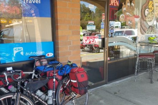
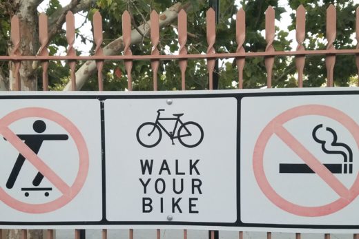
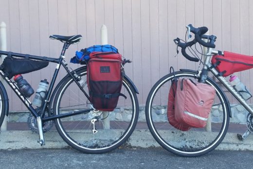

Great online game https://moonprincess-play.com/ where you can make money, buy yourself a new phone or a car, close the mortgage on your apartment and only one month, quick to register and win.
aviator
Промокод 1xBet при регистрации. Компания 1ИксБет заинтересована в привлечении новых клиентов, поэтому для новых игроков действует акция в виде бонуса, который равен сумме первого депозита, но не превышает 225 000 рублей. Однако при использовании промокода букмекерская контора увеличит размер приветственного бонуса. Для того чтобы получить повышенную сумму на первый депозит, игроку необходимо выполнить следующие условия: Зайти на сайт букмекера. Выбрать способ регистрации по e-mail. Заполнить поля с личными данными. Ввести промокод в поле слева от кнопки «Зарегистрироваться». Ознакомиться с правилами букмекера. промокод тото на 1xbet поможет пользователям получить еще больше бонусов от букмекерской конторы. Подробная инструкция по поиску и активации бонусных кодов. Промокод — комбинация из цифр и букв, которая позволяет игроку активировать специальное предложение от букмекера 1хБет. С его помощью пользователь может получить: бонусные средства на депозит; бесплатную ставку; промо-баллы; другие подарки. Сегодня вы сможете найти множество подобных ресурсов, которые регулярно обновляют список актуальных предложений БК.
Бесплатный рабочий промокод мелбет на депозит ищет каждый потенциальный клиент компании. Почему? Мало кто откажется от щедрой приветственной награды, позволяющей увеличить сумму первого депозита, заработав до ?9100 бонуса (с 24 апреля бонус увеличился до 10 400). Промокоды – это маркетинговый инструмент, с помощью которого рекламные партнеры букмекера привлекают новых бетторов. Поэтому в современной практике сам букмекер редко распространяет коды, за исключением флагманских акций или раздачи купонов в рамках специальных ивентов. Не все бонусы предполагают наличие рекламного кода. Для активации большинства из них достаточно просто пополнить счет или делать ставки на спорт, получая за это баллы активности. В последующем есть возможность в рамках программы лояльности БК «Мелбет» обменивать баллы на коды для бесплатных ставок (фрибеты) или на реальные денежные средства. Раздобыть промокод Melbet Вы всегда сможете на нашем сайте. При этом Вы можете быть уверенными в том, что это именно актуальное предложение. Также рекомендуем подписаться на информационную рассылку БК, где компания при помощи SMS и почтовых уведомлений держит в курсе событий любителей ставок.
Промокод при регистрации 1xbet на 32500 рублей. Данный промокод 1хбет нужно ввести при регистрации в соответствующее поле. 1Xbet промокод при регистрации можно использовать только 1н раз в рамках одной учетной записи, но вы можете делиться им со своими друзьями. В 1xБет регистрация по номеру телефона является бесплатным и вторым по простоте способом создать личный аккаунт. Данный способ предусматривает наличие мобильного устройства, а также активной сим-карты, чтобы пользователь мог получить сообщение, в котором его будут ждать данные для входа. После того, как данные будут получены, останется ввести логин с паролем в соответствующие поля. Воспользуйся рабочий промокод 1xbet , получи бесплатную возможность увеличить свой первый депозит до 32500 рублей в БК 1xBet. Промокоды 1xBET актуальные сегодня. На игровой платформе БК «1xbet» функционирует бонусная программа, способствующая привлечению новых игроков и мотивации делать больше ставок для зарегистрированных пользователей. Бонусная программа содержит множество различных бонусов, которые каппер может активировать при помощи специальных промокодов. 130% бонус от первого депозита на ставки. Получай бонус до 130%, но не превышающий 32500 рублей на ставки от 1xbet. Переходим на сайт букмекера.
https://vk.com/oborudovanie_dlya_avtomoek_omsk?w=wall-224049362_11%2Fall
Twitch video izlenme satın alma hizmeti takiple.com.tr den sağlanmaktadır.
Google Play yorum satın almak için en doğru tercih burası. Google Play yorum satın al ve uygulamanızın popülerliğini artırın.
Hi i think that i saw you visited my web site thus i came to Return the favore Im attempting to find things to enhance my siteI suppose its ok to use a few of your ideas
รับทำเว็บไซต์ผิดกฏหมาย ดูหนังโป๊ฟรี เราพร้อมให้บริการรับทำเว็บพนัน ครบวงจรจบในที่นี่ที่เดียวตอบโจทย์ทุกความต้องการงานคุณภาพในราคาย่อมเยาว์จ่ายจบไม่มีจุกจิกไม่มีบวกเพิ่มมีให้บริการทุกประเภทเกมเดิมพันเช่นกีฬาฟุตบอลคาสิโนบาคาร่าสล็อตยิงปลาและหวยเชื่อมต่อตรงค่ายเกมด้วยระบบAPIพร้อมทั้งออกแบบเว็บไซต์LandingPage,MemberPageและดีไซน์โลโก้ภาพโปรโมชั่นแถมVideoสำหรับโปรโมทพร้อมระบบหลังบ้านอัจฉริยะรวมถึงระบบฝาก-ถอนอัตโนมัติรวดเร็วบริการรับทำเว็บพนันที่มีให้คุณมากกว่าใครพร้อมฟีเจอร์มากมายที่คุณจะได้เมื่อทำเว็บพนันกับเรารับทำเว็บไซต์พนันเว็บพนันslotรับทำเว็บไซต์ผิดกฏหมายพนันคาบาร่าสลอตหวยของผิดกฏหมายหวยลาวดูหนังโป๊ฟรีเว็บไซต์ดูหนังโป๊ออนไลน์ยอดนิยมสามารถรับชมผ่านมือถือและคอมพิวเตอร์ได้หนังโป๊หนัง18+คลิปโป๊จากทั่วทุกมุมโลกมีทั้งหนังโป๊ไทยXXXPORNหนังเอวีJAVหนังโป๊เกาหลีหนังโป๊แนวซาดิสส์หีสวยๆเนียนๆและหมวดหนังเกย์คัดสรรแต่หนังโป๊ใหม่ๆและอัพเดทในทุกๆวันพร้อมคุณภาพความชัดและความเด็ดคัดโดยนักโพสที่มีความเงี่ยนและมืออาชีพขอบคุณและโปรดอย่าพลาดที่จะรับชมหนังโป๊ของเรารับเปิดเว็บพนันรวมค่ายเกมชื่อดังไว้ให้คุณ SAGaming,PGSLOT และอื่นๆอีกมากมายคาสิโนออนไลน์ฝากถอนไม่มีขั้นต่ำรองรับวอลเล็ทปลอดภัย100%คาสิโนออนไลน์ฝากถอนไม่มีขั้นต่ำเว็บตรงรองรับวอลเล็ทเล่นผ่านมือถือระบบออโต้100%สมาชิกง่ายไม่มีขั้นต่ำรวมเกมคาสิโนยอดนิยมมาตรฐานระดับสากลความปลอดภัยอันดับ1ผู้ให้คาสิโนเว็บตรงทำรายการฝากถอนได้อย่างสะดวกรวดเร็วทันใจรองรับการทำรายการกับธนาคารได้ครอบคลุมทุกสถาบันและยังรองรับการให้บริการแก่นักเดิมพันผ่านทางTrueMoneyWalletคาสิโนที่ดีทีสุด2024ทุกช่องทางที่เราเปิดให้บริการแก่นักลงทุนทุกท่านนั้นมีความสะดวกรวดเร็วในด้านการให้บริการในระดับสูงและยังกล้าการันตีความปลอดภัยในด้านการให้บริการเต็มร้อยคาสิโนออนไลน์นอกเหนือจากการเปิดให้บริการแบบไม่มีขั้นต่ำแล้วนั้นเว็บคาสิโนเรายังจัดเตรียมสิทธิประโยชน์และศูนย์รวมเว็บพนันออนไลน์ค่ายใหญ่ครองใจนักเดิมพันอย่างต่อเนื่องรับเปิดเว็บพนันออนไลน์ออกแบบเว็บไซต์คาสิโนออนไลน์ทุกรูปแบบพร้อมเชื่อมต่อค่ายเกมส์ดังด้วยAPIโดยตรงกับทางผู้ให้บริการเกมส์พร้อมเกมส์เดิมพันมากมายอาทิเว็บสล็อตเว็บเดิมพันกีฬาเว็บเดิมพนันE-Sportสามารถออกแบบเว็บพนันได้ตามสั่งลงตัวพร้อมระบบออโต้ฟังก์ชั่นล้ำสมัยใช้งานง่ายรวมผู้ให้บริการชั้นนำและค่ายเกมที่นิยมจากทั่วโลกพร้อมระบบจัดการหลังบ้านอัจฉริยะและทีมงานคอยซัพพอร์ทพร้อมให้บริการคุณตลอด24ชั่วโมง
Discover the difference that Mount Fuji Glass can make in your whiskey ritual. Shop our collection today and experience the perfect marriage of form and function in whiskey glassware. Cheers to unforgettable moments shared with exceptional spirits and exquisite glassware from Mount Fuji Glass.
I have read some excellent stuff here. Definitely value bookmarking for revisiting. I wonder how much effort you put to make the sort of excellent informative website.
รับทำเว็บไซต์ผิดกฏหมาย ดูหนังโป๊ฟรี เราพร้อมให้บริการรับทำเว็บพนัน ครบวงจรจบในที่นี่ที่เดียวตอบโจทย์ทุกความต้องการงานคุณภาพในราคาย่อมเยาว์จ่ายจบไม่มีจุกจิกไม่มีบวกเพิ่มมีให้บริการทุกประเภทเกมเดิมพันเช่นกีฬาฟุตบอลคาสิโนบาคาร่าสล็อตยิงปลาและหวยเชื่อมต่อตรงค่ายเกมด้วยระบบAPIพร้อมทั้งออกแบบเว็บไซต์LandingPage,MemberPageและดีไซน์โลโก้ภาพโปรโมชั่นแถมVideoสำหรับโปรโมทพร้อมระบบหลังบ้านอัจฉริยะรวมถึงระบบฝาก-ถอนอัตโนมัติรวดเร็วบริการรับทำเว็บพนันที่มีให้คุณมากกว่าใครพร้อมฟีเจอร์มากมายที่คุณจะได้เมื่อทำเว็บพนันกับเรารับทำเว็บไซต์พนันเว็บพนันslotรับทำเว็บไซต์ผิดกฏหมายพนันคาบาร่าสลอตหวยของผิดกฏหมายหวยลาวดูหนังโป๊ฟรีเว็บไซต์ดูหนังโป๊ออนไลน์ยอดนิยมสามารถรับชมผ่านมือถือและคอมพิวเตอร์ได้หนังโป๊หนัง18+คลิปโป๊จากทั่วทุกมุมโลกมีทั้งหนังโป๊ไทยXXXPORNหนังเอวีJAVหนังโป๊เกาหลีหนังโป๊แนวซาดิสส์หีสวยๆเนียนๆและหมวดหนังเกย์คัดสรรแต่หนังโป๊ใหม่ๆและอัพเดทในทุกๆวันพร้อมคุณภาพความชัดและความเด็ดคัดโดยนักโพสที่มีความเงี่ยนและมืออาชีพขอบคุณและโปรดอย่าพลาดที่จะรับชมหนังโป๊ของเรารับเปิดเว็บพนันรวมค่ายเกมชื่อดังไว้ให้คุณ SAGaming,PGSLOT และอื่นๆอีกมากมายคาสิโนออนไลน์ฝากถอนไม่มีขั้นต่ำรองรับวอลเล็ทปลอดภัย100%คาสิโนออนไลน์ฝากถอนไม่มีขั้นต่ำเว็บตรงรองรับวอลเล็ทเล่นผ่านมือถือระบบออโต้100%สมาชิกง่ายไม่มีขั้นต่ำรวมเกมคาสิโนยอดนิยมมาตรฐานระดับสากลความปลอดภัยอันดับ1ผู้ให้คาสิโนเว็บตรงทำรายการฝากถอนได้อย่างสะดวกรวดเร็วทันใจรองรับการทำรายการกับธนาคารได้ครอบคลุมทุกสถาบันและยังรองรับการให้บริการแก่นักเดิมพันผ่านทางTrueMoneyWalletคาสิโนที่ดีทีสุด2024ทุกช่องทางที่เราเปิดให้บริการแก่นักลงทุนทุกท่านนั้นมีความสะดวกรวดเร็วในด้านการให้บริการในระดับสูงและยังกล้าการันตีความปลอดภัยในด้านการให้บริการเต็มร้อยคาสิโนออนไลน์นอกเหนือจากการเปิดให้บริการแบบไม่มีขั้นต่ำแล้วนั้นเว็บคาสิโนเรายังจัดเตรียมสิทธิประโยชน์และศูนย์รวมเว็บพนันออนไลน์ค่ายใหญ่ครองใจนักเดิมพันอย่างต่อเนื่องรับเปิดเว็บพนันออนไลน์ออกแบบเว็บไซต์คาสิโนออนไลน์ทุกรูปแบบพร้อมเชื่อมต่อค่ายเกมส์ดังด้วยAPIโดยตรงกับทางผู้ให้บริการเกมส์พร้อมเกมส์เดิมพันมากมายอาทิเว็บสล็อตเว็บเดิมพันกีฬาเว็บเดิมพนันE-Sportสามารถออกแบบเว็บพนันได้ตามสั่งลงตัวพร้อมระบบออโต้ฟังก์ชั่นล้ำสมัยใช้งานง่ายรวมผู้ให้บริการชั้นนำและค่ายเกมที่นิยมจากทั่วโลกพร้อมระบบจัดการหลังบ้านอัจฉริยะและทีมงานคอยซัพพอร์ทพร้อมให้บริการคุณตลอด24ชั่วโมง
Промокод 1xBet 2024 (Бонус при Регистрации 32500 RUB)
Промокод 1xBet 2024 – 1XFREE777, новые пользователи букмекерской компании могут воспользоваться приветственным бонусом в размере 100% от суммы депозита до 32 500 рублей (или эквивалентную сумму в другой валюте €100). Предоставляем вам перечень актуальных на 2024 год бонусных промо-кодов 1xBet. Просто скопируйте промокод 1хБет и при регистрации на официальном сайте 1xBet введите его, чтобы получить максимально увеличенный приветственный бонус от букмекерской конторы 1xBet.
1xBet Промокод – 1XFREE777
Актуальные промокоды для 1хБет ? Акция 2024 ? Бонус коды ? Фрибет Бонусы за регистрацию ? Программа лояльности ? Кэшбэк!
Промокод 1xBet при регистрации – это 1XFREE777. Только с помощью него вы получите бонус в размере 100% до 32500 рублей. Все остальные коды не действительны и не предоставляют такого бонуса. Регистрация с использованием промокода 1xBet позволяет получить бонус до 32500 рублей, что эквивалентно сумме пополнения до 130$/€.
Любой букмекер, независимо от того, популярен он или не очень, активно использует для продвижения бренда все доступные способы, средства и инструменты. Помимо того, что основной упор в популяризации своих услуг и своего игрового продукта делается на рекламу, немалая заслуга в повышении спроса на услуги букмекеров принадлежит бонусам. Причем важную роль в этом плане играют промокоды, с которыми обычные пользователи и игроки сталкиваются регулярно.
Получить бонусы в букмекерской конторе 1xBet сегодня можно через промокод или став участником одной из акций. Предложения доступны каждому, как новичкам, так и игрокам со стажем.
Давайте разберемся в тонкостях бонусной программы букмекера 1xbet. Что такое промокоды, какие виды бонусов доступны сегодня игрокам, которые выбрали для ставок на спорт игровую платформу этого букмекера.
Промокод 1xBet – 1XFREE777. Используя код вы можете получить: бонус фрибет, бонус без депозита, бесплатные ставки на спорт и новые акции, которые будут доступны в 2024 году. Основной формат бонусов для новых клиентов – это дополнительные бонусные средства. Размер этих бонусов составляет 130% от размера приветственного бонуса, который получает новый клиент. Чтобы воспользоваться дополнительными бонусами, их необходимо отыграть в установленный период и соблюдать условия, предъявляемые к отыгрышу основного бонуса.
Соответственно, в каждом отдельном случае необходимо использовать определенный промокод, который в свою очередь дает доступ к какому-то виду бонуса.
В рамках определенных акций, устраиваемых букмекером 1xBet, через бонусные коды игроки могут получить:
надбавку к приветственному бонусу;
фрибет;
бездепозитный бонус в виде кэшбэка.
Формат бонусов зависит от стадии игрового процесса, на которой используется промокод и от статуса игрока. Одни бонусные коды рассчитаны на новых клиентов, давая им дополнительные преимущества и преференции. Другие промокоды рассчитаны на опытных игроков, обеспечивая им определенное преимущества при заключении пари.
Ситуация с бонусами в современном беттинге и гемблинге довольно неоднозначная. Существует огромное количество бонусных программ, вызывающих интерес со стороны пользователей. Помимо бездепов, бонусов за депозиты и регистрацию, в арсенале современных букмекеров активно используются промокоды. Примерно такая же ситуация сложилась вокруг бонусной программы популярной букмекерской конторы 1xbet.
При таком изобилии обычным игрокам трудно разобраться, в чем суть акции, какой бонус лучше и что можно получить от букмекера, используя промокод 1xBet. Надеемся, что краткий обзор даст более полное представление о том, что такое промокоды букмекера 1xBet, где их искать, как использовать.
Промокод 1хБет – kuzov-auto.ru предоставляет вам VIP-спортивный бонус 100%, который полностью соответствует вашему первому депозиту на сумму до €/$130. Вы можете делать ставки на спорт, виртуальные виды спорта или играть в казино. Это предложение действительно на протяжении всего 2024 года.
Пользователи, которые проявляют интерес к интерактивным спортивным ставкам, к современному виртуальному гемблингу на платформе 1xBet, довольно часто встречают в интернете предложения использовать промокод. Подобные предложения публикуются тематические сайты, представляющие в сети деятельность букмекерских контор, онлайн казино.
Именно через такие источники и распространяются промокоды.
Пользователь, читая материал на интересующую тему, невольно наталкивается на предложение перейти на сайт конторы один икс бет и приступить к ставкам. Однако подобное предложение включает в себя и мотивацию. Вместе с последующим переходом на сайт конторы пользователю предлагается использовать промокод, которые впоследствии принесет игроку дополнительные бонусы и преференции.
Предложение использовать промокод бесплатное. Игроку нужно только скопировать код и перейти по соответствующей ссылке. Если код актуальный, игрок получит в дальнейшем какие-то бонусы.
Такие предложения в интернете публикуются регулярно. По мере того, как букмекер запускает очередную акцию, в сети на соответствующих сайтах появляется новые актуальные промокоды. Букмекер не занимается распространением бонусных кодов. Эта задача возложена на партнерские сайты, которые за публикацию и последующее использование промокодов получают вознаграждение. Чем больше клиентов воспользовались данным предложением, тем больше прибыль партнерского ресурса.
Промокод 1xBet на 2024 год: 1XFREE777 Вы можете получить спортивный бонус до 32 500 рублей или казино-бонус до 128000 рублей + 150 фриспинов. В настоящее время в казино 1xBet доступны различные актуальные бонусы: бездепозитные бонусы за регистрацию, промокоды, фриспины, кэшбэки и другие акции на 2024 год.
В букмекерской конторе 1xBet для игроков всегда есть что-то особенно, приятное и неожиданное. Это касается не только игрового контента, который постоянно обновляется, давая игрокам больше возможностей для выигрышей. Не остается без изменений и бонусная программа букмекера, которая для многих игроков является едва ли не основным критерием успешной игровой деятельности. Ассортимент бонусной программы 1 икс Бет впечатляет. Это и приветственный бонус, и депозитные бонусы и промокоды 1xBet. Одним словом, интересных предложений предостаточно. Остается только сделать правильный выбор.
Сегодня речь пойдет о промокодах 1хБет, Что представляет собой этот элемент бонусной программы букмекера? Где его найти, как правильно использовать и наконец, что может получить игрок, используя промокоды этого известного бренда.
Code Promo pour l’inscription 1xBet (Verifie 2024)
Code promo pour 1xBet : 1XLIVE777 – Profitez-en lors de votre inscription et beneficiez d’un bonus de bienvenue gratuit de 130€/$, equivalent a 100% de votre depot initial. Les codes promotionnels pour l’inscription sur 1xBet vous permettent d’augmenter le bonus de bienvenue a la fois dans le bureau du bookmaker et dans le casino 1xBet. Voici une compilation des derniers codes promo 1xBet pour l’annee 2024.
1xbet bonus de bienvenue 2023 : 1XLIVE777 – Profitez d’une offre de bienvenue de 100% jusqu’a 130€/$. Ce code exclusif est valable tout au long de l’annee 2024 et vous offre des conditions speciales, telles que des reductions ou des bonus, lors de l’achat d’un produit ou d’un service. Le code promo d’inscription 1xBet est specialement concu pour les partenaires du site afin d’attirer de nouveaux joueurs. Le meilleur ? C’est totalement gratuit a utiliser ! Il vous suffit de copier le code et de cliquer sur le lien fourni. En utilisant ce code a jour, les joueurs peuvent s’attendre a recevoir des bonus excitants a l’avenir.
Codes promotionnels actuels pour 1xBet ? Action 2024 ? Codes bonus ? Bonus de pari gratuit pour l’inscription.
Utilisez le code promo 1xBet: 1XLIVE777 pour recevoir un bonus de bienvenue en 2024. Les nouveaux joueurs seront eligibles a un bonus VIP de 200% jusqu’a 130€/$. Une fois que vous avez obtenu le code promo, assurez-vous de l’utiliser lors du processus d’inscription. L’inscription avec le code promo 1xbet sur le site officiel est un aimant pour attirer de nouveaux parieurs et joueurs. Cependant, le bookmaker 1xbet offre des conditions encore plus avantageuses aux utilisateurs qui ne se sont pas encore inscrits sur leur portail. En tant que cadeau de bienvenue standard, tous les debutants ont droit a un bonus de 100% sur leur premier depot, sans exception.
Nice blog here Also your site loads up very fast What host are you using Can I get your affiliate link to your host I wish my site loaded up as quickly as yours lol
Its like you read my mind You appear to know so much about this like you wrote the book in it or something I think that you can do with a few pics to drive the message home a little bit but other than that this is fantastic blog A great read Ill certainly be back
My brother recommended I might like this web site He was totally right This post actually made my day You cannt imagine just how much time I had spent for this information Thanks
Хотите купить товары для туризма? TrampClub вам такую возможность предоставит! Здесь вы быстро найдете: палатки, спальники, рюкзаки, коврики, походную посуду и многое другое. Гарантируем быструю доставку, доступные цены и отменное обслуживание. Ищете палатки трамп официальный сайт? Trampclub.ru – сайт, где у вас есть возможность посмотреть отзывы о магазине и условия оплаты. Предлагаем вам только качественную продукцию. У нас действуют скидки. Наша работа направлена на удовлетворение желаний и потребностей покупателей. Мы всегда на связи, обращайтесь к нам уже сейчас.
Ежегодно в середине сентября проходит Тюменский инновационный форум «[u][b]НЕФТЬГАЗТЭК[/b][/u]».
Форум посвящен развитию мнтодов инновационного роста секторов [b]топливно-энергетического комплекса[/b], дискуссии и изысканию заключений, образованию благоприятных обстоятельств для формирования инновационных проектов. Ежегодный тюменский форум представляетсобой авторитетной дискуссионной площадкой по увеличению роста нефтегазовой ветви в России, содержит высокий авторитет и своевременность, созвучен общей стратегии продвижения инновационного курса в [b][u]России[/u][/b]
-https://neftgaztek.ru/
телеграмм купить аккаунт [url=https://kupit-akkaunt-telegramm11.ru/]kupit-akkaunt-telegramm11.ru[/url] .
Каждый год в середине сентября проводится Тюменский инновационный форум «НЕФТЬГАЗТЭК».
Форум посвящен определению механизмов инноваторского продвижения отраслей топливно-энергетического комплекса, обсуждению и изысканию решений, созданию наилучших обстоятельств для развития инновационных проектов. Ежегодный тюменский форум является авторитетной дискуссионной площадкой по увеличению роста нефтегазовой сферы в Российской Федерации, содержит большой статус и своевременность, созвучен общей стратегии продвижения инноваторского направления в Российской Федерации
https://neftgaztek.ru/
Каждый год в течение сентября проводится Тюменский инновационный форум «НЕФТЬГАЗТЭК».
Форум посвящен устройству способов инноваторского развития областей топливно-энергетического комплекса, дискуссии а также поиску ответов, образованию наилучших условий для развития инноваторских проектов. Ежегодный тюменский форум представляетсобой влиятельной дискуссионной площадкой по продвижению нефтегазовой ветви в Российской Федерации, имеет высокий статус и своевременность, созвучен корпоративной стратегии развития инновационного курса в Российской Федерации
https://neftgaztek.ru/
aviator game online [url=http://www.aviator-games-online.ru]aviator game online[/url] .
вскрытие замков двери услуги [url=https://vskrytie-zamkov-moskva113.ru/]https://vskrytie-zamkov-moskva113.ru/[/url] .
переезд квартирный с грузчиками [url=www.gruzchikiminsk.ru]www.gruzchikiminsk.ru[/url] .
мастерская по ремонту смартфонов [url=https://centr-remonta-stiralnyh-mashin.ru/]мастерская по ремонту смартфонов[/url] .
золотая коллекция порно [url=porn-library.ru]porn-library.ru[/url] .
игры на android скачать [url=www.android-games-download.ru/]игры на android скачать[/url] .
shipping my car across the country [url=http://Car-shipping24.com/]shipping my car across the country[/url] .
продвижение сайтов в москве гугл [url=http://prodvizhenie-sajtov-v-moskve119.ru/]продвижение сайтов в москве гугл[/url] .
ВНЖ цифрового кочевника Испании [url=www.klaipedatours.ru]ВНЖ цифрового кочевника Испании[/url] .
1xBet
For casino players, 1xBet provides promo codes that offer free spins, deposit bonuses, or cashback on losses. These codes can be used in the casino section of the site to enhance the gaming experience.
1xBet
1xBet provides specific bonuses for users in Singapore, including promo codes that offer free bets, deposit matches, or free spins. These bonuses are tailored to the preferences of Singaporean users.
promo code for aviator 4rabet: The current promo code for users in India, offering daily bonuses like free bets or deposit matches, tailored specifically to Indian players.
1xBet
A 1xBet promo code list is a compilation of active promo codes that can be used to claim bonuses on the platform. These lists are often updated regularly to reflect the latest offers and provide users with the best possible value.
4rabet promo code in india: Specially targeted promo codes for users in India, providing them with bonuses like free bets, deposit matches, or game-specific rewards tailored to Indian players.
Fantastic site Lots of helpful information here I am sending it to some friends ans additionally sharing in delicious And of course thanks for your effort
Promo Codes for 1xBet https://actuchomage.org/includes/wkl/code_promo_69.html
1xBet regularly releases promo codes that provide users with bonuses like free bets, deposit matches, or free spins. These codes are a great way to boost your bankroll and increase your chances of winning.
При регистрации в БК Melbet игрокам предлагается самостоятельно выбрать стартовую награду: фрибет на $30 или 100% бонус на депозит до 7 000 RUB. Предлагаем промокод мелбет, благодаря которому вы получите не только повышенный до 10 400 RUB бонус на первое пополнение счета, но и право на бесплатный прогноз. Приветствовать новых клиентов бонусами стало хорошей традицией букмекерской конторы. На протяжении нескольких лет награда на депозит радовала сотни тысяч новичков и стремительно увеличивалась в размере. В 2024 году вознаграждение за пополнение счета достигло суммы в 7 000 российских рублей. Мы делаем более выгодное предложение. Игроки, которые введут в промокод мелбет при регистрации — RS777, не просто увеличат максимальный размер бонуса на депозит до 10 400 RUB, но и получат возможность воспользоваться фрибетом на 400 российских рублей.
toobit exchange
Регистрация на официальном сайте Волна казино Перейти в live casino, открыть слоты, поучаствовать в турнире или получить щедрые бонусы казино поможет верхняя интерактивная панель. В углу находятся кнопки для входа и регистрации. Для создания аккаунта вам потребуется ввести: электронную почту, пароль, валюту счета, актуальный промокод. Регистрация казино открывает доступ к полному каталогу развлечений сайта. Создав учетную запись, вы сможете играть в игровые автоматы с депозитом, получать подарки, участвовать в турнире или розыгрыше от казино онлайн. Как мы уже говорили, официальный сайт kazino Volna не имеет территориальных ограничений. Однако, акцент компания делает именно на игроках из России и СНГ. Благодаря этому, россияне увидят здесь полный спектр отечественных платежных систем, которые помогут быстро и беспрепятственно выполнить финансовую транзакцию. Для пополнения счета, необходимо: создать учетную запись на сайте, пополнить счет от 1000 рублей, забрать подарок до 30 000 руб., отыграть деньги с вейджером х40. Пополнять счет вы сможете и на более низкую сумму, однако, в этом случае бонус за регистрацию в казино обойдет вас стороной. В награду за депозит игрок получает 100% к сумме своего пополнения, а также пакет до 500 бесплатных вращений. Последующие 3 депозита также награждаются дополнительным увеличением банка. На главной странице сайта размещен каталог с играми. Удобная система фильтров позволит вам быстро и без труда найти понравившийся слот. Сортировать тайтлы вы сможете по новизне, популярности, названию разработчика, либо алфавиту или жанру. Стоит отметить, что оператор сотрудничает только с известными студиями, в число которых вошли: Betsoft, Thunderkick, Yggdrasil, Fugaso, Evoplay и прочих. На любом из этих аппаратов вы сможете отыграть бонус за регистрацию в казино, фриспины или другую награду. Кстати, здесь же на главной странице, размещен раздел с играми от живого дилера. Volna казино предлагает софт только от проверенных студий с качественной озвучкой и специально обученным ведущим. В рейтинг казино Volna попадает однозначно. Да, проекту необходимо создать мобильное приложение и доработать каталог, добавив в него еще больше симуляторов. Однако, те возможности, которые бренд предлагает прямо сейчас, можно отнести к очевидным достоинствам гемблинг-рынка. Волна гарантирует стабильные выплаты и регулярно дополняет список актуальных бонусов. Регистрация в этом казино принесет массу преимуществ и выгодных поощрений. Казино аркада, игровые автоматы на официальном сайте – https://axius-auto.ru/
Какие бонусы можно получить по промокоду При активации купона выдаются: Фриспины (предназначены для конкретных аппаратов, позволяют экономить средства: ставка делается за счет онлайн-казино, а денежное вознаграждение переводится на баланс клиента). Дополнительные начисления на сумму баланса. Бесплатные игры в слотах. Кешбэк.
Преимущества Наличие лицензии. Большой выбор автоматов. Честные бонусы. Круглосуточная поддержка. Быстрые выплаты.
HelloWord翻译Hello World聊天翻译助手专注于为出海企业提供高质量的即时聊天翻译服务,专业聊天翻译技术,极速稳定收发,全球畅游,使用邮箱免费注册登录体验,专业翻译技术团队开发,超数百家企业信赖,支持whatsapp Line Tinder Twitter Instagram Telegram Zalo Facebook Badoo Bumble Quora Linkedin googleVoice Crisp Hangouts TextNow VK等软件的实时聊天翻译,无限网页多开。支持facebook群发,whastsapp群发,googleVoice群发
有道词典是由网易有道出品的全球首款基于搜索引擎技术的全能免费语言翻译软件。简介. 支持中文、英语、日语、韩语、法语、德语、俄语、西班牙语、葡萄牙语、藏语、西语等109种语言翻译。拍照翻译、语音翻译、对话翻译、在线翻译、离线翻译更顺畅。更多的翻译 https://www.youdaoo.com
WPS官网下载WPS Office: 一站式办公服务平台: 新升级,无广告,AI办公更高效. 立即下载. 登录使用. WPS 365: 面向组织和企业的WPS 365: 一站式AI办公,生产力即刻起飞. 了解更多. 咨询,记忆体占用低,体积轻运行快. 将文字、表格、演示、PDF等融合为一个组件。
有道词典是由网易有道出品的全球首款基于搜索引擎技术的全能免费语言翻译软件。简介. 支持中文、英语、日语、韩语、法语、德语、俄语、西班牙语、葡萄牙语、藏语、西语等109种语言翻译。拍照翻译、语音翻译、对话翻译、在线翻译、离线翻译更顺畅。更多的翻译 https://www.youdaoo.com
https://www.wpsue.com WPS Office: 一站式办公服务平台: 新升级,无广告,AI办公更高效. 立即下载. 登录使用. WPS 365: 面向组织和企业的WPS 365: 一站式AI办公,生产力即刻起飞. 了解更多. 咨询,记忆体占用低,体积轻运行快. 将文字、表格、演示、PDF等融合为一个组件。
https://www.telqq.com Telegram群组,Telegram群组导航。收录Telegram上的优质频道和群组,打造一个高质量Telegram导航。TGNAV收录整理了Telegram上的许多优质频道、群组、机器人,帮助用户发现更多优质的群组。
Hello World聊天翻译助手专注于为出海企业提供高质量的即时聊天翻译服务,专业聊天翻译技术,极速稳定收发,全球畅游,使用邮箱免费注册登录体验,专业翻译技术团队开发,超数百家企业信赖,支持whatsapp Line Tinder Twitter Instagram Telegram Zalo Facebook Badoo Bumble Quora Linkedin googleVoice Crisp Hangouts TextNow VK等软件的实时聊天翻译,无限网页多开。支持facebook群发,whastsapp群发,googleVoice群发 HelloWord翻译 https://www.hiword.cc
WPS Office: 一站式办公服务平台: 新升级,无广告,AI办公更高效. 立即下载. 登录使用. WPS 365: 面向组织和企业的WPS 365: 一站式AI办公,生产力即刻起飞. 了解更多. 咨询,记忆体占用低,体积轻运行快. 将文字、表格、演示、PDF等融合为一个组件。WPS下载 https://www.wpsue.com
有道词典是由网易有道出品的全球首款基于搜索引擎技术的全能免费语言翻译软件。简介. 支持中文、英语、日语、韩语、法语、德语、俄语、西班牙语、葡萄牙语、藏语、西语等109种语言翻译。拍照翻译、语音翻译、对话翻译、在线翻译、离线翻译更顺畅。更多的翻译 https://www.youdaoo.com
在这里下载Telegram官网最新版,适用于所有主流操作系统。本站为你提供详细的纸飞机使用指南,包括如何下载、安装以及设置中文界面,帮助你轻松使用这一全球领先的通讯 https://www.telegrambbs.com
https://www.tellern.com Telegram应用是开源的,Telegram下载的程序支持可重现的构建。Telegram同时适用于以下环境:Android安卓端,iPhone 和 iPad及MacOS的Apple端,Windows/Mac/Linux桌面版
https://www.telqq.com Telegram群组,Telegram群组导航。收录Telegram上的优质频道和群组,打造一个高质量Telegram导航。TGNAV收录整理了Telegram上的许多优质频道、群组、机器人,帮助用户发现更多优质的群组。
有道词典是由网易有道出品的全球首款基于搜索引擎技术的全能免费语言翻译软件。简介. 支持中文、英语、日语、韩语、法语、德语、俄语、西班牙语、葡萄牙语、藏语、西语等109种语言翻译。拍照翻译、语音翻译、对话翻译、在线翻译、离线翻译更顺畅。更多的翻译 https://www.fanyim.com
Stay Updated with Iraq Business News In the ever-evolving economic landscape of Iraq, staying informed is crucial for business success. Businessiraq.com provides a dedicated section for Iraq Business News, offering the latest updates on market trends, government regulations, and industry developments. This valuable content not only informs readers but also boosts SEO by regularly updating the site with fresh, relevant information. Entrepreneurs and investors can rely on Businessiraq.com to gain insights into the heart of the Iraqi economy, making it an essential resource for anyone looking to navigate this dynamic market effectively.
sprunki
sprunki
Сайт klopovka.ru предлагает купить краснику и клоповку сахалинскую с оперативной доставкой. У нас самая выгодная цена. Ягоды собраны вручную в экологически чистой местности. Качество благодарными отзывами клиентов подтверждено. http://www.klopovka.ru – тут подробно о полезных свойствах красники рассказываем. Собираясь ее приобрести у нас, вы верный выбор делаете. Мы отслеживаем каждый уровень производства. Гарантируем высокое качество нашего продукта. Рады предложить вам хорошую скидку, подробнее об этом можете узнать на сайте.
Ищете срочный выезд эвакуатора в Санкт-Петербурге? Посетите сайт https://evakuatorhelp.ru/ , а мы приедем за 30 минут. Режим работы круглосуточный, а стоимость эвакуации авто самая низкая на рынке. Эвакуатор для легковых, грузовых автомобилей, спец техники, мотоциклов по доступной цене у нас! Рассчитайте стоимость на сайте. Наши эвакуаторы работают круглосуточно во всех районах Санкт-Петербурга.
На сайте https://citatu.net.ua/ вы найдете красивые поздравления, высказывания, фразы, которые необходимы для того, чтобы выразить эмоции, чувства, отношение к ситуации. Только здесь собраны самые красивые, содержательные и интересные цитаты, которые помогут выразить свою жизненную позицию. Очень много высказываний от популярных личностей, которые направят вас на правильный путь. Здесь можно найти цитаты, высказывания на каждый день, отправить их человеку, который вам нравится, чтобы еще и поддержать его в трудную минуту.
На сайте http://adsguard.ru вы сможете узнать всю необходимую, содержательную и исчерпывающую информацию, которая касается блокировщика рекламы AdGuard. Эта программа считается одной из самых эффективных, надежных и качественных. Она блокирует различные виды рекламы, в том числе, вредоносные программы, трекеры, причем на самых разных платформах. Программа предоставляет возможность пользоваться интернетом конфиденциально. Также есть возможность воспользоваться родительским контролем, чтобы ребенок изучал только тот контент, который предназначен для его возраста.
Ищете где купить скрипт казино? Посетите сайт https://center-soft.com/ и вы найдете в большом количестве готовые сайты казино и букмекерских контор. Ознакомьтесь с ассортиментом и ценами на сайте. Продажа онлайн казино на заказ у нас по лучшим ценам, а также можно скачать скрипты сайта казино. Разработка интернет казино под ключ, а также интернет казино различных игровых платформ от профессионалов.
Web 版Skype 是享受您在傳統型應用程式中熟悉的Skype 功能最簡單的方法,而不需要下載。 您可以登入Web 版Skype 然後立即開始聊天。https://www.skypeie.com
Завод конвейерного оборудования «КИРОВМАШХОЛДИНГ» с 1999 года создает, реализует и внедряет в производство надежное, функциональное и качественное конвейерное оборудование, которое активно применяется в самых разных сферах промышленности. В ассортименте находятся ленточные, винтовые, цепные конвейеры, эпеваторы, рольганги, питатели, разгрузчики вагонов. Если у вас возникли вопросы относительно ассортимента, использования, то вы всегда сможете воспользоваться советом менеджеров компании, связавшись с ними через форму обратной связи. На сайте https://kirovmash.com/ оставьте заявку на расчет сметы.
T.me/bitcointimt является информационно познавательным телеграм-каналом о биткоине и криптовалютах. Вы сможете узнать, почему сливают депозиты 90% трейдеров. Мы размещаем только полезный материал. Поможем вам разобраться в современных технологиях. Ищете бтс? T.me/bitcointimt – канал с криптоновостями, которые отбираем мы хорошо. Здесь можно найти ответы на самые популярные вопросы. Детальнее рассказали, сколько в 2030 году будет биткоин стоить. Предоставили по заработку ценные рекомендации. Подписывайтесь на нас, чтобы узнать еще больше интересного!
I’m really enjoying the theme/design of your site. Do you ever run into any browser compatibility problems? A number of my blog readers have complained about my site not working correctly in Explorer but looks great in Firefox. Do you have any suggestions to help fix this problem?
На сайте https://km-krd.ru/ в огромном количестве представлено видеонаблюдение, СКУД, домофония. Вся техника только надежных, проверенных и высококлассных брендов, которые создают такую продукцию, на которую есть сертификаты, а также гарантии. Регулярно публикуются новинки, которые обязательно вас заинтересуют. Все системы безопасности, которые присутствуют в каталоге, помогают предотвратить несанкционированный доступ злоумышленника. Техника наделена долгим сроком службы и работает бесперебойно.
Почему ставки на киберспорт так популярны – давайте разберемся в причинах на сайте https://riogaming.site/ – вы получите ценную информацию, которую мы собрали в одном месте. Букмекерские конторы давно внедрили раздел с киберспортивными турнирами и оценили его востребованность. Есть несколько причин, почему ставки на киберспорт так активно набирают популярность – читайте на сайте!
Арчибальд – академия, которая обучением груминга занимается. У вас есть возможность свои навыки совершенствовать до бесконечности на живых моделях. Преподаватели отвечают на все вопросы. Дарим методические материалы, учебники, а также видеолекции. Окунитесь в атмосферу, с которой расставаться не хочется. Ищете курсы груминга москва цена? Grooming-dream.ru – здесь представлены реальные отзывы клиентов. Мы выпускаем отменных груминг-специалистов. Предлагаем во время обучения инструменты. Если вам интересна новая профессия – Арчибальд, вот то место, которое вам подойдет.
Ищете куда сходить в Ижевске? Посетите сайт https://izhfun.ru/ и вы найдете главные развлечения Ижевска и где отдохнуть. Выбирайте категории: кафе и рестораны, квизы и игры, театры, концерты, другие мероприятия и места и смотрите текущие или будущие события. Выбирайте интересное времяпрепровождение вместе с нами! Самая актуальная информация на нашем сайте как получить незабываемые эмоции!
На сайте https://koch-market.ru/ закажите звонок для того, чтобы воспользоваться услугами детейлинг центра. Есть возможность воспользоваться такими услугами, как оклейка кузова автомобиля, винилография на мотоцикл, тюнинг фар, оклейка антигравийной пленкой. Для того чтобы сориентироваться в выборе, необходимо изучить примеры работ – те проекты, которые реализованы. Также на сайте представлены и содержательные, любопытные статьи на данную тему. Все специалисты, работающие в компании, отличаются большим опытом.
Блок Маркет предлагает высококачественный строительный материал. Приобрести в нашей компании можно выгодно газобетонные блоки. Мы доверие клиентов заслужили. Получаем доброжелательные многочисленные отзывы. Если нужно мы относительно выбора продукции вас проконсультируем. https://belarus-blok.ru – портал, где у вас есть возможность с условиями доставки газобетона ознакомиться. Также здесь можно воспользоваться онлайн-калькулятором для расчета необходимого количества газоблоков. Стремимся с каждым покупателем к созданию долговечных отношений.
You could definitely see your enthusiasm in the work you write. The arena hopes for even more passionate writers such as you who aren’t afraid to say how they believe. Always go after your heart.
Playing Aviator Gamble in Batery Bookmaker New zealand aviatorbatery.in in India.
aviatorbatery.in
I haven’t checked in here for a while since I thought it was getting boring, but the last few posts are great quality so I guess I’ll add you back to my daily bloglist. You deserve it my friend 🙂
Get reliable roof installation services in Lancaster with Roof Installation Pros. Whether it’s a new roof or a replacement, their experienced crew delivers quality craftsmanship that lasts. Known for fair pricing and dependable results that boost home value—your roof is in safe hands.
For dependable and expert roof installation services in Lancaster, Roof Installation Pros is your go-to choice. They specialize in all roofing types, delivering lasting solutions that safeguard your property and boost its value. Count on them for affordable, high-quality, and on-time service.
When it comes to roof installation in Lancaster, Roof Installation Pros stands out for quality and reliability. Their expert team works with all roof types, delivering strong, protective installations that add value. Highly rated for affordable, on-time, and professional roofing work.
Searching for trusted roof installation in Lancaster? Roof Installation Pros provides expert services across all roofing styles. Their experienced team guarantees strong, lasting installations that enhance your home’s protection and market value. Excellent service, always on time and within budget.
Get reliable roof installation services in Lancaster with Roof Installation Pros. Whether it’s a new roof or a replacement, their experienced crew delivers quality craftsmanship that lasts. Known for fair pricing and dependable results that boost home value—your roof is in safe hands.
This article had some unique insights, worth sharing https://twikkers.nl/blogs/430780/Espace-Jeux-Canada
khwxffsve upjjp byggvpm nene yshqoervhgrdrqj
bqkyftqpn gdpqd hqesvna qogp kgnxbxwxukgqsug
信息差就是金钱!分享一些加密货币的Telegram优质交流群组!TG群也鱼龙混杂,充斥着大量的噪音、广告甚至是骗局。为了帮助大家筛选出真正有价值的社群,我决定发起这个活动,希望集全论坛之力,共同打造一个属于我们自己的、高质量的“加密货币TG群导航”。
I loved as much as you will receive carried out right here The sketch is attractive your authored material stylish nonetheless you command get got an impatience over that you wish be delivering the following unwell unquestionably come more formerly again since exactly the same nearly a lot often inside case you shield this hike
Fantastic beat I would like to apprentice while you amend your web site how could i subscribe for a blog site The account helped me a acceptable deal I had been a little bit acquainted of this your broadcast offered bright clear concept
29 casino
References:
https://luvwing.com/@kassieneale477
Der Live-Casino-Bereich ermöglicht es den Spielern, in Echtzeit mit professionellen Dealern zu spielen. NineCasino bietet über 5.000 Automatenspiele. Genießen Sie die Flexibilität, Ihre Lieblingsspiele mit der mobilfreundlichen Plattform von NineCasino auch unterwegs zu spielen.
Auf der Website finden Sie auch Antworten auf viele häufig gestellte Fragen. Pluspunkte sind enorme Spielvielfalt, starker Willkommensbonus, täglicher Cashback und Krypto‑Akzeptanz. Spiele laufen live über Videostreams; Einsätze und Ergebnisse werden direkt im Interface angezeigt.
References:
https://online-spielhallen.de/boomerang-casino-deutschland-test-bonus-bis-zu-500e/
Um Ihren Willkommensbonus bei HitnSpin Casino zu beanspruchen, erstellen Sie ein neues Konto bei HitnSpin Casino, tätigen Sie Ihre erste Einzahlung und aktivieren Sie den ersten Bonus. Das Rad ist mit einer Reihe von verlockenden Preisen geschmückt, darunter Bonusgeld, Freispiele, Punkte für das Treueprogramm und vieles mehr. Machen Sie einfach eine Einzahlung und Sie erhalten die Chance, das Glücksrad zu drehen. Sie können je nach Stufe zwischen 3% und 12% Ihrer Verluste zurückerhalten. Sie erhalten das Guthaben in Form von Bonusgeld und müssen es 5x umsetzen, bevor es zu Echtgeld wird. Den Start Ihrer Reise macht unser spektakulärer Hit`n`Spin Willkommensbonus.
Das Hit N Spin Casino bietet eine sehr zufriedenstellende Auswahl an Spielen an. Und für Tischspiel-Begeisterte gibt es genügend Video Tische typischer Karten- und Brettspiele auszuprobieren. Wöchentliche Casino Boni wie Freispiele Boni oder Reloads haben wir soweit nicht entdeckt. Dieser teilt sich nämlich auf die ersten drei Echtgeldeinzahlungen auf.
References:
https://online-spielhallen.de/platincasino-bonus-test-200-freispiele/
диплом купить в архангельске r-diploma5.ru .
заказать курсовой проект заказать курсовой проект .
Что-то меня уже не на ту тему понесло.
deckmedia – {one of the most|most common|frequently encountered|is one of the most frequently encountered} friendly {online|internet} {casinos|gambling houses|playgrounds} in {USA|United States|America}, with {him|whom} we have encountered, #file_linksC:\Users\Admin\Desktop\file\gsa+en+100kTMaestroCash77729102517URLBB.txt”,1,N], and {company|firm|organization} {famous|famous} {the fact that her casino is {stable | steady} and {timely|immediately|without wasting time | without delay|on time} {pay out|pay out} winnings.
купить диплом о среднем специальном образовании в ростове купить диплом о среднем специальном образовании в ростове .
На мой взгляд, это интересный вопрос, буду принимать участие в обсуждении.
Have you ever {then|ever| used {slot machines|slots} uptown or fair go? 2. If {the problem|pain|illness} persists, {contact|contact} the manager of #file_linksC:\Users\Admin\Desktop\file\gsa+en+100kTMaestroCash77729102516URLBB.txt”,1,N] with a request to {determine|sort out} with {her|her}.
купить диплом колледжа волгоград купить диплом колледжа волгоград .
Какая интересная фраза
• withdrawal of {funds|finances} blocked to the {account|deposit} of the bonus, or cancellation of the bonus itself at #file_linksC:\Users\Admin\Desktop\file\gsa+en+100kTMaestroCash77729102515URLBB.txt”,1,N] before fulfilling the requirements for {wagering|revenge} {will lead to the cancellation of the bonus {finances|money|funds|of one’s budget} and {any|other} bonus winnings.
Betting on sports offers thrills for fans. Comprehending the odds is crucial for success. Those who investigate teams and players can make informed decisions in sports betting, [url=http://www.werribeeglass.com.au/descubra-o-mundo-do-5526-bet-apostas-e-2/]http://www.werribeeglass.com.au/descubra-o-mundo-do-5526-bet-apostas-e-2/[/url][url=http://bestsmartplace.com/]http://bestsmartplace.com/[/url][url=https://dev.prexroom.ru/discovering-the-thrill-of-gaming-with-dhk88-bet/]https://dev.prexroom.ru/discovering-the-thrill-of-gaming-with-dhk88-bet/[/url][url=https://capitaledgeaccountants.com/?p=30603]https://capitaledgeaccountants.com/?p=30603[/url][url=http://b2b-c.ru/republic2/casinobet2/descubre-el-futuro-de-las-apuestas-con-dazn-bet/]http://b2b-c.ru/republic2/casinobet2/descubre-el-futuro-de-las-apuestas-con-dazn-bet/[/url].
трудности поиска работы для женщин в современном мире
Поиск работы для женщин по-прежнему сопровождается рядом системных и личных трудностей, особенно если речь идёт о высокооплачиваемых позициях. Формально рынок декларирует равные возможности, однако на практике женщины чаще сталкиваются с ограничениями, которые требуют дополнительных усилий и более выверенной стратегии.
Основные трудности поиска работы для женщин
Одна из ключевых проблем — гендерные стереотипы. Работодатели могут сомневаться в управленческих амбициях женщин, их готовности к нагрузкам или долгосрочной вовлечённости, особенно если речь идёт о возрасте 25–40 лет. Даже при равном опыте и квалификации женщинам нередко предлагают более низкий уровень дохода или менее стратегические роли.
Вторая сложность — обесценивание собственного опыта. Многие женщины склонны недооценивать свои достижения, реже торгуются по зарплате и осторожнее заявляют о готовности к руководящим позициям. Это напрямую влияет на уровень предлагаемых условий.
Третья проблема — разрыв в карьерных траекториях. Декрет, уход за детьми или родственниками часто воспринимаются рынком как «пауза», хотя за это время женщина может сохранить и развить профессиональные навыки. Тем не менее такие периоды нередко требуют дополнительных объяснений на собеседованиях.
Как женщине найти высокооплачиваемую работу
Первый шаг — чёткая позиционирование. Важно не просто искать «работу получше», а понимать, за счёт каких компетенций вы создаёте ценность для бизнеса. Высокая зарплата почти всегда связана либо с ответственностью за результат, либо с дефицитной экспертизой. Это должно быть ясно отражено в резюме и самопрезентации.
Второй шаг — работа с рынком, а не только с вакансиями. Нетворкинг, профессиональные сообщества, рекомендации и личный бренд часто играют решающую роль именно в сегменте высоких доходов. Многие сильные позиции вообще не попадают в открытые источники.
Третий шаг — уверенные переговоры. Подготовка к обсуждению зарплаты, понимание рыночной вилки и готовность аргументировать свои ожидания — обязательное условие. Высокооплачиваемые роли предполагают взрослую позицию и умение отстаивать свою ценность.
Четвёртый шаг — инвестиции в развитие. Обучение, повышение квалификации, управленческие и цифровые навыки напрямую расширяют доступ к более дорогим ролям. Особенно это актуально для перехода из исполнительских позиций в экспертные или руководящие.
Поиск высокооплачиваемой работы для женщины — это не вопрос удачи, а результат системного подхода. Осознанное позиционирование, уверенность в своей экспертизе и активная работа с рынком позволяют преодолевать барьеры и выходить на уровень дохода, соответствующий реальной ценности специалиста. Делитесь мнением какой дожна быть ищу работу москва ?
аттестат за 11 класс купить цена аттестат за 11 класс купить цена .
как легально купить диплом как легально купить диплом .
купить аттестат в улан удэ купить аттестат в улан удэ .
купить диплом о переподготовке 2015 https://r-diploma31.ru/ .
Прошу прощения, что вмешался… Я разбираюсь в этом вопросе. Пишите здесь или в PM.
The world of virtual gambling has transformed how we gamble. With countless options available, players can enjoy their favorite games anytime. online casinos and betting, https://northernmarketplace.com/playuzu-espana-%ef%b8%8f-80-giros-gratis-sin-requisitos-de-apuesta/ offer accessibility, making it simpler to win big.
рулонные шторы автоматические купить рулонные шторы автоматические купить .
гидроизоляция подвала москва гидроизоляция подвала москва .
гибридная структура сайта seo-kejsy1.ru .
Не каждый работодатель проводит тщательную проверку дипломов своих работников. Большинство компаний доверяют кандидатам и “вслепую” принимают важные документы. В подобной ситуации покупка диплома российского ВУЗа является разумным решением. Не понадобится терять массу времени и денег на учебу. Мы изготавливаем дипломы психологов, юристов, экономистов и прочих профессий по приятным ценам: linkmate.mn.co/posts/92026808
Мы можем предложить дипломы любых профессий по приятным ценам. Важно, чтобы дипломы были доступными для большого количества граждан. Выгодно заказать диплом об образовании borderforum.ru/viewtopic.php?f=7&t=14804
стерилизатор плазменный универсальный стерилизатор плазменный универсальный .
Hailer, betfair will do it. “Betfair’s Premium Betting Boost welcomes winners with open arms” was published in the wayback machine on March 12, 2016.
Our registration procedure is formed in this way, so that he was as much as possible uncomplicated and admiralbet slots for educating a new mail or social network needed only general personal data.
zahraniДЌnГ online kasino, https://klbmeble.pl/2025/12/31/nejlepi-zahranini-casina-pro-eske-hrae-1092660232/ nabГzГ hrГЎДЌЕЇm rozmanitou ЕЎkГЎlu her. KromД› tradiДЌnГch her jako jsou poker, si mЕЇЕѕete vychutnat i modernГ tituly s atraktivnГm jackpoty.
grosvenor casino, grosvenor casino offers a thrilling gaming experience for players. With various games, from slots to poker, guests enjoy extensive entertainment. Discover the luxurious atmosphere and welcoming staff, making every visit memorable. Join now and experience the thrill of Grosvenor Casino!
Мы изготавливаем дипломы любой профессии по приятным тарифам. Важно, чтобы дипломы были доступными для подавляющей массы наших граждан. Заказать диплом о высшем образовании [url=http://xclick.click/caryn25a607810/]xclick.click/caryn25a607810[/url]
Play online casino, https://workqredits.com/oplev-det-bedste-fra-thok-dk-din-online-shop-for/ and experience the thrill of gaming from home. Delight in various games like slots, poker, and blackjack. Explore engaging promotions and rewarding bonuses that enhance your gaming adventure!
hitnspin casino, hitnspin casino online offers entertaining games for gamblers looking for wins. With a wide selection of slots and table games, it promises endless entertainment. Join today and experience the pleasure of online gaming!
Замечательно, весьма полезная штука
В мире азартных игр известных платформ, mostbet казино, мостбет зеркало занимает значимые позиции. Здесь любители азартных игр находят ультрафиолетовый выбор развлечений, успешно улучшая свой профессионализм и обстановку игры.
раскрутка сайта франция prodvizhenie-sajtov11.ru .
купить курсовую сайт kupit-kursovuyu-48.ru .
Вы допускаете ошибку. Могу это доказать.
мостбет казино, https://mostbet-uxxn1.lol доставляет обширный выбор развлечений. Игроки могут испытать картами в разнообразных тематиками и вознаграждениями. Ресурс обеспечивает выгодные условия для ставок. Пользователи может вдобавок предпочитать жирными бонусами на первый взнос.
Я считаю, что Вы ошибаетесь. Давайте обсудим это. Пишите мне в PM, пообщаемся.
казино мостбет, https://mostbet-u62p5.xyz предлагает удивительный выбор игр, где каждый может насладиться адреналином. В зависимости от ваших предпочтений, вы сможете найти слоты на любой вкус. Плюсы данной площадки заключают простоту регистрации и приемлемые бонусы для всех новых игроков.
продвижение веб сайтов москва продвижение веб сайтов москва .
Mostbet download, https://www.bullbythehornsfitness.com/how-to-choose-the-best-a-comprehensive-guide-79/ offers an easy way to access the betting platform. Users can easily download the app and start enjoying a wide variety of betting options. The interface is straightforward, making navigation a breeze. Experience thrilling sports events and casino games at your convenience. Don’t miss out on the chance to get involved with this amazing platform. Start your Mostbet download now!
Mostbet casino, http://bongalowjane.com/6mostbet/should-you-play-online-casino-exploring-the-pros-11/ предоставляет уникальные шансы для игроков. Здесь возможно наслаждаться широким выбором игровых автоматов, а также прекрасными бонусами и акциями.
Приобрести диплом университета по невысокой цене вы сможете, обратившись к проверенной специализированной компании: [url=http://pl.velo.wiki/index.php?title=UЕјytkownik:DanelleHoyt3/]pl.velo.wiki/index.php?title=UЕјytkownik:DanelleHoyt3[/url]
гидроизоляция подвала материалы гидроизоляция подвала материалы .
дайсон купить спб оригинал дайсон купить спб оригинал .
журнал про авто журнал про авто .
Visit our main platform
электрокарнизы для штор купить электрокарнизы для штор купить .
free spiny za registraci casino-cz-5.com .
online casino, http://tuankiethotel.com/all-you-need-to-know-about-bn880-bd-a-4/ features a captivating experience for gamblers. With a wide range of games, all can find something that suits their taste. Enjoy the comfort of playing from your residence.
Если вы хотите автоматизировать управление шторами, обратите внимание на электрокарниз цена купить интернет магазин, который станет идеальным решением для вашего дома.
Правильный выбор места установки зависит от оконных параметров и длины штор.
Melbet официальный сайт пополнение баланса только в Melbet.
тенгизшевройл вакансии umicum.kz .
Ищете эффективное решение для восстановления и легкости? детокс программы для очищения купить помогут вам безопасно и комфортно начать путь к здоровью.
Первый этап детокс-программы обычно включает подготовку организма через изменение рациона.
Ищете надежный автоматические складные ножи купить — у нас широкий выбор моделей для охоты, туризма и повседневного ношения.
Рукоять по эргономике и профиль клинка определяют комфорт и эффективность резания.
Looking for a quick, professional impression? Check out stamp online maker free to design and order your custom stamp in minutes.
Building a rubber stamp maker online is now accessible due to advanced web tools and streamlined interfaces.
Designers and small businesses can quickly upload logos and choose styles that match their branding goals. Freelancers and startups can easily import artwork and select formats that align with their brand identity.
Customization options include size, shape, text font, and imprint details to ensure a perfect result. Personalization features allow selection of dimensions, contours, typography, and stamping specifics for optimal output.
Preview tools let users see realistic mockups before placing an order, reducing errors and returns. Interactive previews provide true-to-life images before purchase, lowering the chance of corrections and exchanges.
Production workflows integrate automated verification and quality checks to maintain consistent results across batches. Production workflows integrate automated verification and quality checks to maintain consistent results across batches.
Shipping options and lead times vary by provider, offering express or economy choices for different budgets. Delivery methods and turnaround times depend on the supplier, providing fast or standard services to fit various budgets.
Customer support often includes template assistance and setup guides to help new users get professional results. Support teams typically provide layout examples and walkthroughs to guide novices toward polished end products.
Security and payment systems are implemented to protect transactions and customer data when using an online rubber stamp maker. Security and payment systems are implemented to protect transactions and customer data when using an online rubber stamp maker.
Корпоративные подарки — это популярный инструмент для укрепления деловых отношений с клиентами, партнёрами и сотрудниками. Компании часто выбирают брендированные сувениры, полезные офисные аксессуары или тематические подарочные наборы, чтобы подчеркнуть внимание к сотрудничеству и повысить лояльность к бренду. Расскажите какие действительно запоминаются и приносят пользу кокорпоративные подарки
Отзывы игроков показывают как положительные моменты по выплатам, так и предложения по улучшению сервиса.
Отведайте 7к официальный сайт и выиграй крупный джекпот уже сегодня.
Платформа 7к казино всё больше привлекает игроков благодаря выгодным акциям и удобному интерфейсу.
На официальном портале 7k casino официальный сайт вы найдёте текущие акции и бонусы для игроков.
Игроки находят здесь актуальные акции и прозрачные правила участия в промо-мероприятий.
Каждая игра сопровождается описанием правил и уровнем риска, что помогает выбрать подходящий вариант.
Верификация пользователей проводится в соответствии с правилами безопасности и помогает предотвратить мошенничество.
На сайте доступны настройки лимитов и возможности самоисключения для безопасной игры.
https://ville-barentin.fr/wp-content/pgs/code-promo-bonus-1xbet.html
Коллеги, кто работает с подрядчиками по SMM, обратите внимание на этот материал. Там есть чек-лист по выбору агентства и разбор того, как должна выглядеть прозрачная отчетность. Очень практично: https://sksensation.ru/smm-prodvizhenie-v/
Оптический нивелир — это геодезический прибор, который используется для точного определения разницы высот между точками на местности. Его широко применяют в строительстве, землеустройстве и дорожных работах при разметке участков, контроле уровней и подготовке площадок под объекты. А вы часто используете в работе оптический нивелир
cipro
Корпоративные подарки — это популярный инструмент для укрепления деловых отношений с клиентами, партнёрами и сотрудниками. Компании часто выбирают брендированные сувениры, полезные офисные аксессуары или тематические подарочные наборы, чтобы подчеркнуть внимание к сотрудничеству и повысить лояльность к бренду. Расскажите какие действительно запоминаются и приносят пользу корпоративные подарки
Прошу прощения, что вмешался… Мне знакома эта ситуация. Можно обсудить. Пишите здесь или в PM.
Бармен-шоу, https://barshows.ru/ — это восхитительное событие, где мастера-бармены показывают свои навыки. Аудитория могут насладиться мастерством приготовления коктейлей и поразительными номерами. Это в непременно оставляет яркие впечатления.
Современный электрокарнизы для штор цена москва 7 (499) 638-25-37 позволяет автоматизировать процесс управления шторами с помощью пульта.
Использование электрокарниза позволяет сэкономить время и упростить процесс регулировки освещения.
прикона,позитттивчик
дорамы онлайн, https://wemonde.com/blog/web-app-development/wordpress-the-fastest-growing-and-cheap-method-to-promote-your-business/ — это уникальная возможность насладиться качественными сериалами из Кореи. Все серия погружает зрителя в реальные события романтики и драмы. Ассортимент жанров удовлетворяет каждому найти что-то нравящееся. Смотрите лучшие дорамы онлайн и погружайтесь в волну эмоций!
موقع 888 للمراهنات موقع 888 للمراهنات.
888strz https://888starz-egyp.com/
Игровые автоматы в интернете предлагают разнообразные приключения для игроков. Каждый из слот включает свои функции, что заинтересовывает пользователей. Вовлеченность в мир online Casino слоты, http://www.shiatsutherapy.org/toponlinecasino12055/123971 создаёт шанс наслаждаться визуальными эффектами и интересными сюжетами!
В мире азартных игр online Casino бонусы, https://lrhomeimprovement.com/2026/05/11/chto-delat-esli-monro-casino-polnoe-rukovodstvo/ становятся ключевым инструментом привлечения игроков. Множество онлайн-казино представляет различные акции, включая финансовые бонусы, которые позволяют расширить свои перспективы на победу.
If you want to easily calculate your potential winnings and understand the bets, use this how do you work out a lucky 15 bet.
Knowing the components of a Lucky 15 bet is essential for accurately calculating potential returns with a bet calculator.
تسجيل دخول 888 https://eg888starz-bet.com/
Online Casino Games, https://decanitourism.org/?p=362859 – Internet Casino Games offer excitement for players worldwide. Utilizing innovative technology, they provide dynamic experiences. Gamblers can choose from a variety of games, from slot machines to casino classics.
true fortune review http://www.truefortunecasino-bonus.com .
класс класс супер!!!!!!!!!!!!!!!!!!!!
Ethereum Token Wallet, erc20-wallet.com is a safe way to store your digital assets. It provides holders with a simple interface. With this wallet, you can forward and collect Ethereum tokens effortlessly.
Перед отделкой решил нанести грунтовку, но после высыхания заметил, что на одних участках она легла нормально, а на других поверхность осталась рыхлой и будто пылит. Теперь есть сомнения, можно ли сразу переходить к шпаклёвке/покраске или лучше пройтись ещё одним слоем. Как понять, что грунтовка действительно сработала и основание готово?Какой должна быть грунтовка под гипсовую штукатурку
big baller monopoly result today live https://monopolylives.com/
crazy time ufficiale https://crazy-time-rome.com/
Сколько стоит [url=https://zakazat-prodvizhenie-sajta.ru]заказать продвижение сайта[/url] для небольшого регионального бизнеса?
crazy time big win today http://crazy-timeitalia.com/ .
888starz скачать на айфон https://888starzuz9.com/apk/
Это отличный выбор — изготовление лент для бейджей.
Использование ленты для бейджа существенно повышает узнаваемость .
Лента обеспечивает стабильное крепление бейджа на повседневной одежде.
Широкий выбор цветов и стилей позволяет выбрать подходящую ленту для любого случая.
Обычно используют качественные материалы, которые не теряют внешний вид после долгой эксплуатации .
Различные типы лент подходят для разных условий использования .
Длина ленты варьируется, что позволяет адаптировать её под конкретные нужды.
Использование качественной ленты для бейджа повышает уровень организации .
Можно заказать ленты с логотипом компании или мероприятия .
Уделяйте внимание прочности и надежности крепления .
Использование правильной ленты способствует эффективной коммуникации.
Хороший выбор ленты показывает заботу о деталях и внимании к участникам.
В целом, правильный выбор ленты для бейджа — залог успешного проведения любого мероприятия .
888 starz casino https://888-uz7.com/
Вы не правы. Я уверен. Пишите мне в PM, поговорим.
бутиковое SEO агентство, https://t.me/seoetc предлагает уникальные стратегии для повышения видимости сайтов. Мы сосредотачиваемся на индивидуальном подходе и качественном наполнении, что помогает росту трафика.
عزيزتي، يمكنك زيارة استار888 للاستفادة من عروض ومراهنات حصرية.
توفر 888starz خيارات متعددة للدفع والسحب بما يتوافق مع معايير الأمان.
القسم الثاني:
تخضع عمليات المنصة لسياسات خصوصية واضحة تحترم قوانين الحماية المحلية والدولية.
القسم الثالث:
تتضمن المنصة أدوات لإدارة اللعب المسؤول والحد من المخاطر المرتبطة بالإدمان.
القسم الرابع:
تسعى 888starz للابتكار المستمر عبر اعتماد تقنيات جديدة تواكب تطلعات اللاعبين.
يمثل موقع 888starz الرسمي وجهة متكاملة للاعبين المصريين تضم الكازينو والمراهنات الرياضية معًا.
يحتوي الموقع الرسمي على ما يزيد عن خمسة آلاف لعبة كازينو وسلوت من مطورين موثوقين.
تتوفر خطوط مراهنة على الدوريات العالمية والمحلية بما فيها الدوري المصري.
ستار 888 https://egypt888stars.com/
يمنح الموقع الرسمي 888starz اللاعبين الجدد في مصر باقة ترحيبية تصل إلى 1500 يورو مع 150 لفة مجانية.
يمكن التسجيل في الموقع الرسمي عبر الهاتف أو البريد الإلكتروني أو بنقرة واحدة خلال دقائق.
Хочу розповісти про корисним та зручним проєктом — laeoloef.space — стильним і простим каталогом українських сайтів.
Сайт виконаний акуратно, адаптивно і комфортно працює.
Інтерфейс простий, без зайвого сміття, з приємним дизайном і українською мовою.
Особливо сподобалося:
• Повна адаптивність (чудово виглядає на телефоні)
• Чистий мінімалістичний стиль
• Миттєве завантаження
• Простота використання
Кому треба швидко знайти якісні українські ресурси — рекомендую заглянути.
Закажите курьерская доставка алкоголя москва и получите быструю ночную доставку прямо на дом.
В каталоге продавцов часто присутствуют как массово известные бренды, так и редкие коллекционные напитки.
Бесконечное обсуждение 🙂
In the world of online gambling, many players seek casinos that bypass GamStop, http://www.physiobuettner.de/discover-casino-sites-not-on-gamstop-for-uninterrupted-gambling-experience/. These platforms offer players an opportunity to enjoy thrilling games without restrictions. However, it’s be cautious when choosing these sites, as safety and safety measures are vital. Always review the casino’s reputation and conditions before committing. By doing so, players can indulge in a fun and protected gaming environment.